Observation Date: 12/06/2019
Route/Location:
West side of Lost Trail Pass, traveling up through the ski area
Weather:
variable high clouds, strong south ridgetop winds, temps in the high 20s
Wind:
Strong south winds, blowing the rime from 12/5 off the trees, and transporting snow into localized drifts on north through east aspects
New Snow: No New Snow
Avalanche Activity:
none
Other Comments:
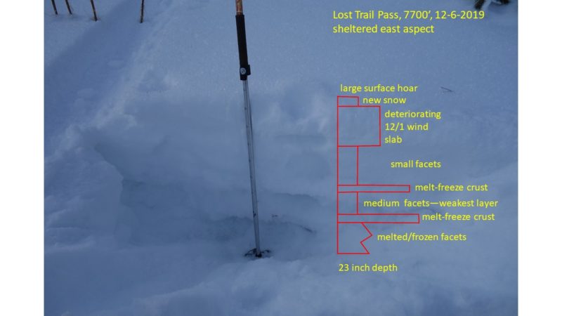
The entire 23” deep snowpack is composed of faceted grains in various stages of development—see snowpit photo below. The weakest layer is between the two crusts. The isolated column above this layer stayed together as a somewhat cohesive slab. Spectacular surface hoar capped the pack, although it was not surviving the strong south winds in exposed areas. Finally, new wind slabs were being locally deposited along the ridgelines. The upper crust, above the weakest layer, supported skiers, but how much new snow will it or any other of the weak layers support? Hopefully, we’ll find out some day…..caution advised.
Snowpack is still too shallow to ski or ride any steeper terrain.
Observer: J Lonn, Dieterich, Janiec