Posted:
Feb 6, 2021 @ 5:14 pm

 The avalanche warning has been extended for the southern Mission, southern Swan, Rattlesnake, and southern and central Bitterroot mountains. The avalanche danger for the west central Montana backcountry is HIGH. The avalanche hazard is increasing with continued snowfall, rising temperatures, and wind. Human triggered avalanches are certain. Avalanches may run long distances.  Travel in avalanche terrain is not recommended. This avalanche warning is valid till Monday, February 08, 2021 . The avalanche warning will either be extended or terminated at 7:00 am on February 08, 2021.

Weather and Snowpack

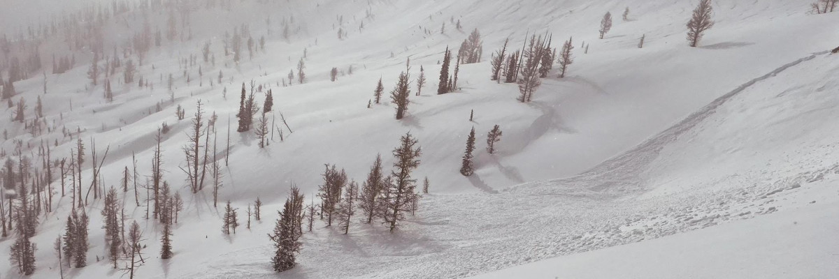
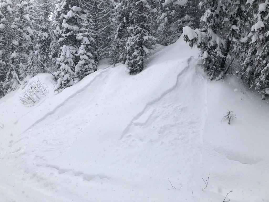
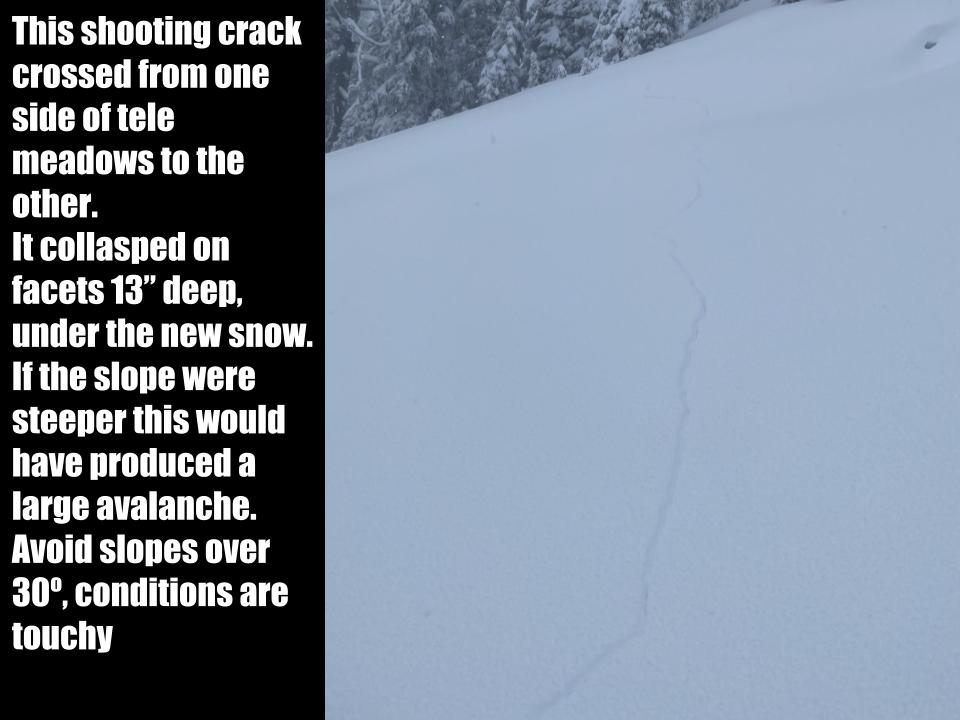
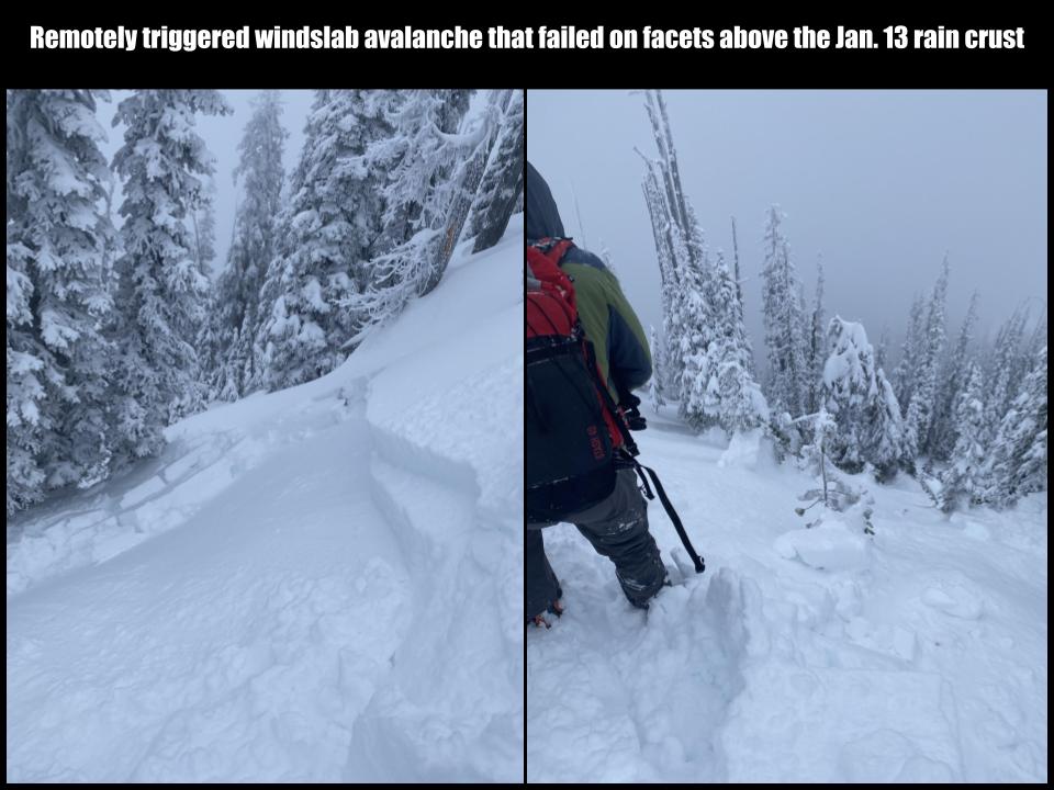
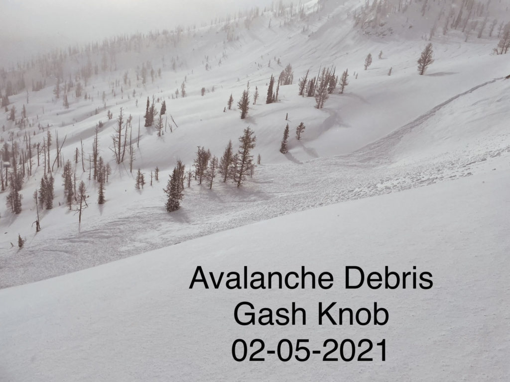
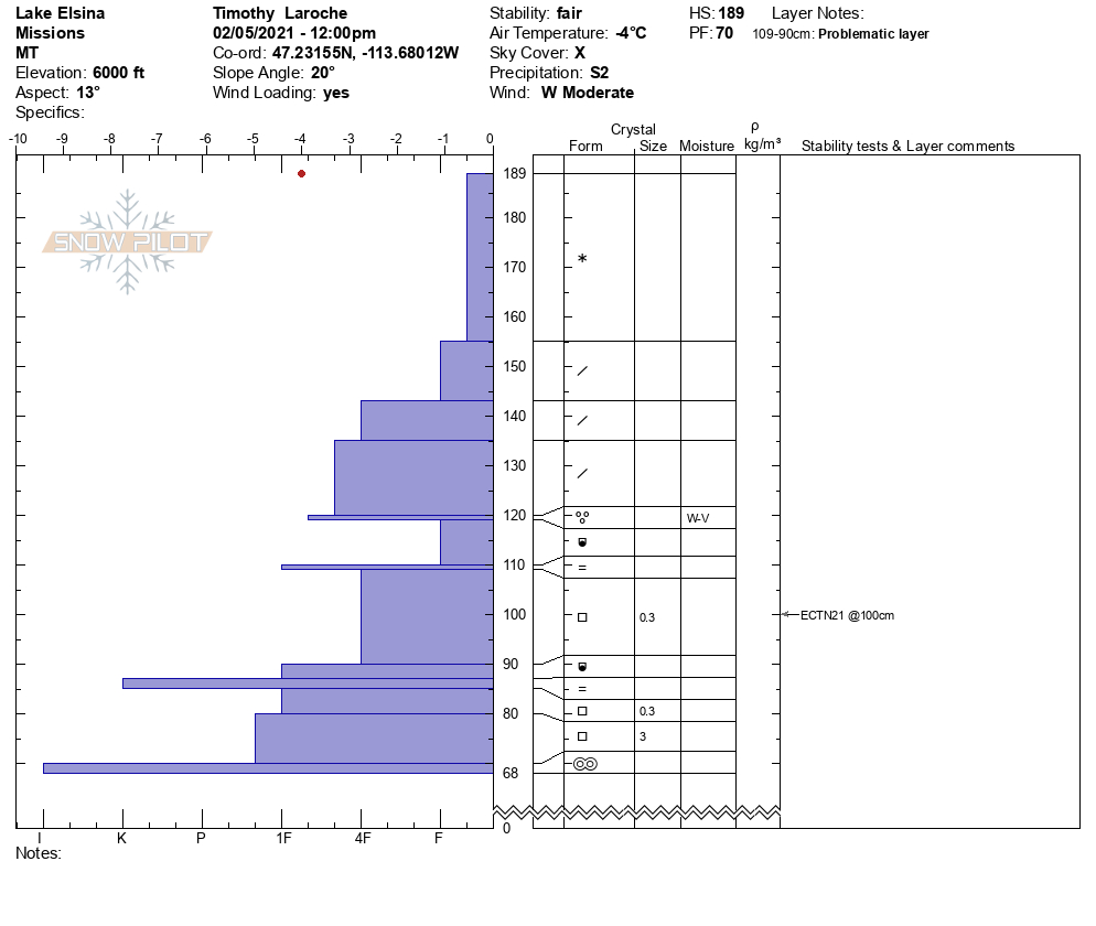
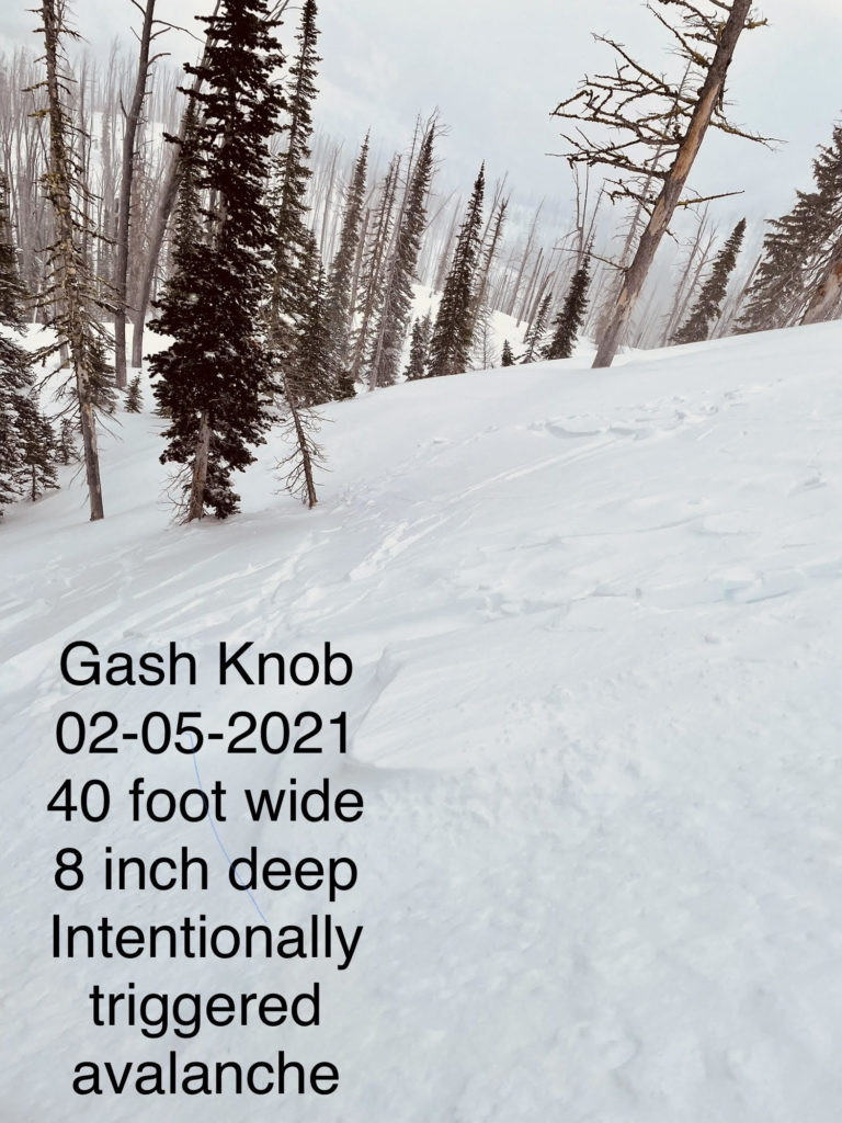
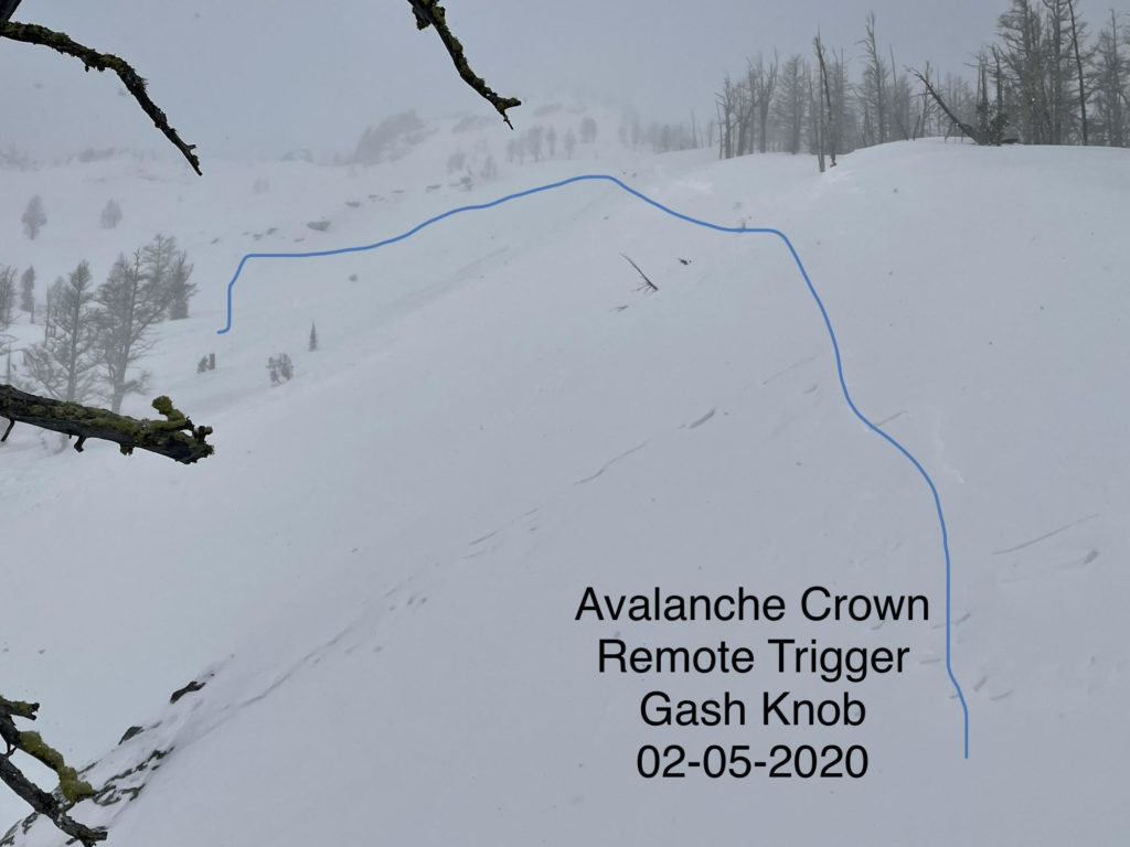
Strong winds and new snow are creating dangerous avalanche conditions. Today in the southern Missions, picked up another 12 inches of snow and saw active transport of snow to leeward aspects. New snow is testing the weak layers in the snowpack. We were able to remotely trigger slides yesterday at Gash Point in the central Bitterroot on multiple aspects on buried weak layers. We had shooting cracks and propagations at Lolo Pass. These are all signs to stay away from avalanche terrain. Yesterday in the Rattlesnake we were getting shooting cracks and remote triggering slides on 30 degree slopes. Natural slides were reported by the warming hut on north facing slopes in the Seeley Lake area.

Avoid traveling in avalanche terrain today. Avoid being under run out zones. Expect the avalanche danger to continue to be elevated as more snow and wind continue till Monday. Beware of slopes above you.

The Bottom Line

Travel in avalanche terrain is not recommended. Avoid runout zones. You can trigger an avalanche remotely from the side, below or above you. Natural avalanches are likely.

This warning will be terminated or extended tomorrow at 7:00 pm.

Ski and ride safe.

READ FULL ADVISORY  

Problem 1 - Storm slabs

  • TYPE

    storm-slabs

    Storm Slabs

    Release of a soft cohesive layer (a slab) of new snow which breaks within the storm snow or on the old snow surface. Storm-slab problems typically last between a few hours and few days. Storm-slabs that form over a persistent weak layer (surface hoar, depth hoar, or near-surface facets) may be termed Persistent Slabs or may develop into Persistent Slabs.

  • SIZE

    5-6

    2-3 (Large)

    The potential size of avalanche resulting from this problem.

  • LIKELIHOOD

    Likelihood-6

    Likely/Very Likely

    The likelihood of an avalanche resulting from this problem.

10 to 20 inches of new snow throughout the advisory area. This is a significant amount of new snow and will take time to bond.

Problem 2 - Wind Drifted Snow

  • TYPE

    wind-slabs

    Wind Slabs

    Release of a cohesive layer of snow (a slab) formed by the wind.  Wind typically erodes snow from the upwind sides of terrain features and deposits snow on the downwind side.  Wind slabs are often smooth and rounded and sometimes sound hollow, and can range from soft to hard. Wind slabs that form over a persistent weak layer (surface hoar, depth hoar, or near-surface facets) may be termed Persistent Slabs or may develop into Persistent Slabs.

  • SIZE

    5-6

    2-3 (Large)

    The potential size of avalanche resulting from this problem.

  • LIKELIHOOD

    Likelihood-6

    Likely/Very Likely

    The likelihood of an avalanche resulting from this problem.

New snow is being loaded onto leeward slopes. Winds are shifting and are cross loading slopes.

Cornice are growing. Give them a wide berth.

Problem 3 - Persistent Weak Layers

  • TYPE

    persistent-slabs

    Persistent Slabs

    Release of a cohesive layer of soft to hard snow (a slab) in the middle to upper snowpack, when the bond to an underlying persistent weak layer breaks.  Persistent layers include: surface hoar, depth hoar, near-surface facets, or faceted snow. Persistent weak layers can continue to produce avalanches for days, weeks or even months, making them especially dangerous and tricky. As additional snow and wind events build a thicker slab on top of the persistent weak layer, this avalanche problem may develop into a Persistent, Deep-Slab.

  • SIZE

    6-7

    3 (Large-Very Large)

    The potential size of avalanche resulting from this problem.

  • LIKELIHOOD

    Likelihood-6

    Likely/Very Likely

    The likelihood of an avalanche resulting from this problem.

Faceted layers can be found throughout the forecast area. Shallower snowpacks have worse structure than deeper areas and are more suspect. In specific areas, persistent slabs are up to 40 inches thick and have become low likelihood, high consequence problems. The worst faceting is in the Rattlesnake where depth hoar has developed at the base of the snowpack.

Pay attention to shooting cracks and collapsing in the snowpack. If you get off your machine or skis and punch through to the ground, it is a sure sign of a poor snowpack structure.

The January 13 crust facet combo is now 2 to 4 feet deep and reawakening.

The new snow will be testing these weak layers in the snowpack.

It is very possible to trigger an avalanche remotely from the side, below and above.

FORECAST & OUTLOOK

New snow is forecasted through Monday. See the forecast.

This information is the sole responsibility of the Forest Service and does not apply to operating ski areas. The avalanche danger rating expires at midnight tonight but the information can help you make a more informed decision regarding travel in avalanche terrain for the next few days.

Our advisory area includes National Forest System lands in the Bitterroot Mountains from Lost Trail Pass north to Granite Pass, the Rattlesnake Mountains north of Missoula and the Southern Swan and Mission Mountains near Seeley Lake, MT. Avalanche information for the Lookout Pass/St. Regis Basin area is available from the Idaho Panhandle Avalanche Center.