Posted:
Feb 23, 2021 @ 5:59 pm

The avalanche warning has been extended for the southern Mission, southern Swan, Rattlesnake, and southern and central Bitterroot mountains. The avalanche danger for the west central Montana backcountry is HIGH. The avalanche hazard remains elevated with continued wind and precipitation. Human-triggered avalanches are certain, natural avalanches are likely. Very large, destructive avalanches are possible. Travel in avalanche terrain is not recommended. This avalanche warning is valid for 36 hours. The avalanche warning will either be extended or terminated at 7:00am on February 25, 2021.

Weather and Snowpack

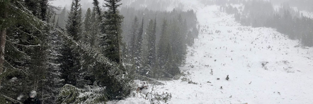
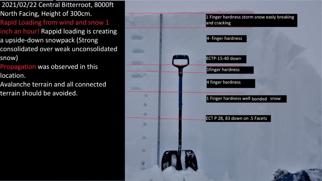
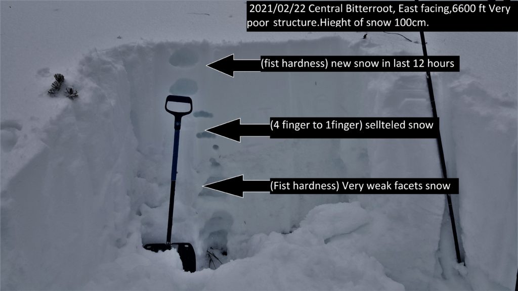
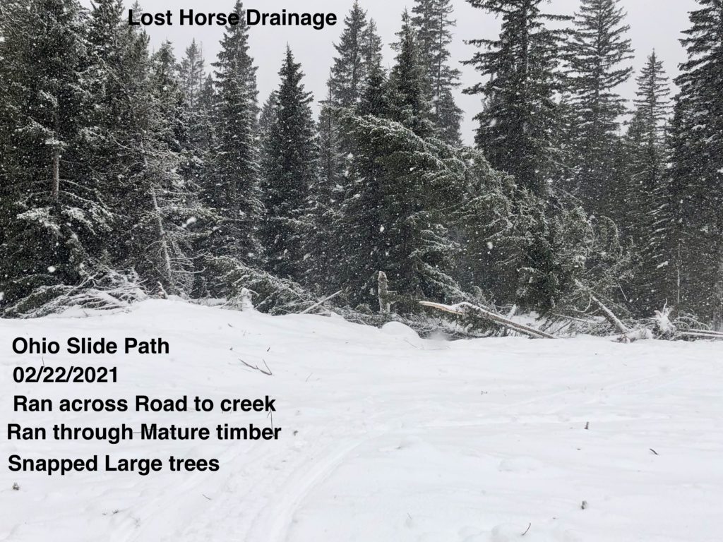
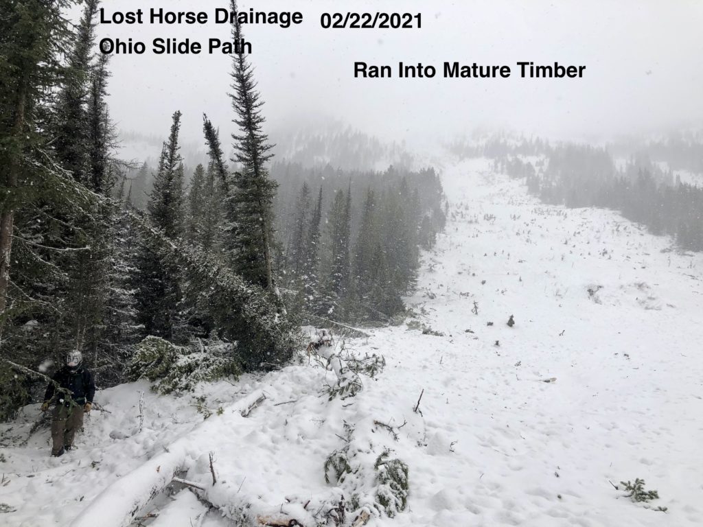
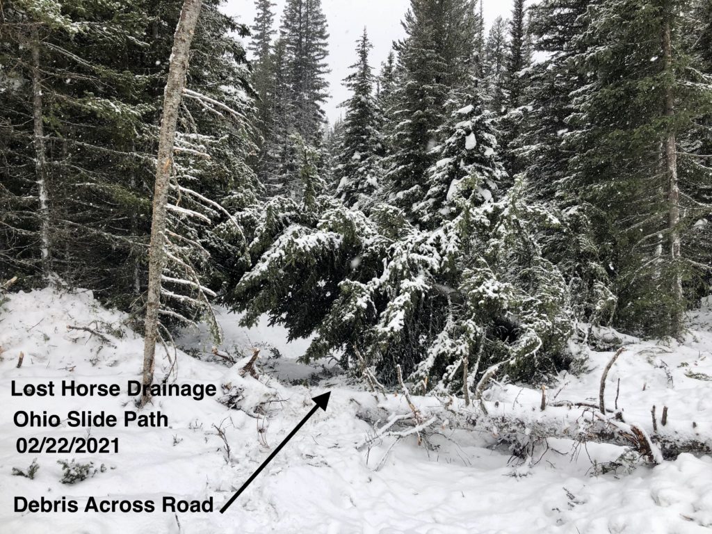
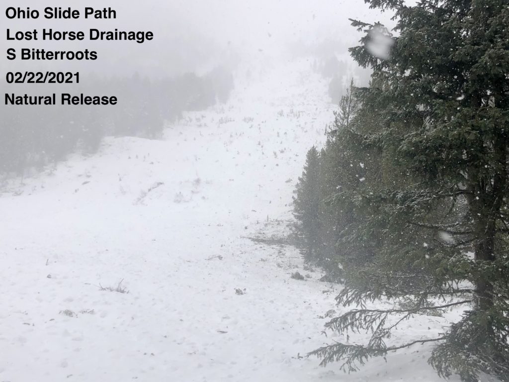
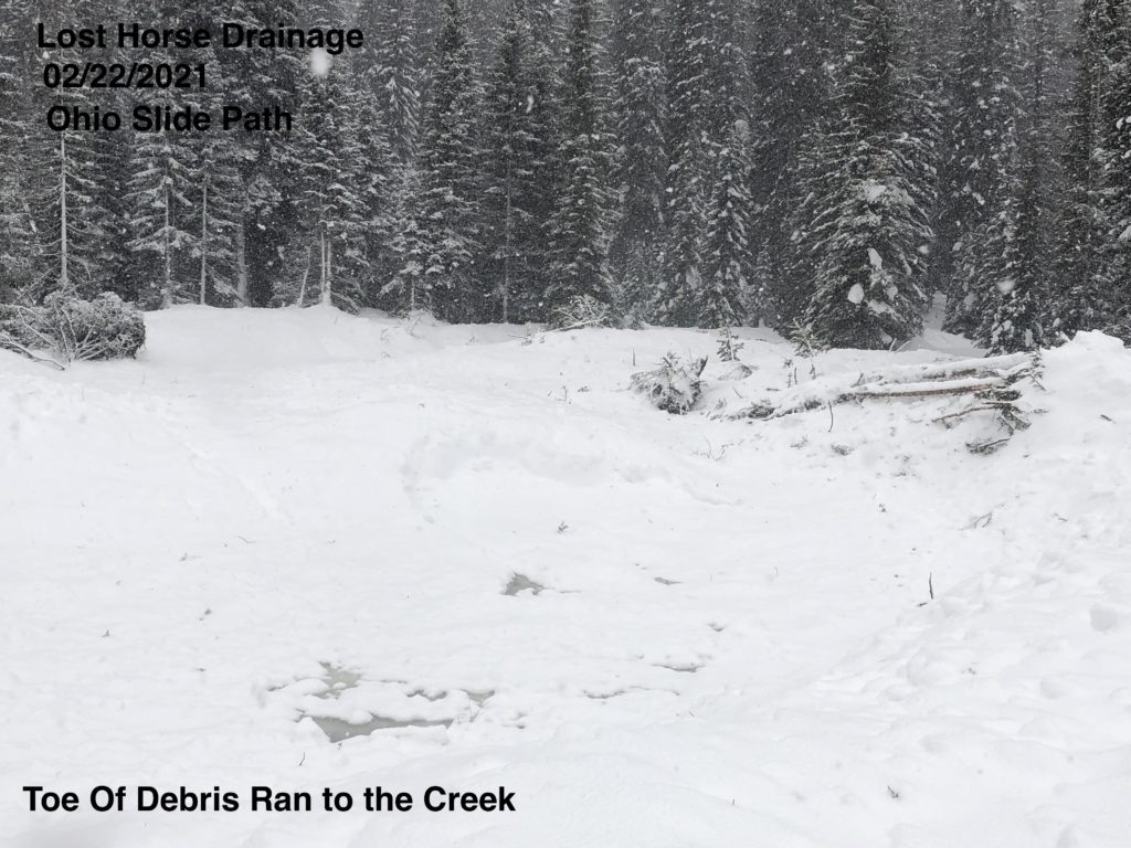
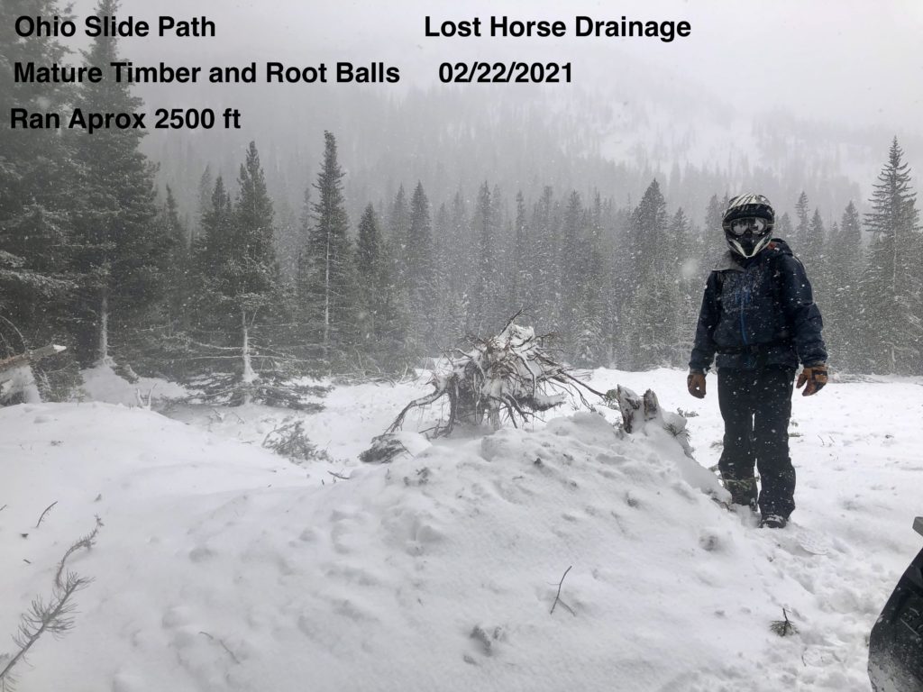
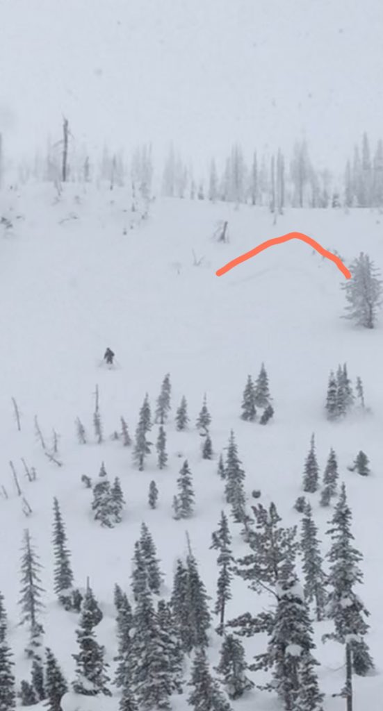
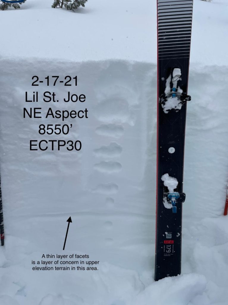
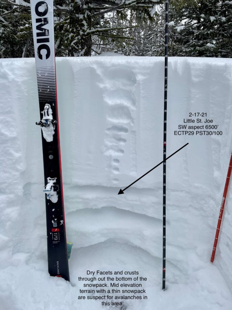
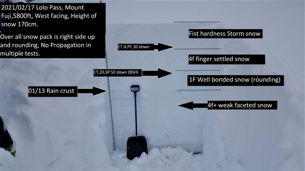
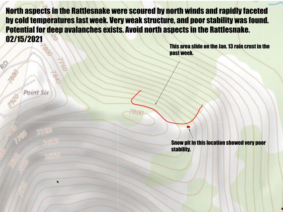
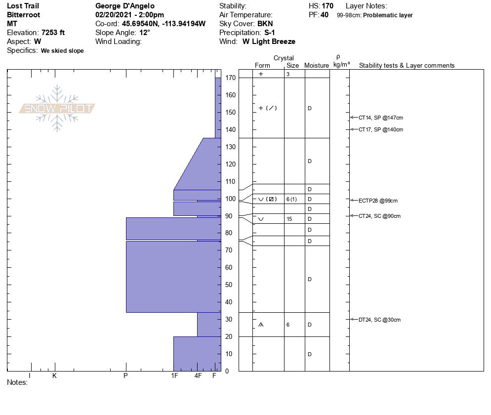
Strong winds and snowfall have created dangerous avalanche conditions. Up to 1.8″ of SWE has fallen since last night and vast amounts of snow have been transported by strong winds. 3″-7″ additional snow is expected tonight accompanied by moderate winds. Deep faceted layers are being stressed and reawakened by wind and snow load. A D4 avalanche that uprooted mature trees and ran the full length of the historic path released naturally in Lost Horse in the central Bitterroot Sunday evening, stepping down to ground. There have been multiple reports of whumpfing and settling on basal facets in the Bitterroot in the past week, indicating an unstable structure that could fail catastrophically. This is the area currently most loaded by new snow and wind, increasing the likelihood of very large, full-depth avalanches. The Rattlesnake has facets and very poor structure on north aspects that have been heavily loaded by wind and snow for the past 36 hours. Winds have also created dangerous wind slabs that are growing rapidly. In the southern Swan, these began failing naturally on Sunday, and have grown since. Cornices are huge, growing, and unstable. Cornice fall or windslab could step down to deeper layers. Sections of basal facets that could be overloaded exist throughout the region and avalanches similar to the one in Lost Horse are possible.

The Bottom Line

Travel in avalanche terrain is not recommended.  Avoid being under run-out zones, avalanches may be remotely triggered, and run to historic limits. You can trigger an avalanche remotely from the side, below, or above you. Expect the avalanche danger to be elevated as snow and winds continue.

This warning will be terminated or extended on Thursday, February 25 at 7:00 am.

Ski and ride safe.

READ FULL ADVISORY  

Problem 1 - Wind slabs

  • TYPE

    wind-slabs

    Wind Slabs

    Release of a cohesive layer of snow (a slab) formed by the wind.  Wind typically erodes snow from the upwind sides of terrain features and deposits snow on the downwind side.  Wind slabs are often smooth and rounded and sometimes sound hollow, and can range from soft to hard. Wind slabs that form over a persistent weak layer (surface hoar, depth hoar, or near-surface facets) may be termed Persistent Slabs or may develop into Persistent Slabs.

  • SIZE

    3-4

    1-2 (Small-Large)

    The potential size of avalanche resulting from this problem.

  • LIKELIHOOD

    Likelihood-8

    Very Likely/Certain

    The likelihood of an avalanche resulting from this problem.

  • ADDED DANGER

    Increased Slope Danger

    Increased/Added Danger

    There is an increased risk of avalanches on these slopes:

    N - North
    NE - Northeast
    E - East
    SE - Southeast
    S - South
    SW - Southwest
    W - West
    NW - Northwest

Strong to extreme winds and heavy precipitation have affected all elevations (video) and due to localized terrain effects, winds slab, and cross loading may be found on all aspects.

Watch for stiff, hollow sounding drifts and shooting cracks.

Windslab is building with moderate westerly winds and human-triggered avalanches are certain.

Cornices are growing and are unstable. Give them a wide berth.

Windslab avalanches and cornice fall may step down to deeper faceted layers.

Problem 2 - Persistent Slabs

  • TYPE

    persistent-slabs

    Persistent Slabs

    Release of a cohesive layer of soft to hard snow (a slab) in the middle to upper snowpack, when the bond to an underlying persistent weak layer breaks.  Persistent layers include: surface hoar, depth hoar, near-surface facets, or faceted snow. Persistent weak layers can continue to produce avalanches for days, weeks or even months, making them especially dangerous and tricky. As additional snow and wind events build a thicker slab on top of the persistent weak layer, this avalanche problem may develop into a Persistent, Deep-Slab.

  • SIZE

    7-8

    3-4 (Very Large)

    The potential size of avalanche resulting from this problem.

  • LIKELIHOOD

    Likelihood-4

    Possible/Likely

    The likelihood of an avalanche resulting from this problem.

  • ADDED DANGER

    Increased Slope Danger

    Increased/Added Danger

    There is an increased risk of avalanches on these slopes:

    N - North
    NE - Northeast
    E - East
    SE - Southeast
    S - South
    SW - Southwest
    W - West
    NW - Northwest

Faceted layers are found in multiple locations in the forecast area. These are the low likelihood/high consequence layers that have been a concern for a couple of months. The D4 R4 avalanche in Lost Horse that failed Sunday evening tells us that the tipping point has been reached and is indicative of the types of avalanches possible with the current structure and loading. The likelihood of these high consequence avalanches has risen.

Basal facets and depth hoar are present up to 7500′ and in shallow windswept areas throughout the forecast area. North aspects are more faceted. These underlie a deep consolidated snowpack that continues to be rapidly loaded. Multiple collapses on these facets in the past week reveal weak structure and an unstable snowpack.

Facets at the January 13th rain crust and buried facets at other layers also exist in the snowpack. These are being overloaded as well.

Shallow slides in windslab or upper facet layers may step down to deeper faceted layers.

Persistent slabs may fail naturally or be triggered remotely from above, below, or the side.

Avoid all avalanche terrain and provide very wide margins around runout zones.

VIDEO

FORECAST & OUTLOOK

Numerous snow showers will persist into Wednesday morning. Another 3 to 7 inches of snow is expected by noon on Wednesday. The winds will continue to be moderate, but not as strong as the last 24 hours. The area should experience a respite from the precipitation Wednesday night into Thursday. Another cold front is expected to move through the region on Thursday causing widespread snow and gusty westerly winds. The snow appears to persist through the end of the week and into Sunday morning.

This information is the sole responsibility of the Forest Service and does not apply to operating ski areas. The avalanche danger rating expires at midnight tonight but the information can help you make a more informed decision regarding travel in avalanche terrain for the next few days.

Our advisory area includes National Forest System lands in the Bitterroot Mountains from Lost Trail Pass north to Granite Pass, the Rattlesnake Mountains north of Missoula and the Southern Swan and Mission Mountains near Seeley Lake, MT. Avalanche information for the Lookout Pass/St. Regis Basin area is available from the Idaho Panhandle Avalanche Center.