Posted:
Mar 20, 2021 @ 6:49 am

The avalanche danger in the west central Montana backcountry is Low.

Good Morning. This is Jeff Carty with the West Central Montana Avalanche Center advisory on Saturday, March 20, 2021. This advisory is sponsored by REI. This advisory does not apply to operating ski areas and expires at midnight tonight. The USDA Forest Service is solely responsible for its content.

Snowpack and weather

After a very warm week that culminated with all elevations remaining above freezing on Thursday night, we are back to cooler temperatures. Mountain temperatures dipped to 20º last night and are expected to reach 38º today. Cloud cover should keep solar warming to a minimum, but the sun may come out and affect southern aspects. 0.1″-0.2″ SWE fell in the past 24 hrs, snow accumulation was negligible due to warm temperatures. Elevations below 5500′ received rain. 1″-2″ of snow is forecast today, and up to 3″ tonight. Light winds, with strong gusts, will be out of the northwest.

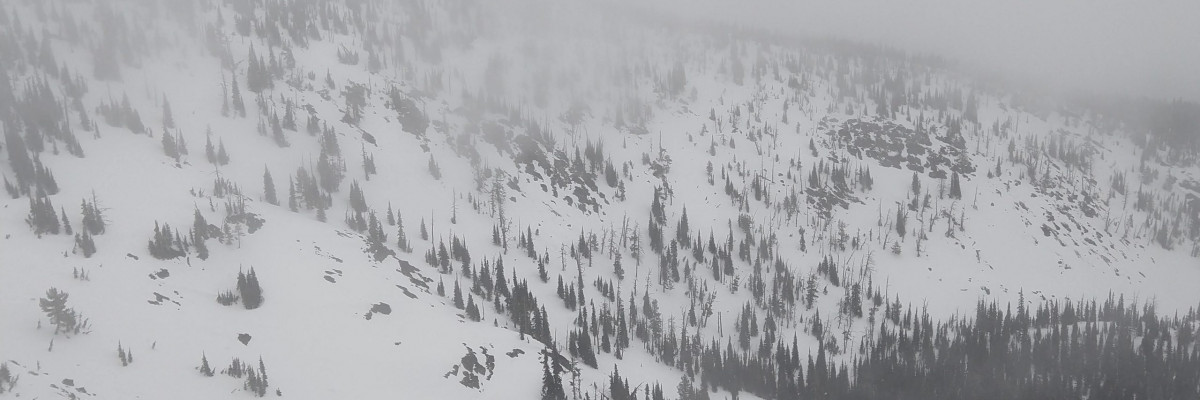
All elevations and aspects were affected by above freezing temperatures yesterday. The dry snow that had been preserved on north faces is gone and was moist to a foot down in the snowpack. Pockets of dry snow may be preserved above 8000′ feet.

Despite the week of warmth, we were able to find faceted layers at the base of the snowpack on the north, They were rounding and gaining strength, but it is worth noting that they are out there in isolated locations. They would be unlikely to trigger in the location found yesterday given the depth and the density of the overlying slab. Isolated pockets of facets may still exist in other locations. There remains a very slight possibility that just the right trigger point or cornice fall could trigger a persistent slab.

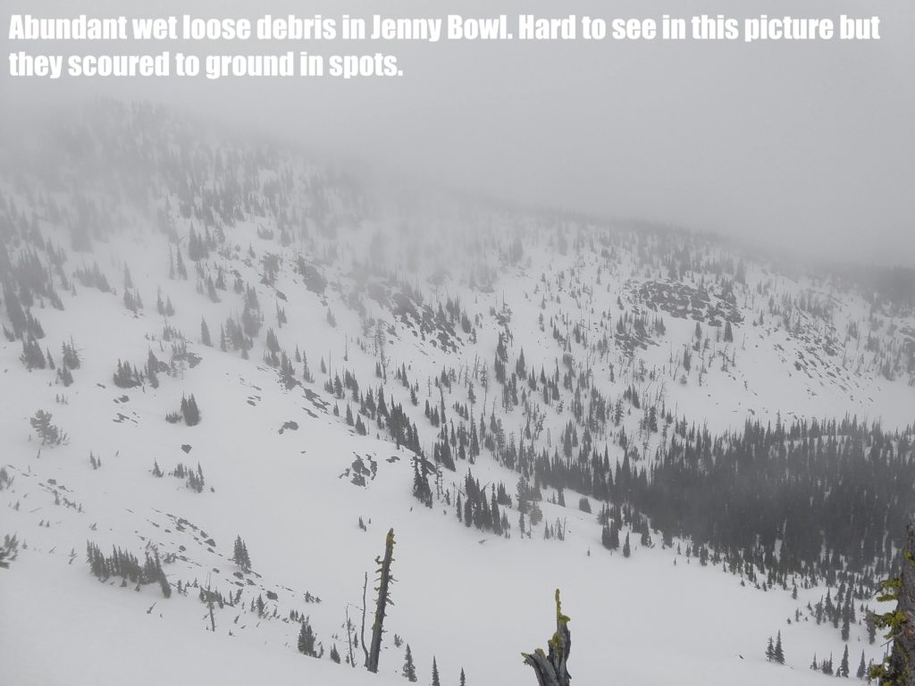
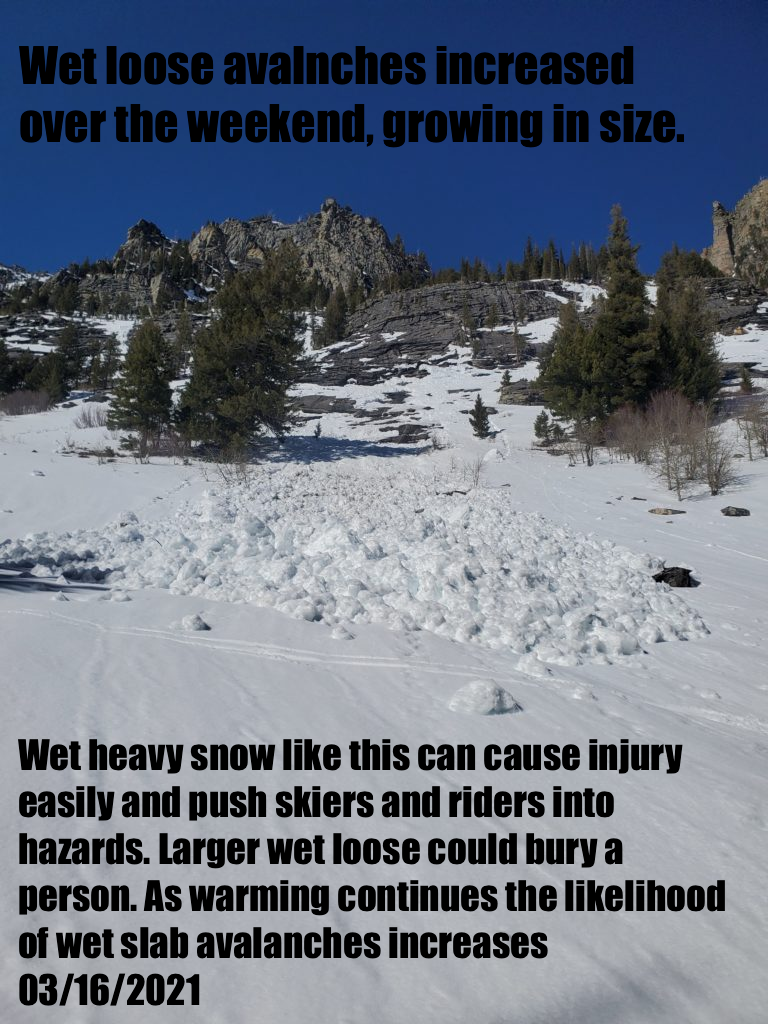
All other aspects but north were saturated to ground yesterday. Some spots were approaching isothermal, with noncohesive snow below a deteriorating crust. It’s conditions such as this that can lead to large wet spring avalanches. However, cold temperatures last night have locked the snowpack in place with a stout supportive crust. The cold nights and mild days in the forecast should keep the whole snowpack refrozen.  Avalanche hazard will remain low as long as the snowpack remains solidly frozen, or unless enough snow accumulates to create new problems. 

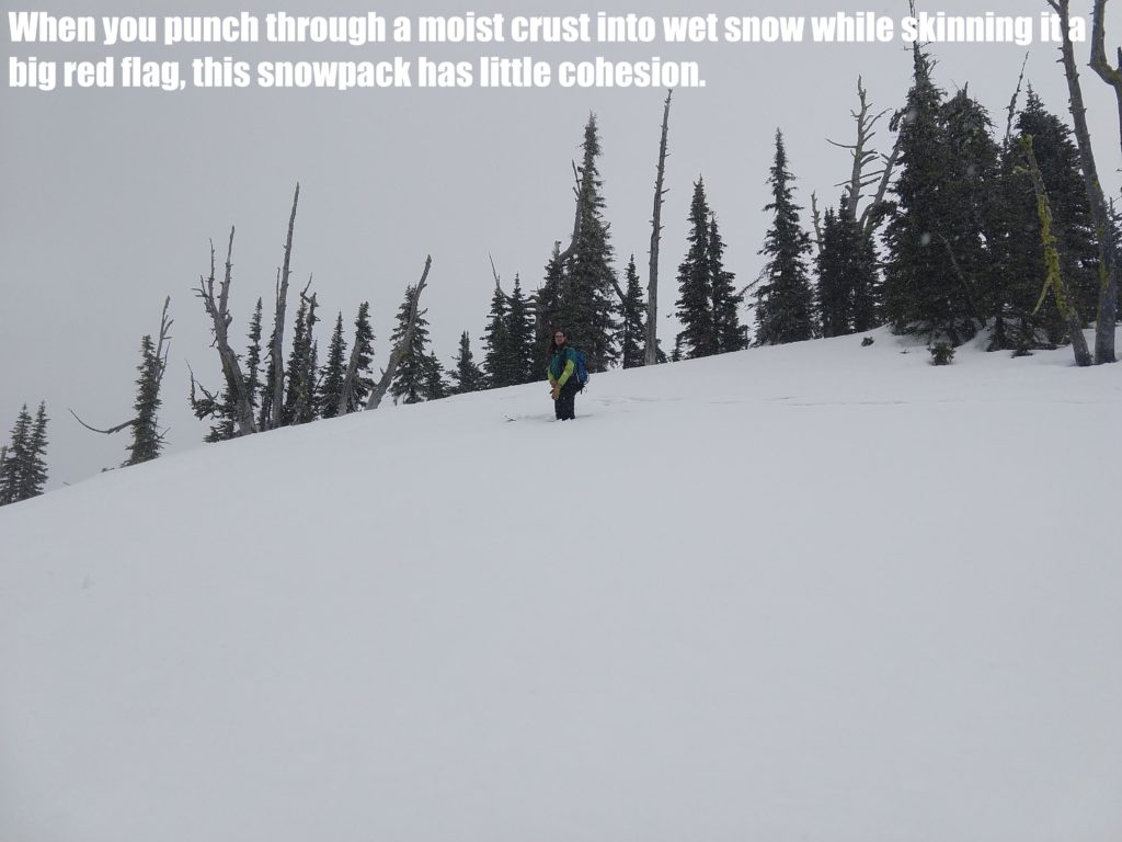
Sun, rising temperatures, or rain could cause a rise in hazard. If the snowpack is saturated more than a few inches below the surface, if you sink into softened snow to mid boot, or if you are punching through the crust into wet snow, it’s time to go. Any rain on snow should be cause for concern. 

The minimal amount of snow forecast for today is unlikely to create any instabilities. By tomorrow there may be enough, combined with wind, to create small wind slabs.

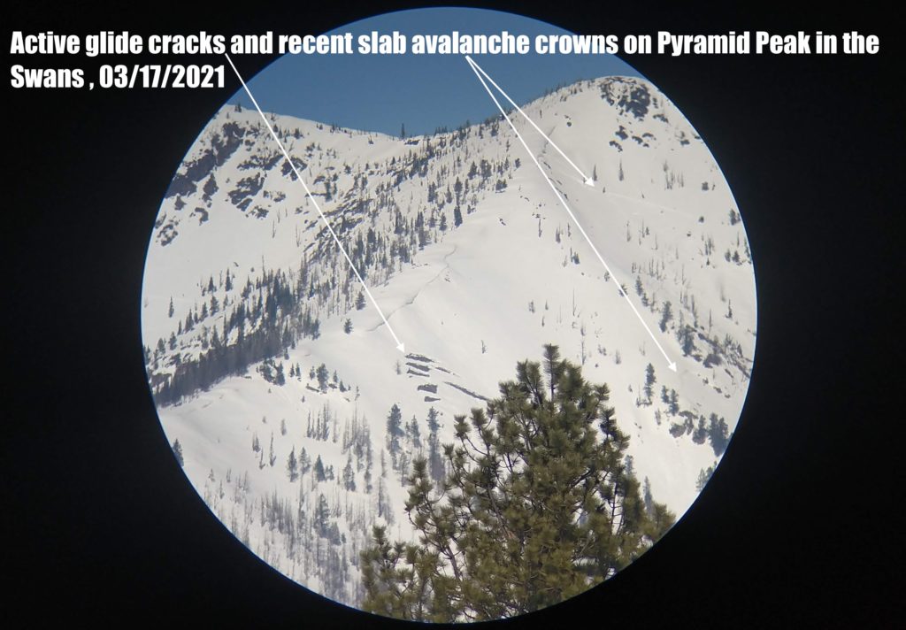
Cornices and glide cracks will be with us for the rest of the season. These are two unpredictable avalanche problems. The cornices left after the warmth are a hazard that will increase with warmth, sun, or rain. Give them a wide berth above and stay out from underneath. Glide cracks will have opened and accelerated with the warmth. While slowed, they are still opening despite cold temperatures as the ground beneath the snowpack remains unfrozen. They can fail unexpectedly, creating full-depth avalanches. Stay off slopes where they are present.

The bottom line

The snowpack has refrozen, and the hazard is low. Warming or rain may cause the hazard to rise. If you are sinking into moist snow or breaking through the supportable crust, it is time to head home. Reassess conditions throughout the day and stay alert for signs of instability. Look for red flags. Carry a beacon, shovel, and probe.
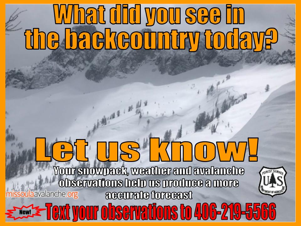
Public Observations

Thank you to everyone who has taken the time to send in a public observation. Please keep sharing what you find and see while out in the backcountry. You can now text us your observations to (406) 219-5566 when you don’t have time to fill out the observations page.

Ski and ride safe.


READ FULL ADVISORY  

Problem 1 - Wet snow problems

  • TYPE

    loose-wet

    Loose Wet

    Release of wet unconsolidated snow or slush. These avalanches typically occur within layers of wet snow near the surface of the snowpack, but they may quickly gouge into lower snowpack layers. Like Loose-Dry Avalanches,they start at a point and entrain snow as they move downhill, forming a fan-shaped avalanche. They generally move slowly, but can contain enough mass to cause significant damage to trees, cars or buildings. Other names for loose-wet avalanches include point-release avalanches or sluffs. Loose-wet avalanches can trigger slab avalanches that break into deeper snow layers.

  • SIZE

    3-4

    1-2 (Small-Large)

    The potential size of avalanche resulting from this problem.

  • LIKELIHOOD

    Likelihood-1

    Unlikely

    The likelihood of an avalanche resulting from this problem.

  • ADDED DANGER

    Increased Slope Danger

    Increased/Added Danger

    There is an increased risk of avalanches on these slopes:

    E - East
    SE - Southeast
    S - South
    SW - Southwest
    W - West

Cold overnight temperatures have frozen the snowpack solidly and wet snow avalanches are unlikely.

There is a chance that the sun could be out for a bit today, but it is unlikely to cause significant warming.

However, if the clouds part and there is a rise in temperature stay alert for warming snow that could lead to instabilities.

Rollerballs, saturated snow more than a few inches deep, or punching through crust into wet snow means it’s time to head for shadier aspects.

Problem 2 - Persistent Slabs

  • TYPE

    persistent-slabs

    Persistent Slabs

    Release of a cohesive layer of soft to hard snow (a slab) in the middle to upper snowpack, when the bond to an underlying persistent weak layer breaks.  Persistent layers include: surface hoar, depth hoar, near-surface facets, or faceted snow. Persistent weak layers can continue to produce avalanches for days, weeks or even months, making them especially dangerous and tricky. As additional snow and wind events build a thicker slab on top of the persistent weak layer, this avalanche problem may develop into a Persistent, Deep-Slab.

  • SIZE

    3-4

    1-2 (Small-Large)

    The potential size of avalanche resulting from this problem.

  • LIKELIHOOD

    Likelihood-1

    Unlikely

    The likelihood of an avalanche resulting from this problem.

  • ADDED DANGER

    Increased Slope Danger

    Increased/Added Danger

    There is an increased risk of avalanches on these slopes:

    N - North
    NE - Northeast
    NW - Northwest

We are still able to find isolated pockets of persistent weak layers. Overall it is unlikely to trigger these but a very slight possibility exists.

It would take just the right trigger point or large trigger such as cornice fall to cause these to fail.

North facing slopes, greater than 35º, convex, and with a snowpack shallower than 5 feet are where these might be triggered.


VIDEO

FORECAST & OUTLOOK

Showers look to increase in coverage today and linger through the evening. Light accumulations are expected down to 3500 feet and maybe a bit lower under stronger showers. Snow levels will lower after sunset. Breezy west and northwest winds will become widespread during this afternoon. The next weather system will bring another chance for showers with snow levels down to as low as 2500 feet. At this time, 2 to 5 inches of new snow is possible for the Bitterroot spine and towards Point 6. Due to the showery nature, some places may see more or less.

This information is the sole responsibility of the Forest Service and does not apply to operating ski areas. The avalanche danger rating expires at midnight tonight but the information can help you make a more informed decision regarding travel in avalanche terrain for the next few days.

Our advisory area includes National Forest System lands in the Bitterroot Mountains from Lost Trail Pass north to Granite Pass, the Rattlesnake Mountains north of Missoula and the Southern Swan and Mission Mountains near Seeley Lake, MT. Avalanche information for the Lookout Pass/St. Regis Basin area is available from the Idaho Panhandle Avalanche Center.