Posted:
Mar 23, 2021 @ 6:10 am

The avalanche danger in the west-central Montana backcountry is MODERATE. New snow and winds have created avalanche conditions.

Good Morning. This is Travis Craft with the West Central Montana Avalanche Center advisory on Tuesday, March 23, 2021. This advisory does not apply to operating ski areas and expires at midnight tonight. The USDA Forest Service is solely responsible for its content.

Weather and Snowpack

Temperatures range from 17 to 26 degrees this morning. Over the last 24 hours, .3 to .6 inches of SWE have been recorded. Winds will be light today.

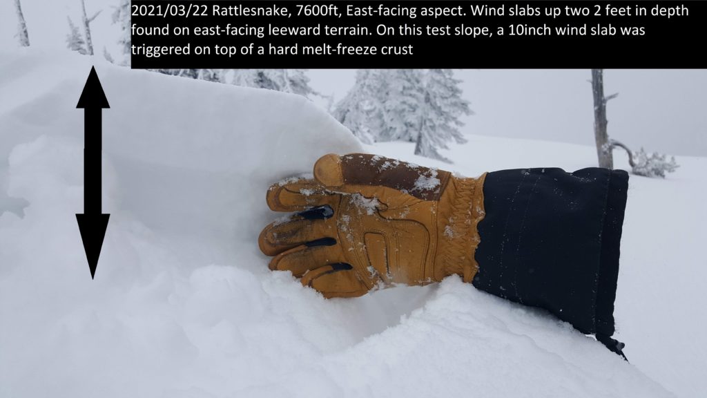
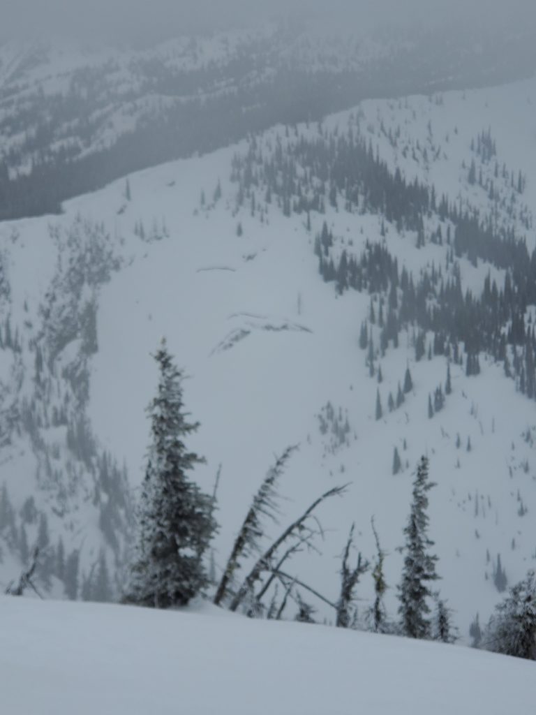
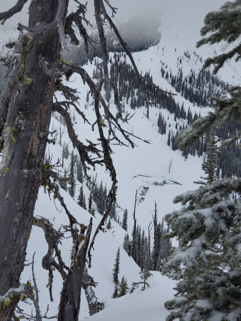
Yesterday we found upper elevation start zones and leeward aspects to have wind slabs. These slabs ranged in depth from a couple of inches to 10 inches. These slabs will be sensitive to humans today.

New snow has not bonded to old snow surfaces. This can generate small slides that can knock you off your feet. Use test slopes to see how the new snow is bonding. Terrain traps such as gullies concentrate the depth and strength of these slides. Obstacles such as cliffs or rocks will increase the likelihood of trauma.

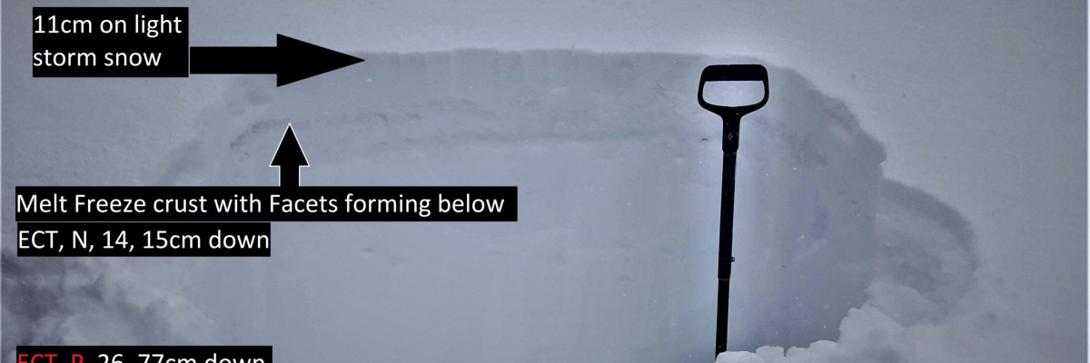
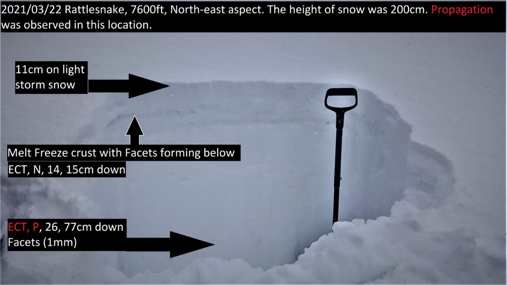
We found propagation in our pit on a north-facing slope on facets. This is not a widespread problem, but remember to reassess the snowpack as you travel in the mountains and be prepared to dial back objectives when found.

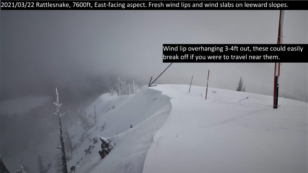
Cornices and glide cracks will be with us for the rest of the season. These are two unpredictable avalanche problems. The cornices remaining after the warmth are a hazard. This hazard will increase with warmth, sun, or rain. Give them a wide berth above and stay out from underneath. Glide cracks will have opened and accelerated with the warmth. While slowed, they are still opening despite cold temperatures as the ground beneath the snowpack remains unfrozen. They can fail unexpectedly, creating full-depth avalanches. Stay off slopes where they are present.

Bottom Line

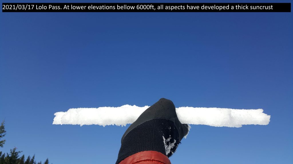
Winter weather is back. Look for sheltered slopes today. Choose slopes with a supportable crust. On these slopes managing your sluff will be important. Dig a pit. Search for instabilities, not stability. Use test slopes and hand pits to see how the new snow is bonding. Reassess conditions throughout the day and stay alert for signs of instability. Look for red flags. Carry a beacon, shovel, and probe.

Public Observations

Thank you to everyone who has taken the time to send in a public observation. Please keep sharing what you find and see while out in the backcountry. You can now text us your observations to (406) 219-5566 when you don’t have time to fill out the observations page.

Ski and ride safe.


READ FULL ADVISORY  

Problem 1 - Wind Drifted Snow

  • TYPE

    wind-slabs

    Wind Slabs

    Release of a cohesive layer of snow (a slab) formed by the wind.  Wind typically erodes snow from the upwind sides of terrain features and deposits snow on the downwind side.  Wind slabs are often smooth and rounded and sometimes sound hollow, and can range from soft to hard. Wind slabs that form over a persistent weak layer (surface hoar, depth hoar, or near-surface facets) may be termed Persistent Slabs or may develop into Persistent Slabs.

  • SIZE

    3-4

    1-2 (Small-Large)

    The potential size of avalanche resulting from this problem.

  • LIKELIHOOD

    Likelihood-3

    Possible

    The likelihood of an avalanche resulting from this problem.

New snow has been transported on ridges and leeward slopes. These wind slabs will be sensitive to human triggers.

Problem 2 - New snow

  • TYPE

    loose-dry

    Loose Dry

    Release of wet unconsolidated snow or slush. These avalanches typically occur within layers of wet snow near the surface of the snowpack, but they may quickly gouge into lower snowpack layers. Like Loose-Dry Avalanches,they start at a point and entrain snow as they move downhill, forming a fan-shaped avalanche. They generally move slowly, but can contain enough mass to cause significant damage to trees, cars or buildings. Other names for loose-wet avalanches include point-release avalanches or sluffs. Loose-wet avalanches can trigger slab avalanches that break into deeper snow layers.

  • SIZE

    3-4

    1-2 (Small-Large)

    The potential size of avalanche resulting from this problem.

  • LIKELIHOOD

    Likelihood-3

    Possible

    The likelihood of an avalanche resulting from this problem.

New snow has landed on abundance of old snow surfaces. The new snow has not bonded well to the old snow surfaces and will run fast and far. Use test slopes to see how the new snow is bonding.

Problem 3 - Persistent Weak Layers

  • TYPE

    persistent-slabs

    Persistent Slabs

    Release of a cohesive layer of soft to hard snow (a slab) in the middle to upper snowpack, when the bond to an underlying persistent weak layer breaks.  Persistent layers include: surface hoar, depth hoar, near-surface facets, or faceted snow. Persistent weak layers can continue to produce avalanches for days, weeks or even months, making them especially dangerous and tricky. As additional snow and wind events build a thicker slab on top of the persistent weak layer, this avalanche problem may develop into a Persistent, Deep-Slab.

  • SIZE

    4-5

    2 (Large)

    The potential size of avalanche resulting from this problem.

  • LIKELIHOOD

    Likelihood-2

    Unlikely/Possible

    The likelihood of an avalanche resulting from this problem.

On isolated slopes there are facets that are still propagating in tests. If you get a propagation in your pit dial back your objectives for the day.

Observations

FORECAST & OUTLOOK

  • Danger Trend

    same

    Same Danger

  • Area Forecast

    Light Snow

Unsettled weather today with a chance of light accumulations of snow today. See the forecast.

This information is the sole responsibility of the Forest Service and does not apply to operating ski areas. The avalanche danger rating expires at midnight tonight but the information can help you make a more informed decision regarding travel in avalanche terrain for the next few days.

Our advisory area includes National Forest System lands in the Bitterroot Mountains from Lost Trail Pass north to Granite Pass, the Rattlesnake Mountains north of Missoula and the Southern Swan and Mission Mountains near Seeley Lake, MT. Avalanche information for the Lookout Pass/St. Regis Basin area is available from the Idaho Panhandle Avalanche Center.