Posted:
Apr 6, 2021 @ 6:19 am

The avalanche danger in the west-central Montana backcountry is MODERATE.

Good Morning. This is Travis Craft with the West Central Montana Avalanche Center advisory on Tuesday, April 6, 2021. This is our last regular advisory of the season. This advisory does not apply to operating ski areas and expires at midnight tonight. The USDA Forest Service is solely responsible for its content.

Today’s advisory is dedicated to you, everyone that sent in observations, read the forecast, took an avalanche class, or donated money, time or equipment. This resource is the result of continued community support and partnerships. On behalf of the WCMAC, thank you for another great season.

Weather and Snowpack

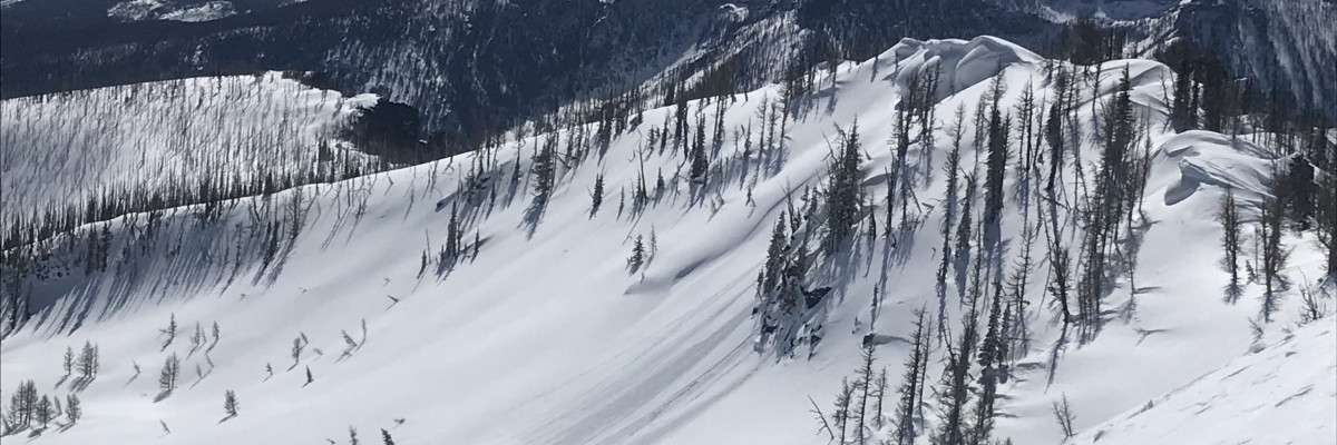
Over the last 48 hours, the snowpack has refrozen above 5000 feet. Temperatures range from 21 degrees to 31 degrees this morning. Over the last 24 hours, the advisory area has accumulated 3 to 5 new inches of snow. The weather continues to alternate between winter and spring in the mountains.

The refreezing of the snowpack will keep wet avalanche problems in check until we have another warm-up. The new snow is sitting on a refrozen surface. Look for loose dry avalanches to be small today. If the sun comes out look for the loose dry to change over to loose wet avalanches on sun-exposed slopes. If you see roller balls or start to punch through the snowpack it is time to find shadier aspects.

Timing is everything with spring conditions. Stability will be greater in the morning and decrease throughout the day.

The Bottom Line 

Warming temperatures will increase avalanche danger throughout the day. Roller balls are signs to change aspect. Use small test slopes and hand pits to check new snow depth and bonding to old snow surfaces. Dig a pit. Pay attention to terrain traps. Search for instabilities, not stability. Reassess conditions throughout the day and stay alert for signs of instability. Look for red flags. Carry a beacon, shovel, and probe.

Special Announcements

We want to reiterate our most sincere thanks for your support this season. Providing west-central Montana’s avalanche forecasts and free education programs is made possible in part through your generosity and our gracious sponsors’ help. This winter, we succeeded in reaching more people than ever before and provided new educational opportunities for all backcountry user groups. Together, we can save lives and continue creating the most fun, safe, and responsible backcountry community possible. Again, thank you for your continued support. We couldn’t do it without you!

READ FULL ADVISORY  

Problem 1 - New Snow

  • TYPE

    loose-dry

    Loose Dry

    Release of wet unconsolidated snow or slush. These avalanches typically occur within layers of wet snow near the surface of the snowpack, but they may quickly gouge into lower snowpack layers. Like Loose-Dry Avalanches,they start at a point and entrain snow as they move downhill, forming a fan-shaped avalanche. They generally move slowly, but can contain enough mass to cause significant damage to trees, cars or buildings. Other names for loose-wet avalanches include point-release avalanches or sluffs. Loose-wet avalanches can trigger slab avalanches that break into deeper snow layers.

  • SIZE

    2-3

    1 (Small)

    The potential size of avalanche resulting from this problem.

  • LIKELIHOOD

    Likelihood-3

    Possible

    The likelihood of an avalanche resulting from this problem.

Loose dry avalanches will be possible today. These avalanches should not be large. Manage your terrain where a small slide can magnify the consequences of a fall.

Problem 2 - Persistent Weak Layers

  • TYPE

    persistent-slabs

    Persistent Slabs

    Release of a cohesive layer of soft to hard snow (a slab) in the middle to upper snowpack, when the bond to an underlying persistent weak layer breaks.  Persistent layers include: surface hoar, depth hoar, near-surface facets, or faceted snow. Persistent weak layers can continue to produce avalanches for days, weeks or even months, making them especially dangerous and tricky. As additional snow and wind events build a thicker slab on top of the persistent weak layer, this avalanche problem may develop into a Persistent, Deep-Slab.

  • SIZE

    4-5

    2 (Large)

    The potential size of avalanche resulting from this problem.

  • LIKELIHOOD

    Likelihood-2

    Unlikely/Possible

    The likelihood of an avalanche resulting from this problem.

  • ADDED DANGER

    Increased Slope Danger

    Increased/Added Danger

    There is an increased risk of avalanches on these slopes:

    N - North
    NE - Northeast
    NW - Northwest

Isolated pockets of buried facets and surface hoar exist from 6″ to 18″ deep on north slopes. Overall these are well bonded but a slight possibility exists to trigger these layers in steep convex or unsupported terrain greater than 35º.

FORECAST & OUTLOOK

  • Danger Trend

    same

    Same Danger

  • Area Forecast

    Sun

Sun and temperatures rising to 40’s above 5000 feet. Tonight look for temperatures to drop below freezing. Temperatures dropping below freezing overnight will create lower avalanche danger in the morning. Look for the avalanche danger to slow increase throughout the day with sun and warming temperatures.

This information is the sole responsibility of the Forest Service and does not apply to operating ski areas. The avalanche danger rating expires at midnight tonight but the information can help you make a more informed decision regarding travel in avalanche terrain for the next few days.

Our advisory area includes National Forest System lands in the Bitterroot Mountains from Lost Trail Pass north to Granite Pass, the Rattlesnake Mountains north of Missoula and the Southern Swan and Mission Mountains near Seeley Lake, MT. Avalanche information for the Lookout Pass/St. Regis Basin area is available from the Idaho Panhandle Avalanche Center.