
Heavy mountain snowfall expected.
Hi everyone, this is Steve Karkanen at the West Central Montana Avalanche Center with early season avalanche safety information issued November 21, 2014.
The National Weather Service Office in Missoula has issued winter weather advisories and a winter storm warning for west central Montana. Heavy snowfall amounts with 40 mph W-SW winds are expected at the higher elevations starting early Saturday. Mountain locations above 6000‘ may see up to 12” of new snow by Monday.
This system will be from the west-southwest which typically means the air mass will be much warmer and wetter than last week’s arctic blast.
This storm has the potential to add a lot of water weight onto a relatively weak snowpack structure in some locations.
The Saddle Mountain, Twin Lakes, North Fork Jocko and Stuart Peak SNOTEL sites were reporting 10-15” of snow on the ground earlier this week. The current snowpack has already been through several periods of cold dry air and big temperature gradients. Many locations now have facets at the surface and deeper into the snow near old melt freeze crusts.
This is similar to the early conditions last year when brutally cold late November and December temperatures formed a layer of facets near the ground which persisted for several weeks. This will need to be closely watched for the next few weeks.
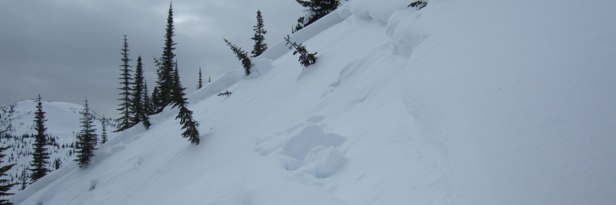
While it may seem early and even look a bit thin from the valley, the higher peaks and ridges have more than enough snow to allow avalanches to form.
In past years there have been a number of early season close calls and fatalities in Montana involving hunters and climbers. Hunters tend to travel solo without avalanche rescue equipment as avalanches are about the last thing they are thinking of as they follow elk tracks across steep, open terrain.
If you see any of these obvious clues to dangerous snow conditions, avoid being on or under open slopes steeper than 30 degrees.
- recent avalanche activity –
- cracking or collapsing snowpack
- heavy snowfall
- high winds
- rapid increase in temperature
If you spend any amount of time in the mountains in the winter, chances are good that you will encounter avalanche terrain. Having basic awareness of terrain, weather and snow factors goes a long way toward making good decisions in avalanche terrain. To that end we are offering several basic and advanced avalanche awareness classes this winter. We also have instructors available to give your organization a range of programs from introductory to classes with a field component. Check out our course offerings here: http://www.missoulaavalanche.org/education-events/
We plan to begin issuing regular avalanche advisories on Friday December 12, 2014.


