Posted:
Dec 23, 2014 @ 6:18 am

On slopes above 6000 feet that are steeper than 30 degrees, the avalanche danger is considerable in the west central Montana backcountry.  We have rescinded the avalanche warning issued Sunday afternoon; but snow and high winds have loaded steep slopes and human-triggered avalanches are still likely.

Good Morning, this is Dudley Improta with the west central Montana avalanche advisory for December 23, 2014. This danger rating does not apply to operating ski areas and expires at midnight tonight (Dec. 23).

Weather and Snowpack

Relatively nice weather is on tap for today. Mountain temperatures are ranging from 14 – 25 degrees F. West and southwest winds are blowing 11-14 mph and  gusting into the 20 mph range. This will be short lived, as another storm is expected tonight.

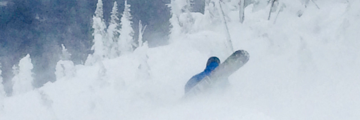
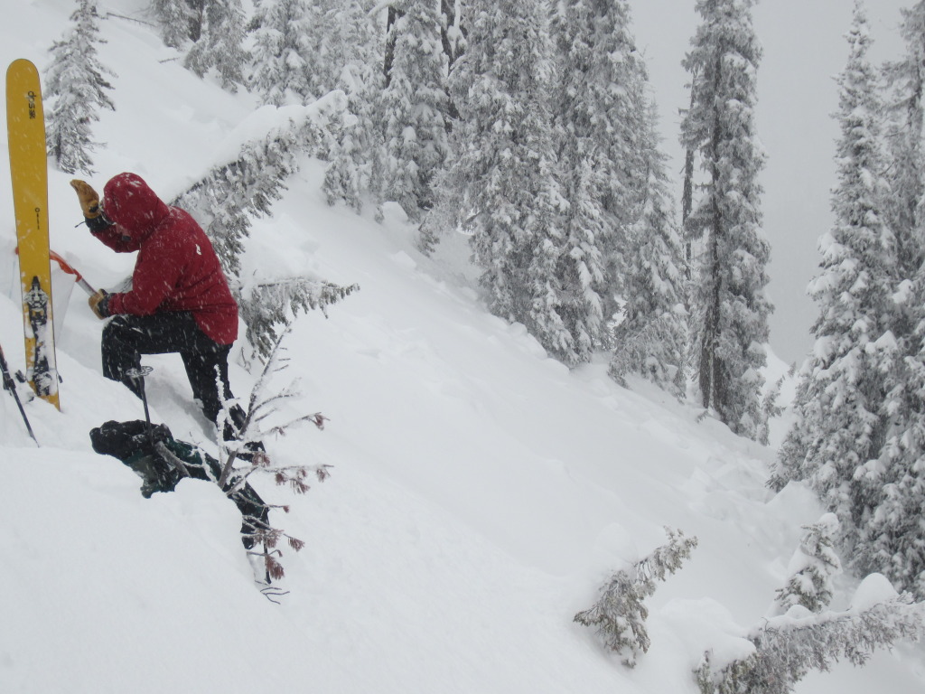
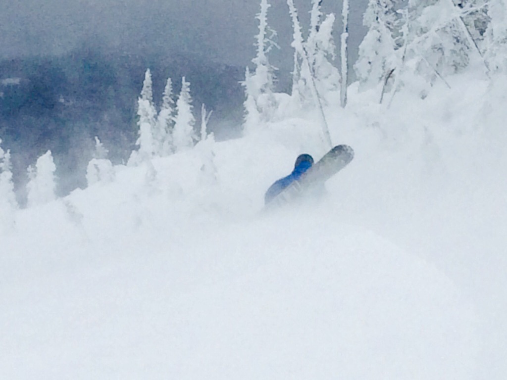
Snow accompanied by high winds created dangerous avalanche conditions the past two days. Steve and I triggered remote avalanches Sunday and we received good observations from the public, reporting natural and triggered avalanches.

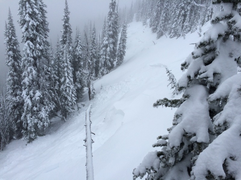
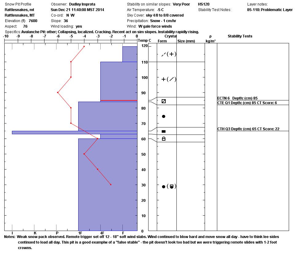
Yesterday we took a tour in the Rattlesnakes and our observations indicated the snow had settled out somewhat; but there were plenty of  signs a slide could be triggered. We observed many natural releases that propagated up to 100 yards; and our snow pit tests showed the slab strengthening but retaining energy.

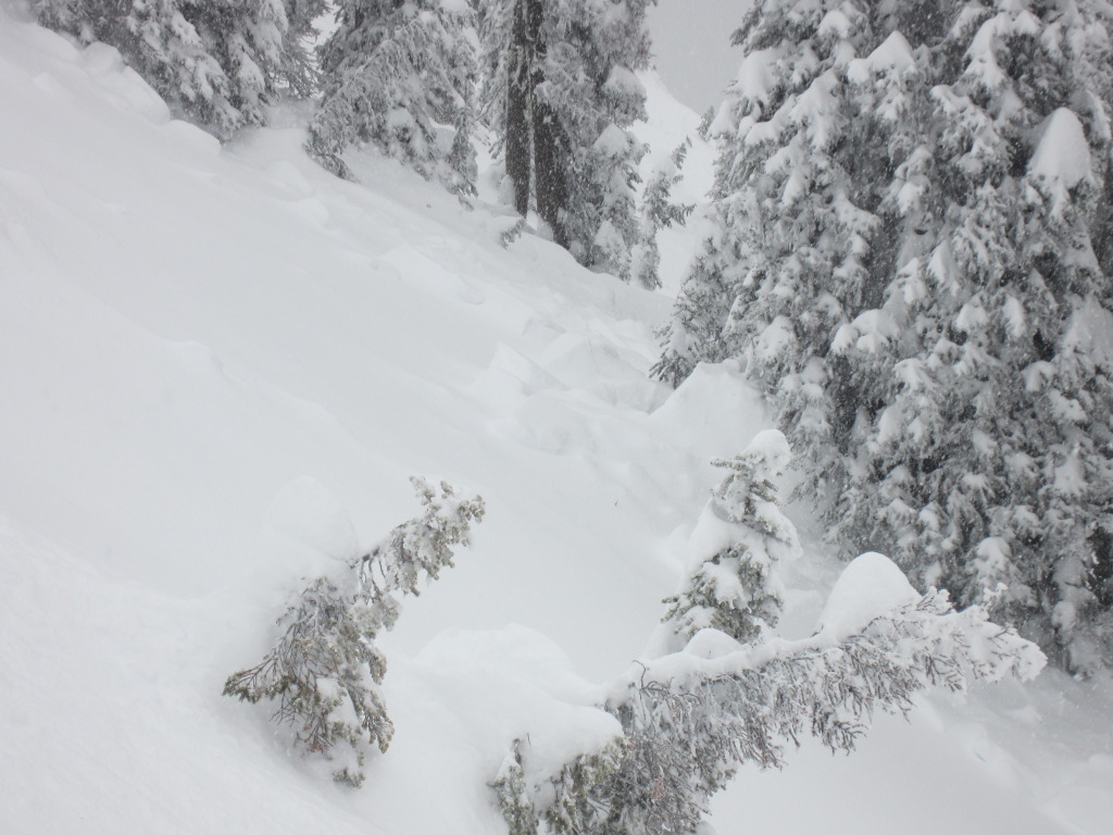
The Snowbowl Patrol was able to trigger a lot of activity with explosives. Cross-loaded southwest couloirs produced slab avalanches; with the most leeward areas seeing crowns up to 2 feet. Again, in the most leeward areas, they experienced extensive whoomphing, settlement and cracking.

I would expect the snow to be even more sensitive in the central and southern (Lost Trail Pass backcountry) Bitterroots because of the increased snow load in these areas over the past couple of days.

All this tells me, that although we may be past the crux of this cycle, instabilities in the snowpack can be triggered. I would tiptoe around for another day or two.  That being said, more storms are on the way, and tiptoeing may be standard operating procedure for a while.

Weather Forecast and Avalanche Outlook

Brief high pressure will build into the area today. Another storm is expected to move through on Wednesday and Thursday. This storm may produce 6 to 8 inches of snow. Winds, mainly out of the west and southwest, will be less than what we have experienced; but still strong enough to move the new snow. I would expect the avalanche danger on steep terrain to remain elevated for the immediate future.

Steve will issue the next advisory on Boxing Day, 2014 (Friday). Ski and ride safe, have a great holiday.

Public observations can be important to the avalanche advisory and to riders and skiers.  If you would like to send us snow observations use our public observations form or e-mail us at  [email protected] .

READ FULL ADVISORY  

Problem 1 - Wind Slabs

  • TYPE

    wind-slabs

    Wind Slabs

    Release of a cohesive layer of snow (a slab) formed by the wind.  Wind typically erodes snow from the upwind sides of terrain features and deposits snow on the downwind side.  Wind slabs are often smooth and rounded and sometimes sound hollow, and can range from soft to hard. Wind slabs that form over a persistent weak layer (surface hoar, depth hoar, or near-surface facets) may be termed Persistent Slabs or may develop into Persistent Slabs.

  • SIZE

    4-5

    2 (Large)

    The potential size of avalanche resulting from this problem.

  • LIKELIHOOD

    Likelihood-6

    Likely/Very Likely

    The likelihood of an avalanche resulting from this problem.

  • ADDED DANGER

    Increased Slope Danger

    Increased/Added Danger

    There is an increased risk of avalanches on these slopes:

    N - North
    NE - Northeast
    E - East
    SE - Southeast
    S - South
    W - West
    NW - Northwest

  • IMAGE

Wind slabs from the snow and high winds on Sunday and Monday  are still a concern. On Sunday, many natural avalanches ran on wind-loaded slopes. Steep slopes (>30 deg.) above 6000 feet, that haven’t run, are highly suspect.

Problem 2 - Lingering storm slabs

  • TYPE

    storm-slabs

    Storm Slabs

    Release of a soft cohesive layer (a slab) of new snow which breaks within the storm snow or on the old snow surface. Storm-slab problems typically last between a few hours and few days. Storm-slabs that form over a persistent weak layer (surface hoar, depth hoar, or near-surface facets) may be termed Persistent Slabs or may develop into Persistent Slabs.

  • SIZE

    4-5

    2 (Large)

    The potential size of avalanche resulting from this problem.

  • LIKELIHOOD

    Likelihood-4

    Possible/Likely

    The likelihood of an avalanche resulting from this problem.

  • ADDED DANGER

    Increased Slope Danger

    Increased/Added Danger

    There is an increased risk of avalanches on these slopes:

    N - North
    NE - Northeast
    E - East
    SE - Southeast
    S - South
    SW - Southwest
    W - West
    NW - Northwest

Even in areas that are not wind-loaded, storm slabs from Sunday and Monday exist on steep (>30 deg.) slopes above 6000 feet.

Photos and pit from 12/21 – 12/22/14

FORECAST & OUTLOOK

Brief high pressure will build into the area today. Another storm is expected to move through on Wednesday and Thursday. This storm may produce 6 to 8 inches of snow. Winds, mainly out of the West and Southwest, will be less robust than what we have experienced; but still strong enough to move the new snow. I would expect the avalanche danger on steep terrain to remain elevated for the immediate future.

This information is the sole responsibility of the Forest Service and does not apply to operating ski areas. The avalanche danger rating expires at midnight tonight but the information can help you make a more informed decision regarding travel in avalanche terrain for the next few days.

Our advisory area includes National Forest System lands in the Bitterroot Mountains from Lost Trail Pass north to Granite Pass, the Rattlesnake Mountains north of Missoula and the Southern Swan and Mission Mountains near Seeley Lake, MT. Avalanche information for the Lookout Pass/St. Regis Basin area is available from the Idaho Panhandle Avalanche Center.