
We are continuing the avalanche warning issued yesterday. On slopes steeper than 30 degrees the avalanche danger in the west central Montana backcountry is high. Heavy snow and strong winds from Sunday and Monday have loaded steep backcountry terrain. Travel in avalanche terrain or in avalanche run-out zones is not recommended. The area is under a winter storm warning until 11 am this morning.
This danger rating expires at midnight tonight (January 6) and does not apply to operating ski areas.
Good morning, this Dudley Improta with the West Central Montana Avalanche Center’s avalanche advisory for January 6, 2015.
Weather & Snowpack Discussion
This morning west and southwest mountain winds are blowing at 10-11 mph and gusting to 30 mph. Temperatures above 6000 feet are just below or above freezing, 27-35 degrees F.
The robust winter storm that moved through the area Sunday and Monday should begin to abate by mid-morning. Yesterday we issued an avalanche warning due to heavy snows and strong winds. Rain up to 5000 feet increased the instability of the storm snow at lower elevations; while elevations above 6000 feet accumulated warmer, heavy snows on top of the existing colder snow; and things started moving.
Slides on highways and roads were noted in the region. Snotels are showing 14 to 16 inches of snow with 2 to 3 inches of snow water in the last 48 hours. This is a heavy load to put on the snowpack and it will take some time to adjust.
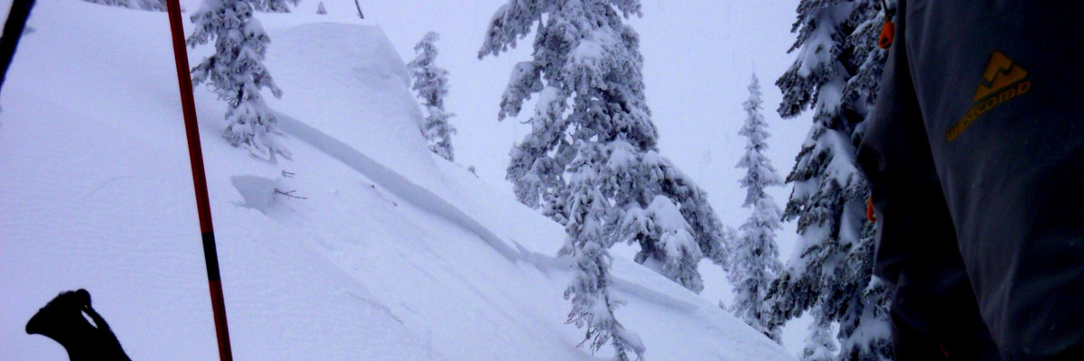
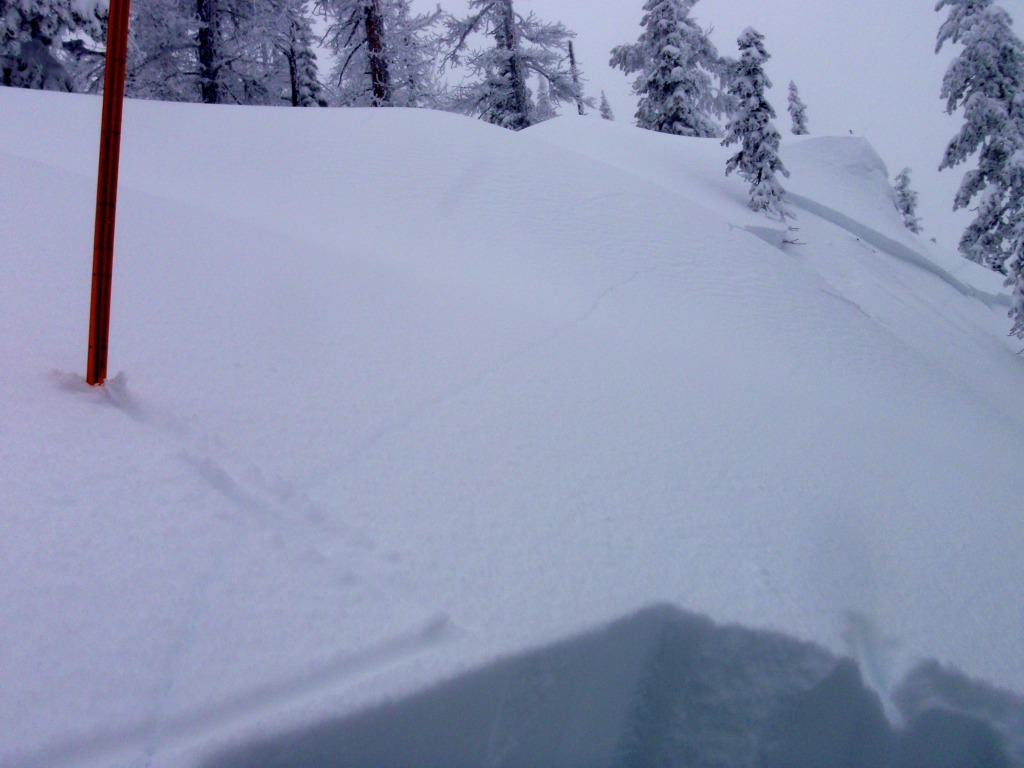
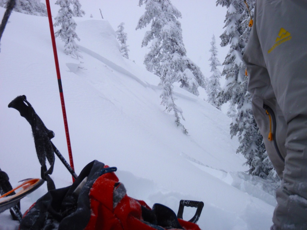
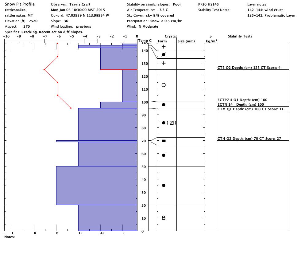
The Snowbowl Patrol triggered 1 to 1.5 foot slabs on southwest aspects with explosives yesterday. With 50-100 yards of visibility, Travis and I traveled in the Rattlesnakes near the Snowbowl Ski Area. We triggered smallish, remote storm slabs on north aspects; but we were sticking to very safe terrain. I suspect there are larger slabs ready to go on big, steep open bowls.
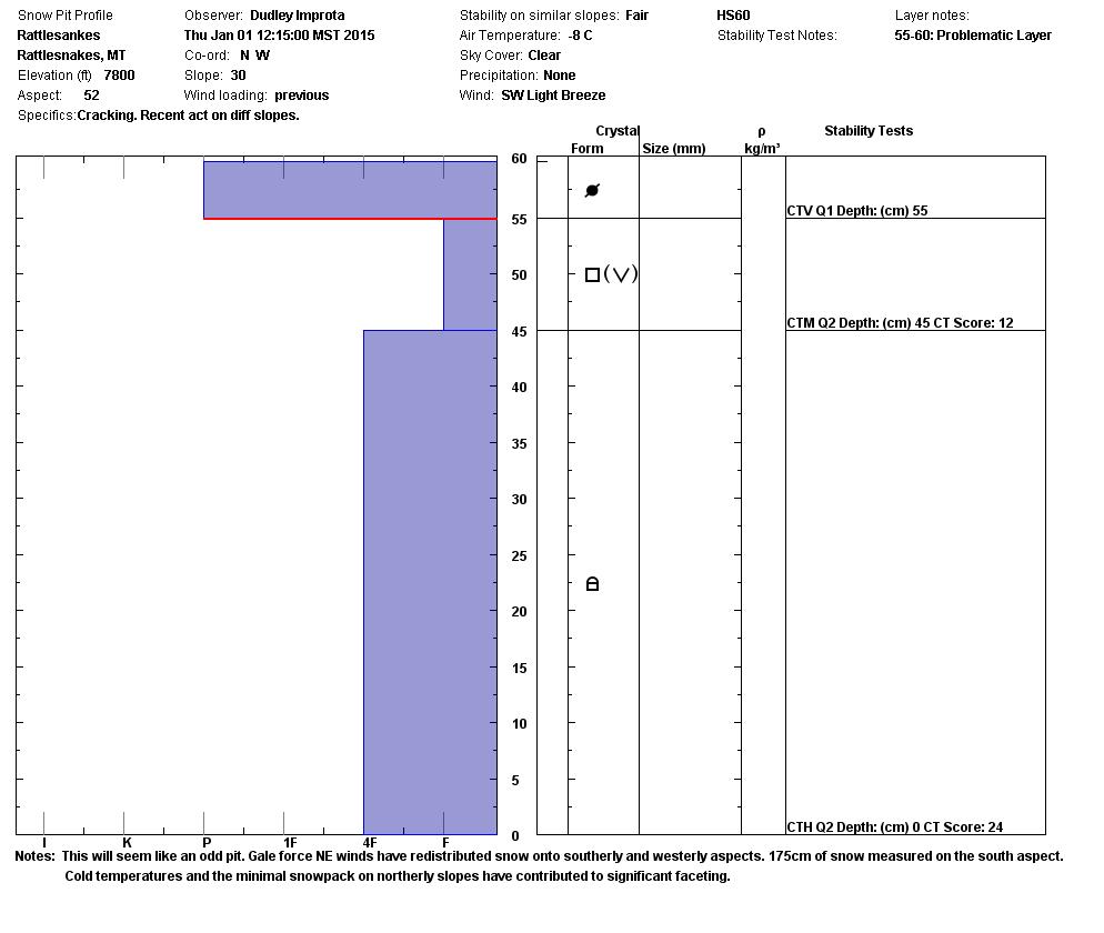
I have added Steve’s pit from 1/1/15 in the photos below to remind you of the weak structure we observed on north and northeast slopes. The new, heavy snow is sitting on this weak structure in areas that north and northeast winds hammered at the end of December.
The good news is the warmer temperatures will probably help settle things out in a day or two.
Avalanche & Weather Outlook
High pressure will build into the northern Rockies this evening and into Wednesday. Temperatures may warm for elevations above 4000 feet. Moderate snowfall is predicted along the Divide on Thursday. The warm temperatures should help the snow stabilize quickly.
North Fork of Placid Creek Avalanche Incident
On December 27, 2014 four snowmobilers were caught in an avalanche near Seeley lake. There were two complete burials, but no injuries. We have posted the incident report on our documents page.
Avalanche Hazard and Weather Forecasting for Backcountry Recreationists
We are presenting a free lecture designed to improve your avalanche hazard and weather forecasting skills. Luke Zukiewicz, Snow Hydrologist with the Natural Resource Conservation Service (Montana Snow Survey Program Manager) and Lee Ann Allegretto, Meteorologist and Avalanche Program Manager with the National Weather Service in Missoula are the featured speakers.
They will be discussing how to interpret and use weather and snowpack data available on the web.
Wednesday, January 21 – 6-8pm at the Trailhead 221 East Front Street Missoula, MT
Ride and ski safe. I will issue the next regularly scheduled advisory Friday, December 9.


