Posted:
Jan 20, 2015 @ 6:27 am

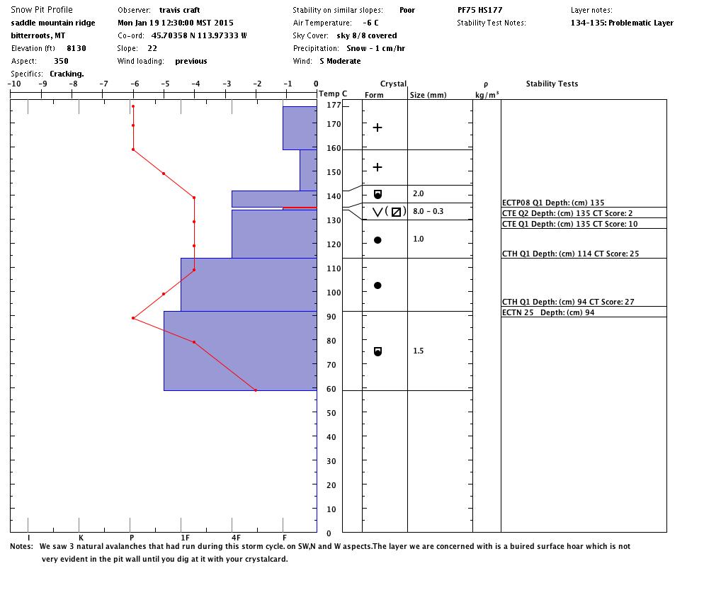
The avalanche danger is CONSIDERABLE on any terrain above 6000 feet steeper than 30 degrees in the Bitterroot range from Lost Trail to Hoodoo Pass.

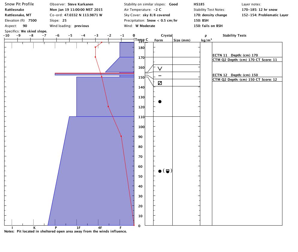
In the more northern Rattlesnake and southern Swan and Mission Mountains near Seeley Lake, high winds and new snow has also increased the avalanche danger to CONSIDERABLE on any wind loaded slope steeper than 30 degrees at elevations above 6000 feet.

Considerable means dangerous avalanche conditions exist. Natural avalanches are possible, human triggered avalanches likely. Use good terrain and travel management skills and be conservative in your decision making.

Below 6000 feet, and on other slopes not affected by the wind and heavy new snow, the avalanche danger is MODERATE. Natural avalanches are unlikely but human triggered avalanches are possible.

Hello backcountry skiers and riders, this is Steve Karkanen with the Tuesday January 20th avalanche advisory from the West Central Montana Avalanche Center. The above danger rating expires at midnight tonight and does not apply to operating ski areas.

Winds in excess of 60mph pounded western Montana the past 48 hours. The wind on Point Six was recorded at 70mph from the west on Sunday. The Bitterroot mountains picked up several inches of precipitation in this storm with rain falling at pass levels Sunday. This rain did turn back to snow and all mountain locations received snow through the day Monday. This morning, winds are more tolerable and mountain temperatures are in the 20’s. SNOTEL sites report an additional 2-5 inches new snow overnight.

We had observers in several locations throughout the area yesterday and received a couple of valuable public observations. Observers in the southern Bitterroot near Lost Trail report a weak snow structure involving the buried surface hoar that formed last week. This weak layer is very sensitive on steep terrain and wind loaded areas will be especially touchy for a few days.

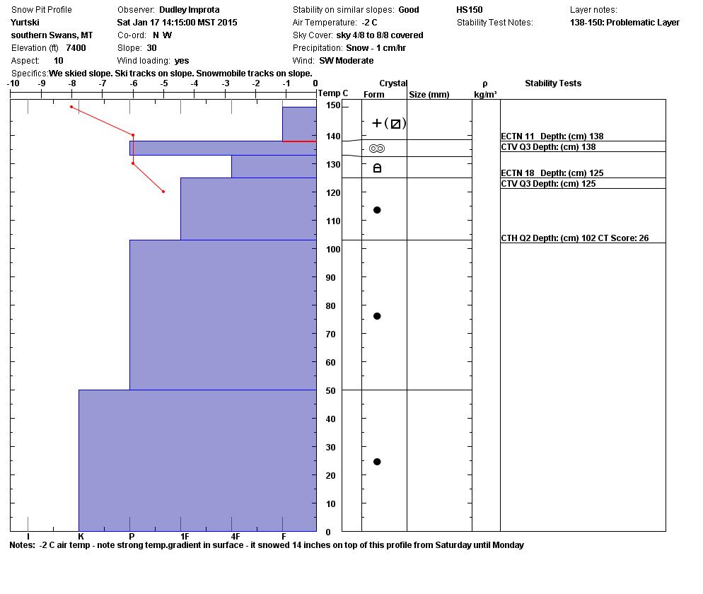
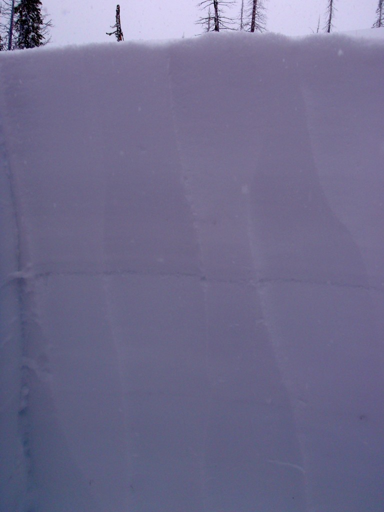
The more northern locations in the Rattlesnake and southern Swan ranges are not as touchy as the Bitterroot appears to be right now but in both cases, it’s a tricky situation. Everything we see on our tours tell us that we are in a mostly stable condition until we start digging and doing stability tests.  We still find snappy clean failures nearly 3 feet deep in some areas (Rattlesnake and near Lolo Pass). You can’t tell if these weak layers are present on a slope by just looking at it or traveling across it. You have to dig.


On Wednesday evening we are sponsoring a free backcountry weather workshop at the Trail Head, 221 East Front from 6-8pm. Learn how to use SNOTEL information and hear about new National Weather Service forecasting products.

Dudley will issue the next advisory on Friday January 23.

READ FULL ADVISORY  

Problem 1 - Sensitive wind slabs

  • TYPE

    wind-slabs

    Wind Slabs

    Release of a cohesive layer of snow (a slab) formed by the wind.  Wind typically erodes snow from the upwind sides of terrain features and deposits snow on the downwind side.  Wind slabs are often smooth and rounded and sometimes sound hollow, and can range from soft to hard. Wind slabs that form over a persistent weak layer (surface hoar, depth hoar, or near-surface facets) may be termed Persistent Slabs or may develop into Persistent Slabs.

  • SIZE

    3-4

    1-2 (Small-Large)

    The potential size of avalanche resulting from this problem.

  • LIKELIHOOD

    Likelihood-5

    Likely

    The likelihood of an avalanche resulting from this problem.

  • ADDED DANGER

    Increased Slope Danger

    Increased/Added Danger

    There is an increased risk of avalanches on these slopes:

    N - North
    NE - Northeast
    E - East
    SE - Southeast
    S - South

Above 8000 feet wind speeds of up to 70mph Sunday and 30-40mph winds Monday moved any available snow onto leeward terrain. Winds have diminished this morning but may still be strong enough to move snow from the higher peaks and ridges.

Problem 2 - Persistent weak layers

  • TYPE

    persistent-slabs

    Persistent Slabs

    Release of a cohesive layer of soft to hard snow (a slab) in the middle to upper snowpack, when the bond to an underlying persistent weak layer breaks.  Persistent layers include: surface hoar, depth hoar, near-surface facets, or faceted snow. Persistent weak layers can continue to produce avalanches for days, weeks or even months, making them especially dangerous and tricky. As additional snow and wind events build a thicker slab on top of the persistent weak layer, this avalanche problem may develop into a Persistent, Deep-Slab.

  • SIZE

    4-5

    2 (Large)

    The potential size of avalanche resulting from this problem.

  • LIKELIHOOD

    Likelihood-2

    Unlikely/Possible

    The likelihood of an avalanche resulting from this problem.

  • ADDED DANGER

    Increased Slope Danger

    Increased/Added Danger

    There is an increased risk of avalanches on these slopes:

    N - North
    NE - Northeast
    E - East
    SE - Southeast
    S - South

The surface hoar layer that formed last week needs to be considered for several more days. It was destroyed in many locations but we can find it in pockets sheltered from the wind and sun.  The deeper faceted layer 70-100cm (2-3 feet deep) is still failing cleanly in compression testing but is not propagating like it was last Thursday. East to north aspects are the likely places to find these weak layers. These persistent weaknesses are widespread throughout the advisory area.

Problem 3 - Storm snow slab

  • TYPE

    storm-slabs

    Storm Slabs

    Release of a soft cohesive layer (a slab) of new snow which breaks within the storm snow or on the old snow surface. Storm-slab problems typically last between a few hours and few days. Storm-slabs that form over a persistent weak layer (surface hoar, depth hoar, or near-surface facets) may be termed Persistent Slabs or may develop into Persistent Slabs.

  • SIZE

    3-4

    1-2 (Small-Large)

    The potential size of avalanche resulting from this problem.

  • LIKELIHOOD

    Likelihood-5

    Likely

    The likelihood of an avalanche resulting from this problem.

  • ADDED DANGER

    Increased Slope Danger

    Increased/Added Danger

    There is an increased risk of avalanches on these slopes:

    N - North
    NE - Northeast
    E - East
    SE - Southeast
    S - South
    SW - Southwest
    W - West
    NW - Northwest

In the Bitterroot Range from Lolo Pass to Lost Trail Pass at elevations above 6000 feet, heavy new snow is easily failing on the weak layer that formed during the clear weather last week. The buried surface hoar layer seems to be more pronounced in the Bitterroot mountains than we see in the Rattlesnake, southern Missions and Swans.

Profiles and pictures from January 19, 2015.

FORECAST & OUTLOOK

The Missoula Weather Service Office is forecasting high pressure to once again build over the area later today. There’s a good chance inversions will set up with warmer mountain temperatures.

Expect the avalanche danger to slowly improve while the high pressure is over us. Wind slabs should be avoided for a few more days.

This information is the sole responsibility of the Forest Service and does not apply to operating ski areas. The avalanche danger rating expires at midnight tonight but the information can help you make a more informed decision regarding travel in avalanche terrain for the next few days.

Our advisory area includes National Forest System lands in the Bitterroot Mountains from Lost Trail Pass north to Granite Pass, the Rattlesnake Mountains north of Missoula and the Southern Swan and Mission Mountains near Seeley Lake, MT. Avalanche information for the Lookout Pass/St. Regis Basin area is available from the Idaho Panhandle Avalanche Center.