Posted:
Feb 27, 2015 @ 6:25 am

The avalanche danger is MODERATE on shaded north facing and recently wind loaded terrain steeper than 35 degrees above 7000 feet. Natural avalanches are unlikely, human triggered avalanches are possible. Heightened avalanche conditions exist in mostly isolated steep terrain and in areas where cold temperatures have allowed weak layers to persist and come back to life each time it snows heavily.

The avalanche danger is LOW at all other mountain locations in west central Montana.

Hello backcountry skiers and riders! This is Steve Karkanen with the West Central Montana Avalanche Center’s backcountry avalanche advisory for Friday, February 27. This information is the responsibility of the Forest Service and does not apply to operating ski areas.


Weather and Snowpack

Mountain temperatures are in the teens and low twenties this morning with light W-SW winds at 8000 feet. No precipitation has been recorded in the past 24 hours.

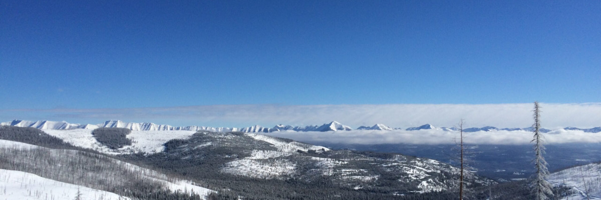
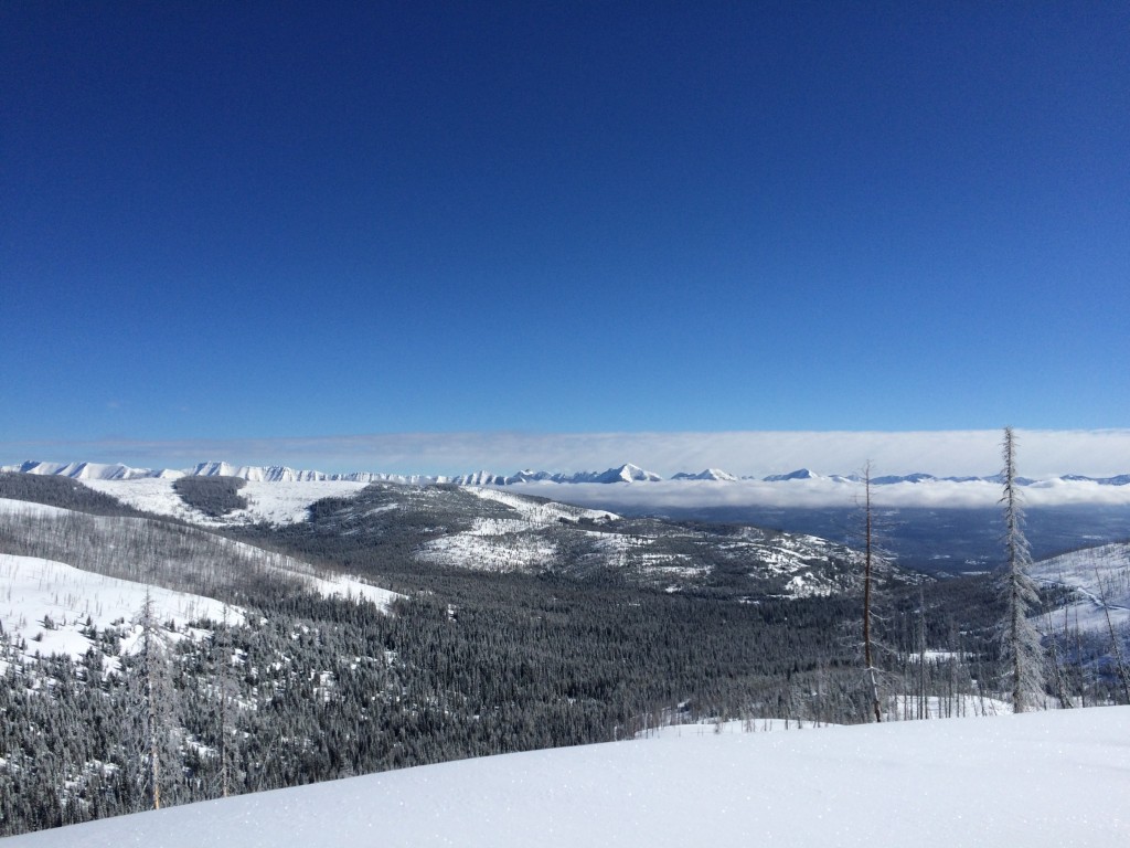
The Rattlesnake and southern Mission Mountains west of Seeley Lake picked up another 5-6 inches of snow Wednesday with other locations receiving much less.

Wind slabs formed in many lee areas and the new snow will slough on slopes steeper than 40 degrees.

There is plenty of snow available for transport so wind slabs will continue to be the primary avalanche problem for the next few days. On very steep terrain, loose snow avalanches are the secondary concern.

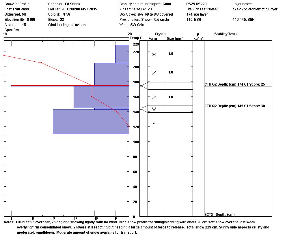
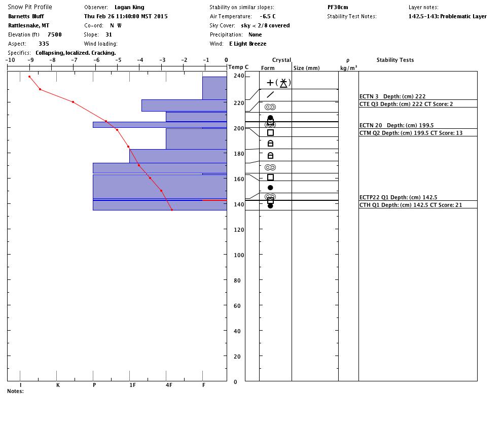
In the Rattlesnake, Travis and Logan found that the new snow has reactivated the now deeply buried facet layer that formed in January. They were able to get full propagation in several tests on a shaded north aspect (see video).   Ed and Casey found this layer on shaded aspects and it was reactive in compression testing (CTH25 Q2).

Colder temperatures have allowed the deeply buried facet layers to persist and become reactive with new snow in some locations. This is best described as a “spotty and isolated” problem. Most other locations visited this week do not have this persistent weakness so it is not widespread. The Rattlesnake and southern Missions received the most snowfall since last weekend (10″ to 14″ with an additional 4″ to 6″ yesterday in the Missions).  The additional load was just enough to “wake up” this old problem.

It is also casts enough uncertainty into the equation to bring the avalanche danger up a notch.  It’s worth taking the time to see if it exists.


Weather and Avalanche Forecast

Missoula Weather is forecasting scattered snow showers accompanied by gusty east winds through Friday. Colder air will settle in over the weekend and is expected to remain through mid week. Only light snow is expected this weekend.

The avalanche danger will remain similar for the next few days as cold air takes hold. Heavy new snow, high winds or a rapid increase in temperatures will raise the avalanche danger.

The snow surface is recrystallizing under the influence of strong temperature differences in the upper few inches of the snowpack.  This will be the next weak layer if it snows heavily again.


Dudley will issue the next advisory on Tuesday, March 3.


READ FULL ADVISORY  

Problem 1 - Wind slabs

  • TYPE

    wind-slabs

    Wind Slabs

    Release of a cohesive layer of snow (a slab) formed by the wind.  Wind typically erodes snow from the upwind sides of terrain features and deposits snow on the downwind side.  Wind slabs are often smooth and rounded and sometimes sound hollow, and can range from soft to hard. Wind slabs that form over a persistent weak layer (surface hoar, depth hoar, or near-surface facets) may be termed Persistent Slabs or may develop into Persistent Slabs.

  • SIZE

    2-3

    1 (Small)

    The potential size of avalanche resulting from this problem.

  • LIKELIHOOD

    Likelihood-2

    Unlikely/Possible

    The likelihood of an avalanche resulting from this problem.

  • ADDED DANGER

    Increased Slope Danger

    Increased/Added Danger

    There is an increased risk of avalanches on these slopes:

    N - North
    NE - Northeast
    E - East
    SE - Southeast
    S - South

Wind slabs will easily form on any lee terrain as the wind increases today.

Problem 2 - Loose snow avalanches

  • TYPE

    loose-dry

    Loose Dry

    Release of wet unconsolidated snow or slush. These avalanches typically occur within layers of wet snow near the surface of the snowpack, but they may quickly gouge into lower snowpack layers. Like Loose-Dry Avalanches,they start at a point and entrain snow as they move downhill, forming a fan-shaped avalanche. They generally move slowly, but can contain enough mass to cause significant damage to trees, cars or buildings. Other names for loose-wet avalanches include point-release avalanches or sluffs. Loose-wet avalanches can trigger slab avalanches that break into deeper snow layers.

  • SIZE

    2-3

    1 (Small)

    The potential size of avalanche resulting from this problem.

  • LIKELIHOOD

    Likelihood-2

    Unlikely/Possible

    The likelihood of an avalanche resulting from this problem.

  • ADDED DANGER

    Increased Slope Danger

    Increased/Added Danger

    There is an increased risk of avalanches on these slopes:

    N - North
    NE - Northeast
    E - East
    SE - Southeast
    S - South
    SW - Southwest
    W - West
    NW - Northwest

The new snow is bonding well to the old snow surface but it will easily slough on very steep terrain features.

VIDEO

Video of ECTP22 on a heavily shaded north slope in the Rattlesnake. The colder temperatures have allowed the deeply buried facet layers to persist and become reactive with new snow in this particular location. This is best described as a “spotty and isolated” problem. Most other locations visited this week do not have this persistent weakness and it is not widespread. The Rattlesnake and southern Missions received the most snowfall since last weekend (10″ to 14″ with an additional 4″ to 6″ yesterday in the Missions).  The additional load was just enough to “wake up” this old problem.

Profiles and pictures from February 26, 2015.

FORECAST & OUTLOOK

Missoula Weather is forecasting scattered snow showers accompanied by gusty east winds through Friday. Colder air will settle in over the weekend and is expected to remain through mid week. Only light snow is expected this weekend.

The avalanche danger will remain similar for the next few days as cold air takes hold. Heavy new snow, high winds or a rapid increase in temperatures will raise the avalanche danger.

The snow surface is recrystallizing under the influence of strong temperature differences in the upper few inches of the snowpack.  This will be the next weak layer if it snows heavily again.

This information is the sole responsibility of the Forest Service and does not apply to operating ski areas. The avalanche danger rating expires at midnight tonight but the information can help you make a more informed decision regarding travel in avalanche terrain for the next few days.

Our advisory area includes National Forest System lands in the Bitterroot Mountains from Lost Trail Pass north to Granite Pass, the Rattlesnake Mountains north of Missoula and the Southern Swan and Mission Mountains near Seeley Lake, MT. Avalanche information for the Lookout Pass/St. Regis Basin area is available from the Idaho Panhandle Avalanche Center.