Posted:
Mar 3, 2015 @ 6:49 am

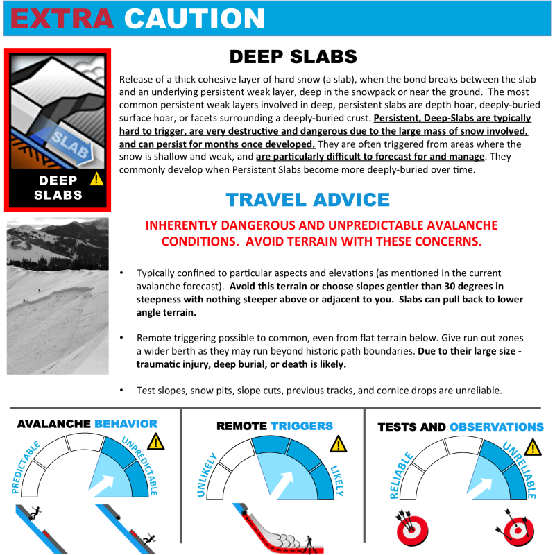
The avalanche danger in the west central Montana backcountry is rated at moderate. It is possible to trigger loose snow and wind slab avalanches.  There is also the probability, albeit low, of triggering a deep slab avalanche on very steep slopes (>35 degrees).

Good morning, this Dudley Improta with the West Central Montana Avalanche Center’s advisory for March 3, 2015. This danger rating does not apply to operating ski areas, is the sole responsibility of the U.S. Forest Service and expires at midnight tonight (2/3/15).

Weather and Snowpack

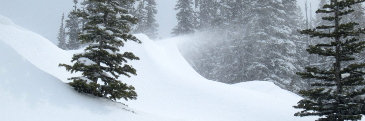
The winter storm warning from yesterday has been cancelled; west central Montana is now under a winter weather advisory until 11 A.M. The northern part of the advisory area picked up 4 to 5 inches of snow, the central Bitterroot got up to 6 inches. Some snow banding (periods of intense snow in certain areas) did occur; the Ch-paa-qn (Sleeping Woman) snotel is showing 8 inches from last night. The winds howled in the mountains and are still gusting in the 30 mph range this morning; mainly out of the east. Mountain temperatures are below 0 F.

The winds with last night’s storm began out of the south and west and eventually became easterly. The snow we picked up last night is cold and light. Wind slabs are a possibility on just about any aspect. The old surface of the snow was generally stiff; so the new light snow will sluff easily on slopes steeper than 35 degrees.

Like I mentioned above, some banding did occur with this storm. There will be areas in west central Montana that received more than 6 inches. The slopes in these areas will be capable of producing larger wind slabs and loose snow sluffs.

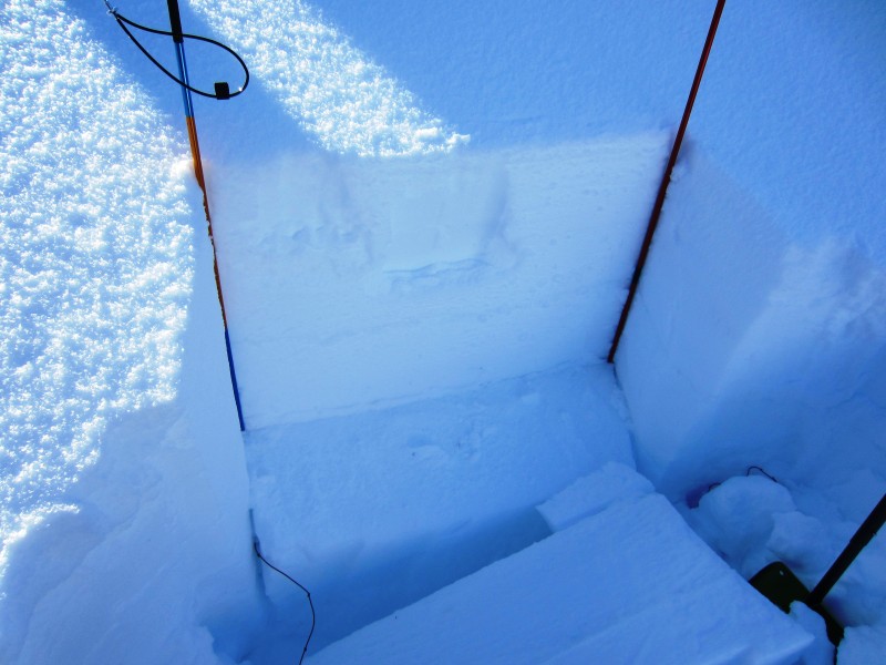
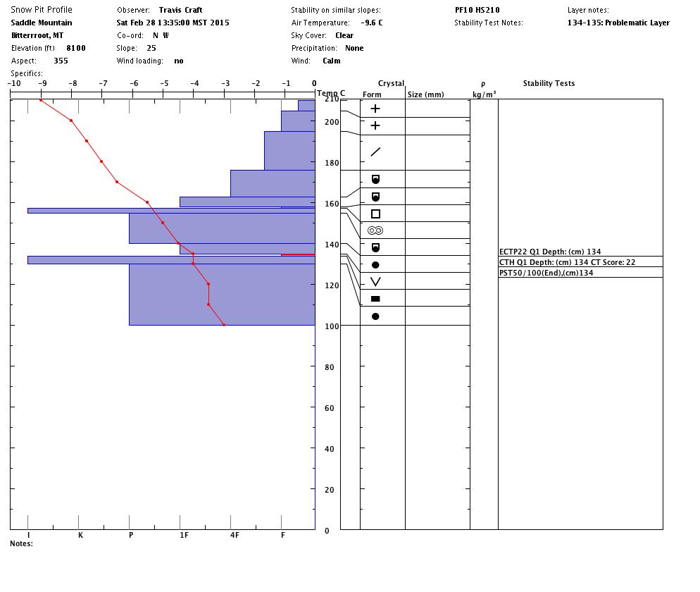
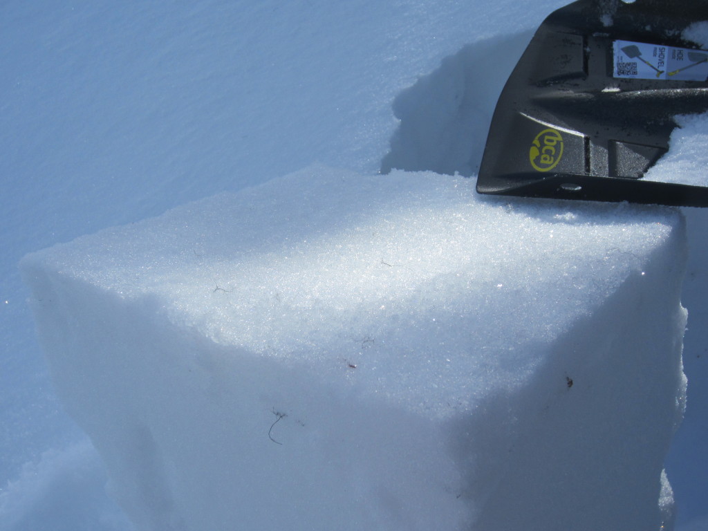
We are still keeping an eye on a deeper slab that has been propagating in our extended column tests for a month. I re-posted our video below from February 26 that shows this failure. We got the same layer to propagate with energy near Lost Trail (pit profile below) and in the Rattlesnakes on Sunday. The persistence and “on again/off again” character of this layer has us scratching our heads. I would dig down a little deeper than a  meter (3 feet) to look for it if I were considering any steep slopes with shaded northerly aspects.

Weather and Avalanche Conditions Outlook

The weather service is forecasting dry conditions with a gradual rise in temperatures beginning tomorrow. This pattern is likely through the coming weekend. I would expect the avalanche danger to remain the same at least through Wednesday. My main concern is the wind and the cold, loose snow available for transport. The avalanche danger should decrease toward the end of the week with the weather predicted.

If you would like to send snow observations use our public observations form or send us an e-mail at [email protected] .

I will post the next regularly scheduled advisory on Friday, March 6.

Ride and ski safe and have a great week.


READ FULL ADVISORY  

Problem 1 - wind slabs

  • TYPE

    wind-slabs

    Wind Slabs

    Release of a cohesive layer of snow (a slab) formed by the wind.  Wind typically erodes snow from the upwind sides of terrain features and deposits snow on the downwind side.  Wind slabs are often smooth and rounded and sometimes sound hollow, and can range from soft to hard. Wind slabs that form over a persistent weak layer (surface hoar, depth hoar, or near-surface facets) may be termed Persistent Slabs or may develop into Persistent Slabs.

  • SIZE

    2-3

    1 (Small)

    The potential size of avalanche resulting from this problem.

  • LIKELIHOOD

    Likelihood-4

    Possible/Likely

    The likelihood of an avalanche resulting from this problem.

Strong winds have blown from west/southwest to north/northeast in the last 24 hours. With swirling mountain winds and cross-loading, any aspect could harbor a wind slab.

Problem 2 - loose cold snow

  • TYPE

    loose-dry

    Loose Dry

    Release of wet unconsolidated snow or slush. These avalanches typically occur within layers of wet snow near the surface of the snowpack, but they may quickly gouge into lower snowpack layers. Like Loose-Dry Avalanches,they start at a point and entrain snow as they move downhill, forming a fan-shaped avalanche. They generally move slowly, but can contain enough mass to cause significant damage to trees, cars or buildings. Other names for loose-wet avalanches include point-release avalanches or sluffs. Loose-wet avalanches can trigger slab avalanches that break into deeper snow layers.

  • SIZE

    2-3

    1 (Small)

    The potential size of avalanche resulting from this problem.

  • LIKELIHOOD

    Likelihood-4

    Possible/Likely

    The likelihood of an avalanche resulting from this problem.

The new snow came in very cold and is light in nature. It is sitting in some very hard surfaces out there. It would be no surprise to trigger a loose snow avalanche. This is probably manageable unless it knocks you into a hazard (cliffs, trees, gulleys).

Problem 3 - persistent deep slab

  • TYPE

    deep-persistent-slabs

    Deep Persistent Slabs

    Release of a thick cohesive layer of hard snow (a slab), when the bond breaks between the slab and an underlying persistent weak layer, deep in the snowpack or near the ground.  The most common persistent weak layers involved in deep, persistent slabs are depth hoar, deeply-buried surface hoar, or facets surrounding a deeply-buried crust. Persistent, Deep-Slabs are typically hard to trigger, are very destructive and dangerous due to the large mass of snow involved, and can persist for months once developed. They are often triggered from areas where the snow is shallow and weak, and are particularly difficult to forecast for and manage. They commonly develop when Persistent Slabs become more deeply-buried over time.

  • SIZE

    4-5

    2 (Large)

    The potential size of avalanche resulting from this problem.

  • LIKELIHOOD

    Likelihood-2

    Unlikely/Possible

    The likelihood of an avalanche resulting from this problem.

  • ADDED DANGER

    Increased Slope Danger

    Increased/Added Danger

    There is an increased risk of avalanches on these slopes:

    N - North
    NE - Northeast

  • IMAGE

We have been getting a deep layer, throughout the area, to react and propagate in our stability tests for a month. The last time we know it was triggered was 2 1/2 weeks ago; but it continues to propagate cleanly, with high strength, in our extended column tests. This layer has us scratching our heads, I would be remiss if I didn’t bring it to your attention (once again).

VIDEO

I am re-posting the video, from 2/26/15, of Logan getting the deep slab to fail with a high strength score. We got that slab to fail  with similar extended column test scores from Lost Trail Pass to the Rattlesnakes this past weekend. This slab has been failing cleanly for a month, the last time we know it was triggered was 2 1/2 weeks ago. I would look for it on cold, shaded, steep slopes.

Lost Trail snowpit, preserved surface hoar and sled training with Gary Guse, an instructor with the Avalanche Center.

FORECAST & OUTLOOK

The weather service is forecasting dry conditions with a gradual rise in temperatures beginning tomorrow. This pattern is likely through the coming weekend. I would expect the avalanche danger to remain the same at least through Wednesday. My main concern is the wind and the cold, loose snow available for transport. The avalanche danger should decrease toward the end of the week with the weather predicted.

This information is the sole responsibility of the Forest Service and does not apply to operating ski areas. The avalanche danger rating expires at midnight tonight but the information can help you make a more informed decision regarding travel in avalanche terrain for the next few days.

Our advisory area includes National Forest System lands in the Bitterroot Mountains from Lost Trail Pass north to Granite Pass, the Rattlesnake Mountains north of Missoula and the Southern Swan and Mission Mountains near Seeley Lake, MT. Avalanche information for the Lookout Pass/St. Regis Basin area is available from the Idaho Panhandle Avalanche Center.