Posted:
Apr 1, 2015 @ 4:17 pm

Hello backcountry snow seekers. This is Steve Karkanen with springtime avalanche information from the West Central Montana Avalanche Center.

With the upper Clark Fork basin showing between 70% and 90% of normal snowpack for April 1, we can be thankful for the early season snow we received. December and early January were good to us and the only reason western Montana mountain ranges are not in the dire condition other western US mountain ranges are in (see map).

I’ll do my best to be optimistic about the current lack of snow by saying that mountain locations in the Northern Rockies can continue to accumulate snow through April and even May. And when that happens, avalanches happen, usually due to the new snow not bonding to the old snow surface or melt water percolating down and lubricating a slide path’s bed surface.

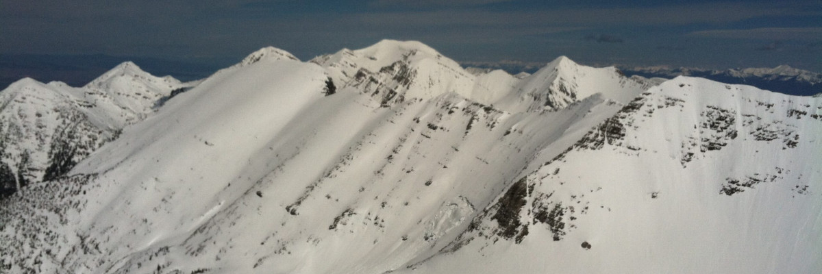
For the most part, our snowpack has already been through several melt-freeze cycles and rain events and has adjusted to spring early this year. The main avalanche issues to be concerned with now are wet loose snow avalanches on warm days after a new snowfall, fresh wind slab development during storms and weakened cornices.

The best travel advice for this time of year is to avoid being on or under steep terrain when you start seeing pinwheels or other movement with the melting snow.  Move to more shaded or cooler terrain when you see this or when you are easily punching through to boot top level.

After new snow, check to see how well it has bonded to the older snow surface and realize that wind slabs can remain sensitive for several days.

Cornices can’t be trusted and they especially weak in the spring.

This will be our last information statement for this season but we will continue to monitor and post any public observations as we receive them. If you get out and see something worth passing along, please do send us an email or use the form available on our website at missoulaavalanche.org. The information provided might keep someone out of trouble.

Thanks for all the support this year! We couldn’t do it without your financial help and it is deeply appreciated. A special thank you goes out to the dedicated board members of the West Central Montana Avalanche Foundation, our non-profit support organization.


READ FULL ADVISORY  

Problem 1 - Loose Wet Snow

  • TYPE

    loose-wet

    Loose Wet

    Release of wet unconsolidated snow or slush. These avalanches typically occur within layers of wet snow near the surface of the snowpack, but they may quickly gouge into lower snowpack layers. Like Loose-Dry Avalanches,they start at a point and entrain snow as they move downhill, forming a fan-shaped avalanche. They generally move slowly, but can contain enough mass to cause significant damage to trees, cars or buildings. Other names for loose-wet avalanches include point-release avalanches or sluffs. Loose-wet avalanches can trigger slab avalanches that break into deeper snow layers.

  • SIZE

    3-4

    1-2 (Small-Large)

    The potential size of avalanche resulting from this problem.

  • LIKELIHOOD

    Likelihood-3

    Possible

    The likelihood of an avalanche resulting from this problem.

  • ADDED DANGER

    Increased Slope Danger

    Increased/Added Danger

    There is an increased risk of avalanches on these slopes:

    N - North
    NE - Northeast
    E - East
    SE - Southeast
    S - South
    SW - Southwest
    W - West
    NW - Northwest

Loose wet snow avalanches on terrain steeper than 35 degrees will be the primary avalanche problem to watch for in April and May.


Problem 2 - Fresh Wind Slabs

  • TYPE

    wind-slabs

    Wind Slabs

    Release of a cohesive layer of snow (a slab) formed by the wind.  Wind typically erodes snow from the upwind sides of terrain features and deposits snow on the downwind side.  Wind slabs are often smooth and rounded and sometimes sound hollow, and can range from soft to hard. Wind slabs that form over a persistent weak layer (surface hoar, depth hoar, or near-surface facets) may be termed Persistent Slabs or may develop into Persistent Slabs.

  • SIZE

    3-4

    1-2 (Small-Large)

    The potential size of avalanche resulting from this problem.

  • LIKELIHOOD

    Likelihood-3

    Possible

    The likelihood of an avalanche resulting from this problem.

  • ADDED DANGER

    Increased Slope Danger

    Increased/Added Danger

    There is an increased risk of avalanches on these slopes:

    N - North
    NE - Northeast
    E - East
    SE - Southeast
    S - South
    SW - Southwest
    W - West
    NW - Northwest

Look for recent wind deposits during and after each snowfall as the wind redeposits any new snow onto old hard snow surfaces.

Problem 3 - Unstable Cornices

  • TYPE

    cornices

    Cornices / Cornice Fall

    Release of an overhanging mass of snow that forms as the wind moves snow over a sharp terrain feature, such as a ridge, and deposits snow on the down-wind side. They range from small wind lips of soft snow to large overhangs of hard snow that are 30 feet (~10 meters) or taller. They can break off the terrain suddenly and pull back onto the ridge top and catch people by surprise even on the flat ground above the slope. Even small cornices can have enough mass to be destructive and deadly. Cornice fall can entrain loose surface snow or trigger slab avalanches.

  • SIZE

    2-3

    1 (Small)

    The potential size of avalanche resulting from this problem.

  • LIKELIHOOD

    Likelihood-3

    Possible

    The likelihood of an avalanche resulting from this problem.

  • ADDED DANGER

    Increased Slope Danger

    Increased/Added Danger

    There is an increased risk of avalanches on these slopes:

    N - North
    NE - Northeast
    E - East

Cornices will become unstable during warm temperatures, give them a wide berth.

MAP

FORECAST & OUTLOOK

Expect the usual unpredictable spring weather in the west central Montana backcountry. It may be April, but it’s still winter in the backcountry.

This information is the sole responsibility of the Forest Service and does not apply to operating ski areas. The avalanche danger rating expires at midnight tonight but the information can help you make a more informed decision regarding travel in avalanche terrain for the next few days.

Our advisory area includes National Forest System lands in the Bitterroot Mountains from Lost Trail Pass north to Granite Pass, the Rattlesnake Mountains north of Missoula and the Southern Swan and Mission Mountains near Seeley Lake, MT. Avalanche information for the Lookout Pass/St. Regis Basin area is available from the Idaho Panhandle Avalanche Center.