Posted:
Dec 17, 2015 @ 6:07 am

The avalanche danger in the West Central Montana backcountry is MODERATE. Natural avalanches are unlikely, human triggered avalanches are possible. Heightened avalanche conditions may exist in isolated terrain.

Good morning and happy powder Thursday, this is Logan King with the West Central Montana Avalanche Center’s backcountry avalanche advisory for Thursday, December 17th. This information is the responsibility of the Forest Service and does not apply to operating ski areas and expires at midnight.


WEATHER AND SNOWPACK

As of 5am this morning mountain temps are approximately 10 degree fahrenheit, currently all anemometers are down and we don’t have any windspeed data. Mountain ranges in the advisory area have seen 5-12 inches of new snow in the last 24 hours.

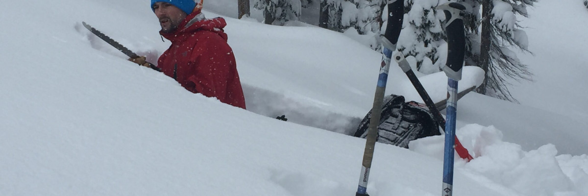
Travis and I rode into Twin Lakes in the Bitterroot yesterday and found about a foot of new low density snow. This new snow is sitting on a crust but appears to be bonding well. The primary problem that we were seeing was  loose snow avalanches. However under the crust was a bit of an anomaly. We found very saturated snow between crust layers from the rain event a few weeks back in mid elevation pits. The two very wet layers are lying between three very dense crusts. Given current conditions this is an unusual situation in the snowpack, and an unusual snowpacks result in unusual avalanche problems so keep an eye on this layer (video). However, the good news was this layer was rapidly being buried deeper in the snowpack and was not very reactive in stability tests.

The second concern that we have in the region are storm slabs. The new snow is sitting on a crust in many areas in the region and the subtle layers/interfaces in the storm snow were not very reactive in our stability tests but with more load overnight may become more sensitive. Remember, anytime a significant load is added to the snowpack it warrants cautious evaluation because the snow needs time to adjust to a new load.

Lastly, facets continue to persist on cold shaded slopes or in shallower snowpacks. They are not nearly as reactive but they can still be found and will potentially be more reactive under the new load. The only way to know if these persistent weak layers are present is to dig.


WEATHER AND AVALANCHE FORECAST

Currently it is partly cloudy and calm but snow is forecasted later in the afternoon and into tonight with the possibility to turn to rain as snow levels rise throughout the region. Loading is expected to continue later today and through the weekend. Winds are also forecasted to increase with the warmer and overrunning frontal passage which have the potential to further increase avalanche danger.

I will issue the next advisory on Saturday, December 19.
READ FULL ADVISORY  

Problem 1 - Loose Dry Sluffs

  • TYPE

    loose-dry

    Loose Dry

    Release of wet unconsolidated snow or slush. These avalanches typically occur within layers of wet snow near the surface of the snowpack, but they may quickly gouge into lower snowpack layers. Like Loose-Dry Avalanches,they start at a point and entrain snow as they move downhill, forming a fan-shaped avalanche. They generally move slowly, but can contain enough mass to cause significant damage to trees, cars or buildings. Other names for loose-wet avalanches include point-release avalanches or sluffs. Loose-wet avalanches can trigger slab avalanches that break into deeper snow layers.

  • SIZE

    1-2

    < 1 (Small)

    The potential size of avalanche resulting from this problem.

  • LIKELIHOOD

    Likelihood-4

    Possible/Likely

    The likelihood of an avalanche resulting from this problem.

The upper layers of the new snow are producing sluffs but can be mitigated with good terrain management. These will only increase as more snow is added to the snowpack.

Problem 2 - Soft Storm Slabs

  • TYPE

    storm-slabs

    Storm Slabs

    Release of a soft cohesive layer (a slab) of new snow which breaks within the storm snow or on the old snow surface. Storm-slab problems typically last between a few hours and few days. Storm-slabs that form over a persistent weak layer (surface hoar, depth hoar, or near-surface facets) may be termed Persistent Slabs or may develop into Persistent Slabs.

  • SIZE

    3-4

    1-2 (Small-Large)

    The potential size of avalanche resulting from this problem.

  • LIKELIHOOD

    Likelihood-3

    Possible

    The likelihood of an avalanche resulting from this problem.

With any significant new load storm slabs are always a concern.

Problem 3 - Isolated Facets

  • TYPE

    persistent-slabs

    Persistent Slabs

    Release of a cohesive layer of soft to hard snow (a slab) in the middle to upper snowpack, when the bond to an underlying persistent weak layer breaks.  Persistent layers include: surface hoar, depth hoar, near-surface facets, or faceted snow. Persistent weak layers can continue to produce avalanches for days, weeks or even months, making them especially dangerous and tricky. As additional snow and wind events build a thicker slab on top of the persistent weak layer, this avalanche problem may develop into a Persistent, Deep-Slab.

  • SIZE

    3-4

    1-2 (Small-Large)

    The potential size of avalanche resulting from this problem.

  • LIKELIHOOD

    Likelihood-3

    Possible

    The likelihood of an avalanche resulting from this problem.

  • ADDED DANGER

    Increased Slope Danger

    Increased/Added Danger

    There is an increased risk of avalanches on these slopes:

    N - North
    NE - Northeast
    E - East
    NW - Northwest

The persistent weak layers are localized on colder aspects and in isolated areas of shallow snow. They can still be reactive and have the potential to cause avalanches especially under a new load.

VIDEO

Pit near twin lakes in Lost Horse canyon of the Bitterroot range. (sorry for the audio but the snow was coming down)

New snow and wet layers in Lost Horse

FORECAST & OUTLOOK

The forecast is calling for more precipitation over the next few days with snow possibly turning to rain moving into Friday and returning to colder temperatures with more snow over the weekend.

This information is the sole responsibility of the Forest Service and does not apply to operating ski areas. The avalanche danger rating expires at midnight tonight but the information can help you make a more informed decision regarding travel in avalanche terrain for the next few days.

Our advisory area includes National Forest System lands in the Bitterroot Mountains from Lost Trail Pass north to Granite Pass, the Rattlesnake Mountains north of Missoula and the Southern Swan and Mission Mountains near Seeley Lake, MT. Avalanche information for the Lookout Pass/St. Regis Basin area is available from the Idaho Panhandle Avalanche Center.