Posted:
Dec 19, 2015 @ 6:12 am

The current avalanche danger is MODERATE in the West Central Montana Backcountry. Natural avalanches are unlikely, human triggered avalanches are possible. Heightened avalanche conditions may exist in isolated terrain.

Good morning this is Logan King with the West Central Montana Avalanche Center’s backcountry avalanche advisory for Saturday, December 19th. This information is the responsibility of the Forest Service and does not apply to operating ski areas and expires at midnight.


WEATHER AND SNOWPACK

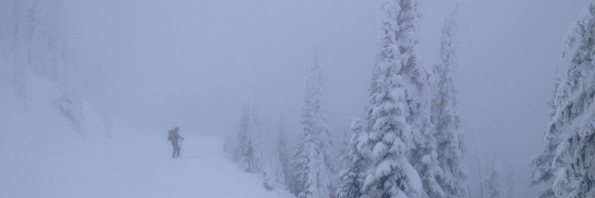
The region has seen an additional 2-6 inches overnight bringing many mountain locations to well over a foot in the past 48 hours. Current temperatures for mountain locations in West Central Montana are in the mid to upper 20’sF  and ridge top winds are light gusting to about 10mph primarily out of the NW.

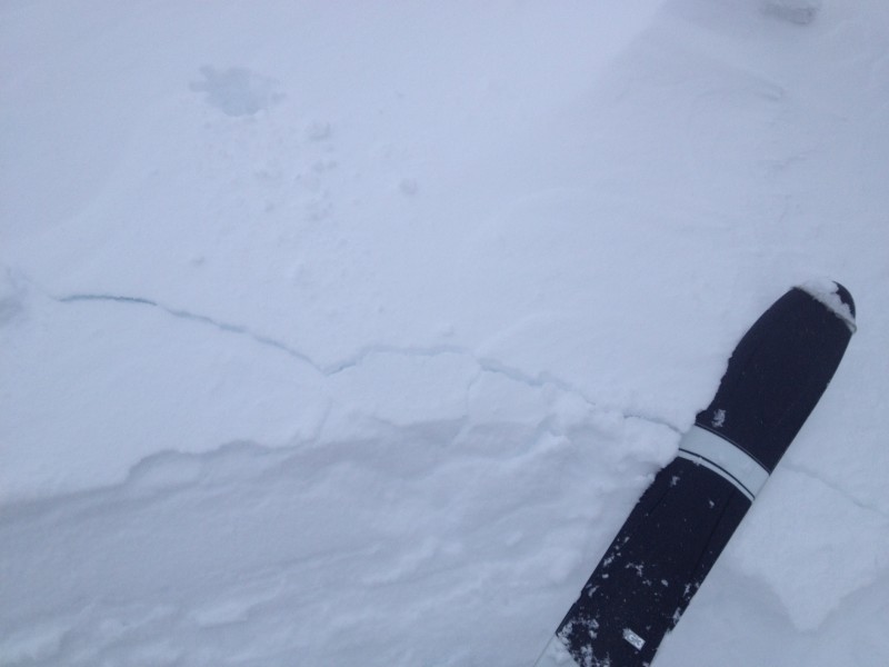
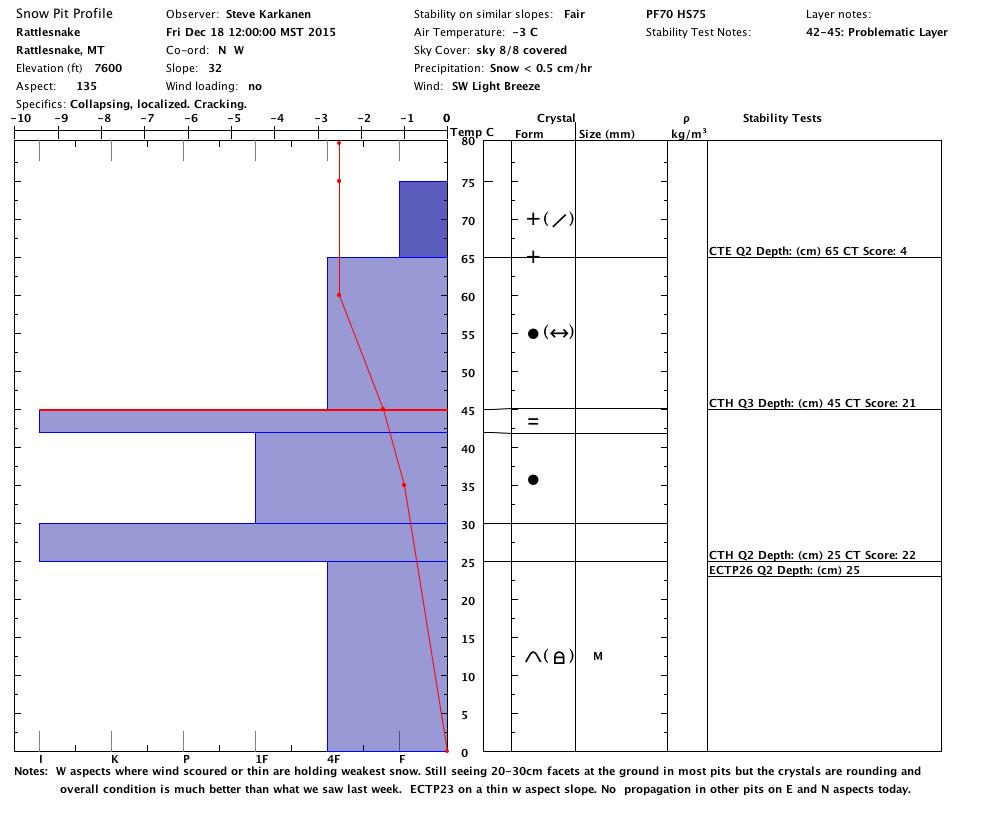
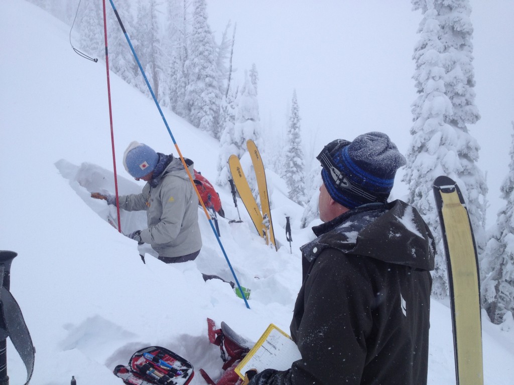
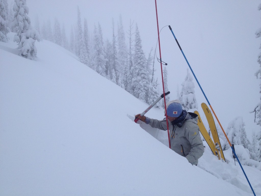
The main avalanche concern continues to be loose dry avalanches. The new snow, for the most part is bonding well and has not been showing any signs of propagation in stability tests (video). Loose snow avalanches are often smaller in size but the risk is dependent on the terrain, so carefully consider consequences of getting caught in a slide even if it is a small slide.

Storm slabs are the secondary avalanche concern for the advisory area. Although they are not very reactive in stability tests with continued loading they may become reactive. The majority of the area has seen over a foot of snow in the last few days and is continuing to get more load so be aware that a tipping point may soon be reached and stay aware of changes throughout the day.

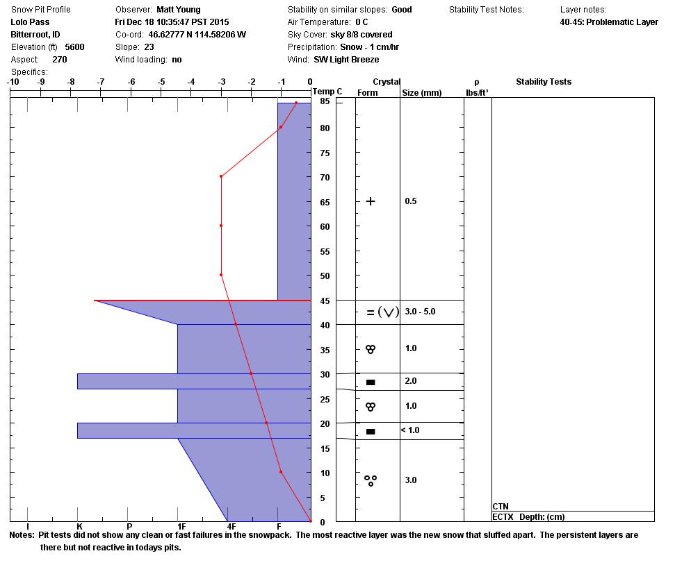
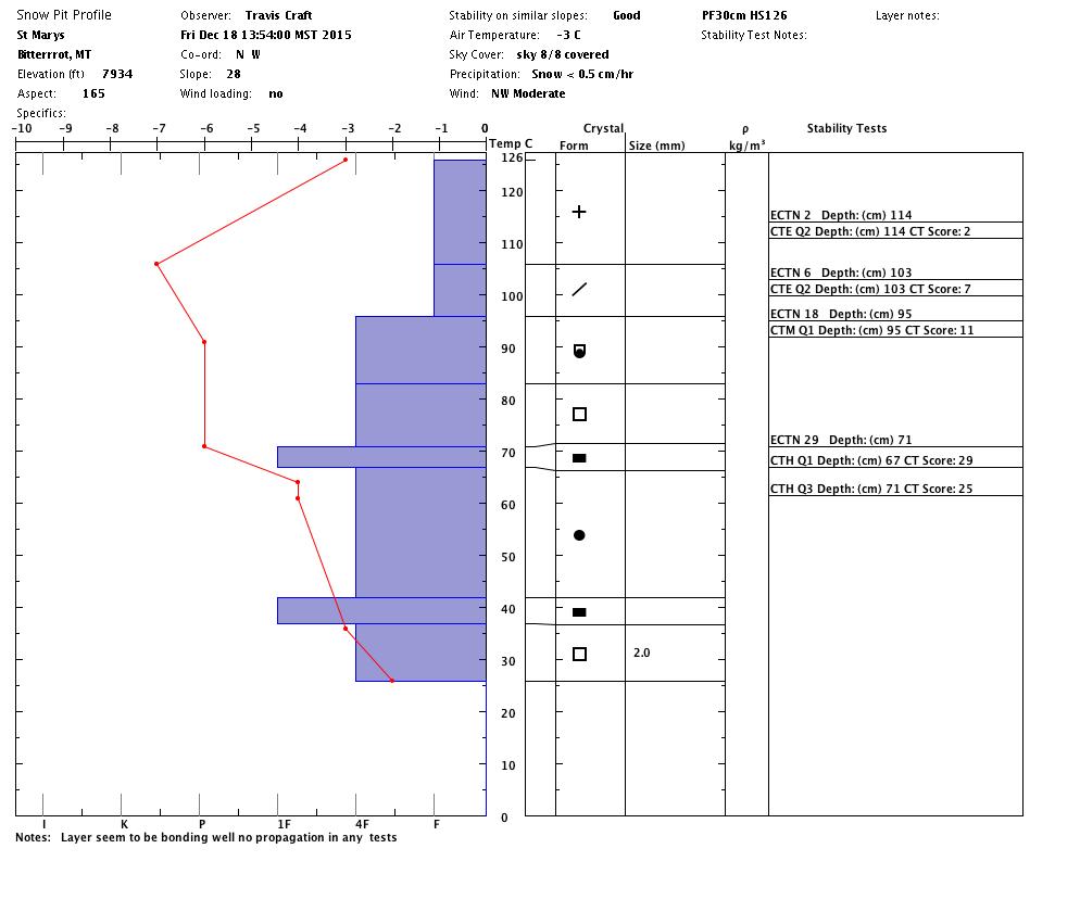
Faceted grains can still be found in nearly all pits in the advisory area, that said they appear to be moving towards rounds and strengthening but this can be a slow process. These persistent facets may still be reactive in cold and shallow snowpacks.


WEATHER AND AVALANCHE FORECAST

The forecast is calling for continued snow and colder temperatures. As more snow is added to the snowpack not only do the size of avalanches increase but they will potentially become more sensitive as well. Pay close attention to conditions as they change during the day. The forecast is also predicting continued moisture through mid week so stay safe and enjoy the snow while we have it, remember it is an El Nino after all.

Travis will issue the next advisory on Tuesday, December 22.

READ FULL ADVISORY  

Problem 1 - Loose Snow

  • TYPE

    loose-dry

    Loose Dry

    Release of wet unconsolidated snow or slush. These avalanches typically occur within layers of wet snow near the surface of the snowpack, but they may quickly gouge into lower snowpack layers. Like Loose-Dry Avalanches,they start at a point and entrain snow as they move downhill, forming a fan-shaped avalanche. They generally move slowly, but can contain enough mass to cause significant damage to trees, cars or buildings. Other names for loose-wet avalanches include point-release avalanches or sluffs. Loose-wet avalanches can trigger slab avalanches that break into deeper snow layers.

  • SIZE

    1-2

    < 1 (Small)

    The potential size of avalanche resulting from this problem.

  • LIKELIHOOD

    Likelihood-3

    Possible

    The likelihood of an avalanche resulting from this problem.

There are a few layers of new snow that are starting to bond together but have shown some signs of instability in tests although they are still not propagating.

Problem 2 - Storm Slabs

  • TYPE

    storm-slabs

    Storm Slabs

    Release of a soft cohesive layer (a slab) of new snow which breaks within the storm snow or on the old snow surface. Storm-slab problems typically last between a few hours and few days. Storm-slabs that form over a persistent weak layer (surface hoar, depth hoar, or near-surface facets) may be termed Persistent Slabs or may develop into Persistent Slabs.

  • SIZE

    2-3

    1 (Small)

    The potential size of avalanche resulting from this problem.

  • LIKELIHOOD

    Likelihood-2

    Unlikely/Possible

    The likelihood of an avalanche resulting from this problem.

  • IMAGE

The advisory area has received a good load over the past few days and is only continuing to add to that load.

Problem 3 - Persistent Slabs

  • TYPE

    persistent-slabs

    Persistent Slabs

    Release of a cohesive layer of soft to hard snow (a slab) in the middle to upper snowpack, when the bond to an underlying persistent weak layer breaks.  Persistent layers include: surface hoar, depth hoar, near-surface facets, or faceted snow. Persistent weak layers can continue to produce avalanches for days, weeks or even months, making them especially dangerous and tricky. As additional snow and wind events build a thicker slab on top of the persistent weak layer, this avalanche problem may develop into a Persistent, Deep-Slab.

  • SIZE

    3-4

    1-2 (Small-Large)

    The potential size of avalanche resulting from this problem.

  • LIKELIHOOD

    Likelihood-2

    Unlikely/Possible

    The likelihood of an avalanche resulting from this problem.

  • ADDED DANGER

    Increased Slope Danger

    Increased/Added Danger

    There is an increased risk of avalanches on these slopes:

    N - North
    NE - Northeast
    E - East
    NW - Northwest

Facets are persisting on all aspects but are not very reactive as of late. These facets may be more reactive on cold or shaded slopes or in areas with a shallow snowpack.

VIDEO

Surface instabilities in pits without propagation.

FORECAST & OUTLOOK

  • Danger Trend

    increasing

    Increasing Danger

  • Area Forecast

    More Snow

Snow is expected to continue through the weekend and possibly into mid week next week.

This information is the sole responsibility of the Forest Service and does not apply to operating ski areas. The avalanche danger rating expires at midnight tonight but the information can help you make a more informed decision regarding travel in avalanche terrain for the next few days.

Our advisory area includes National Forest System lands in the Bitterroot Mountains from Lost Trail Pass north to Granite Pass, the Rattlesnake Mountains north of Missoula and the Southern Swan and Mission Mountains near Seeley Lake, MT. Avalanche information for the Lookout Pass/St. Regis Basin area is available from the Idaho Panhandle Avalanche Center.