Posted:
Feb 4, 2016 @ 6:40 am

The current avalanche danger is MODERATE in the west central Montana backcountry.  Human triggered avalanches are possible.  Heightened avalanche conditions exist in isolated terrain.  Evaluate snow and terrain carefully and identify features of concern.

Good morning, this is Travis Craft with the West Central Montana Avalanche Center’s avalanche advisory for February 4, 2016.  This danger rating does not apply to operating ski areas, expires at midnight tonight and is the sole responsibility of the U.S. Forest Service.

Weather and Snowpack

Mountain temperatures range from 14 F to 24 F in the region.  Winds are 09 mph with gusts of 16 mph out of the SSW in the Bitterroot.  The forecast area received 1 to 3 inches of new snow in the last 24 hours.

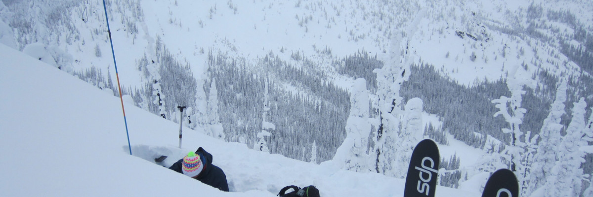
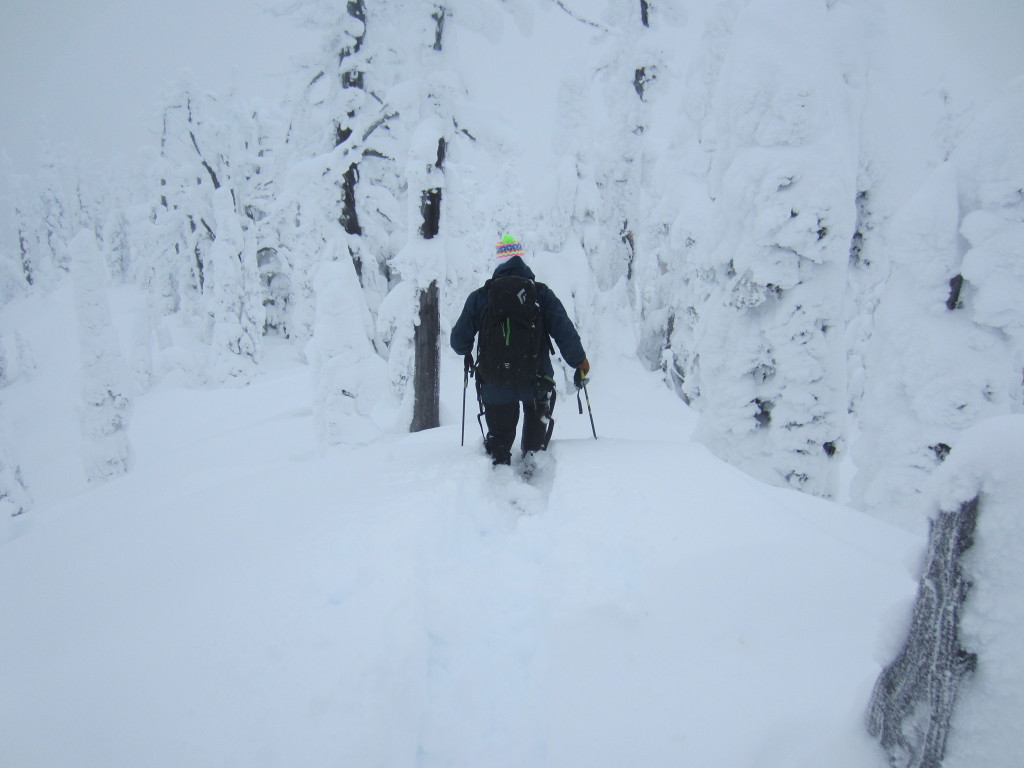
The Rattlesnake has received 16 inches of light snow over the last 48 hours.  The rest of the advisory area received lower amounts of snow.  Dudley and I toured in the Rattlesnake yesterday and we observed that the snowpack is adjusting to the new load.  We saw settlement rings around trees and the snowpack was buckling.  Brian was at Lolo pass and observed similar findings with the snow bonding well to the rain crust at lower elevations.

The main avalanche problem today is loose dry avalanches.  These avalanches are possible to trigger today on steep slopes > 35 degrees and they are not a problem unless you are carried into a terrain trap (trees, cliffs and gullies).

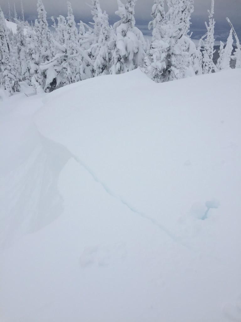
The second avalanche concern today are wind slabs.  These slabs formed in isolated areas on ridge tops.  Though not widespread, these slabs are touchy.  We observed a natural release in the Rattlesnake that occurred in the last 48 hours.  The slab was relatively small and did not trigger any other avalanches on the slope.

The third avalanche problem is a storm slab.  We saw evidence of natural storm slab releases that were only a couple of inches thick.  Beware that on steep slopes it may be possible to trigger these storm slabs.

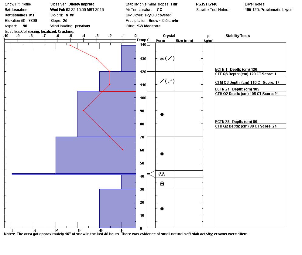
With the accumulation of a significant amount of new snow, the snowpack is adjusting to the weight and is settling.  There are weak layers present in our snowpack, but they were not reactive in our snow pit tests.  When choosing to recreate on a slope, dig a pit to see if there are any layers of concern.  Dudley and I found a shallow snowpack of 115cm where the layer of basal facets was hard to trigger in compression tests and did not propagate in the ECT.

Avalanche and Weather Outlook

The snowpack is settling and adjusting to the new load.  A new weather system is entering our area this morning and is expected to create banding snow showers which could drop 2 inches of snow or more in a short time in isolated areas.  If you start to get shooting cracks, sudden collapses, or any other bullseye data, that means that conditions are changing and becoming rapidly unstable.  The system is predicted to come in with strong winds and there is a lot of new snow available for transport, potentially creating wind slabs.  The avalanche danger may increase with the addition of new snow and strong winds.

Ski and ride safe. Logan will issue the next advisory on Saturday.


READ FULL ADVISORY  

Problem 1 - Loose Dry

  • TYPE

    loose-dry

    Loose Dry

    Release of wet unconsolidated snow or slush. These avalanches typically occur within layers of wet snow near the surface of the snowpack, but they may quickly gouge into lower snowpack layers. Like Loose-Dry Avalanches,they start at a point and entrain snow as they move downhill, forming a fan-shaped avalanche. They generally move slowly, but can contain enough mass to cause significant damage to trees, cars or buildings. Other names for loose-wet avalanches include point-release avalanches or sluffs. Loose-wet avalanches can trigger slab avalanches that break into deeper snow layers.

  • SIZE

    2-3

    1 (Small)

    The potential size of avalanche resulting from this problem.

  • LIKELIHOOD

    Likelihood-2

    Unlikely/Possible

    The likelihood of an avalanche resulting from this problem.

  • IMAGE

We received 16 new inches of snow in the last 48 hours in the Rattlesnake with the rest of the area received less.  Loose dry avalanches are very stubborn to trigger, but they could be a problem if they take you into a terrain trap.

Problem 2 - Wind Slabs

  • TYPE

    wind-slabs

    Wind Slabs

    Release of a cohesive layer of snow (a slab) formed by the wind.  Wind typically erodes snow from the upwind sides of terrain features and deposits snow on the downwind side.  Wind slabs are often smooth and rounded and sometimes sound hollow, and can range from soft to hard. Wind slabs that form over a persistent weak layer (surface hoar, depth hoar, or near-surface facets) may be termed Persistent Slabs or may develop into Persistent Slabs.

  • SIZE

    2-3

    1 (Small)

    The potential size of avalanche resulting from this problem.

  • LIKELIHOOD

    Likelihood-3

    Possible

    The likelihood of an avalanche resulting from this problem.

  • IMAGE

Wind slabs formed on ridge tops in isolated areas.  These are touchy.

Problem 3 - Storm Slabs

  • TYPE

    storm-slabs

    Storm Slabs

    Release of a soft cohesive layer (a slab) of new snow which breaks within the storm snow or on the old snow surface. Storm-slab problems typically last between a few hours and few days. Storm-slabs that form over a persistent weak layer (surface hoar, depth hoar, or near-surface facets) may be termed Persistent Slabs or may develop into Persistent Slabs.

  • SIZE

    3-4

    1-2 (Small-Large)

    The potential size of avalanche resulting from this problem.

  • LIKELIHOOD

    Likelihood-1

    Unlikely

    The likelihood of an avalanche resulting from this problem.

There were small storm slab avalanches that released during the last 48 hours.  The crowns were 3 inches in depth.  These slabs are very stubborn to trigger.

Advisory 02/03/2016

FORECAST & OUTLOOK

A new system has entered our area today and is predicted to bring banded snow showers for the region.  This weather pattern should continue through the night and then break up.  There will be a little break and by Friday another warmer system will enter the area and bring snow with it.

This information is the sole responsibility of the Forest Service and does not apply to operating ski areas. The avalanche danger rating expires at midnight tonight but the information can help you make a more informed decision regarding travel in avalanche terrain for the next few days.

Our advisory area includes National Forest System lands in the Bitterroot Mountains from Lost Trail Pass north to Granite Pass, the Rattlesnake Mountains north of Missoula and the Southern Swan and Mission Mountains near Seeley Lake, MT. Avalanche information for the Lookout Pass/St. Regis Basin area is available from the Idaho Panhandle Avalanche Center.