Posted:
Feb 18, 2016 @ 5:46 am

The current avalanche danger for the west central Montana backcountry is MODERATE. Human triggered avalanches are possible natural avalanches are unlikely, large avalanches may occur in isolated or wind loaded areas. This danger rating does not apply to operating ski areas, expires at midnight tonight and is the sole responsibility of the U.S. Forest Service.

Good morning, this is Logan King with the West Central Montana Avalanche Center’s avalanche advisory for Thursday, February 18th, 2016.

Weather and Snowpack

Temperatures have been unseasonably warm and winds have persisted over the last few days. Currently temperatures at mountain locations are just above freezing and little to no snow has accumulated overnight. Ridge top winds are 18mph and gusting to 28mph out of the SE in the Bitterroot.

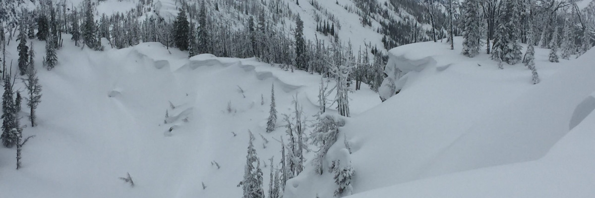
Yesterday Tim and I rode up to Rocky Point and found the snow to be settling and bonding well. The primary avalanche concern that we observed were windslabs. We were able to get a propagation on a wind loaded north aspect (pit) and also saw some localized cracking on other wind loaded aspects (pic). Be suspicious of all lee terrain and carefully assess each slope. Not all windslabs we saw were reactive, but the windslabs we did see were widespread and had the potential to be large slides as well as characteristics conducive to step down to a weak interface deeper in the snowpack. Always consider the consequences of getting caught if the slope you are thinking of skiing or riding were to slide.

The snowpack varies greatly with elevation, rain fell earlier this week to around 6500ft and the lower elevations have had a few days to adjust to the rain event and are continuing to lock up. Above about 6500ft the snow is cooler and weaknesses like facets can still be found. There is a melt freeze crust with facets just below that has been observed in the advisory area at higher elevations the last few days and was the layer that we observed propagating yesterday and Travis saw Q1 shears on in the Rattlesnake on Monday. Be mindful of the changing snowpack and look for areas where facets may have formed.

Avalanche and Weather Outlook

The weather looks to be shifting towards cooler temperatures and light snowfall should be starting up by this afternoon bringing a few inches of snow to the advisory area by Friday. Colder temperatures and snow should persist into the weekend. Avalanche conditions will remain the same until the snow starts to accumulate but with new snow for transport and strong westerly winds windslabs will continue to grow in size.

The next avalanche advisory will be issued on Saturday.
READ FULL ADVISORY  

Problem 1 - Wind Slabs

  • TYPE

    wind-slabs

    Wind Slabs

    Release of a cohesive layer of snow (a slab) formed by the wind.  Wind typically erodes snow from the upwind sides of terrain features and deposits snow on the downwind side.  Wind slabs are often smooth and rounded and sometimes sound hollow, and can range from soft to hard. Wind slabs that form over a persistent weak layer (surface hoar, depth hoar, or near-surface facets) may be termed Persistent Slabs or may develop into Persistent Slabs.

  • SIZE

    4-5

    2 (Large)

    The potential size of avalanche resulting from this problem.

  • LIKELIHOOD

    Likelihood-3

    Possible

    The likelihood of an avalanche resulting from this problem.

Strong winds have formed wind slabs, that have the potential for being triggered.

Problem 2 - Facets around crusts

  • TYPE

    persistent-slabs

    Persistent Slabs

    Release of a cohesive layer of soft to hard snow (a slab) in the middle to upper snowpack, when the bond to an underlying persistent weak layer breaks.  Persistent layers include: surface hoar, depth hoar, near-surface facets, or faceted snow. Persistent weak layers can continue to produce avalanches for days, weeks or even months, making them especially dangerous and tricky. As additional snow and wind events build a thicker slab on top of the persistent weak layer, this avalanche problem may develop into a Persistent, Deep-Slab.

  • SIZE

    3-4

    1-2 (Small-Large)

    The potential size of avalanche resulting from this problem.

  • LIKELIHOOD

    Likelihood-3

    Possible

    The likelihood of an avalanche resulting from this problem.

Facets have been observed under a crust in the advisory area and has been reactive in some stability tests with propagation and Q1 shears.

FORECAST & OUTLOOK

Temperatures will drop in the afternoon and should bring snow back to the advisory area. Strong westerly winds are expected to develop and persist for the next few days.

This information is the sole responsibility of the Forest Service and does not apply to operating ski areas. The avalanche danger rating expires at midnight tonight but the information can help you make a more informed decision regarding travel in avalanche terrain for the next few days.

Our advisory area includes National Forest System lands in the Bitterroot Mountains from Lost Trail Pass north to Granite Pass, the Rattlesnake Mountains north of Missoula and the Southern Swan and Mission Mountains near Seeley Lake, MT. Avalanche information for the Lookout Pass/St. Regis Basin area is available from the Idaho Panhandle Avalanche Center.