
The current avalanche danger for the west central Montana backcountry is MODERATE. Human triggered avalanches are possible in isolated areas and on specific terrain. This danger rating does not apply to operating ski areas, expires at midnight tonight and is the sole responsibility of the U.S. Forest Service.
Good morning, this is Logan King with the West Central Montana Avalanche Center’s avalanche advisory for Saturday, February 20th, 2016.
Weather and Snowpack
Mountain temperatures for the advisory area are currently averaging in the mid twenties and the region has seen an additional 2-5 inches of snow overnight. Strong wind gusts continue with Deer Mountain recording winds of 16mph gusting to 49mph from the west early this morning.
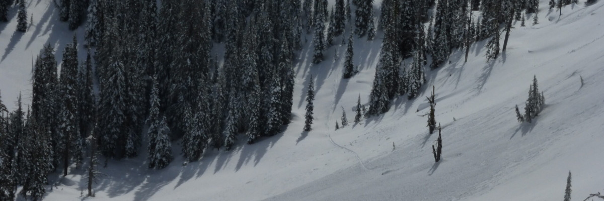
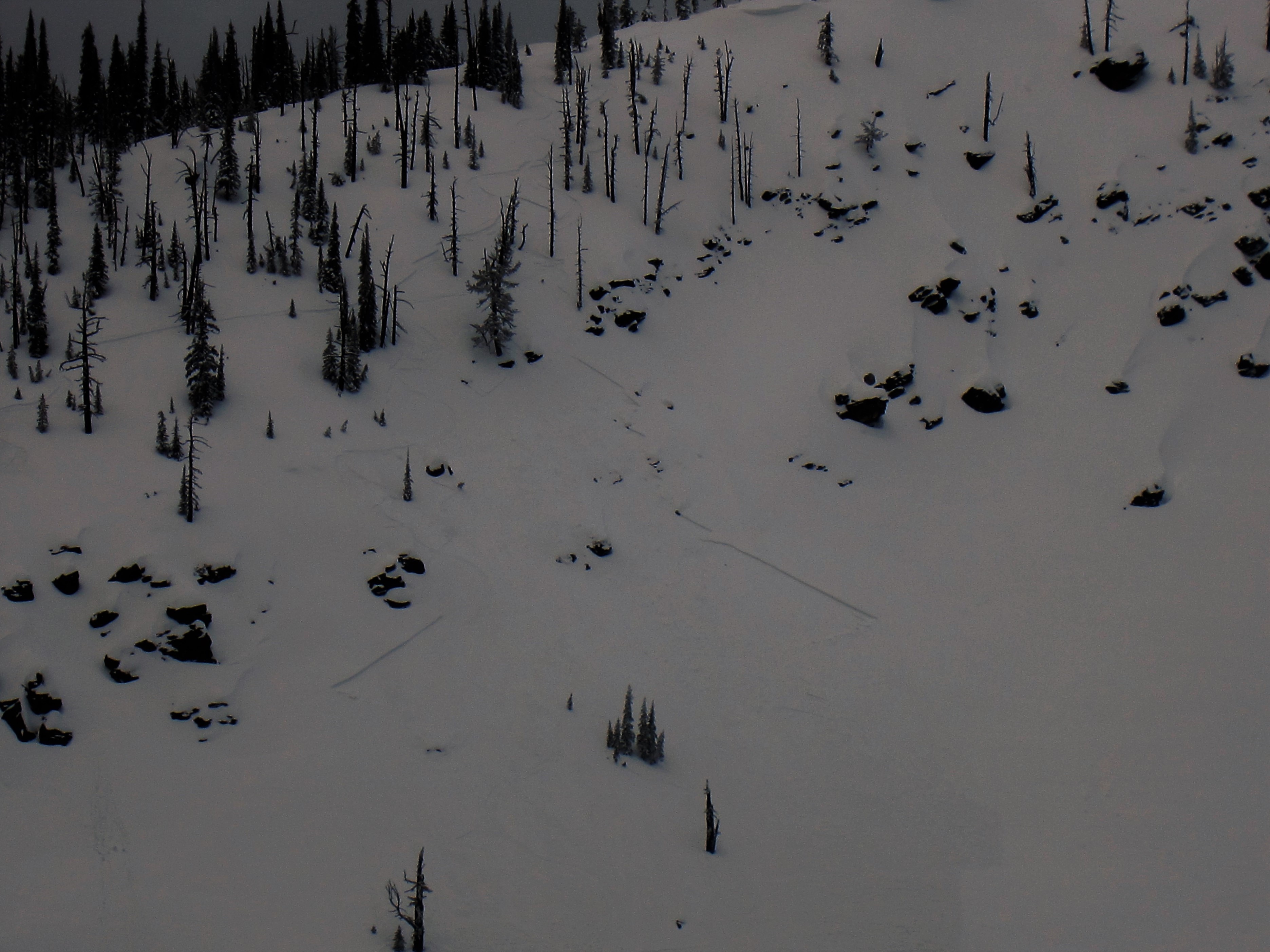
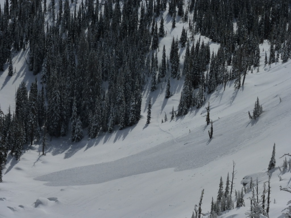
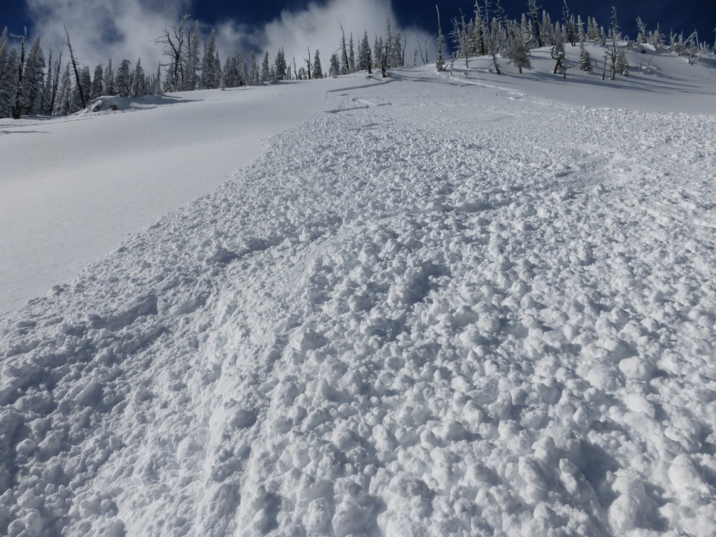
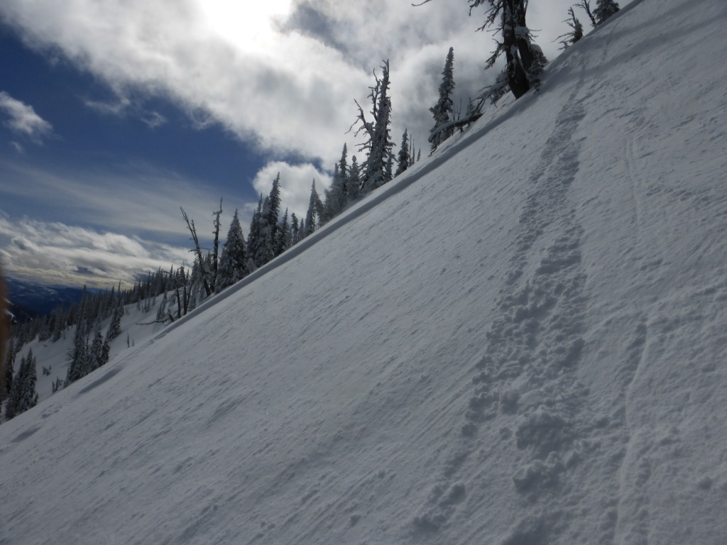
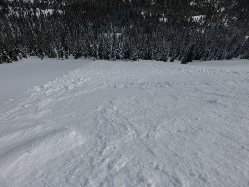
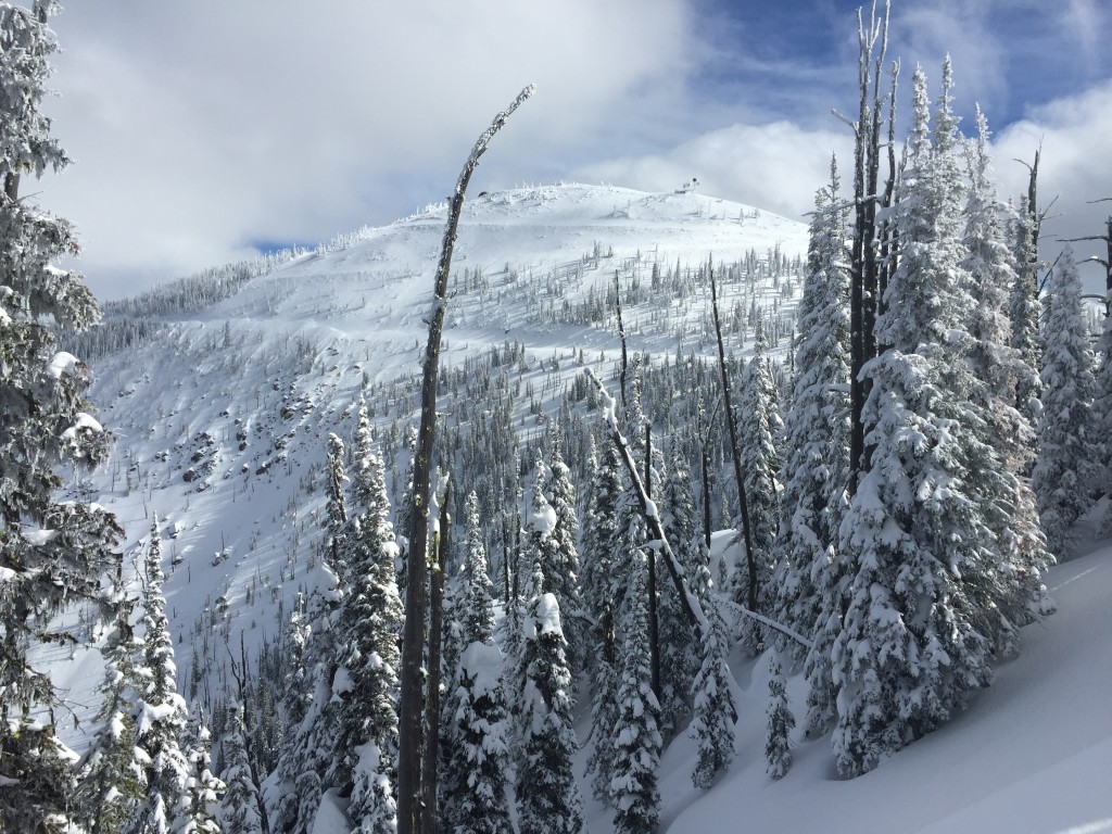
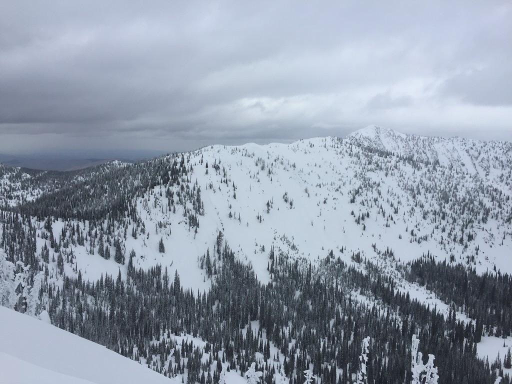
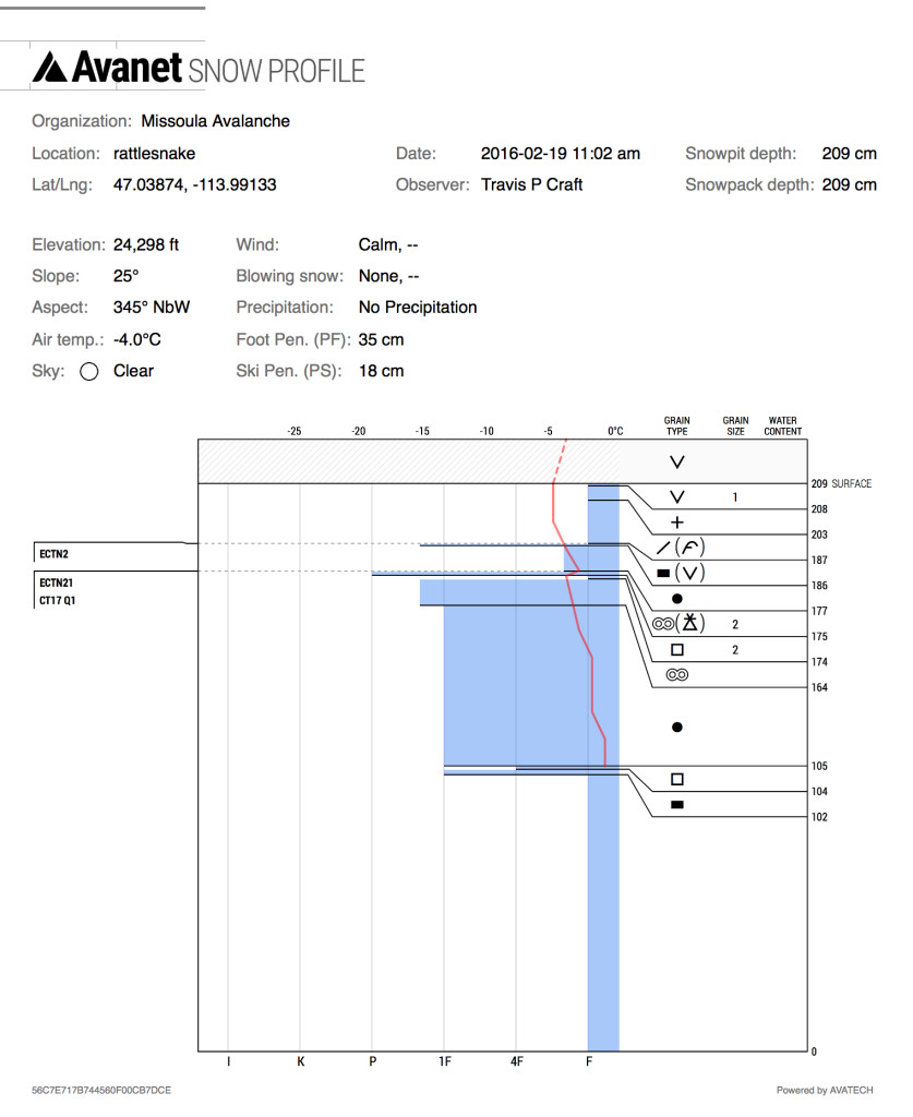
The primary avalanche concern today will be storm slabs. We have seen about 10 inches of cold snow over the last few days and this new snow has not bonded to the older and warmer snow. Travis and I were in the Rattlesnake yesterday and found this interface to fail and propagate in extended column tests on north aspects and a skier trigger slide likely slid on this interface on an eastern aspect in Jenny Bowl as well (pic1). We were able to perform stability tests on a NE aspect adjacent to a slope that had a small skier triggered slide (pic2) and found this interface to be sensitive on the NE aspect as well. The cold/warm interface was reactive on variable aspects so take a look at the snow before recreating and see if the new snow is bonding with the old surface, and though the slab is not very large, carefully evaluate the consequences of getting caught on this storm slab.
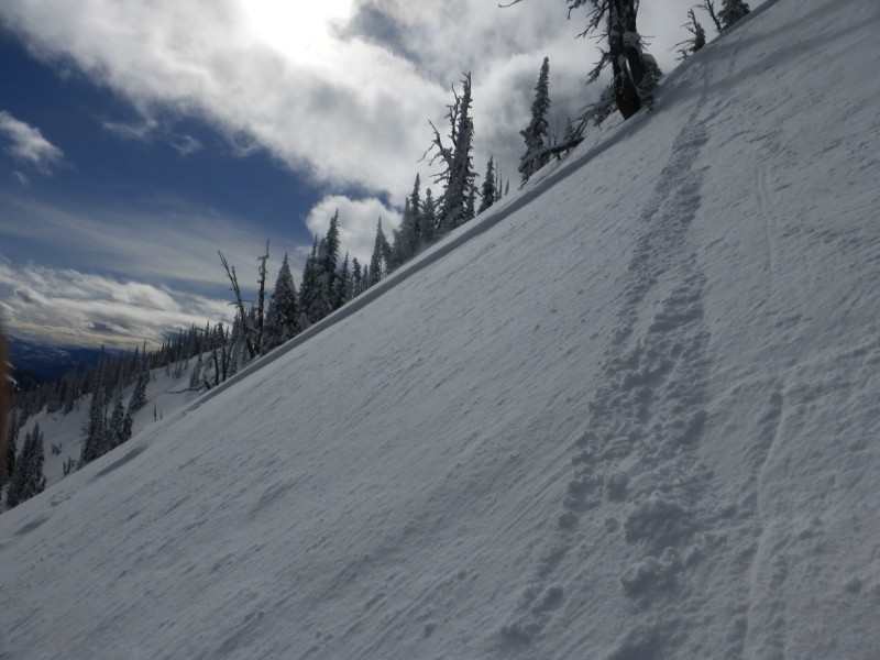
Winds have primarily been out of the south for the later portion of the week and wind slabs were seen in areas that are usually free of wind affected snow. Some of these wind slabs have proven to be reactive over the week and with more low density snow for transport they continue to grow. Evaluate all slopes carefully and look for signs of wind deposit and ultimately wind slabs. With unusual weather you get unusual avalanche problems and pockets harboring small wind slabs are a real problem as of late, specifically on crossed loaded terrain features. These signs are obvious but easily ignored, be suspicious of any terrain feature that appears to have been wind loaded.
Lastly facets continue to persist in the snowpack, and have been most reactive in areas where they are found under a melt freeze crust. Yesterday the facets at mid elevations on an east aspect were found to be wet and failed and propagated readily in stability tests. Unfortunately facets can be found on nearly all aspects. Particularly problematic are wet and saturated facets on aspects with high solar radiation but facets have also been found on cooler shaded aspects. The more northern aspects are not as reactive but the facets are further developed and still warrant a watchful eye.
Avalanche and Weather Outlook
The current pattern of light intermittent snow will likely continue into tonight bring modest accumulations to the area. Winds are also expected to maintain current intensities through today. Sunday will likely bring more settled conditions before another pulse of snow sunday night followed by warming temperatures again setting up early in the week. With no major changes expected for the next 48 hours avalanche conditions will remain relatively constant through the weekend.
The next avalanche advisory will be issued on Tuesday.


