Posted:
Feb 25, 2016 @ 6:16 am

The current avalanche danger is LOW in the west central Montana backcountry. Conditions are generally safe but it is possible to find unstable snow in isolated areas particularly on shaded terrain steeper than 35 degrees above 7000 feet. There is always some chance of triggering an avalanche if you recreate or travel on slopes 35 degrees and steeper.

Good morning, this is Travis Craft with the West Central Montana Avalanche Center’s avalanche advisory for February 25, 2016. This danger rating does not apply to operating ski areas, expires at midnight tonight and is the sole responsibility of the U.S. Forest Service.

Weather and Snowpack

Mountain temperatures are 14 F to 24 F.  Winds are 18 mph with gusts of 21 mph out of the West.  The area has reported a trace amount of snow.  The above average temperatures today will again feel like spring in the mountains.

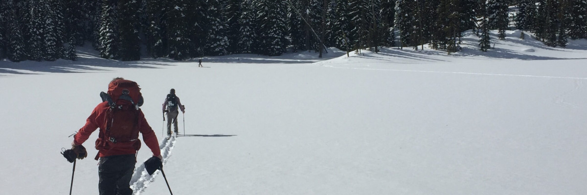
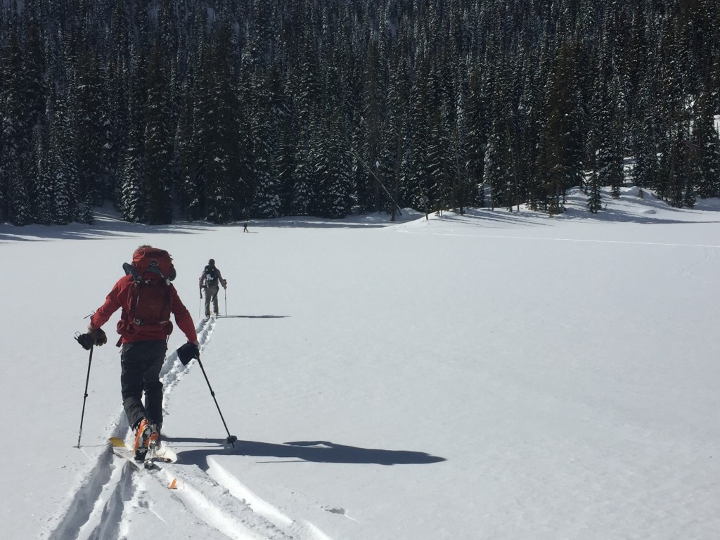
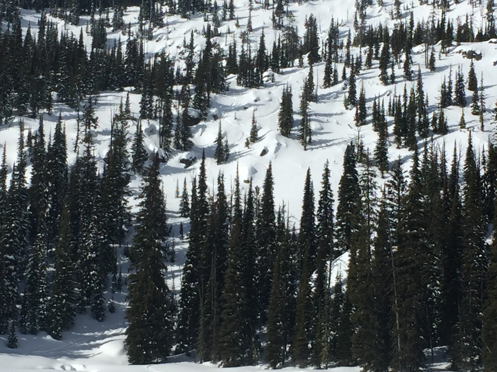
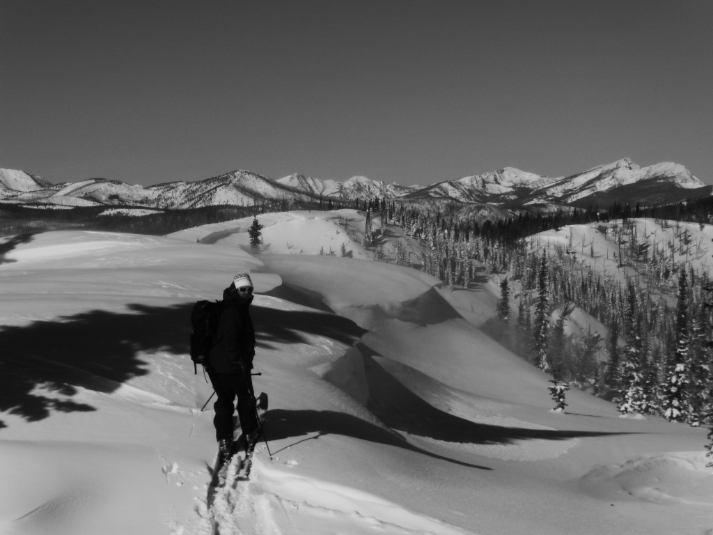
Tim, Steve and I toured in the Rattlesnake yesterday and we found a very well bonded snowpack.  The interfaces of old and new snow was not reactive in our snowpack tests.  The main avalanche problem’s are loose dry avalanches on shadier aspects and loose wet avalanches on sunnier aspects in the afternoon.  These are not very big, but can pose a problem if they knock you off your feet and take you into a terrain trap (tree, cliff, or gully).

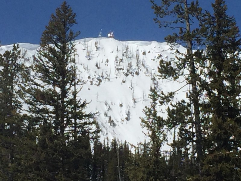
The final problem is cornice failure.  The cornices grew over the weekend and with the temperatures rising in the afternoon give them a wide berth and do not recreate beneath them.

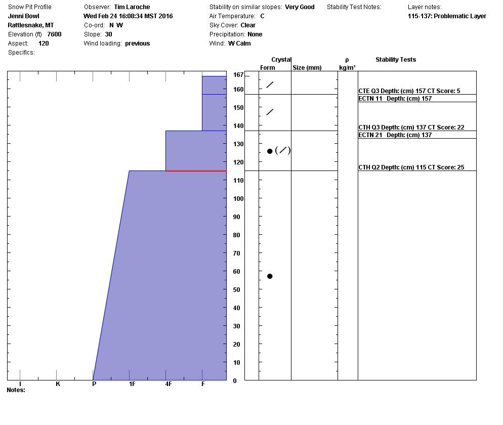
There are facets in our snowpack, they have not been reactive in our snow pit tests.  I would dig a pit and look for these layers to see if they are reactive in my tests on any steep slope I was planning to recreate on.

Weather and Avalanche Outlook

High and dry is the forecast today.  The temperatures are supposed to get into the high 30’s today.  The next chance for precipitation is for Saturday.  A cold front is predicated to move into the area Saturday morning and bring snow with it.  The avalanche hazard will remain the same until we have a weather shift.

Ski and ride safe. I will issue the next advisory on Saturday.


READ FULL ADVISORY  

Problem 1 - Loose Dry

  • TYPE

    loose-dry

    Loose Dry

    Release of wet unconsolidated snow or slush. These avalanches typically occur within layers of wet snow near the surface of the snowpack, but they may quickly gouge into lower snowpack layers. Like Loose-Dry Avalanches,they start at a point and entrain snow as they move downhill, forming a fan-shaped avalanche. They generally move slowly, but can contain enough mass to cause significant damage to trees, cars or buildings. Other names for loose-wet avalanches include point-release avalanches or sluffs. Loose-wet avalanches can trigger slab avalanches that break into deeper snow layers.

  • SIZE

    2-3

    1 (Small)

    The potential size of avalanche resulting from this problem.

  • LIKELIHOOD

    Likelihood-2

    Unlikely/Possible

    The likelihood of an avalanche resulting from this problem.

  • ADDED DANGER

    Increased Slope Danger

    Increased/Added Danger

    There is an increased risk of avalanches on these slopes:

    N - North
    NE - Northeast
    NW - Northwest

Loose dry avalanches on shady slopes.  Not a big deal unless they knock you off your feet and take you into a terrain trap (gully, tree, or cliff).

Problem 2 - Loose Wet

  • TYPE

    loose-wet

    Loose Wet

    Release of wet unconsolidated snow or slush. These avalanches typically occur within layers of wet snow near the surface of the snowpack, but they may quickly gouge into lower snowpack layers. Like Loose-Dry Avalanches,they start at a point and entrain snow as they move downhill, forming a fan-shaped avalanche. They generally move slowly, but can contain enough mass to cause significant damage to trees, cars or buildings. Other names for loose-wet avalanches include point-release avalanches or sluffs. Loose-wet avalanches can trigger slab avalanches that break into deeper snow layers.

  • SIZE

    1-2

    < 1 (Small)

    The potential size of avalanche resulting from this problem.

  • LIKELIHOOD

    Likelihood-2

    Unlikely/Possible

    The likelihood of an avalanche resulting from this problem.

  • ADDED DANGER

    Increased Slope Danger

    Increased/Added Danger

    There is an increased risk of avalanches on these slopes:

    SE - Southeast
    S - South
    SW - Southwest

Loose wet in the afternoon on sun exposed slopes.  Once the aspect you are recreating on starts to feel saturated or you see pinwheels and roller balls, it is time to change aspects to a shadier one.

Problem 3 - Cornices

  • TYPE

    cornices

    Cornices / Cornice Fall

    Release of an overhanging mass of snow that forms as the wind moves snow over a sharp terrain feature, such as a ridge, and deposits snow on the down-wind side. They range from small wind lips of soft snow to large overhangs of hard snow that are 30 feet (~10 meters) or taller. They can break off the terrain suddenly and pull back onto the ridge top and catch people by surprise even on the flat ground above the slope. Even small cornices can have enough mass to be destructive and deadly. Cornice fall can entrain loose surface snow or trigger slab avalanches.

  • SIZE

    4-5

    2 (Large)

    The potential size of avalanche resulting from this problem.

  • LIKELIHOOD

    Likelihood-1

    Unlikely

    The likelihood of an avalanche resulting from this problem.

  • IMAGE

The cornices grew over the weekend and with the temperatures rising in the afternoon give them a wide berth and do not recreate beneath them.

02/25/2016 Gallery

FORECAST & OUTLOOK

High and dry.  The pattern will be for above average temperatures in the mountains until a cold front moves in Saturday.

This information is the sole responsibility of the Forest Service and does not apply to operating ski areas. The avalanche danger rating expires at midnight tonight but the information can help you make a more informed decision regarding travel in avalanche terrain for the next few days.

Our advisory area includes National Forest System lands in the Bitterroot Mountains from Lost Trail Pass north to Granite Pass, the Rattlesnake Mountains north of Missoula and the Southern Swan and Mission Mountains near Seeley Lake, MT. Avalanche information for the Lookout Pass/St. Regis Basin area is available from the Idaho Panhandle Avalanche Center.