Posted:
Mar 1, 2016 @ 6:55 am

The current avalanche danger in the west central Montana backcountry is MODERATE for wind loaded terrain above 6,500ft.  Natural avalanches are unlikely but human triggered avalanches are possible in specific terrain. This danger rating does not apply to operating ski areas, expires at midnight tonight and is the sole responsibility of the U.S. Forest Service.

Good morning, this is Logan King with the West Central Montana Avalanche Center’s avalanche advisory for Tuesday, March 1st, 2016.

Weather and Snowpack

Strong westerly winds and light snow have been seen across the advisory area over the last few days. Winds peaked Sunday night and into monday morning with both Deer Mountain and Point Six recording gusts over 50mph. Winds have settled but are still strong, and are currently registering 19mph and gusting to 28mph from the SW. The majority of the advisory area did not see snow overnight with the exception of a trace to an inch near Lost Trail Pass. 

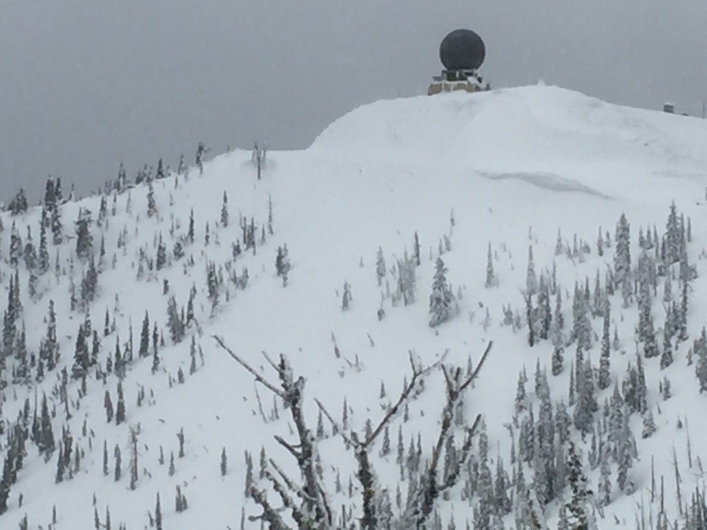
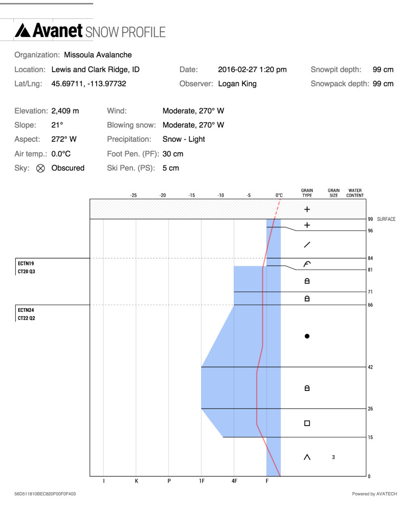
Tim and I were in the Rattlesnake yesterday and saw the results of the strong winds over the last few days. Minimal snowfall limited the amount of snow available for transport and slowed the development of windslabs. Windslabs are still the primary concern on leeward terrain above 6500ft. Windslabs are relatively shallow given the winds that have been recorded but are sitting on bed surfaces of crusts on many lee aspects. Careful travel on wind loaded terrain will be essential today.

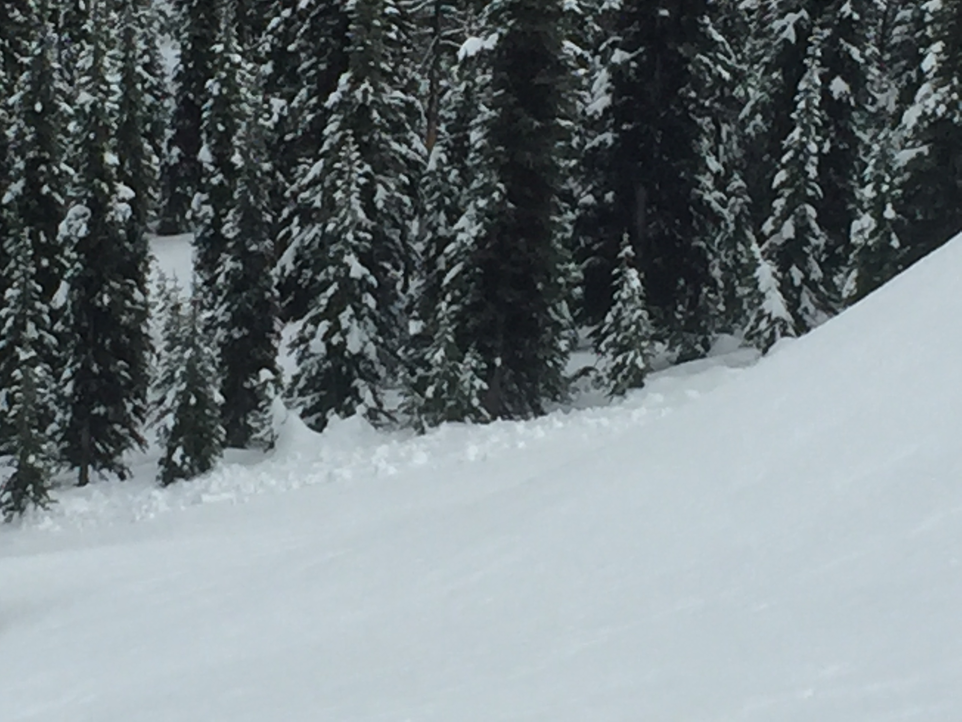
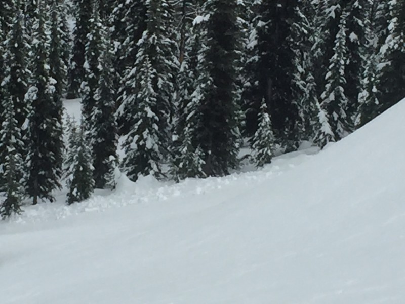
The secondary avalanche concern today will be loose avalanches. A thin veil of soft snow is sitting on a well-formed crust in many areas and will readily move on steeper terrain (pic). Avoid areas susceptible to loose snow avalanches that also have terrain traps that increase the consequences of getting caught.

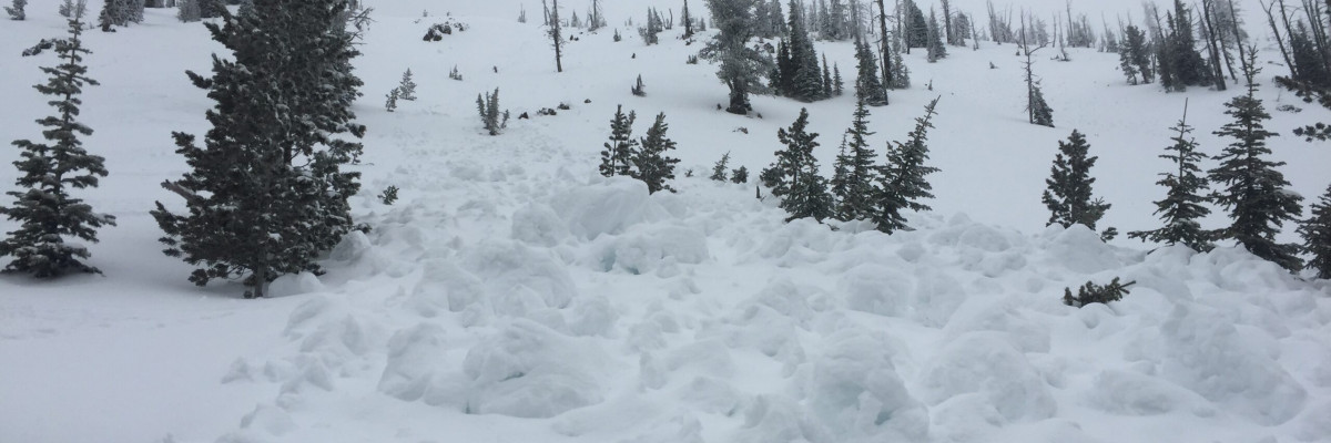
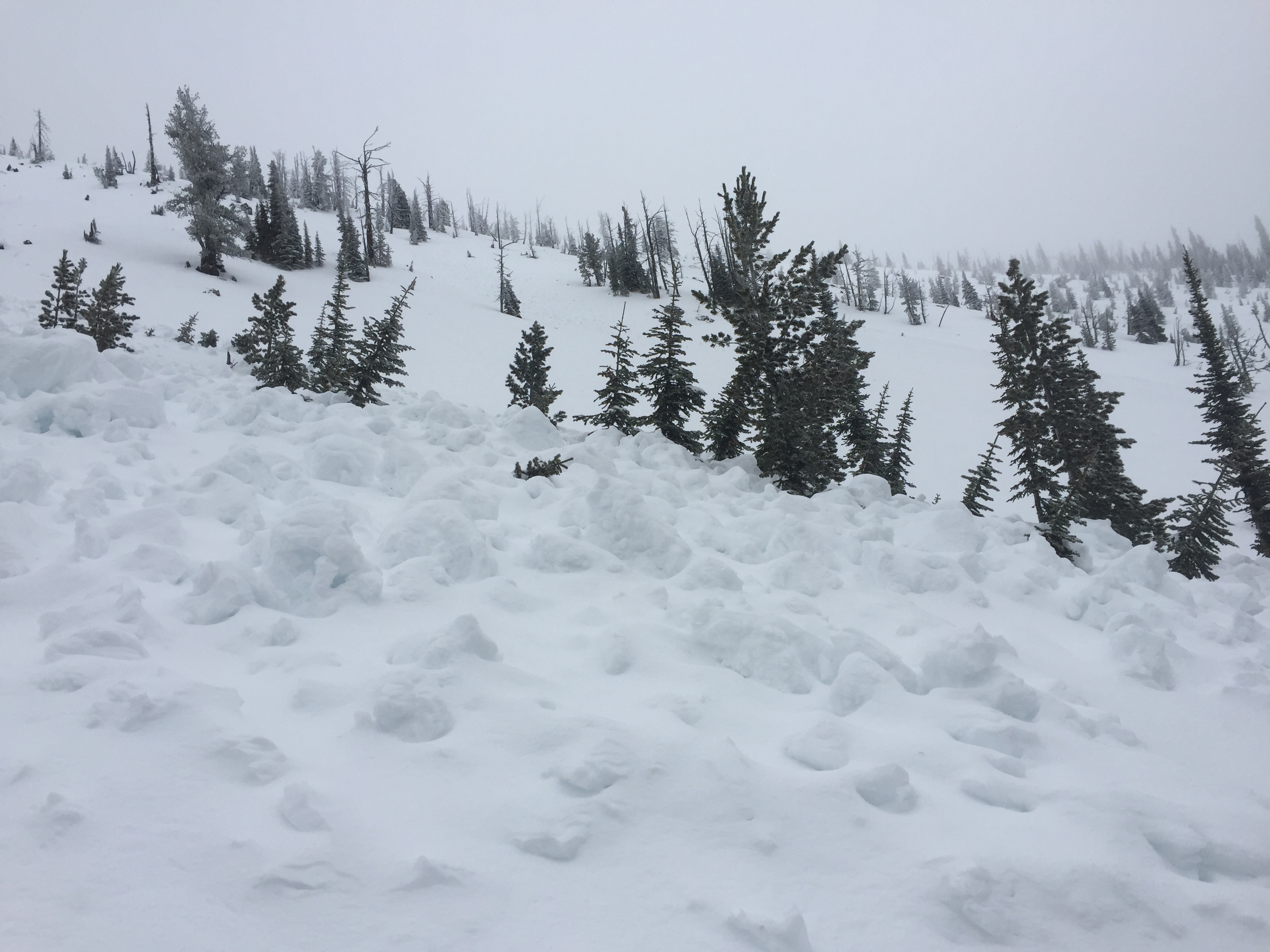
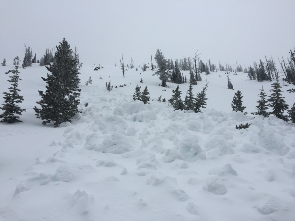
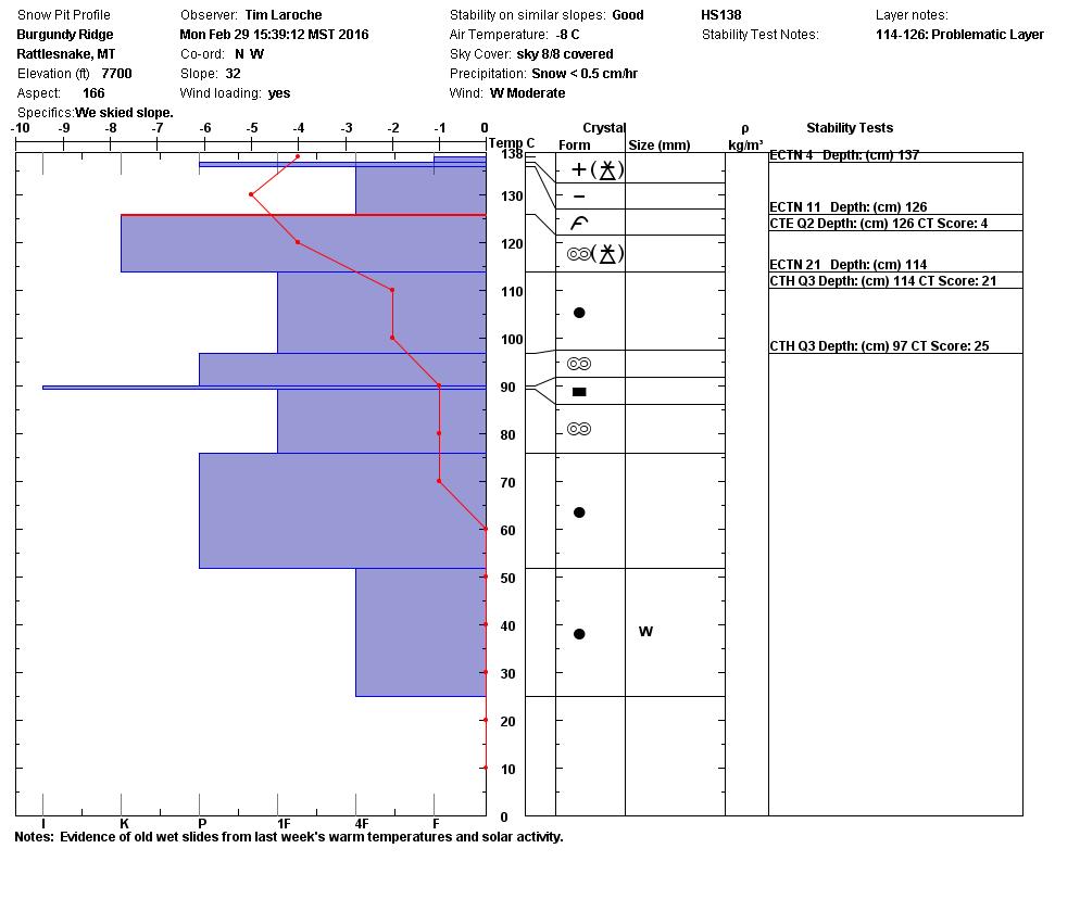
Tim and I also observed the debris from old wet slides (pic1) (pic2) that probably occurred mid-week last week. With the mild temperatures that we have been seeing wet slabs may become a problem if warm days also have significant solar radiation warming the snow surface. Stay aware of weather conditions as they change and how they affect the snow. 

Avalanche and Weather Outlook

Mild temperatures are expected to persist for the next few days. Light pulses of snow will periodically move through the area with a chance of snow coming tonight as the first wave of moisture passes through. Conditions will most likely remain the same in terms of avalanches unless one of the waves of moisture brings a significant new load or wind loading significantly increases.

The next avalanche advisory will be issued on Thursday.

READ FULL ADVISORY  

Problem 1 - Windslabs

  • TYPE

    wind-slabs

    Wind Slabs

    Release of a cohesive layer of snow (a slab) formed by the wind.  Wind typically erodes snow from the upwind sides of terrain features and deposits snow on the downwind side.  Wind slabs are often smooth and rounded and sometimes sound hollow, and can range from soft to hard. Wind slabs that form over a persistent weak layer (surface hoar, depth hoar, or near-surface facets) may be termed Persistent Slabs or may develop into Persistent Slabs.

  • SIZE

    2-3

    1 (Small)

    The potential size of avalanche resulting from this problem.

  • LIKELIHOOD

    Likelihood-3

    Possible

    The likelihood of an avalanche resulting from this problem.

  • ADDED DANGER

    Increased Slope Danger

    Increased/Added Danger

    There is an increased risk of avalanches on these slopes:

    N - North
    NE - Northeast
    E - East
    SE - Southeast
    NW - Northwest

Strong winds have formed windslabs on a solid bed surface on leeward terrain above 6,500ft.

Problem 2 - Loose Snow

  • TYPE

    loose-dry

    Loose Dry

    Release of wet unconsolidated snow or slush. These avalanches typically occur within layers of wet snow near the surface of the snowpack, but they may quickly gouge into lower snowpack layers. Like Loose-Dry Avalanches,they start at a point and entrain snow as they move downhill, forming a fan-shaped avalanche. They generally move slowly, but can contain enough mass to cause significant damage to trees, cars or buildings. Other names for loose-wet avalanches include point-release avalanches or sluffs. Loose-wet avalanches can trigger slab avalanches that break into deeper snow layers.

  • SIZE

    1-2

    < 1 (Small)

    The potential size of avalanche resulting from this problem.

  • LIKELIHOOD

    Likelihood-3

    Possible

    The likelihood of an avalanche resulting from this problem.

  • ADDED DANGER

    Increased Slope Danger

    Increased/Added Danger

    There is an increased risk of avalanches on these slopes:

    N - North
    NE - Northeast
    NW - Northwest

  • IMAGE

Loose snow avalanches will occur on shaded and cold steep terrain.

FORECAST & OUTLOOK

Conditions will be mild through midday with the best chance of snow coming this evening into tomorrow morning.

This information is the sole responsibility of the Forest Service and does not apply to operating ski areas. The avalanche danger rating expires at midnight tonight but the information can help you make a more informed decision regarding travel in avalanche terrain for the next few days.

Our advisory area includes National Forest System lands in the Bitterroot Mountains from Lost Trail Pass north to Granite Pass, the Rattlesnake Mountains north of Missoula and the Southern Swan and Mission Mountains near Seeley Lake, MT. Avalanche information for the Lookout Pass/St. Regis Basin area is available from the Idaho Panhandle Avalanche Center.