Posted:
Mar 3, 2016 @ 6:38 am

The current avalanche danger is MODERATE on wind loaded terrain above 6,500ft in the west central Montana backcountry.  Human triggered avalanches are possible in specific terrain. This danger rating does not apply to operating ski areas, expires at midnight tonight and is the sole responsibility of the U.S. Forest Service.

Good morning, this is Logan King with the West Central Montana Avalanche Center’s avalanche advisory for Thursday, March 3rd, 2016.

Weather and Snowpack

Strong winds continue to persist throughout the advisory area. No new snow was seen overnight but moderate snowfalls yesterday brought an additional 2-6inches of snow since Tuesday morning. Current mountain winds are in the teens and gusting to the twenties from the SE-SW.

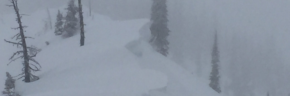
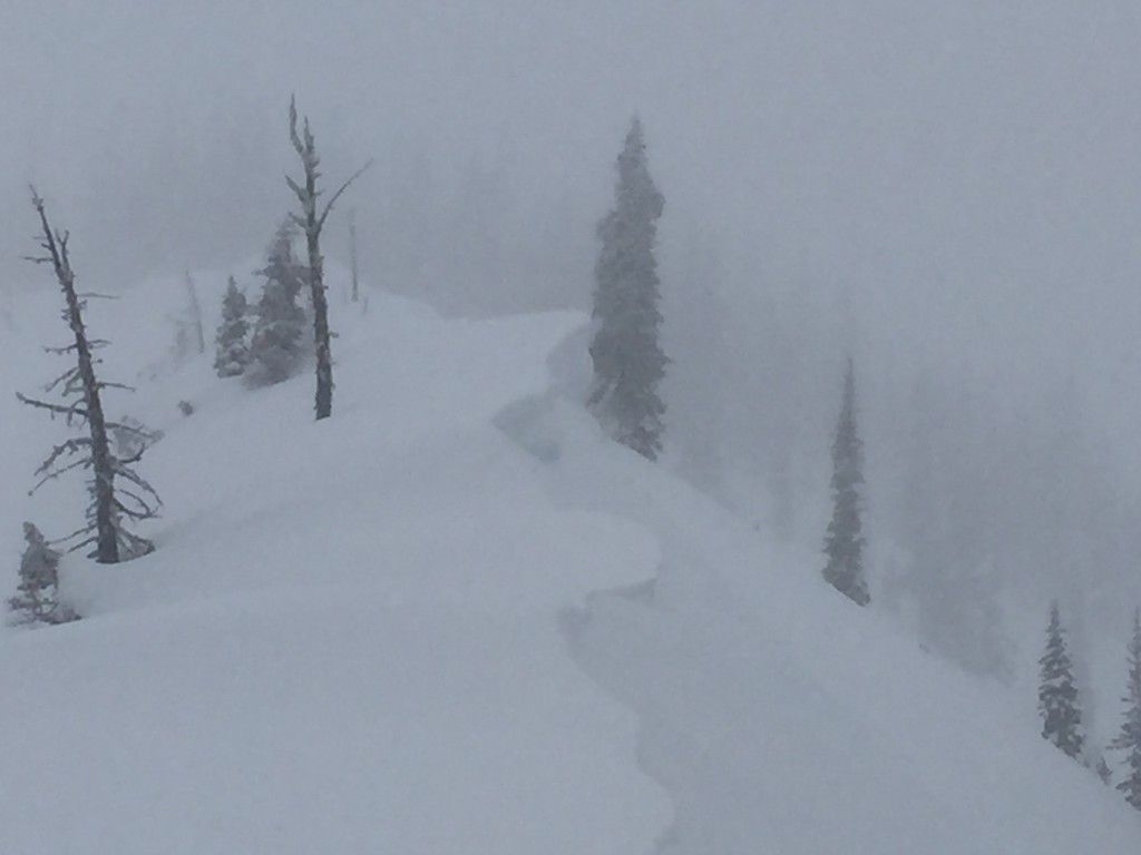
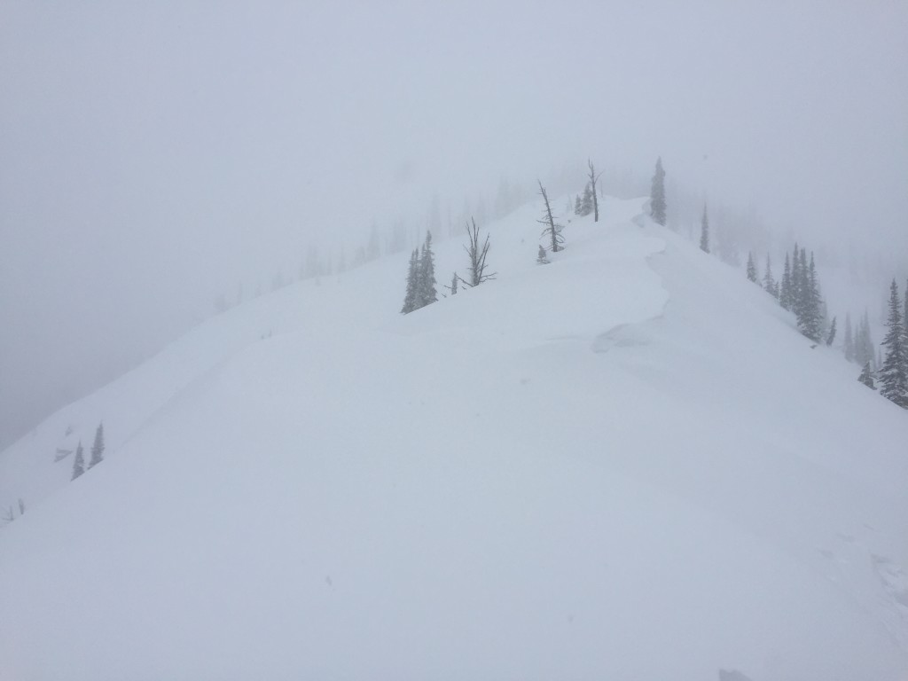
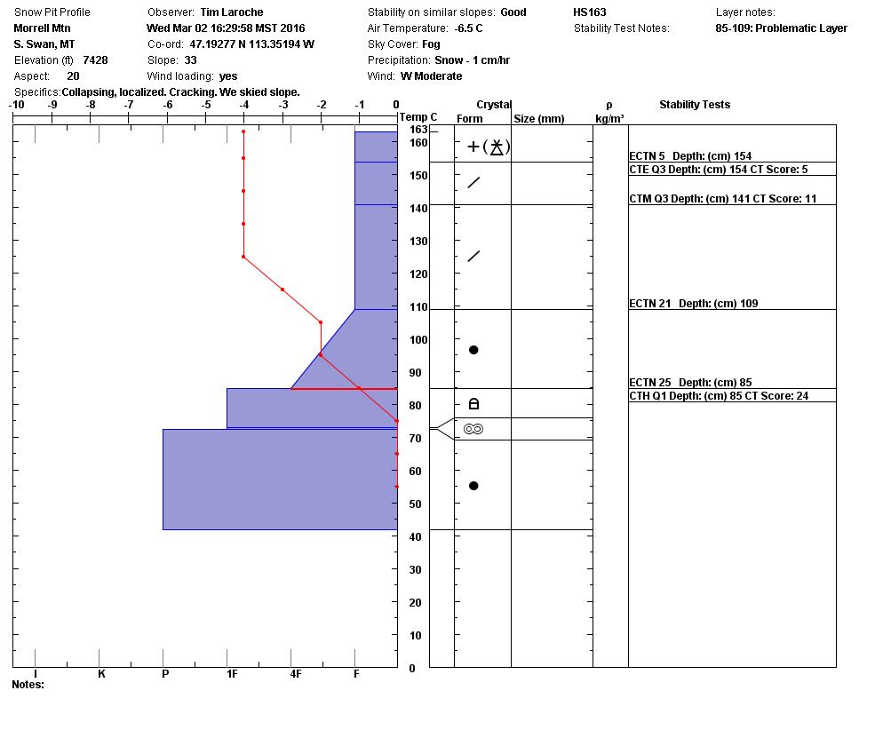
With prolonged strong winds and new snow for transport windslabs continue to be the primary concern throughout the region. Yesterday Tim and I were in the Southern Swan Range and found strong ridge top winds and notable cornice development. We also saw the remnants of a very small natural windslab that released sometime over the last two days.

With the new light snow, loose snow avalanches will be the secondary concern today. Around 2-6 inches of new snow has been seen over the last few days. The new snow will be moving on steeper terrain and in areas where it is sitting on crusts. The majority of loose snow avalanches should settle out over the next day or two, but be cautious of terrain traps or anything that increases the consequences of getting caught.

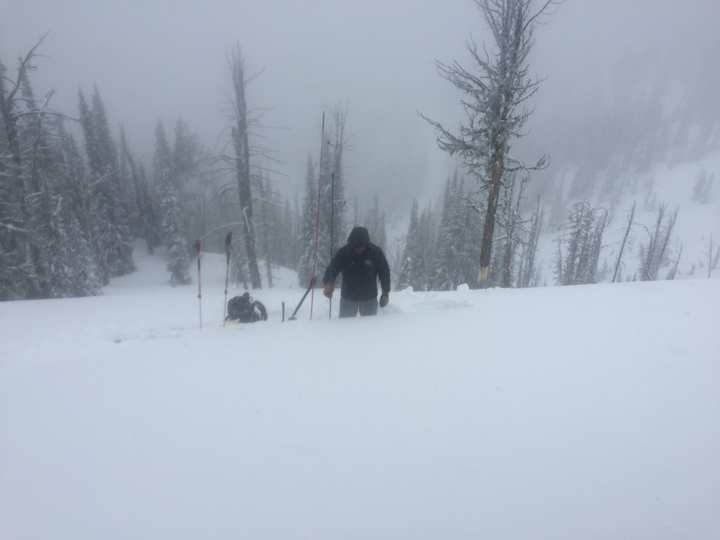
Lastly persistent slabs still warrant some attention. Generally most of the persistent problems have settled out or have been buried deep enough in the snowpack that they are unlikely to be triggered but we did have a propagation (ECTP 24) on a layer of small facets yesterday on a SE aspect. The small facets below crusts near the surface have been intermittently reactive over the last few weeks, so dig pits and test the reactivity of the persistent layers around the crusts.

Avalanche and Weather Outlook

A quick moving band of moisture will bring another round of snow late this morning but will give way to more settled weather this evening and into Friday. Strong westerly winds are predicted to continue but with no significant new load and minimal snow for transport avalanche conditions will remain the same.

Travis will issue the next avalanche advisory on Saturday. 

READ FULL ADVISORY  

Problem 1 - Windslabs

  • TYPE

    wind-slabs

    Wind Slabs

    Release of a cohesive layer of snow (a slab) formed by the wind.  Wind typically erodes snow from the upwind sides of terrain features and deposits snow on the downwind side.  Wind slabs are often smooth and rounded and sometimes sound hollow, and can range from soft to hard. Wind slabs that form over a persistent weak layer (surface hoar, depth hoar, or near-surface facets) may be termed Persistent Slabs or may develop into Persistent Slabs.

  • SIZE

    2-3

    1 (Small)

    The potential size of avalanche resulting from this problem.

  • LIKELIHOOD

    Likelihood-3

    Possible

    The likelihood of an avalanche resulting from this problem.

  • ADDED DANGER

    Increased Slope Danger

    Increased/Added Danger

    There is an increased risk of avalanches on these slopes:

    N - North
    NE - Northeast
    E - East
    SE - Southeast
    NW - Northwest

Strong winds and new snow will further develop windslabs. Debris from a very small natural windslab was seen in the Swan range yesterday.

Problem 2 - Loose Snow

  • TYPE

    loose-dry

    Loose Dry

    Release of wet unconsolidated snow or slush. These avalanches typically occur within layers of wet snow near the surface of the snowpack, but they may quickly gouge into lower snowpack layers. Like Loose-Dry Avalanches,they start at a point and entrain snow as they move downhill, forming a fan-shaped avalanche. They generally move slowly, but can contain enough mass to cause significant damage to trees, cars or buildings. Other names for loose-wet avalanches include point-release avalanches or sluffs. Loose-wet avalanches can trigger slab avalanches that break into deeper snow layers.

  • SIZE

    1-2

    < 1 (Small)

    The potential size of avalanche resulting from this problem.

  • LIKELIHOOD

    Likelihood-3

    Possible

    The likelihood of an avalanche resulting from this problem.

Loose snow avalanches are possible on terrain steeper than 35 degrees.

Problem 3 - Persistent Slabs

  • TYPE

    persistent-slabs

    Persistent Slabs

    Release of a cohesive layer of soft to hard snow (a slab) in the middle to upper snowpack, when the bond to an underlying persistent weak layer breaks.  Persistent layers include: surface hoar, depth hoar, near-surface facets, or faceted snow. Persistent weak layers can continue to produce avalanches for days, weeks or even months, making them especially dangerous and tricky. As additional snow and wind events build a thicker slab on top of the persistent weak layer, this avalanche problem may develop into a Persistent, Deep-Slab.

  • SIZE

    3-4

    1-2 (Small-Large)

    The potential size of avalanche resulting from this problem.

  • LIKELIHOOD

    Likelihood-2

    Unlikely/Possible

    The likelihood of an avalanche resulting from this problem.

  • ADDED DANGER

    Increased Slope Danger

    Increased/Added Danger

    There is an increased risk of avalanches on these slopes:

    E - East
    SE - Southeast
    S - South
    SW - Southwest
    W - West

Facets below the upper most melt-freeze crust have been reactive in stability tests where the crust is nearer to the surface.

FORECAST & OUTLOOK

Midday snow will give way to dryer and windy conditions tonight and into tomorrow.

This information is the sole responsibility of the Forest Service and does not apply to operating ski areas. The avalanche danger rating expires at midnight tonight but the information can help you make a more informed decision regarding travel in avalanche terrain for the next few days.

Our advisory area includes National Forest System lands in the Bitterroot Mountains from Lost Trail Pass north to Granite Pass, the Rattlesnake Mountains north of Missoula and the Southern Swan and Mission Mountains near Seeley Lake, MT. Avalanche information for the Lookout Pass/St. Regis Basin area is available from the Idaho Panhandle Avalanche Center.