Posted:
Mar 8, 2016 @ 6:33 am

The current avalanche danger is MODERATE above 7,000ft and on wind loaded terrain.  Human triggered avalanches are possible in specific areas. The avalanche danger at all other locations is LOW. This danger rating does not apply to operating ski areas, expires at midnight tonight and is the sole responsibility of the U.S. Forest Service.

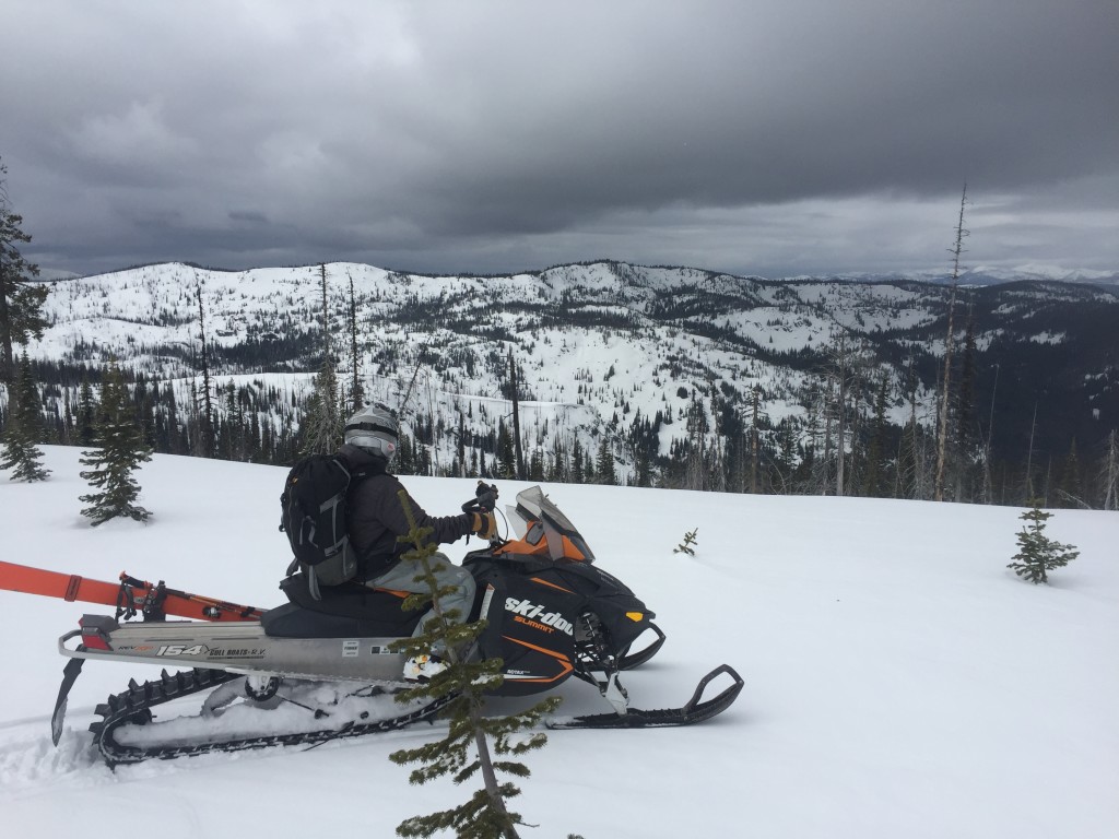
Good morning, this is Logan King with the West Central Montana Avalanche Center’s avalanche advisory for Tuesday, March 8th, 2016.

Weather and Snowpack

Winter is making a subtle return to West Central Montana and has brought a trace to 3 inches of snow over night. Currently ridge top winds are light and gusting to the low teens from the W-WNW at Point Six and Deer Mountain. As of 5am this morning mountain temperatures are ranging from 22-30 degrees and light snow is expected through the early morning hours today.

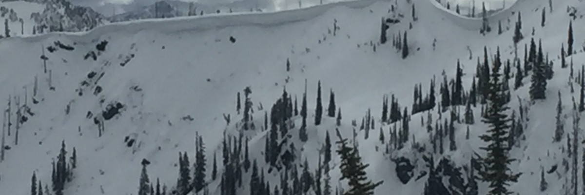
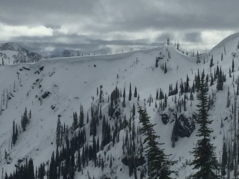
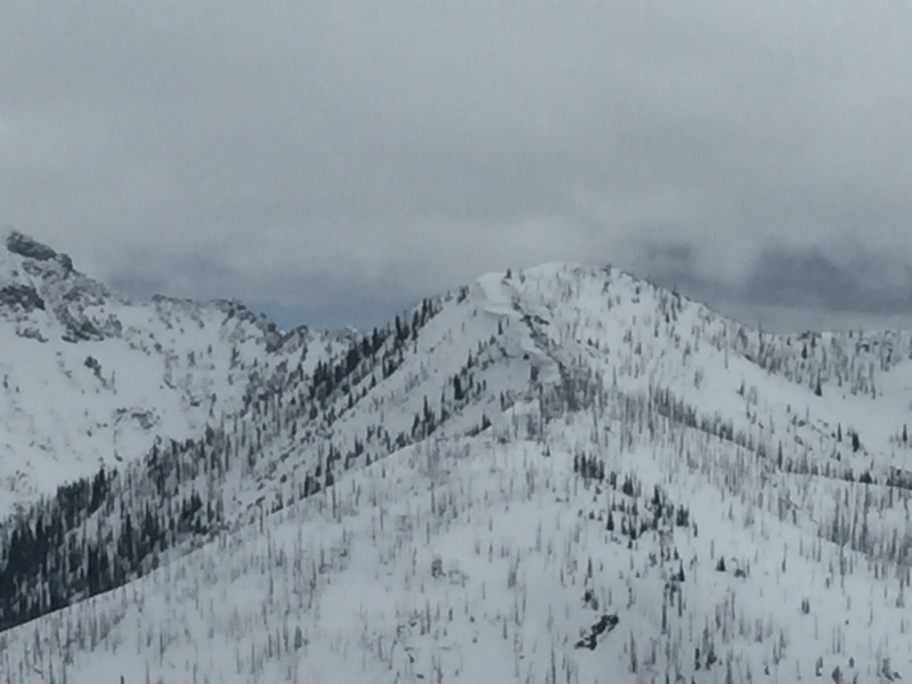
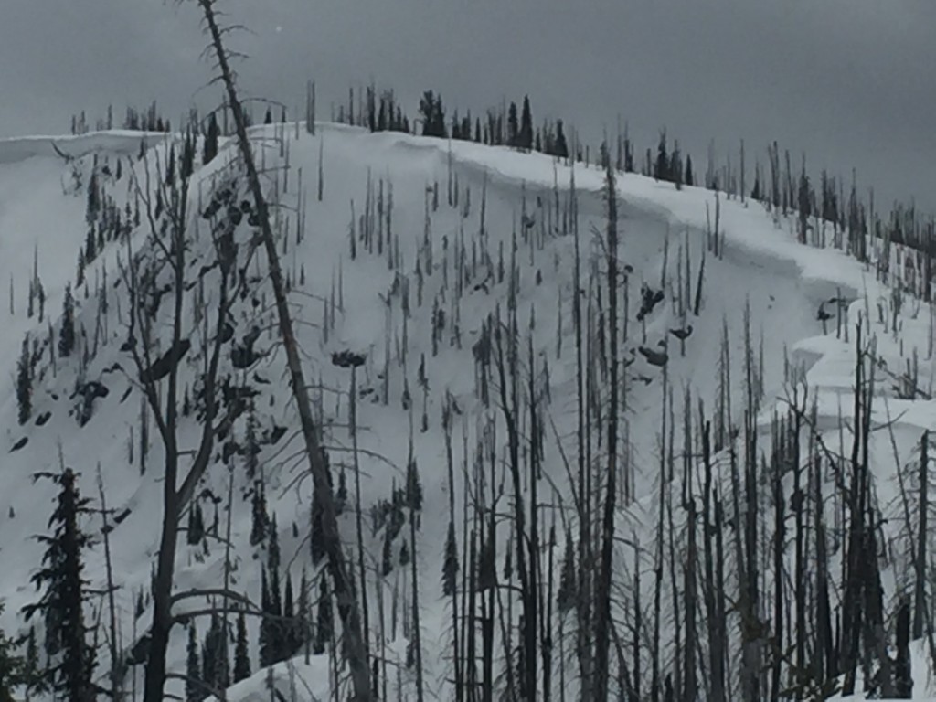
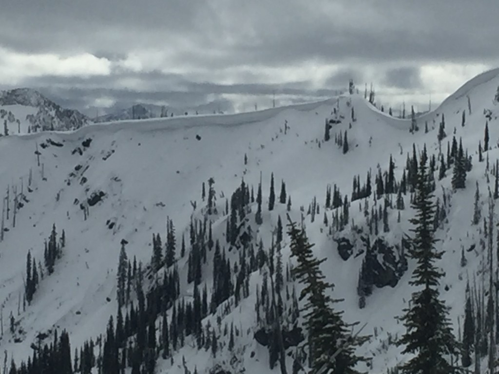
Windslabs are the primary avalanche concern today. Windslabs are small and stubborn but are still lurking and warrant close attention. Windslabs are primarily located in terrain above 7,000ft. Carefully assess any terrain above 7,000ft that appears to be wind affected to determine if a windslab is present and reactive. Of particular concern are areas that are lightly wind affected and harboring persistent weak layers.

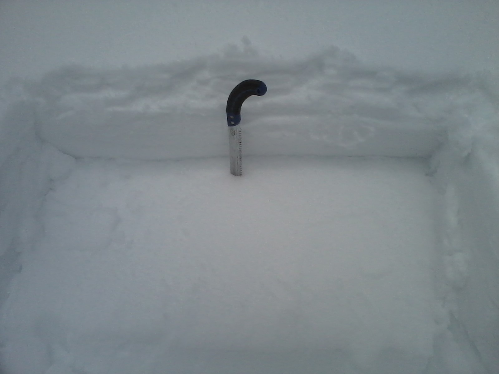
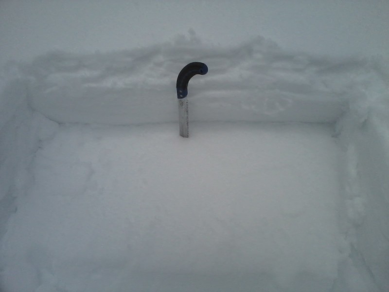
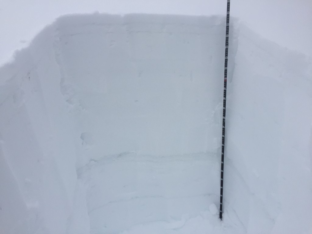
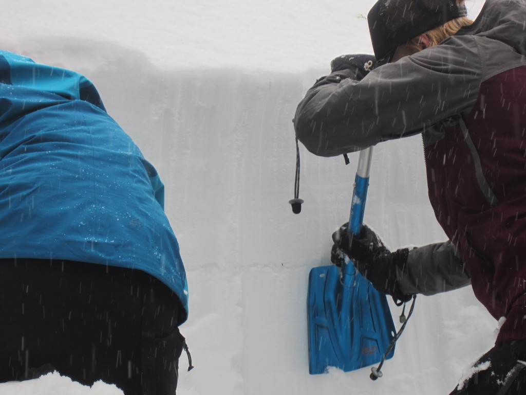
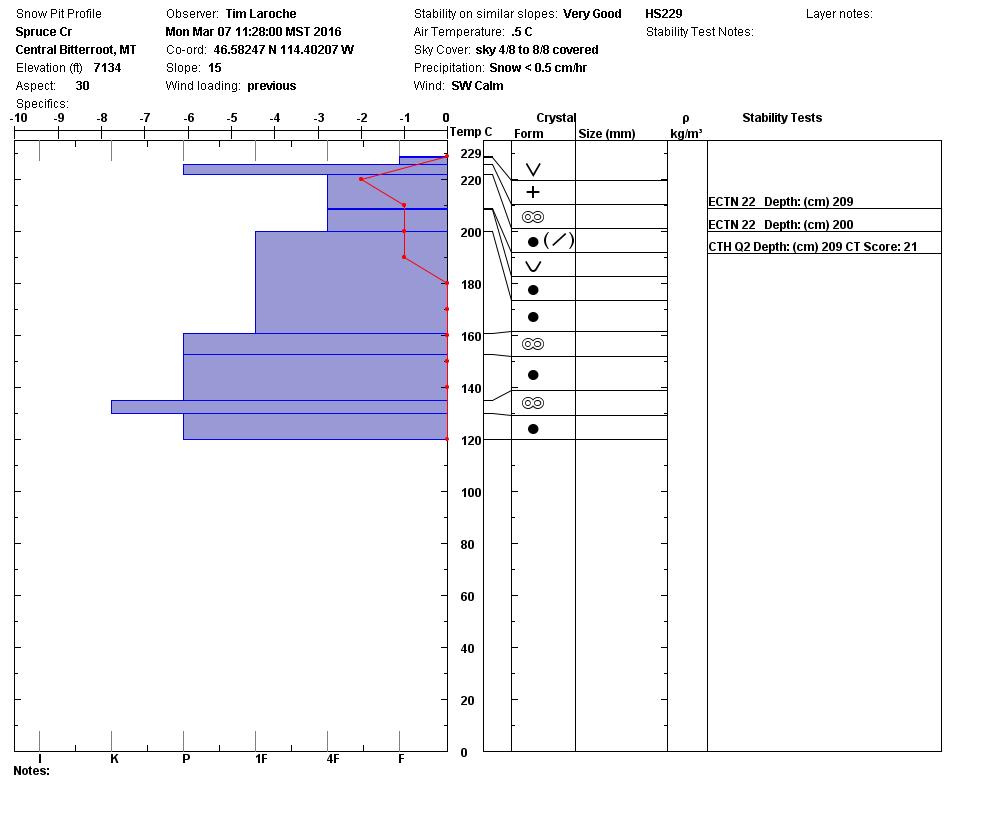
Persistent grains that are adjacent to the uppermost melt freeze crust (presidents day M/F crust) continue to be intermittently reactive. Areas that have a thin layer of soft wind load or the facets are nearer to the surface continue to occasionally be reactive in propagation tests (ECTP 12 pic). Avoid areas where facets are adjacent to the crust and close to the snow surface as well as areas that have a small soft windslab sitting on the melt freeze crust facets. The only way to know if these conditions exists is to dig pits, so carefully evaluate the snow and perform stability tests. 

Lastly with crust consistently forming on the surface and light new snow over night the new surface snow will be susceptible to loose snow avalanches on terrain steeper than 35 degrees. Carefully evaluate the consequences of getting caught by even a small slide and avoid terrain traps. 

Avalanche and Weather Outlook

Light snow is expected to continue through the morning today and will be tapering off later in the afternoon. The next series of snow showers is expected to move in early Wednesday, but snow totals will be unremarkable. More snow is expected as the week progresses but snow levels look to climb later in the week. No major changes are expected to occur in the next couple of days and the avalanche danger will remain the same.

Travis will issue the next avalanche advisory on Thursday. 

READ FULL ADVISORY  

Problem 1 - Wind Slabs

  • TYPE

    wind-slabs

    Wind Slabs

    Release of a cohesive layer of snow (a slab) formed by the wind.  Wind typically erodes snow from the upwind sides of terrain features and deposits snow on the downwind side.  Wind slabs are often smooth and rounded and sometimes sound hollow, and can range from soft to hard. Wind slabs that form over a persistent weak layer (surface hoar, depth hoar, or near-surface facets) may be termed Persistent Slabs or may develop into Persistent Slabs.

  • SIZE

    2-3

    1 (Small)

    The potential size of avalanche resulting from this problem.

  • LIKELIHOOD

    Likelihood-2

    Unlikely/Possible

    The likelihood of an avalanche resulting from this problem.

  • IMAGE

Windslabs are small and stubborn and are of most concern above 7,000ft.

Problem 2 - Persistent Slab

  • TYPE

    persistent-slabs

    Persistent Slabs

    Release of a cohesive layer of soft to hard snow (a slab) in the middle to upper snowpack, when the bond to an underlying persistent weak layer breaks.  Persistent layers include: surface hoar, depth hoar, near-surface facets, or faceted snow. Persistent weak layers can continue to produce avalanches for days, weeks or even months, making them especially dangerous and tricky. As additional snow and wind events build a thicker slab on top of the persistent weak layer, this avalanche problem may develop into a Persistent, Deep-Slab.

  • SIZE

    3-4

    1-2 (Small-Large)

    The potential size of avalanche resulting from this problem.

  • LIKELIHOOD

    Likelihood-2

    Unlikely/Possible

    The likelihood of an avalanche resulting from this problem.

  • ADDED DANGER

    Increased Slope Danger

    Increased/Added Danger

    There is an increased risk of avalanches on these slopes:

    NE - Northeast
    E - East
    SE - Southeast
    S - South
    SW - Southwest

  • IMAGE

The melt freeze crust that formed over presidents day continues to intermittently propagate with energy in stability tests in areas where the crust is nearer to the surface or lightly wind loaded.

Problem 3 - Loose Snow

  • TYPE

    loose-dry

    Loose Dry

    Release of wet unconsolidated snow or slush. These avalanches typically occur within layers of wet snow near the surface of the snowpack, but they may quickly gouge into lower snowpack layers. Like Loose-Dry Avalanches,they start at a point and entrain snow as they move downhill, forming a fan-shaped avalanche. They generally move slowly, but can contain enough mass to cause significant damage to trees, cars or buildings. Other names for loose-wet avalanches include point-release avalanches or sluffs. Loose-wet avalanches can trigger slab avalanches that break into deeper snow layers.

  • SIZE

    1-2

    < 1 (Small)

    The potential size of avalanche resulting from this problem.

  • LIKELIHOOD

    Likelihood-3

    Possible

    The likelihood of an avalanche resulting from this problem.

New loose snow on crusts or terrain steeper than 35 degrees will be able to produce loose snow slides.

FORECAST & OUTLOOK

Light snow this morning will taper off by this afternoon.

This information is the sole responsibility of the Forest Service and does not apply to operating ski areas. The avalanche danger rating expires at midnight tonight but the information can help you make a more informed decision regarding travel in avalanche terrain for the next few days.

Our advisory area includes National Forest System lands in the Bitterroot Mountains from Lost Trail Pass north to Granite Pass, the Rattlesnake Mountains north of Missoula and the Southern Swan and Mission Mountains near Seeley Lake, MT. Avalanche information for the Lookout Pass/St. Regis Basin area is available from the Idaho Panhandle Avalanche Center.