Posted:
Mar 29, 2016 @ 6:24 am

The current avalanche danger is MODERATE in the west central Montana backcountry. Human triggered avalanches are possible. Heightened avalanche conditions exist in isolated terrain. Evaluate snow and terrain carefully and identify features of concern.

Good morning, this is Travis Craft with the West Central Montana Avalanche Center’s avalanche advisory for March 29, 2016. This danger rating does not apply to operating ski areas, expires at midnight tonight and is the sole responsibility of the U.S. Forest Service.

Weather and Snowpack

Mountain temperatures range from 19 F to 27 F in the region. Winds are 19 mph with gusts of 30 mph out of the NNE in the Bitterroot.  At Point Six in the northern part of the advisory area winds are 21 mph with gusts of 44 mph out of the ENE.  The advisory area received no new snow overnight.  The region picked up 3 new inches of snow in the last 48 hours.

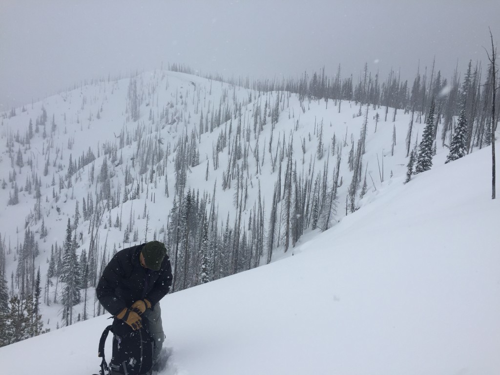
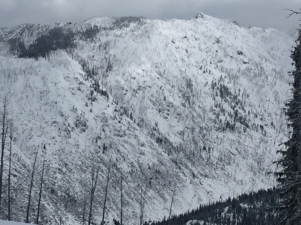
Tim and I took the sleds to the Lolo Pass area yesterday.  The primary avalanche problem is loose dry avalanches on shaded aspects and loose wet avalanches on sun exposed aspects.  Conditions can change quickly in the spring and are very elevation specific.  It feels like winter on the high ridges and as you go down in elevation it feels like spring.

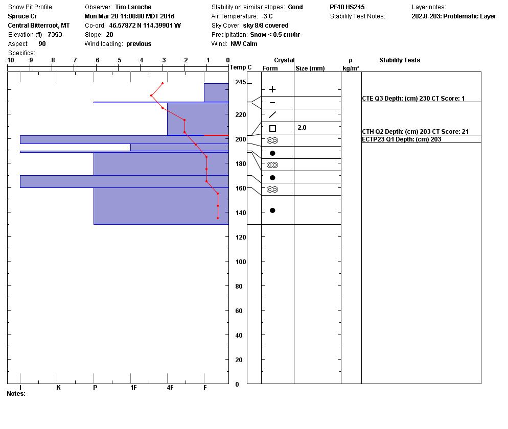
The second avalanche problem is the persistent slab that is failing on facets that sit on the last melt freeze crust. This layer propagated in our tests on shadier aspects yesterday.  These facets are reactive on some slopes.  The way to identify this layer is to dig a pit a meter into the snowpack and see if it is reactive in your tests before committing to a steep slope.

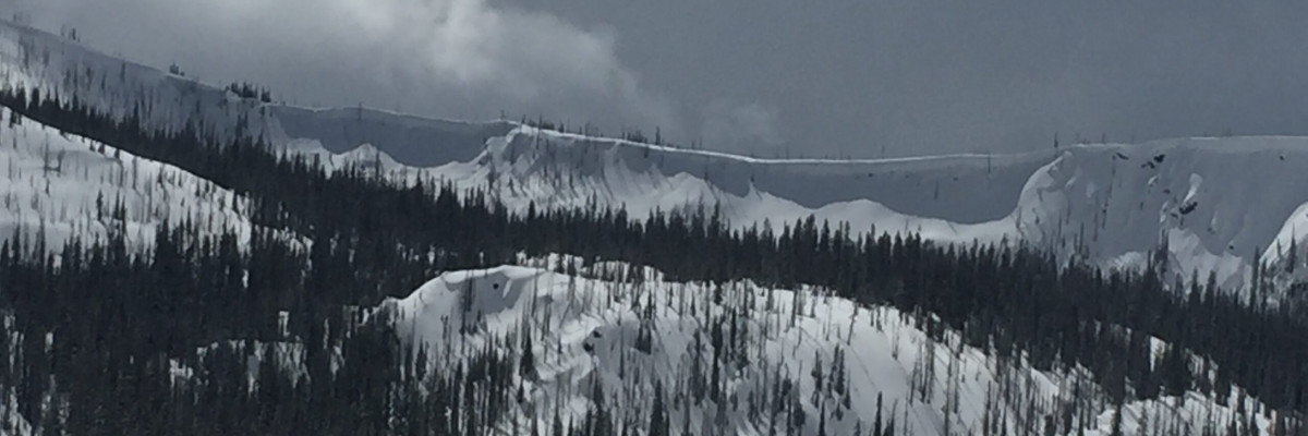
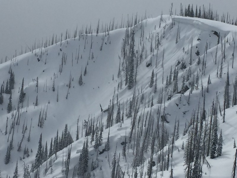
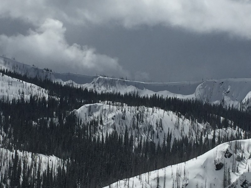
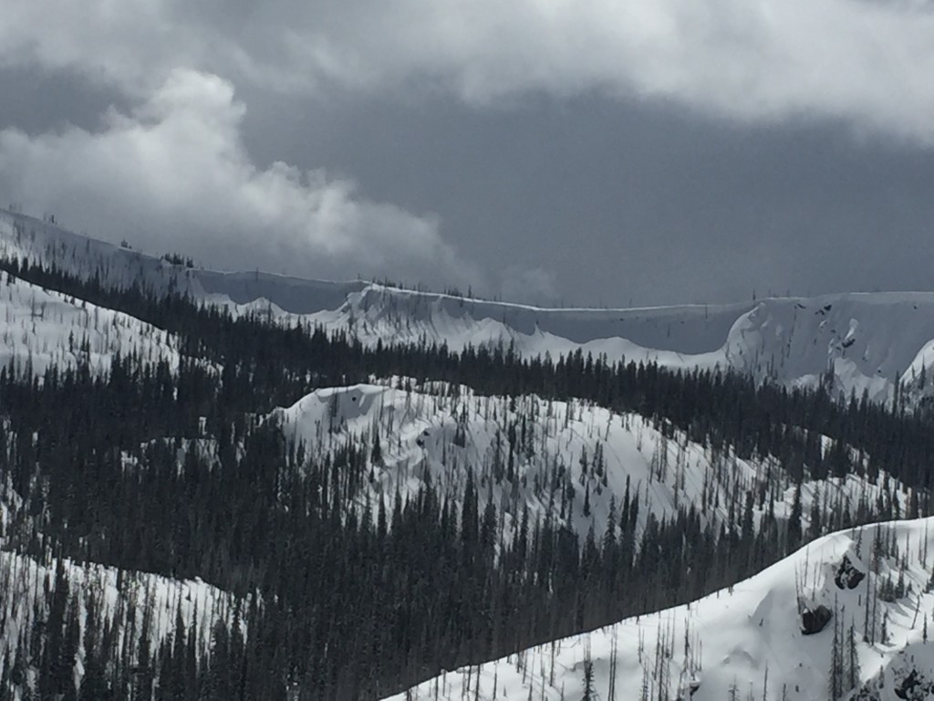
The final avalanche problem is cornice failure.  The cornice are very large right now and with warming temperatures in the afternoon are weakening.  Give them a wide berth.

Weather and Avalanche Outlook

We will have moderate temperatures for the next couple of days with a possibility of picking up small amounts of snow.  The region will experience high winds the next couple of days.  The avalanche danger with these conditions should stay the same.  Remember in the spring, conditions can change rapidly.  With the strong winds there is new snow available for transport.  I would look for leeward terrain to have wind slabs formed on it.

Ski and ride safe.  Logan will issue the next advisory on Thursday.

READ FULL ADVISORY  

Problem 1 - Loose Dry

  • TYPE

    loose-dry

    Loose Dry

    Release of wet unconsolidated snow or slush. These avalanches typically occur within layers of wet snow near the surface of the snowpack, but they may quickly gouge into lower snowpack layers. Like Loose-Dry Avalanches,they start at a point and entrain snow as they move downhill, forming a fan-shaped avalanche. They generally move slowly, but can contain enough mass to cause significant damage to trees, cars or buildings. Other names for loose-wet avalanches include point-release avalanches or sluffs. Loose-wet avalanches can trigger slab avalanches that break into deeper snow layers.

  • SIZE

    2-3

    1 (Small)

    The potential size of avalanche resulting from this problem.

  • LIKELIHOOD

    Likelihood-5

    Likely

    The likelihood of an avalanche resulting from this problem.

  • IMAGE

Loose dry avalanches on colder aspects.  On sun exposed aspects look for loose wet releases.

Problem 2 - Persistent Slabs

  • TYPE

    persistent-slabs

    Persistent Slabs

    Release of a cohesive layer of soft to hard snow (a slab) in the middle to upper snowpack, when the bond to an underlying persistent weak layer breaks.  Persistent layers include: surface hoar, depth hoar, near-surface facets, or faceted snow. Persistent weak layers can continue to produce avalanches for days, weeks or even months, making them especially dangerous and tricky. As additional snow and wind events build a thicker slab on top of the persistent weak layer, this avalanche problem may develop into a Persistent, Deep-Slab.

  • SIZE

    3-4

    1-2 (Small-Large)

    The potential size of avalanche resulting from this problem.

  • LIKELIHOOD

    Likelihood-3

    Possible

    The likelihood of an avalanche resulting from this problem.

There are facets sitting on top of a melt freeze crust that have the potential to propagate.  Dig a pit a meter into the snow to evaluate this layer.

Problem 3 - Cornices

  • TYPE

    cornices

    Cornices / Cornice Fall

    Release of an overhanging mass of snow that forms as the wind moves snow over a sharp terrain feature, such as a ridge, and deposits snow on the down-wind side. They range from small wind lips of soft snow to large overhangs of hard snow that are 30 feet (~10 meters) or taller. They can break off the terrain suddenly and pull back onto the ridge top and catch people by surprise even on the flat ground above the slope. Even small cornices can have enough mass to be destructive and deadly. Cornice fall can entrain loose surface snow or trigger slab avalanches.

  • SIZE

    5-6

    2-3 (Large)

    The potential size of avalanche resulting from this problem.

  • LIKELIHOOD

    Likelihood-2

    Unlikely/Possible

    The likelihood of an avalanche resulting from this problem.

  • IMAGE

Cornices are large and with temperatures heating up in the afternoon it is best to give them a wide berth.

03/29/2016 Advisory

FORECAST & OUTLOOK

Trace amount of snow with strong winds the next two days.

This information is the sole responsibility of the Forest Service and does not apply to operating ski areas. The avalanche danger rating expires at midnight tonight but the information can help you make a more informed decision regarding travel in avalanche terrain for the next few days.

Our advisory area includes National Forest System lands in the Bitterroot Mountains from Lost Trail Pass north to Granite Pass, the Rattlesnake Mountains north of Missoula and the Southern Swan and Mission Mountains near Seeley Lake, MT. Avalanche information for the Lookout Pass/St. Regis Basin area is available from the Idaho Panhandle Avalanche Center.