Posted:
Dec 15, 2016 @ 7:15 am

The current avalanche danger is  Considerable in the west central Montana backcountry on steep (>30 degrees) wind loaded slopes.  On all other slopes the danger is Moderate.

Good morning, this is Travis Craft with the West Central Montana Avalanche Center’s avalanche advisory for December 15, 2016.  This danger rating does not apply to operating ski areas, expires at midnight tonight and is the sole responsibility of the U.S. Forest Service.

Weather and Snowpack

Mountain temperatures range from 12 F to 23 F in the region.  In the Bitterroot winds are 7 mph out of the SSE and Point Six, in the northern part of the advisory area, winds are reading at 12 mph with gusts of 21 mph out of the SW.  The forecast area received 1 to 6 inches of new snow in the last 24 hours. The SWE totals are .3 to .8.

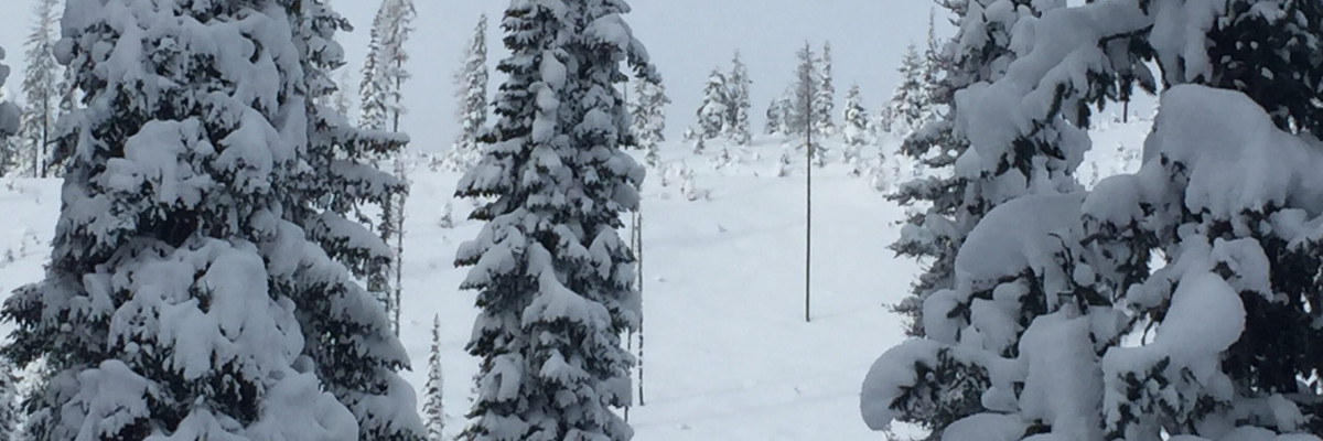
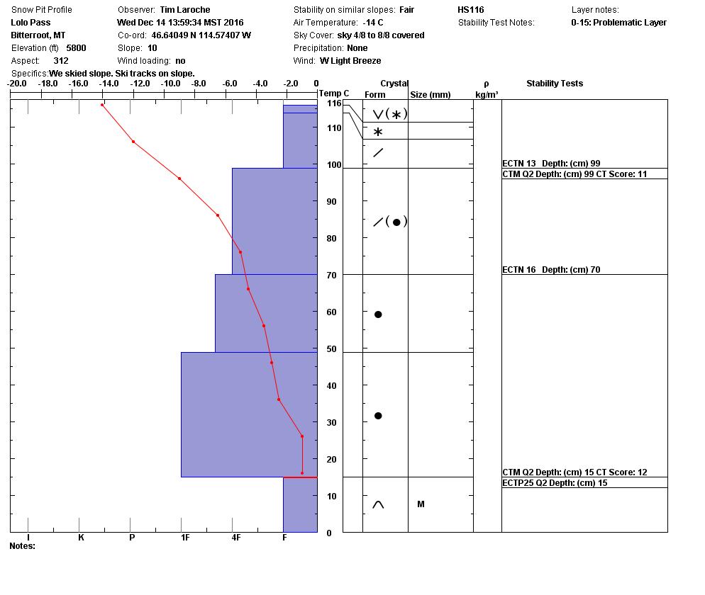
Tim and I toured near Lolo pass yesterday.  The snowpack structure is still poor and the facets near the ground are still failing.  We were able to get propagation in our ECT’s.  With the new snow and winds overnight, steep leeward slopes have considerable danger.  This means careful snowpack evaluation, cautious route-finding and conservative decision-making are essential to recreate today.

The first avalanche problem is a persistent slab that is releasing near the ground on basal facets.  It gained strength, but with the new load from snow and wind loading it will become more reactive.  You need to dig in the snow and assess this layer.

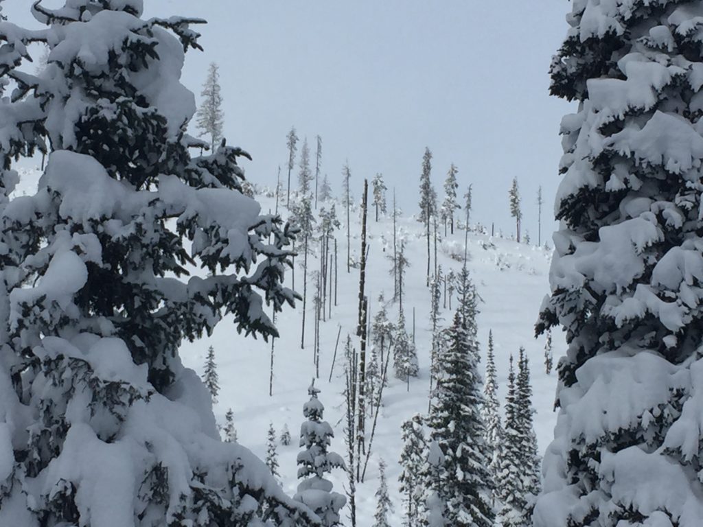
The second avalanche problem are wind slabs created on leeward slopes.  There was new snow to be transported with the wind last night.  These slabs will be identified by the scouring of slopes and hollow drum-like sounds.

Remember, the avalanche advisory is a starting point for decision making.  The actual avalanche hazard could be greater or lower where you are traveling. Pay close attention to any signs of instability: Shooting cracks, recent avalanche activity, collapse noises and whumphing.  Snow showers will linger in the area through tonight as arctic area pushes the warm front out of the region with high winds.

Avalanche and Weather Outlook

Snow showers will linger in the area through tonight as arctic air pushes the warm front out of the region with high winds.  With new snow and wind the avalanche danger will remain the same.  If you are out recreating in the backcountry, please send us your observations, these are very helpful in producing the advisory.

I will issue the next advisory on Saturday, December 17, 2016.

Ski and ride safe.


READ FULL ADVISORY  

Problem 1 - Persistent Slab

  • TYPE

    persistent-slabs

    Persistent Slabs

    Release of a cohesive layer of soft to hard snow (a slab) in the middle to upper snowpack, when the bond to an underlying persistent weak layer breaks.  Persistent layers include: surface hoar, depth hoar, near-surface facets, or faceted snow. Persistent weak layers can continue to produce avalanches for days, weeks or even months, making them especially dangerous and tricky. As additional snow and wind events build a thicker slab on top of the persistent weak layer, this avalanche problem may develop into a Persistent, Deep-Slab.

  • SIZE

    4-5

    2 (Large)

    The potential size of avalanche resulting from this problem.

  • LIKELIHOOD

    Likelihood-3

    Possible

    The likelihood of an avalanche resulting from this problem.

The structure of the snowpack is poor.  Dig in the snow to assess the facets near the ground. Pay close attention to any signs of instability: Shooting cracks, recent avalanche activity, collapse noises and whumphing.  These signs always trump pit tests.

Problem 2 - Wind Slab

  • TYPE

    wind-slabs

    Wind Slabs

    Release of a cohesive layer of snow (a slab) formed by the wind.  Wind typically erodes snow from the upwind sides of terrain features and deposits snow on the downwind side.  Wind slabs are often smooth and rounded and sometimes sound hollow, and can range from soft to hard. Wind slabs that form over a persistent weak layer (surface hoar, depth hoar, or near-surface facets) may be termed Persistent Slabs or may develop into Persistent Slabs.

  • SIZE

    4-5

    2 (Large)

    The potential size of avalanche resulting from this problem.

  • LIKELIHOOD

    Likelihood-3

    Possible

    The likelihood of an avalanche resulting from this problem.

Winds have loaded leeward terrain.

VIDEO

December 15, 2016 advisory

FORECAST & OUTLOOK

  • Danger Trend

    same

    Same Danger

  • Area Forecast

    Wind

Snow showers will linger in the area through tonight as arctic air pushes the warm front out of the region with high winds.

This information is the sole responsibility of the Forest Service and does not apply to operating ski areas. The avalanche danger rating expires at midnight tonight but the information can help you make a more informed decision regarding travel in avalanche terrain for the next few days.

Our advisory area includes National Forest System lands in the Bitterroot Mountains from Lost Trail Pass north to Granite Pass, the Rattlesnake Mountains north of Missoula and the Southern Swan and Mission Mountains near Seeley Lake, MT. Avalanche information for the Lookout Pass/St. Regis Basin area is available from the Idaho Panhandle Avalanche Center.