Posted:
Dec 20, 2016 @ 6:32 am

The current avalanche danger is CONSIDERABLE in the west central Montana backcountry on steep (>35 degrees) wind loaded slopes. On all other slopes the danger is MODERATE.  This means careful snowpack evaluation, cautious route-finding and conservative decision-making are essential to recreate today.

Good morning, this is Travis Craft with the West Central Montana Avalanche Center’s avalanche advisory for December 20, 2016. This danger rating does not apply to operating ski areas, expires at midnight tonight and is the sole responsibility of the U.S. Forest Service.

Weather and Snowpack

Mountain temperatures range from 18 F to 28 F in the region. In the Bitterroot winds are 9 mph with gusts of 13 out of the SSE and Point Six, in the northern part of the advisory area, winds are reading at 3 mph with gusts of 12 mph out of the SE. The forecast area received 1 to 3 inches of new snow in the last 24 hours. The SWE totals are .3 to .6.

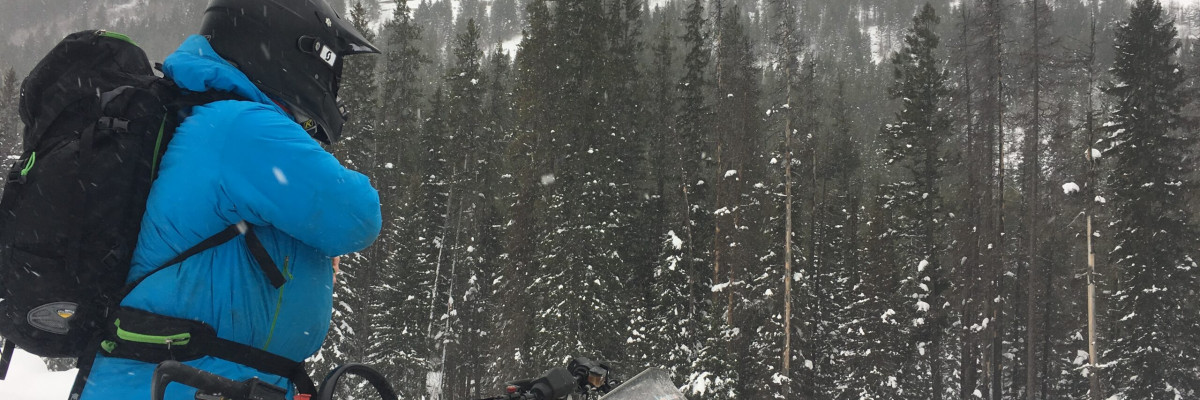
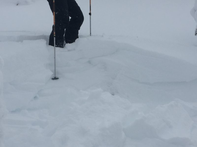
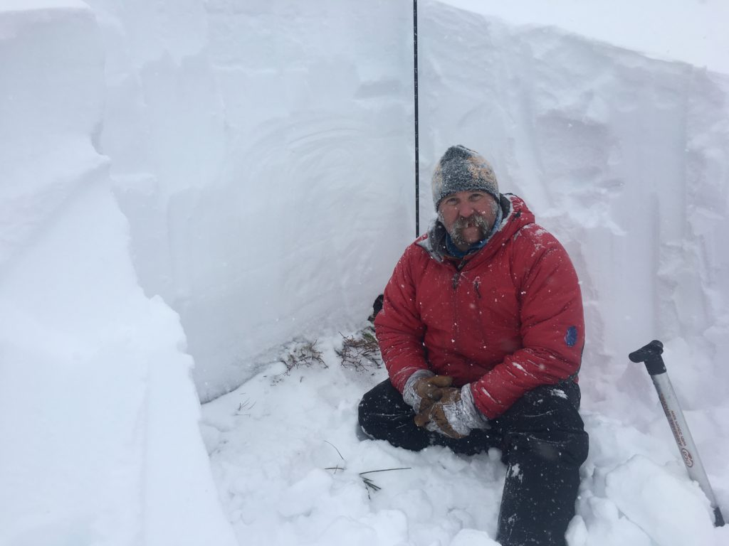
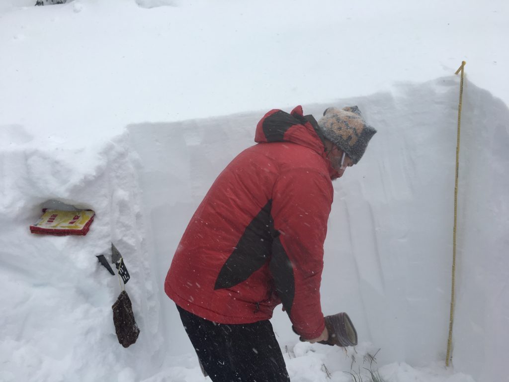
We took sleds into the Twin Lakes in the central Bitterroot.  We observed some localized cracking and wind loading of leeward slopes.  We were able to get the basal facets to propagate in our ECT’s at the ground.  Yurtski in the southern Swan also found these facets near the yurts and were not able to get propagation on them.

The first avalanche problem is wind slabs.  These wind slabs have been deposited on a poor snowpack structure.  With todays predicted high winds and new snowfall expect these slabs to grow in size.

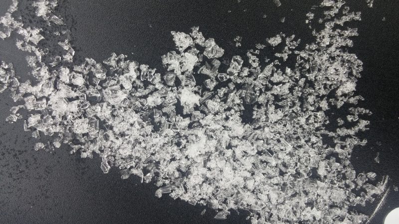
The second avalanche concern is the persistent slab releasing at the ground.  The basal facets are located throughout the advisory area.  Dig into the snowpack and see if these facets propagate.  Also pay attention to bullseye data.

The final problem are storm slabs.  These slabs of heavier snow have been deposited on lower lighter density snow. See Video

Avalanche and Weather Outlook

It is currently snowing.  The mountains are predicted to have over a foot of heavy dense snow accompanied by high winds (50 mph).  With the addition of new snow and high winds expect the avalanche danger to increase rapidly.  Conditions can change quickly especially with the poor snowpack structure and additional loading by the wind.

Logan will issue the next advisory on Thursday December 22, 2016.

Ski and ride safe.

READ FULL ADVISORY  

Problem 1 - Wind Slabs

  • TYPE

    wind-slabs

    Wind Slabs

    Release of a cohesive layer of snow (a slab) formed by the wind.  Wind typically erodes snow from the upwind sides of terrain features and deposits snow on the downwind side.  Wind slabs are often smooth and rounded and sometimes sound hollow, and can range from soft to hard. Wind slabs that form over a persistent weak layer (surface hoar, depth hoar, or near-surface facets) may be termed Persistent Slabs or may develop into Persistent Slabs.

  • SIZE

    3-4

    1-2 (Small-Large)

    The potential size of avalanche resulting from this problem.

  • LIKELIHOOD

    Likelihood-5

    Likely

    The likelihood of an avalanche resulting from this problem.

  • IMAGE

With the new snow and strong winds wind slabs have been deposited on leeward slopes on a poor snowpack structure.

Problem 2 - Persistent Slabs

  • TYPE

    persistent-slabs

    Persistent Slabs

    Release of a cohesive layer of soft to hard snow (a slab) in the middle to upper snowpack, when the bond to an underlying persistent weak layer breaks.  Persistent layers include: surface hoar, depth hoar, near-surface facets, or faceted snow. Persistent weak layers can continue to produce avalanches for days, weeks or even months, making them especially dangerous and tricky. As additional snow and wind events build a thicker slab on top of the persistent weak layer, this avalanche problem may develop into a Persistent, Deep-Slab.

  • SIZE

    6-7

    3 (Large-Very Large)

    The potential size of avalanche resulting from this problem.

  • LIKELIHOOD

    Likelihood-5

    Likely

    The likelihood of an avalanche resulting from this problem.

  • IMAGE

The structure of the snowpack is poor. Dig in the snow to assess the facets near the ground. Pay close attention to any signs of instability: Shooting cracks, recent avalanche activity, collapse noises and whumphing. These signs always trump pit tests.

Problem 3 - Storm Slabs

  • TYPE

    storm-slabs

    Storm Slabs

    Release of a soft cohesive layer (a slab) of new snow which breaks within the storm snow or on the old snow surface. Storm-slab problems typically last between a few hours and few days. Storm-slabs that form over a persistent weak layer (surface hoar, depth hoar, or near-surface facets) may be termed Persistent Slabs or may develop into Persistent Slabs.

  • SIZE

    3-4

    1-2 (Small-Large)

    The potential size of avalanche resulting from this problem.

  • LIKELIHOOD

    Likelihood-3

    Possible

    The likelihood of an avalanche resulting from this problem.

New  heavy snow has been deposited on weaker lower density snow.

VIDEO

Twin Lakes December 19 2016

FORECAST & OUTLOOK

It is currently snowing. The mountains are predicted to have over a foot of heavy dense snow accompanied by high winds (50 mph). With the addition of new snow and high winds expect the avalanche danger to increase rapidly. Conditions can change quickly especially with the poor snowpack structure.

This information is the sole responsibility of the Forest Service and does not apply to operating ski areas. The avalanche danger rating expires at midnight tonight but the information can help you make a more informed decision regarding travel in avalanche terrain for the next few days.

Our advisory area includes National Forest System lands in the Bitterroot Mountains from Lost Trail Pass north to Granite Pass, the Rattlesnake Mountains north of Missoula and the Southern Swan and Mission Mountains near Seeley Lake, MT. Avalanche information for the Lookout Pass/St. Regis Basin area is available from the Idaho Panhandle Avalanche Center.