Posted:
Dec 22, 2016 @ 6:40 am

The current avalanche danger is CONSIDERABLE for the West Central Montana backcountry on steep wind loaded slopes. A Moderate avalanche danger exits on all other slopes.

Good morning, this is Logan King with the West Central Montana Avalanche Center’s avalanche advisory for Thursday, December 22, 2016. This danger rating does not apply to operating ski areas, expires at midnight tonight and is the sole responsibility of the U.S. Forest Service.

Weather and Snowpack

Across West Central Montana no snow was seen overnight and currently mountain temperatures are in the teens. Ridgetop winds are 20mph gusting to the 30’s out of the WSW at Point Six and are in the teens out of the ESE at Deer Mountain.

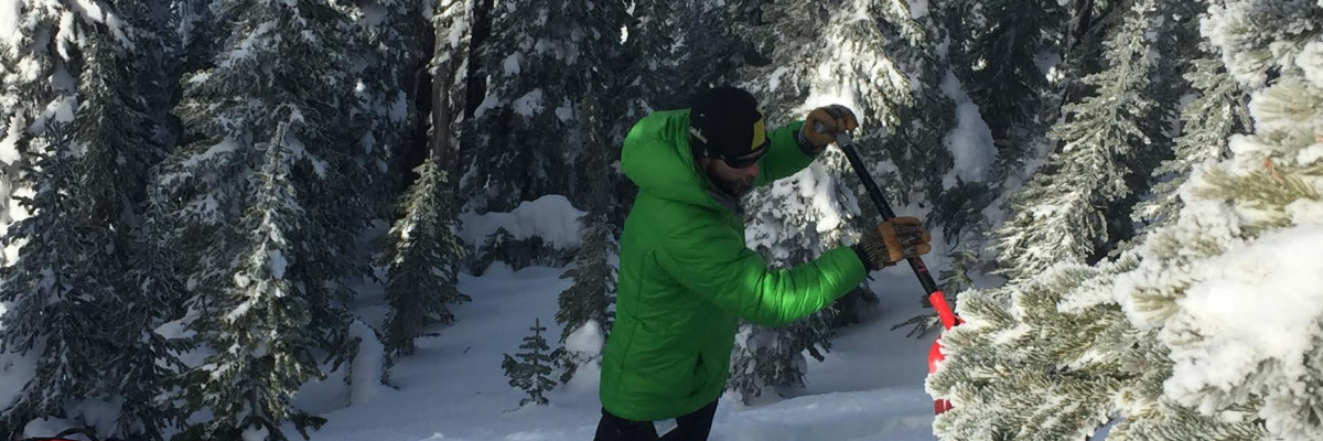
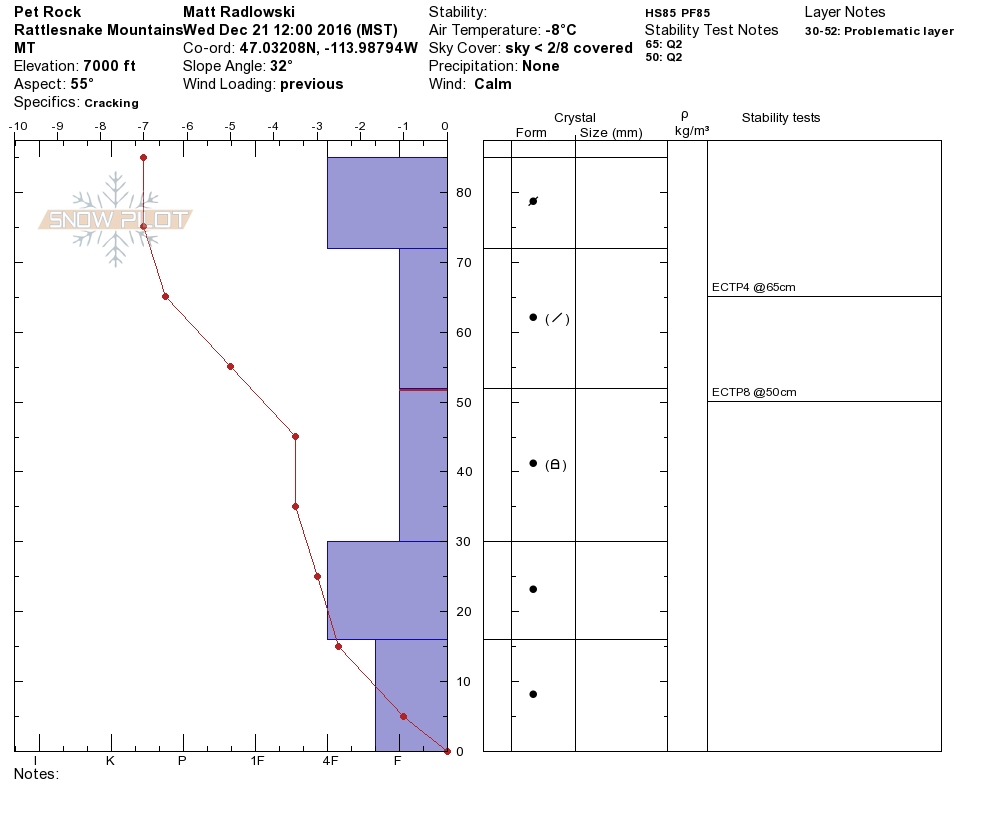
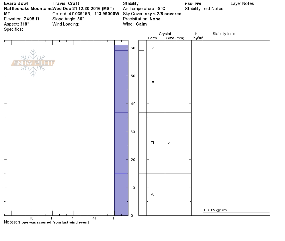
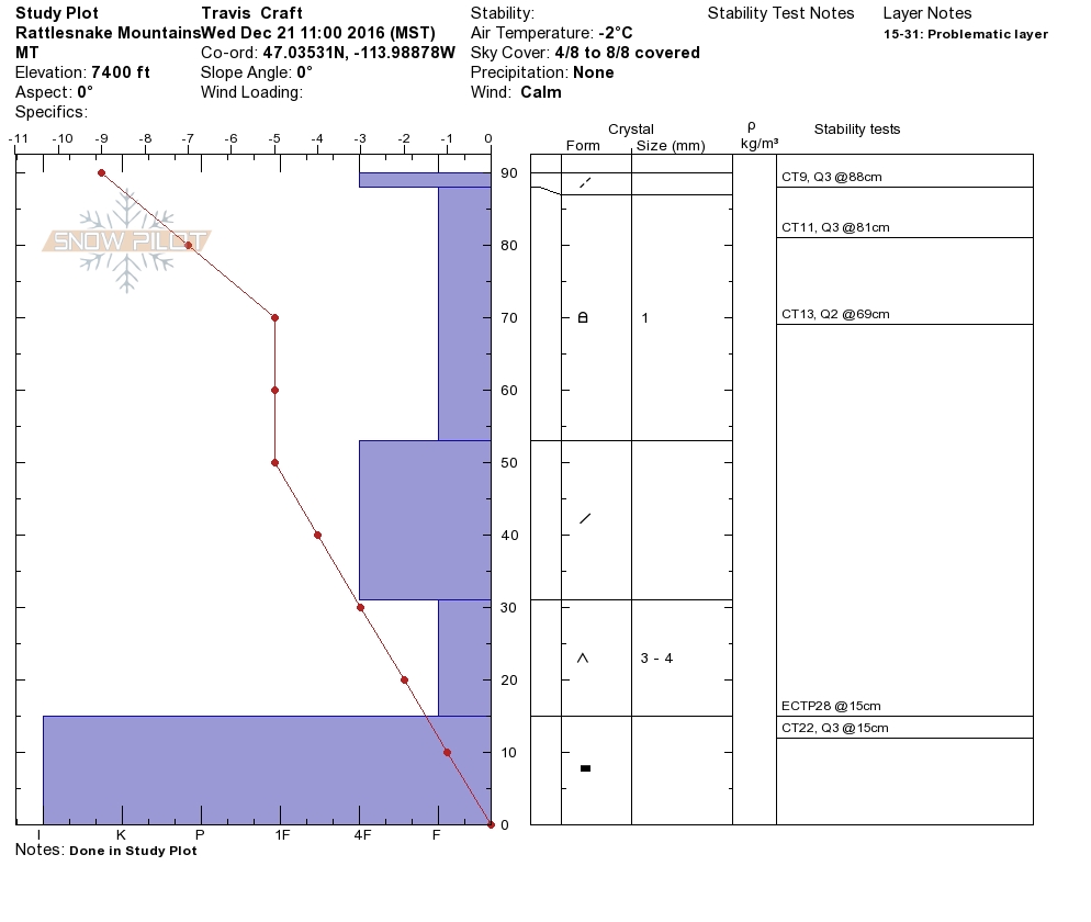
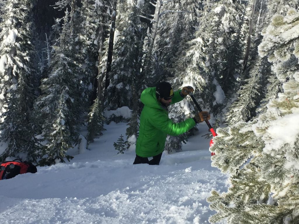
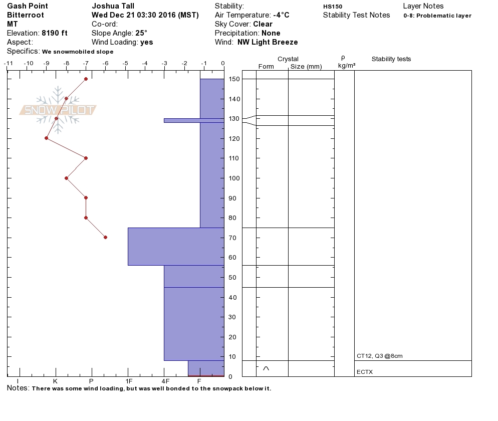
Travis and I were in the Rattlesnake yesterday, which has the shallowest snowpack in the advisory area. There is a well defined weak layer at the base of the snow pack throughout the advisory area, that is most prevalent in the Rattlesnake’s shallow snowpack.

The primary avalanche concern will be windslabs, Tuesdays wind event yielded some very stiff windslabs that are stubborn and not very reactive, but the greatest concern will be areas where softer and smaller windslabs have developed. The softer windslabs are failing and actively propagating with moderate force (video). These finding were confirmed by the Snowbowl Ski Patrol who also found the soft windslabs to be reactive during their explosive work yesterday. We had multiple observers in the Bitterroot yesterday as well who also confirmed windslabs to be the greatest concern in the southern part of the advisory area.

The secondary concern will be persistent weak layers. There are well defined facets and depth hoar throughout the region although it is not as reactive in the bitterroot (video) where the snowpack is a little deeper and stronger. The facets are obvious and hard to miss when you dig so take the time to see whats buried in the snow. There are many areas where the facets are underlying an unconsolidated snowpack, be very cautious on any slope where these facets are found especially if there is any cohesion in snow above them.


Avalanche and Weather Outlook

The stable weather pattern should persist through the day and conditions will remain the same. Mild temperatures are expected today as more snow moves into the region tonight and tomorrow.

I will issue the next advisory on Saturday December 24, 2016.

Ski and ride safe.

READ FULL ADVISORY  

Problem 1 - Windslabs

  • TYPE

    wind-slabs

    Wind Slabs

    Release of a cohesive layer of snow (a slab) formed by the wind.  Wind typically erodes snow from the upwind sides of terrain features and deposits snow on the downwind side.  Wind slabs are often smooth and rounded and sometimes sound hollow, and can range from soft to hard. Wind slabs that form over a persistent weak layer (surface hoar, depth hoar, or near-surface facets) may be termed Persistent Slabs or may develop into Persistent Slabs.

  • SIZE

    3-4

    1-2 (Small-Large)

    The potential size of avalanche resulting from this problem.

  • LIKELIHOOD

    Likelihood-5

    Likely

    The likelihood of an avalanche resulting from this problem.

  • ADDED DANGER

    Increased Slope Danger

    Increased/Added Danger

    There is an increased risk of avalanches on these slopes:

    N - North
    NE - Northeast
    E - East
    SE - Southeast
    S - South

Currently windslabs are the primary concern. The winds gusting into the 70’s on the 20th formed some very stiff slabs but will be difficult to trigger, the greater concern will be smaller and softer windslabs that developed in more sheltered areas that are sitting and facets.

Problem 2 - Depth Hoar and Basal Facets

  • TYPE

    persistent-slabs

    Persistent Slabs

    Release of a cohesive layer of soft to hard snow (a slab) in the middle to upper snowpack, when the bond to an underlying persistent weak layer breaks.  Persistent layers include: surface hoar, depth hoar, near-surface facets, or faceted snow. Persistent weak layers can continue to produce avalanches for days, weeks or even months, making them especially dangerous and tricky. As additional snow and wind events build a thicker slab on top of the persistent weak layer, this avalanche problem may develop into a Persistent, Deep-Slab.

  • SIZE

    3-4

    1-2 (Small-Large)

    The potential size of avalanche resulting from this problem.

  • LIKELIHOOD

    Likelihood-4

    Possible/Likely

    The likelihood of an avalanche resulting from this problem.

Bad news; Large depth hoar grains can be found at the base of the snowpack throughout the area, Good News; the worst of it is in unconsolidated snow, but keep an eye out for areas where a slab may have formed on top of the facets.

VIDEO

FORECAST & OUTLOOK

A dry westerly flow has moved in and today should be cool and clear giving way to snow showers tonight.

This information is the sole responsibility of the Forest Service and does not apply to operating ski areas. The avalanche danger rating expires at midnight tonight but the information can help you make a more informed decision regarding travel in avalanche terrain for the next few days.

Our advisory area includes National Forest System lands in the Bitterroot Mountains from Lost Trail Pass north to Granite Pass, the Rattlesnake Mountains north of Missoula and the Southern Swan and Mission Mountains near Seeley Lake, MT. Avalanche information for the Lookout Pass/St. Regis Basin area is available from the Idaho Panhandle Avalanche Center.