
The current avalanche danger is MODERATE in the West Central Montana backcountry. Natural avalanches are unlikely, human triggered avalanches are possible in specific terrain. Carefully evaluate a slope before traveling on or below it.
Good morning, this is Logan King with the West Central Montana Avalanche Center’s avalanche advisory for Saturday January 7th, 2017. This danger rating does not apply to operating ski areas, expires at midnight tonight and is the sole responsibility of the U.S. Forest Service.
Weather and Snowpack
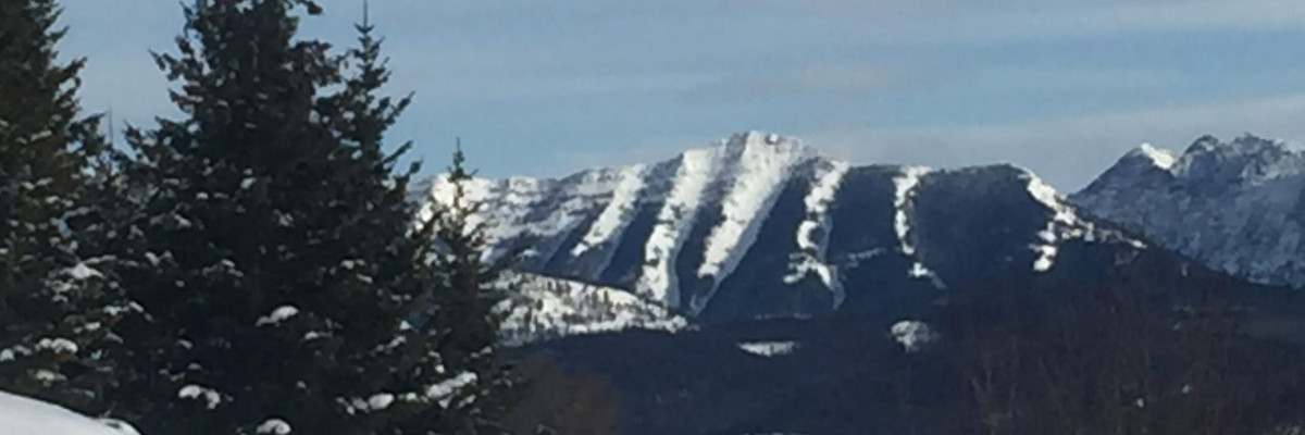
Cold conditions continue to dominate the region, current mountain temperatures range from -2 to 14 degrees fahrenheit in West Central Montana. Winds this morning are from the south east and are gusting to 15mph at Point Six and 26mph at Deer Mountain. Snowfall has been limited since the cold air mass moved into the region with most parts of the advisory area seeing a maximum of about an inch of snow this week.
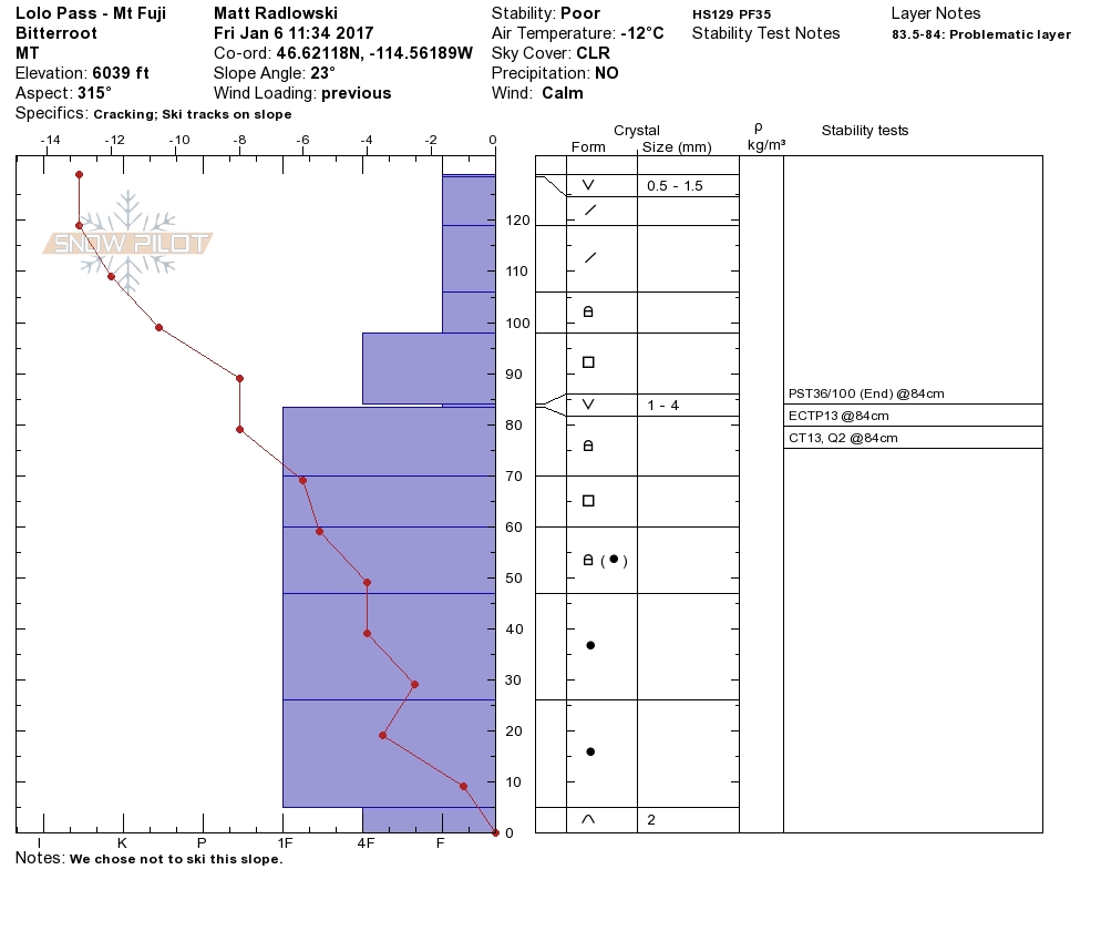
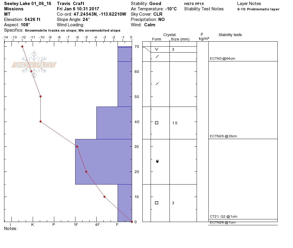
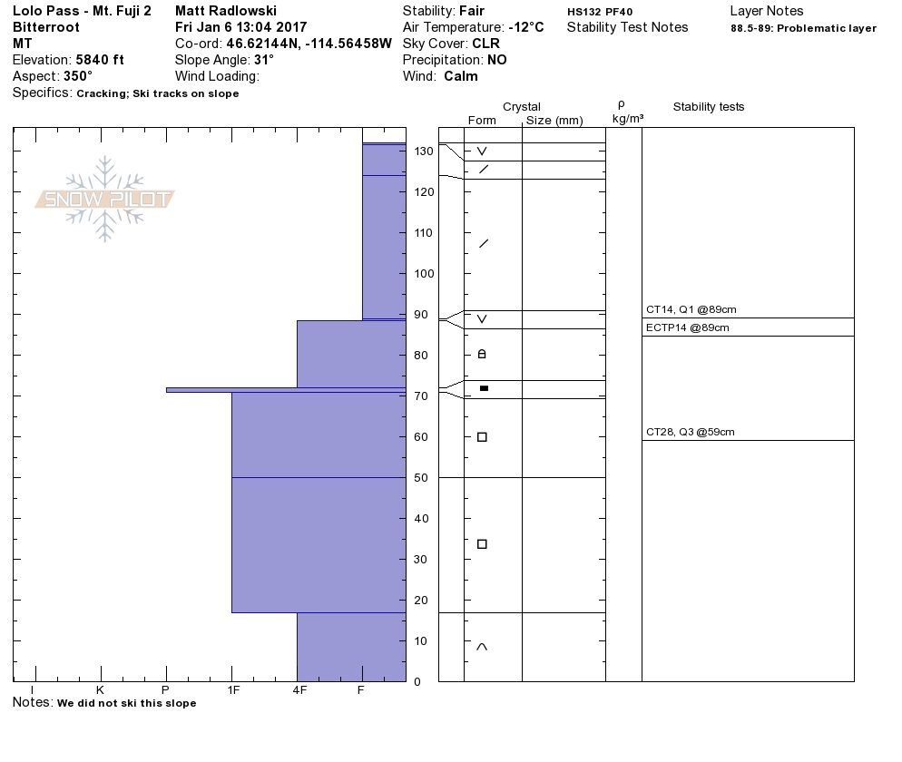
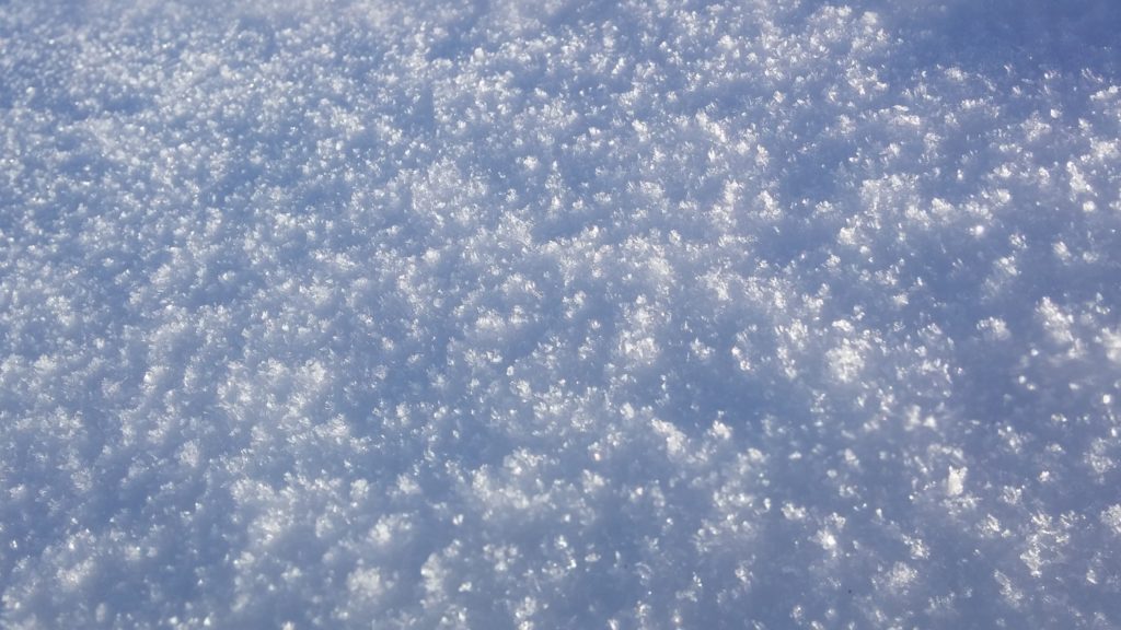
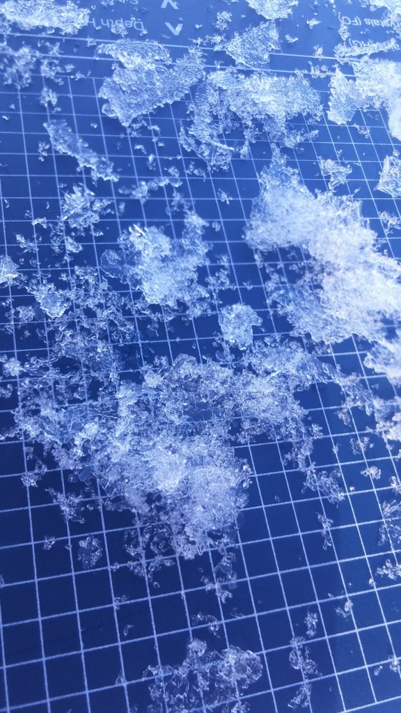
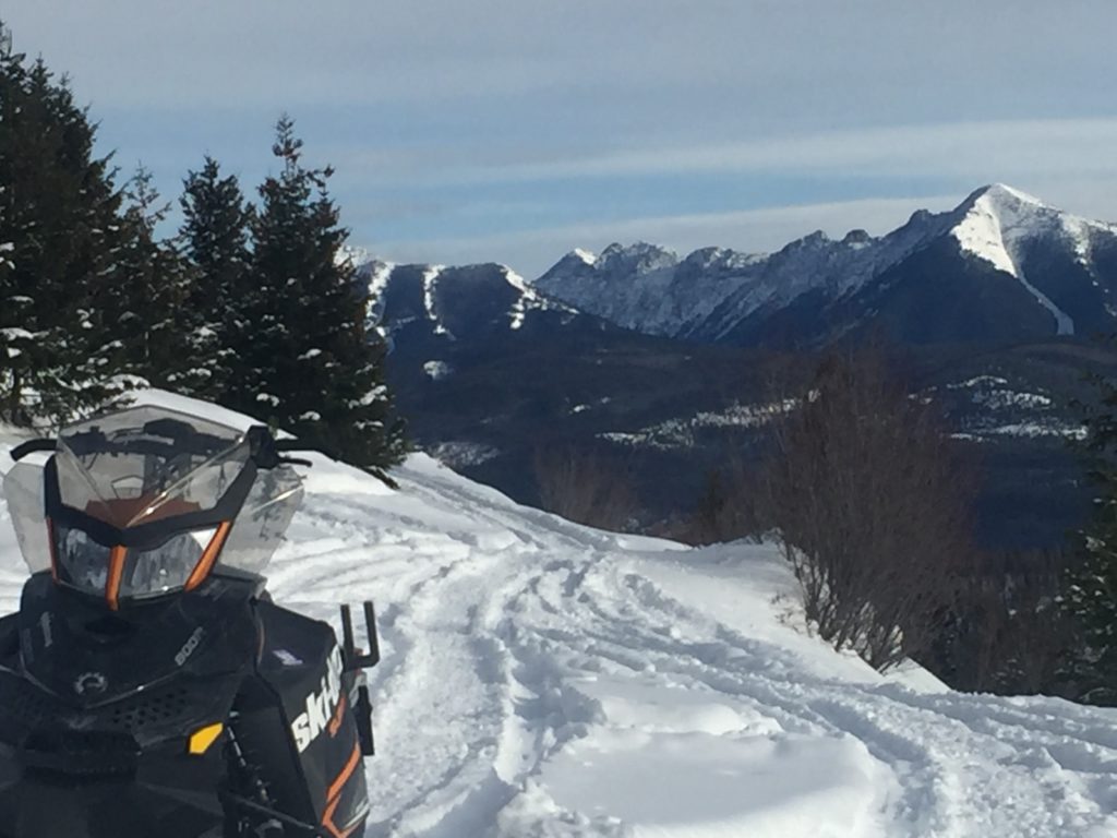
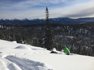
Yesterday Travis and I rode around Seeley Lake and found the basal facets to be mildly reactive in stability test. The greatest concern will be buried surface hoar that Matt observed at Lolo pass yesterday and we also saw in the Rattlesnake earlier this week. The buried surface hoar is propagating with moderate force in stability tests. The basal facets although less reactive will be a major concern for step down avalanches if the upper snow starts to move and will still warrant attention. The only way to know if buried surface hoar or basal facets exists is to dig, so take the time to look at the snow before you choose to recreate. Over the last few days we have seen widespread surface hoar growth throughout the advisory area, although not a concern at moment it will become problematic once a load is added on top of the new surface hoar.
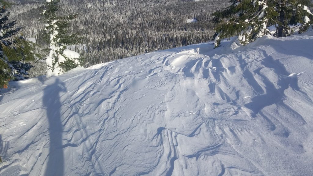
Windslabs will be the secondary concern today. The winds have been erratic over the past week and cross-loading and windslabs can be observed on nearly all aspects and elevations. The winds have decreased and shifted again over the last 24 hours and have given the snow some time to adjust to the windslabs.
The West Central Montana Avalanche Center would like to extend our deepest condolences to friends and families of all involved in the avalanche fatality in Southern Glacier National Park on Thursday. An incident investigation is currently underway by the Flathead Avalanche Center and more information regarding the avalanche should be posted in the next few days.
Avalanche and Weather Outlook.
The cold and calm trend will continue through today and give way to a warm wet system tonight which looks to intensify and peak late Sunday and into Monday. With a heavy new load and another layer of surface hoar getting buried the avalanche danger will increase significantly. Continually evaluate the snow as conditions look to change drastically over the next 48 hours.
If you get out in the backcountry please feel free to share your observations on the public observations page. I will issue the next regular advisory on Tuesday.
Ski and ride safe.


