Posted:
Jan 14, 2017 @ 6:39 am

The current avalanche danger is MODERATE in the west central Montana backcountry.  Evaluate snow and terrain carefully; identify features of concern.  Human triggered avalanches are possible.

Good morning, this is Travis Craft with the West Central Montana Avalanche Center’s avalanche advisory for January 14, 2017.  This danger rating does not apply to operating ski areas, expires at midnight tonight and is the sole responsibility of the U.S. Forest Service.

Weather and Snowpack

Mountain temperatures range from 2 F to 16 F in the region. Winds are 6 mph with gusts of 9 mph in the Bitterroot. Point Six, in the northern part of the advisory area, winds are reading 17 mph with gusts of 21 mph out of the W. The forecast area received 0 to 3 inches of new snow in the last 24 hours. The new snow had SWE’s ranging from 0 to .3 inches of water.

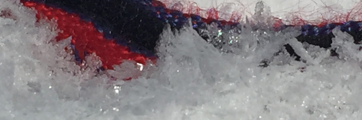
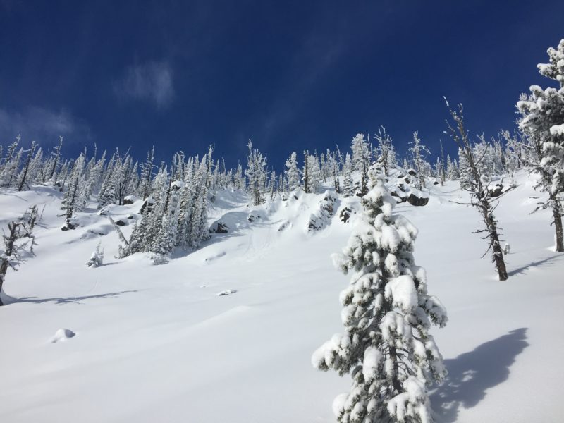
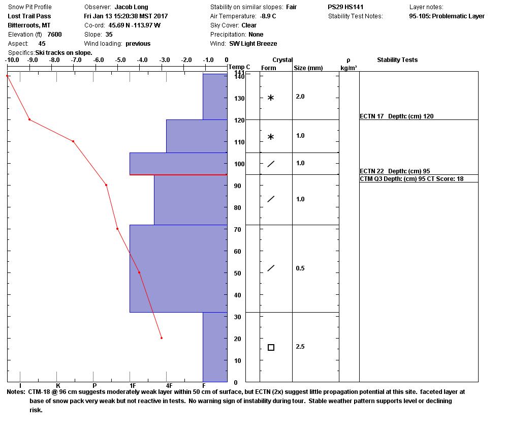
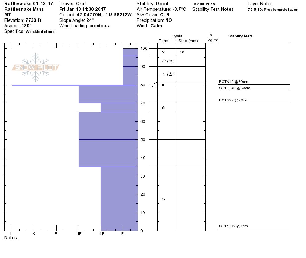
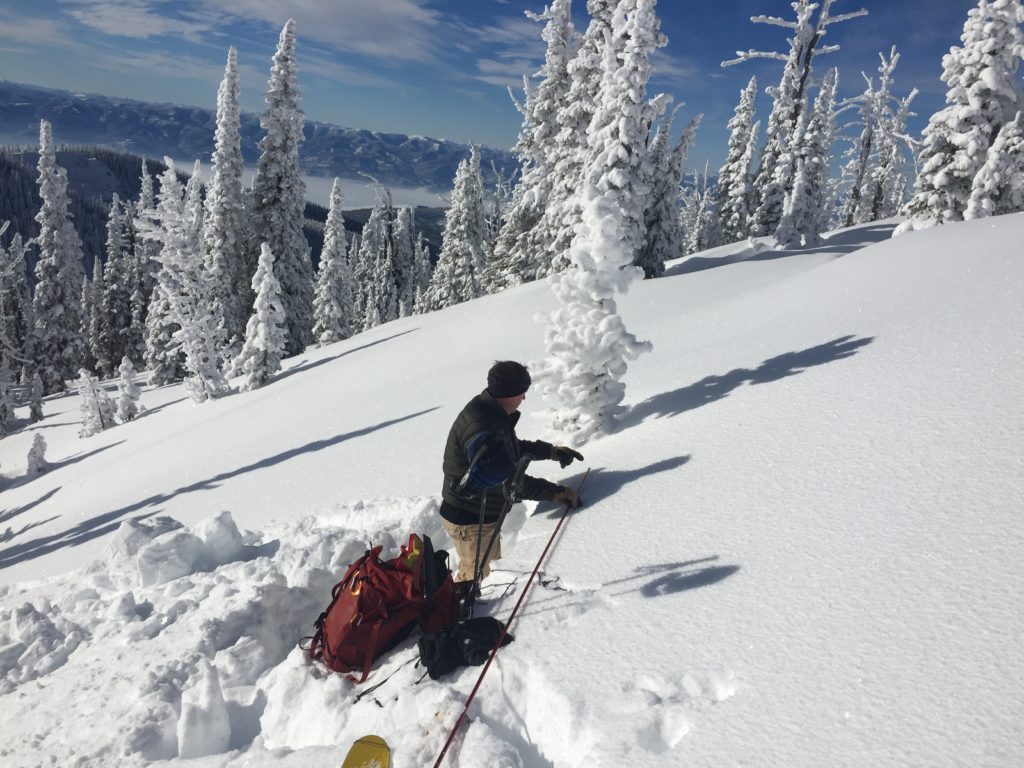
Steve and I toured in the Rattlesnake yesterday.  Jacob and Ed were near Lost Trail Pass. Matt is at Yurtski in the Southern Swan.  All observer’s had excellent visibility and stable weather.  Everyone found significant surface hoar growth throughout the advisory area.  Instabilities in our snowpack are slowly gaining strength, though human triggered avalanches are still possible.

The first avalanche problem is persistent slabs.  There are two layers (1.) 2 feet from the surface of near surface facets and (2.) the basal facets on the ground.  The layers are gaining strength.  All three groups were able to get failures on these layers in compression tests, but ECT’s did not propagate.  Matt triggered a small 15 ft by 20 ft soft slab on the near surface facets in the Swan, on an East facing slope in a shallow snowpack near a rock.  You need to put your shovel in the snow to see how reactive these layers are.  Avoid steep, rocky terrain and slopes with a shallow snowpack.

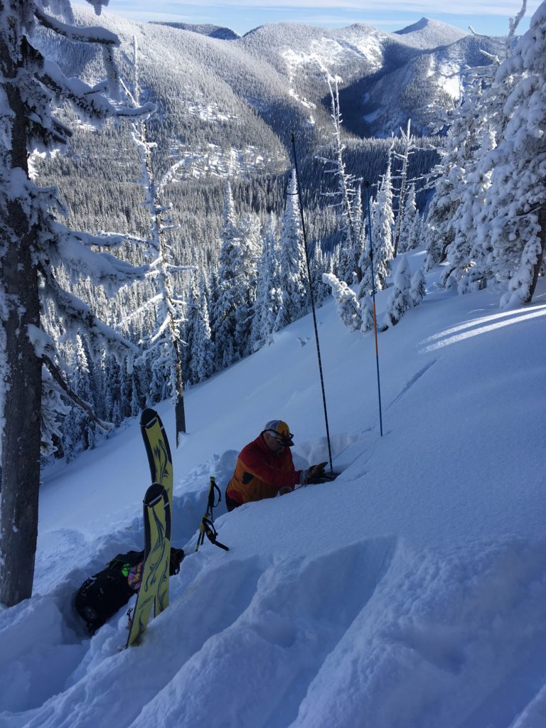
The second avalanche problem is wind slabs.  Matt observed significant cross loading on West facing slopes in the Swan.  Steve and I saw wind slabs on North facing slopes in the Rattlesnake. Wind slabs are present in the region, identify them and avoid them.

The final avalanche problem is loose dry avalanches on steep>35-degree slopes.  Ed and Jacob observed natural point releases in the Bitterroot.  Steve and I found natural sluffs in the Rattlesnake on steep terrain>40-degrees.  These should not be a problem to manage unless they carry you into a terrain trap(cliff, rocks or trees).

Avalanche and Weather Outlook

Cold valley temperatures with warmer temperatures in the mountains.  Warming trend through the weekend.  Our next chance for significant precipitation is Monday evening.  Expect the Avalanche danger to stay the same.

If you are out in the backcountry, please send us your observations, these are very helpful in producing the advisory.

I will issue the next advisory on Tuesday, January 17, 2017.

Ski and ride safe.

READ FULL ADVISORY  

Problem 1 - Persistent Slabs

  • TYPE

    persistent-slabs

    Persistent Slabs

    Release of a cohesive layer of soft to hard snow (a slab) in the middle to upper snowpack, when the bond to an underlying persistent weak layer breaks.  Persistent layers include: surface hoar, depth hoar, near-surface facets, or faceted snow. Persistent weak layers can continue to produce avalanches for days, weeks or even months, making them especially dangerous and tricky. As additional snow and wind events build a thicker slab on top of the persistent weak layer, this avalanche problem may develop into a Persistent, Deep-Slab.

  • SIZE

    3-4

    1-2 (Small-Large)

    The potential size of avalanche resulting from this problem.

  • LIKELIHOOD

    Likelihood-3

    Possible

    The likelihood of an avalanche resulting from this problem.

  • IMAGE

Two layers of concern:

1. A Layer of near surface facets below a crust 30 cm from the surface.

2. The basal facets on the ground.

Problem 2 - Wind Slabs

  • TYPE

    wind-slabs

    Wind Slabs

    Release of a cohesive layer of snow (a slab) formed by the wind.  Wind typically erodes snow from the upwind sides of terrain features and deposits snow on the downwind side.  Wind slabs are often smooth and rounded and sometimes sound hollow, and can range from soft to hard. Wind slabs that form over a persistent weak layer (surface hoar, depth hoar, or near-surface facets) may be termed Persistent Slabs or may develop into Persistent Slabs.

  • SIZE

    3-4

    1-2 (Small-Large)

    The potential size of avalanche resulting from this problem.

  • LIKELIHOOD

    Likelihood-3

    Possible

    The likelihood of an avalanche resulting from this problem.

  • ADDED DANGER

    Increased Slope Danger

    Increased/Added Danger

    There is an increased risk of avalanches on these slopes:

    N - North
    NE - Northeast
    E - East
    NW - Northwest

  • IMAGE

Small wind slabs are present and cross loading on west facing slopes.

Problem 3 - Loose Dry

  • TYPE

    loose-dry

    Loose Dry

    Release of wet unconsolidated snow or slush. These avalanches typically occur within layers of wet snow near the surface of the snowpack, but they may quickly gouge into lower snowpack layers. Like Loose-Dry Avalanches,they start at a point and entrain snow as they move downhill, forming a fan-shaped avalanche. They generally move slowly, but can contain enough mass to cause significant damage to trees, cars or buildings. Other names for loose-wet avalanches include point-release avalanches or sluffs. Loose-wet avalanches can trigger slab avalanches that break into deeper snow layers.

  • SIZE

    1-2

    < 1 (Small)

    The potential size of avalanche resulting from this problem.

  • LIKELIHOOD

    Likelihood-3

    Possible

    The likelihood of an avalanche resulting from this problem.

  • IMAGE

Loose dry sluffs  observed on steep slopes throughout the advisory area.  These should not be a problem to manage unless they carry you into a terrain trap(cliff, rocks or trees).

VIDEO

Snowpack Friday 13th 2017

Observations Friday the 13th 2017

FORECAST & OUTLOOK

Cold valley temperatures with warmer temperatures in the mountains. Warming trend through the weekend. Our next chance for significant precipitation is Monday evening. Expect the Avalanche danger to stay the same.

This information is the sole responsibility of the Forest Service and does not apply to operating ski areas. The avalanche danger rating expires at midnight tonight but the information can help you make a more informed decision regarding travel in avalanche terrain for the next few days.

Our advisory area includes National Forest System lands in the Bitterroot Mountains from Lost Trail Pass north to Granite Pass, the Rattlesnake Mountains north of Missoula and the Southern Swan and Mission Mountains near Seeley Lake, MT. Avalanche information for the Lookout Pass/St. Regis Basin area is available from the Idaho Panhandle Avalanche Center.