
The current avalanche danger is LOW for the west central Montana backcountry. Human triggered avalanches are still possible in isolated terrain.
Good morning, this is Travis Craft with the West Central Montana Avalanche Center’s avalanche advisory for January 17, 2017. This danger rating does not apply to operating ski areas, expires at midnight tonight and is the sole responsibility of the U.S. Forest Service.
Weather and Snowpack
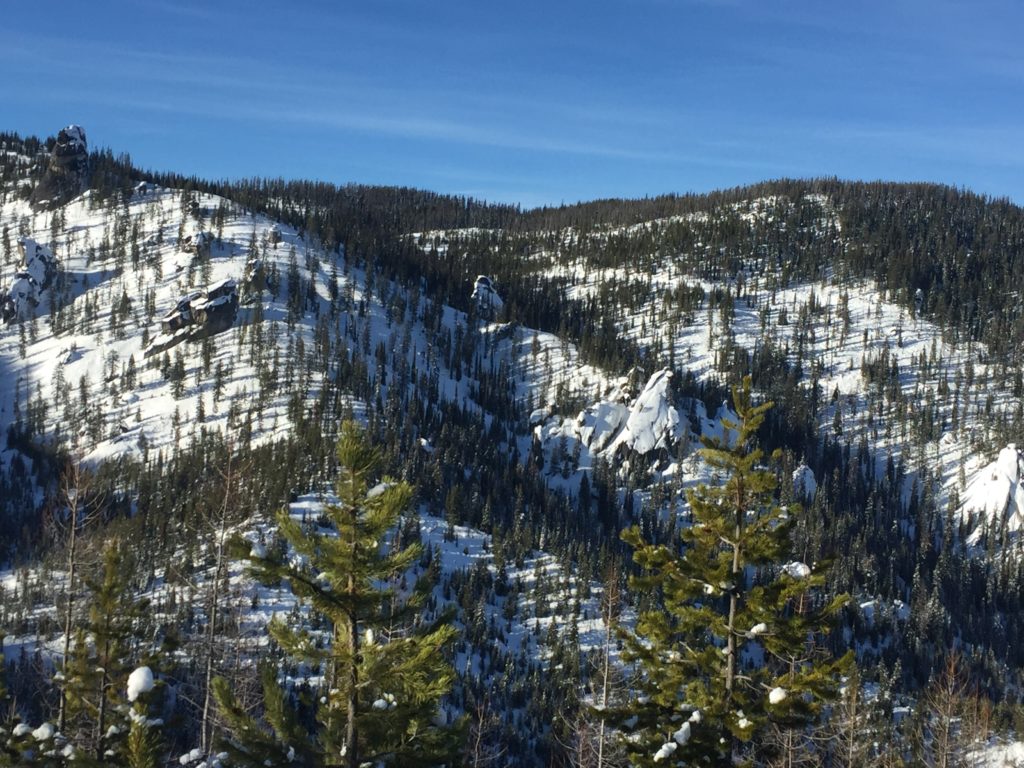
Mountain temperatures range from 13 F to 26 F in the region. Winds are 10 mph out of the S in the Bitterroot. Point Six, in the northern part of the advisory area, winds are reading 22 mph with gusts of 32 mph out of the WSW. The forecast area received 0 to 1 inches of new snow in the last 24 hours. The new snow had SWE’s ranging from 0 to .2 inches of water.
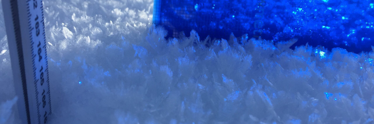
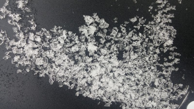
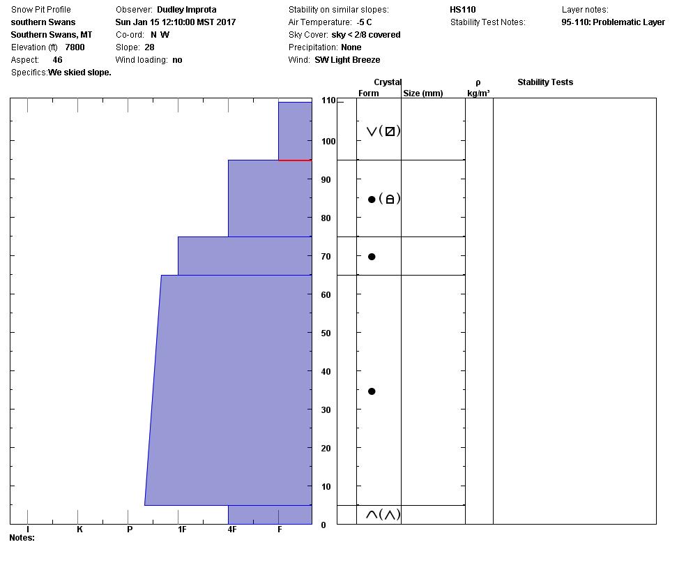
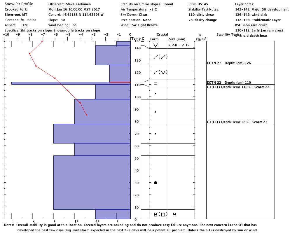
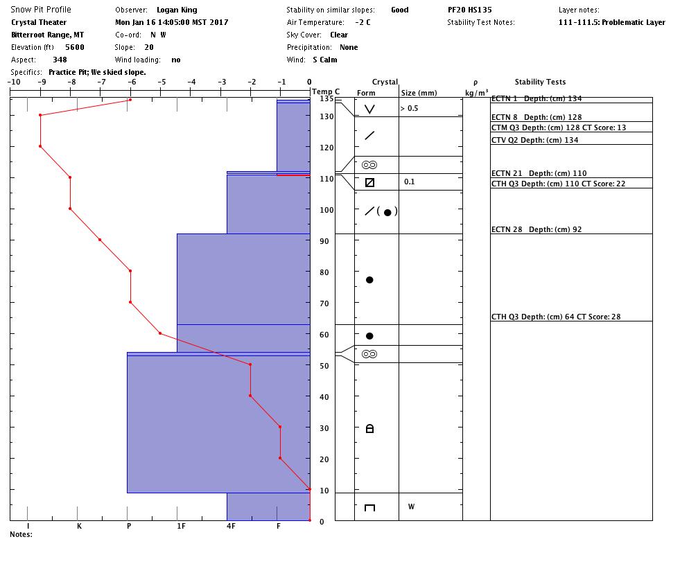
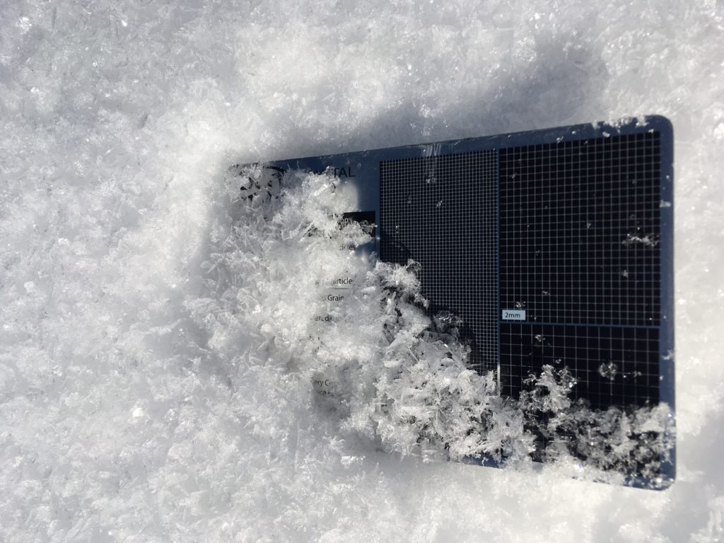
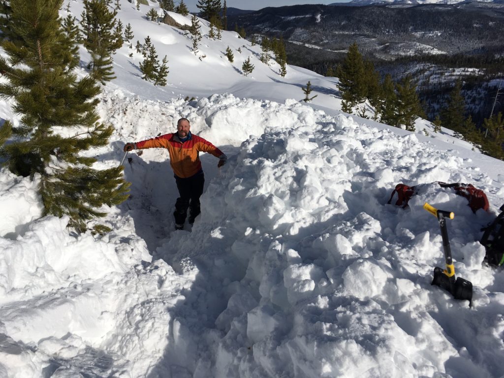
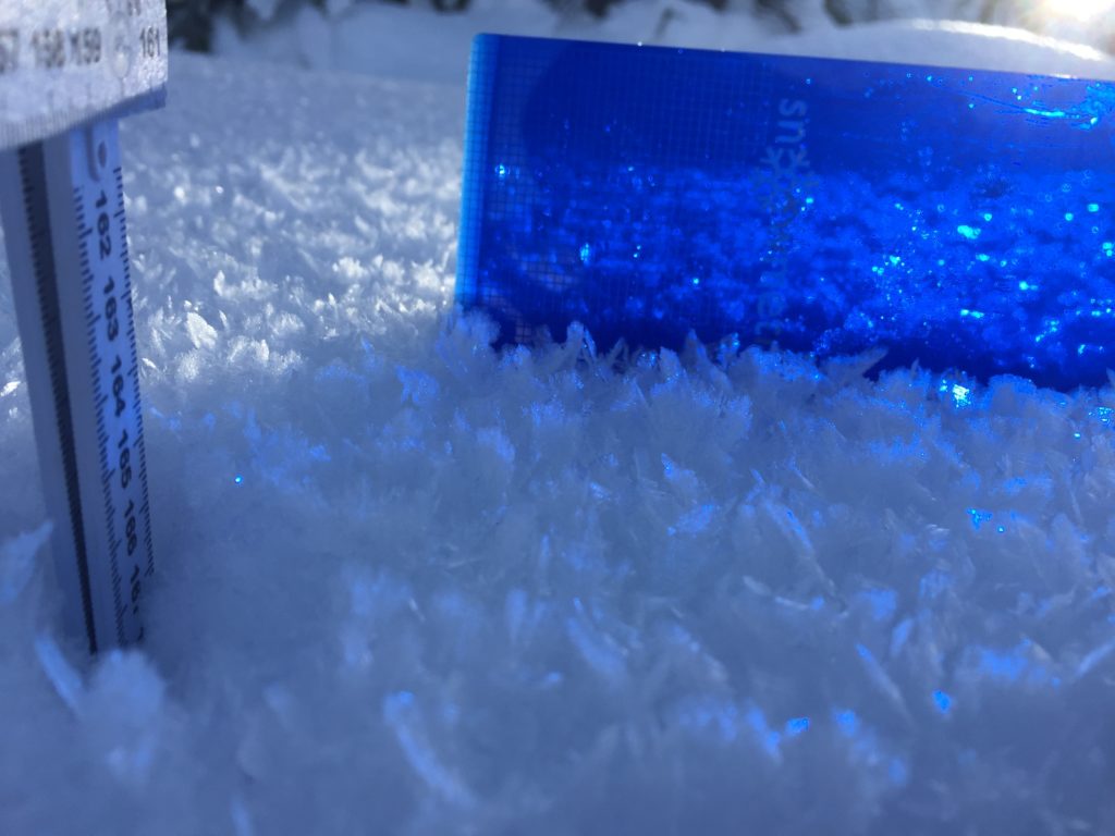
Steve and I took the sleds into the Crooked Fork around Lolo Pass yesterday. Logan went to Crystal Theater. Dudley was at Yurtski in the southern Swan over the weekend teaching a level 1. The persistent weak layers in our snowpack are gaining strength. The high and dry weather has made for some good touring, but all observers reported large surface hoar growth on all aspects. This will be our next layer of concern.
The first avalanche problem is wind slabs. Remember identify wind slabs and avoid them. These slabs are on many different aspects, and some slopes are cross-loaded due to the changes in wind direction over the last couple of days. We had two great public observations from the weekend with wind slabs. Click on the links to see them. One of the slabs was human triggered, and the other was natural.
The second avalanche problem is persistent slabs. There are two layers (1.) 2 feet from the surface of near surface facets and (2.) the basal facets on the ground. The layers are gaining strength. Dig a pit to assess these facets before committing to any steep slope.
These avalanche problems are in isolated terrain. Low avalanche danger still means human triggered avalanches are still possible. Assess slopes carefully and identify any concerns.
Avalanche and Weather
The precipitation forecast maintains a slowing trend, so light snow is possible by this afternoon, but the majority is not expected to begin until Wednesday morning. The avalanche danger will increase with the precipitation. The main concern will be the surface hoar that is being buried by the new snow.
We have been getting a lot of public observations, thank you. If you are out in the backcountry, please send us your observations, these are very helpful in producing the advisory.
The West Central Montana Avalanche Center would like to extend our deepest condolences to friends and families of all involved in the avalanche fatality in Southern Glacier National Park on Thursday, January 05, 2017. Here is the link from the Flathead Avalanche Center of the full report. Logan will issue the next advisory on Thursday, January 19, 2017.
Ski and ride safe.


