Posted:
Feb 2, 2017 @ 6:24 am

The current avalanche danger is MODERATE on wind loaded terrain for the West Central Montana Backcountry. Human triggered avalanches are possible on specific terrain, careful evaluation of avalanche conditions are necessary to recreate today.

Good morning, this is Logan King with the West Central Montana Avalanche Center’s avalanche advisory for Thursday, February 2, 2017.  This danger rating does not apply to operating ski areas, expires at midnight tonight and is the sole responsibility of the U.S. Forest Service.

Weather and Snowpack

Since Tuesday morning an additional 7-14 inches of snow has accumulated in the advisory area. The new snow has added .6-.9 inches of SWE. Winds this morning are out of the East at Point 6 and range from 27-36 mph. At Deer Mountain in the southern Bitterroot winds are calm this morning.

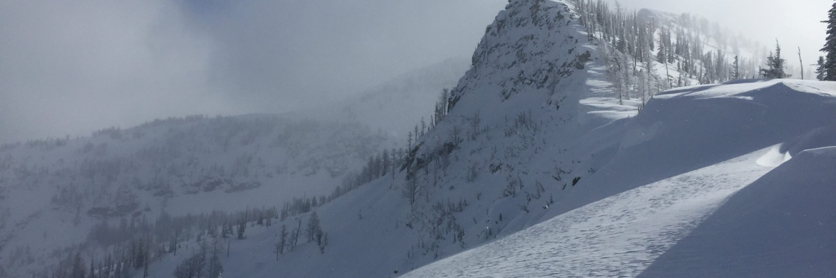
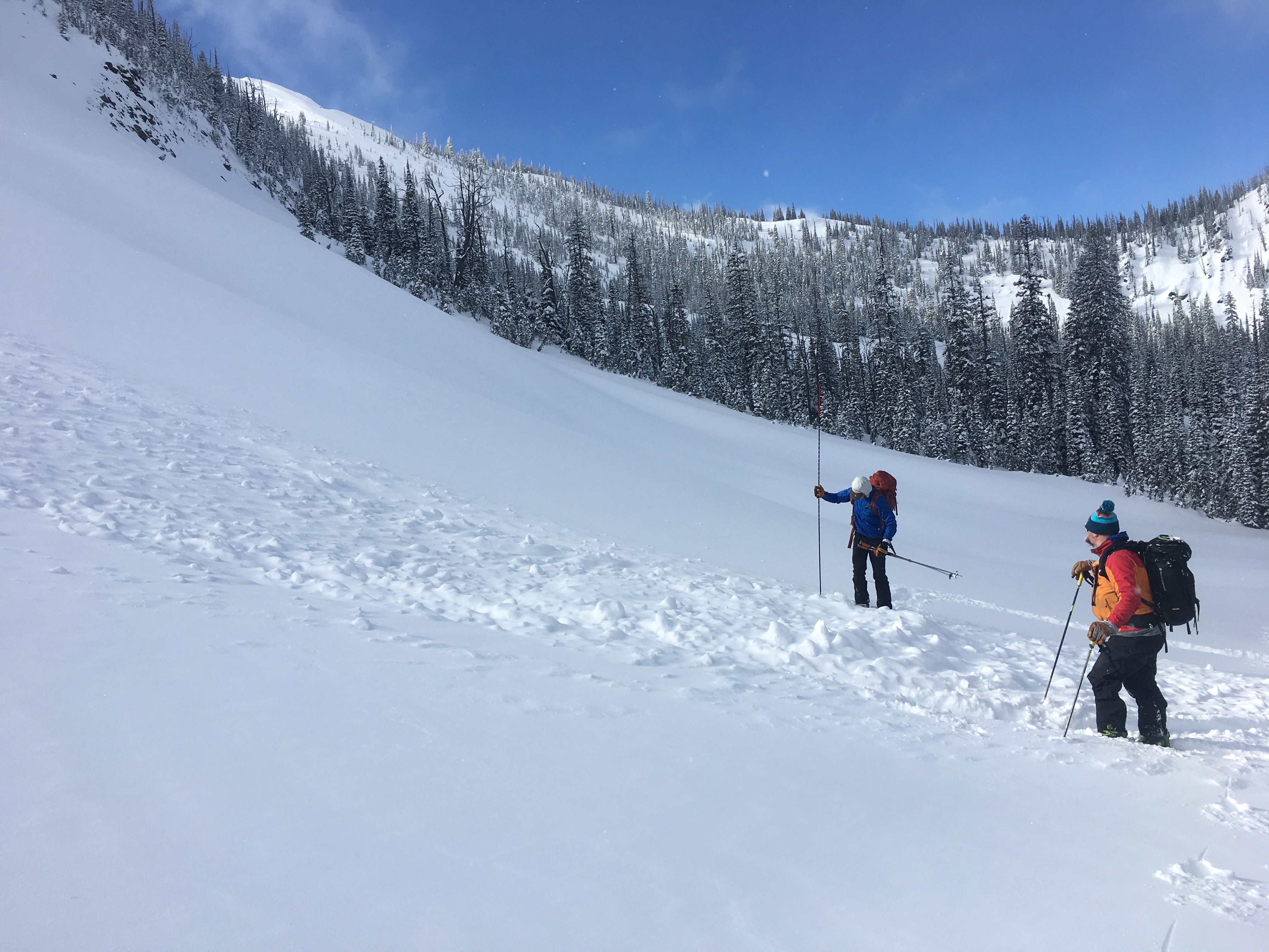
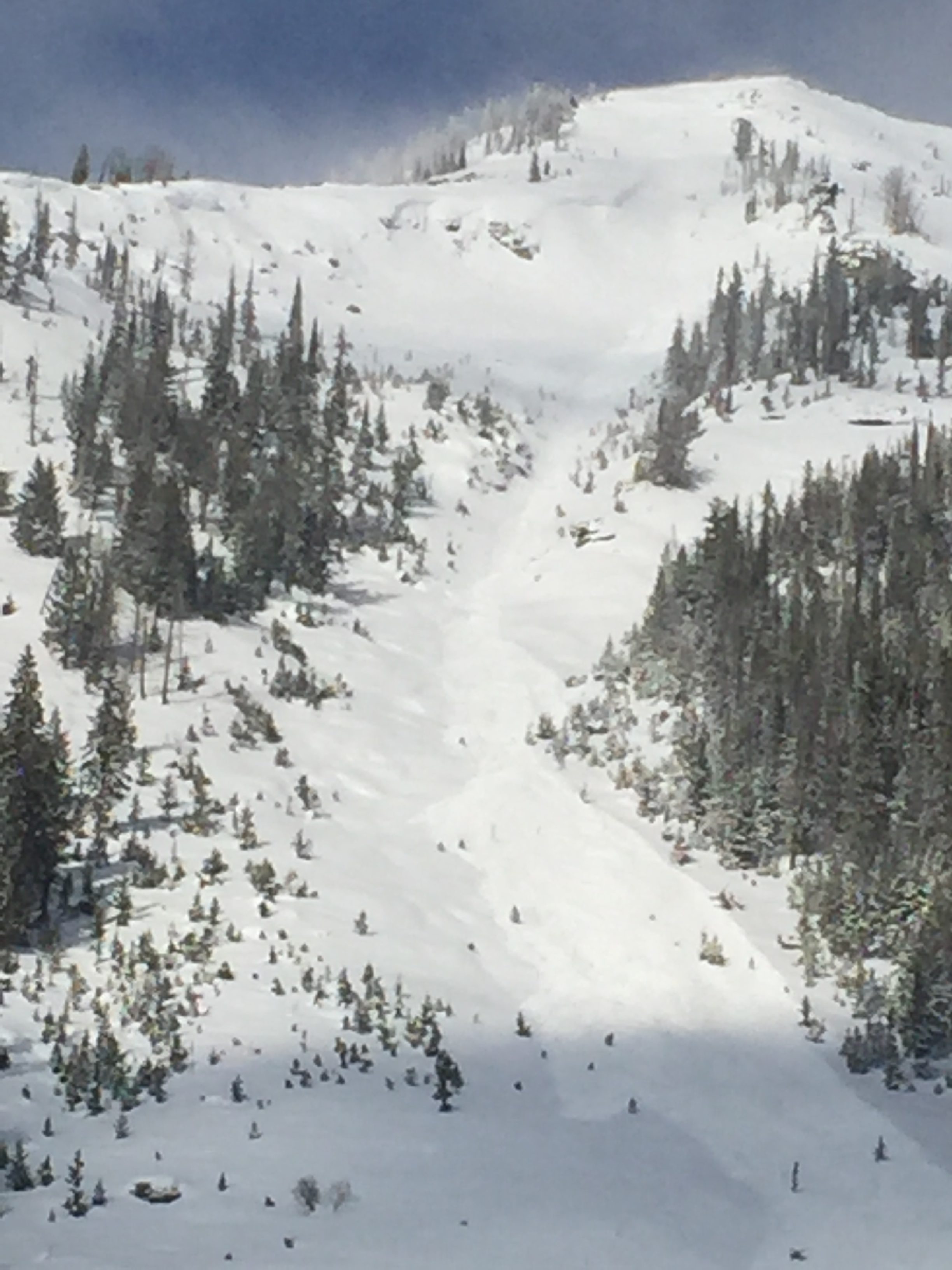
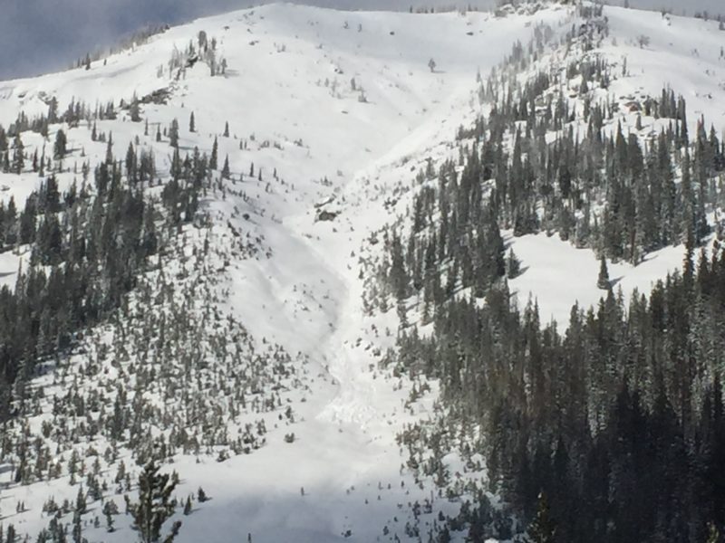
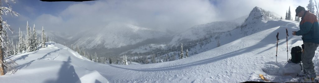
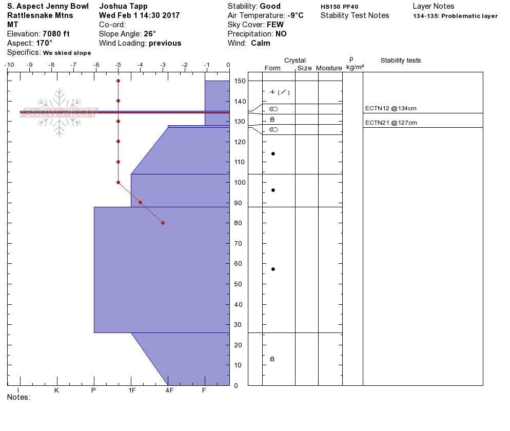
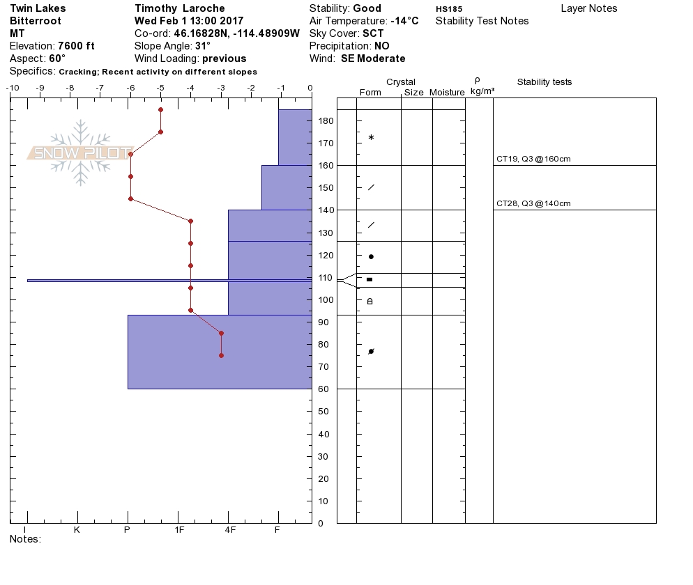
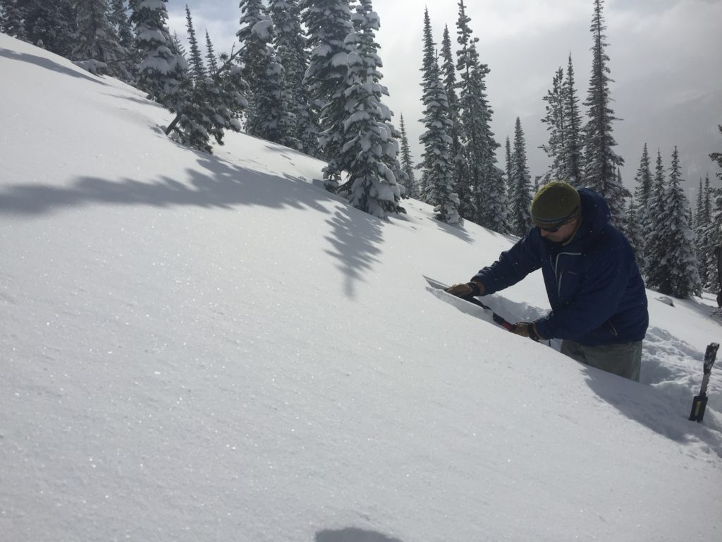
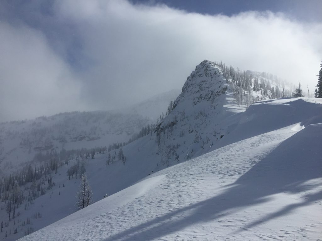
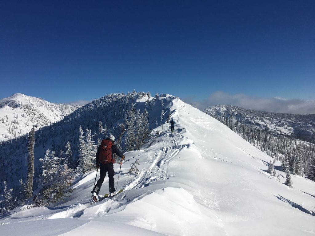
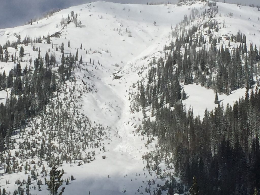
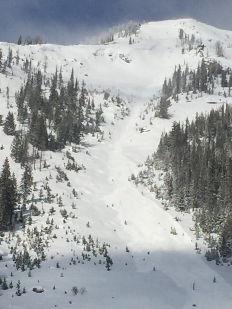
Yesterday Tim and I rode into Twin Lakes and found nearly a foot of new low density snow. Travis found similar conditions while touring in the Rattlesnake. The new low density snow is easily transported and Travis found debris from a naturally released windslab from Tuesday night (pic). Tim and I found active transporting and were able to get some small results in wind loaded terrain with ski cutting. On our ride out we saw a few windslabs that released naturally during the day yesterday (pic1) (pic2). With the activity observed yesterday paired with the wind loading we observed the primary avalanche concern will be windslabs. Identify terrain that appears to be wind loaded and carefully evaluate consequences of an avalanche.

With a large amount of loose dry surface snow, sluffs and loose dry avalanches will be likely in steep terrain. Carefully evaluate the consequences of a loose snow slide as there is a significant amount of snow that can be entrained.

Finally persistent slabs were not reactive yesterday but will still be a bit suspect and will need some time to adjust to the new load. Take the time to dig and see what is under the new surface snow and be cautious of any persistent weak layer that has a slab above it.


Avalanche and Weather Outlook

As a little more moisture moves in, it will bring some light accumulating snow to most areas today. With minimal accumulations expected, avalanche conditions will remain the same today. The next round of significant snow looks to start Friday and continue through Monday.

If you are out in the backcountry, please feel free to share your observations on our public observations page, they are a great resource and are very helpful in producing the advisory. Travis will issue the next advisory on Saturday, February 4 , 2017.

Ski and ride safe.

READ FULL ADVISORY  

Problem 1 - Windslabs

  • TYPE

    wind-slabs

    Wind Slabs

    Release of a cohesive layer of snow (a slab) formed by the wind.  Wind typically erodes snow from the upwind sides of terrain features and deposits snow on the downwind side.  Wind slabs are often smooth and rounded and sometimes sound hollow, and can range from soft to hard. Wind slabs that form over a persistent weak layer (surface hoar, depth hoar, or near-surface facets) may be termed Persistent Slabs or may develop into Persistent Slabs.

  • SIZE

    3-4

    1-2 (Small-Large)

    The potential size of avalanche resulting from this problem.

  • LIKELIHOOD

    Likelihood-3

    Possible

    The likelihood of an avalanche resulting from this problem.

  • IMAGE

Windslabs were failing naturally yesterday or with triggers and are isolated to leeward terrain.

Problem 2 - Loose Dry

  • TYPE

    loose-dry

    Loose Dry

    Release of wet unconsolidated snow or slush. These avalanches typically occur within layers of wet snow near the surface of the snowpack, but they may quickly gouge into lower snowpack layers. Like Loose-Dry Avalanches,they start at a point and entrain snow as they move downhill, forming a fan-shaped avalanche. They generally move slowly, but can contain enough mass to cause significant damage to trees, cars or buildings. Other names for loose-wet avalanches include point-release avalanches or sluffs. Loose-wet avalanches can trigger slab avalanches that break into deeper snow layers.

  • SIZE

    2-3

    1 (Small)

    The potential size of avalanche resulting from this problem.

  • LIKELIHOOD

    Likelihood-5

    Likely

    The likelihood of an avalanche resulting from this problem.

Loose dry avalanches are likely in steep terrain.

Problem 3 - Persistent Slabs

  • TYPE

    persistent-slabs

    Persistent Slabs

    Release of a cohesive layer of soft to hard snow (a slab) in the middle to upper snowpack, when the bond to an underlying persistent weak layer breaks.  Persistent layers include: surface hoar, depth hoar, near-surface facets, or faceted snow. Persistent weak layers can continue to produce avalanches for days, weeks or even months, making them especially dangerous and tricky. As additional snow and wind events build a thicker slab on top of the persistent weak layer, this avalanche problem may develop into a Persistent, Deep-Slab.

  • SIZE

    3-4

    1-2 (Small-Large)

    The potential size of avalanche resulting from this problem.

  • LIKELIHOOD

    Likelihood-2

    Unlikely/Possible

    The likelihood of an avalanche resulting from this problem.

Near surface facets, buried surface hoar and basal facets all pose potential avalanche problems but are minimally reactive as of late.

VIDEO

FORECAST & OUTLOOK

Light snow is forecast for the advisory area today.

This information is the sole responsibility of the Forest Service and does not apply to operating ski areas. The avalanche danger rating expires at midnight tonight but the information can help you make a more informed decision regarding travel in avalanche terrain for the next few days.

Our advisory area includes National Forest System lands in the Bitterroot Mountains from Lost Trail Pass north to Granite Pass, the Rattlesnake Mountains north of Missoula and the Southern Swan and Mission Mountains near Seeley Lake, MT. Avalanche information for the Lookout Pass/St. Regis Basin area is available from the Idaho Panhandle Avalanche Center.