Posted:
Feb 16, 2017 @ 6:38 am

The current avalanche danger is MODERATE for the west central Montana backcountry. Human triggered avalanches are possible in specific terrain. Conditions will change quickly today as water is added to the snowpack and could easily jump to considerable by early afternoon. Continual evaluation of the avalanche conditions will be essential for recreating in the backcountry today.

Good morning, this is Logan King with the West Central Montana Avalanche Center’s avalanche advisory for Thursday, February 16, 2017. This danger rating does not apply to operating ski areas, expires at midnight tonight and is the sole responsibility of the U.S. Forest Service.

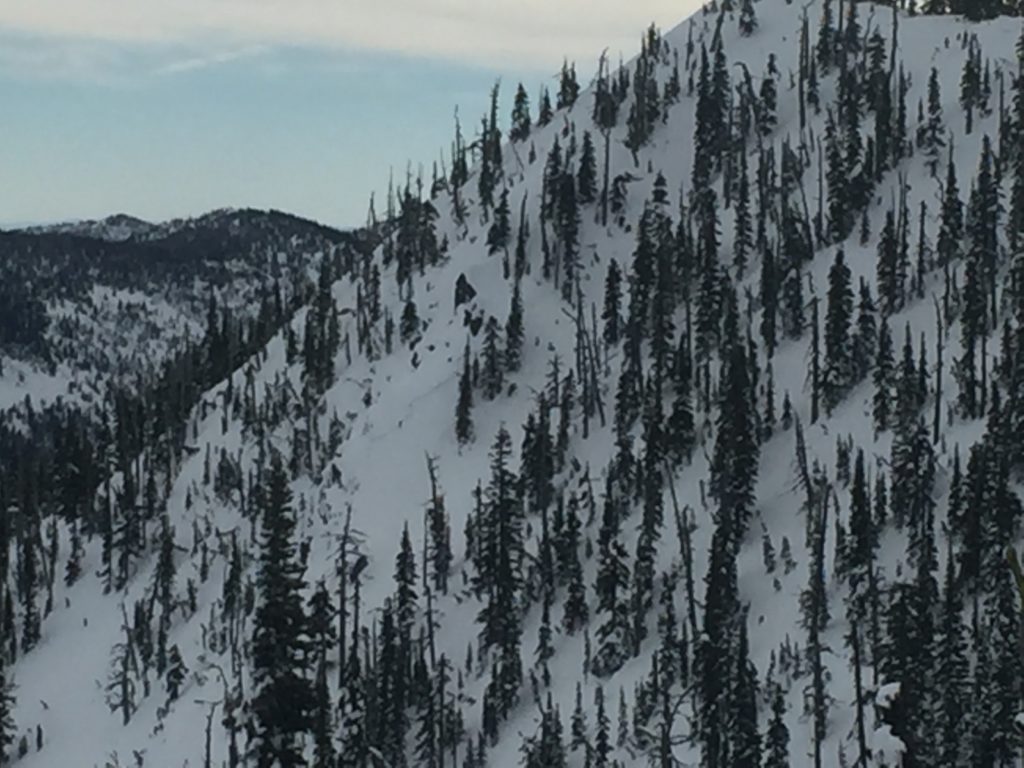
Weather and Snowpack

The high pressure system that has dominated the region early this week is deteriorating and overnight precipitation has started. So far this morning .1-.5 inches of SWE have been added to the snowpack and looks to be rain and not snow to at least 7,500ft. Mountain temperatures this morning are well above freezing in the upper 30’s to low 40’s. Ridge top winds are from the SW at 18mph gusting to 33mph at Point 6 and 16mph gusting to 31mph from the SSE at Deer Mountain.

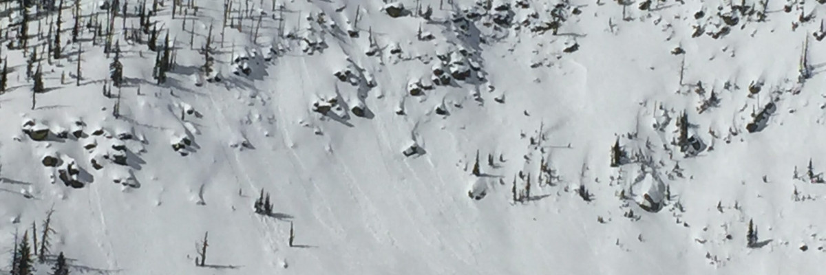
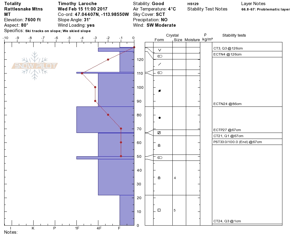
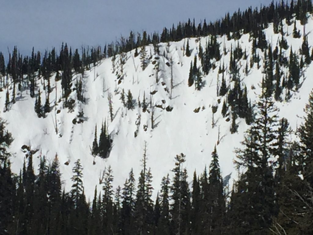
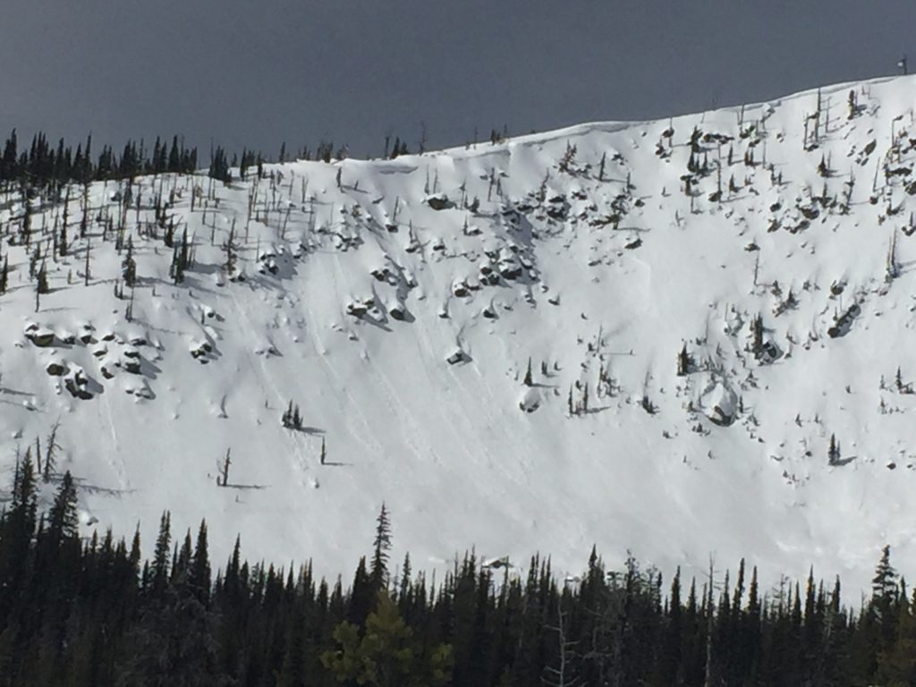
Yesterday Tim and I toured in the Rattlesnake and we found the near surface facets continue to fail and propagate in extended column tests and propagation saw tests. The near surface facets are healing but are still reactive under the right conditions in isolated areas. Take the time to dig and see if the near surface facets are present and reactive before committing to a slope. Carefully evaluate not just the likelihood but also the consequences of getting caught in a persistent slab avalanche as there is a sizable amount of snow in the slab on top of the near surface facets.

The secondary concerns this morning will be wind slabs and loose wet slides. Wind slabs have had some time to settle but are still a concern at higher elevations and in steeper terrain. Look for signs of wind loading and stay aware of conditions as they change today. Loose wet avalanches will also be a concern today, although they are small stay aware of terrain traps that will increase the consequences of getting caught up in a small loose wet slide.

With rain overnight and more expected today the potential for wet slab avalanches will develop by mid-day today. Models suggest that nearly an inch of rain is expected for the Bitterroot Range. Rain on snow events rapidly change avalanche conditions and wet slabs are very difficult to predict, so if you are seeing significant rain on snow conservative decision making will be critical in the mountains today.


Avalanche and Weather Outlook

As the high pressure system is replaced by tropical moisture, precipitation will continue to develop across the region. Rain is expected to persist through the day today and will shift to snow tonight as the temperature starts to drop. Rain on snow can rapidly increase avalanche danger so keep an eye on how much and what type of precipitation is falling.

If you are out in the backcountry, please send us your observations, these are very helpful in producing the advisory. I will issue the next regular advisory on February 18, 2017.

Ski and ride safe.

READ FULL ADVISORY  

Problem 1 - Persistent Slabs-Near Surface Facets

  • TYPE

    persistent-slabs

    Persistent Slabs

    Release of a cohesive layer of soft to hard snow (a slab) in the middle to upper snowpack, when the bond to an underlying persistent weak layer breaks.  Persistent layers include: surface hoar, depth hoar, near-surface facets, or faceted snow. Persistent weak layers can continue to produce avalanches for days, weeks or even months, making them especially dangerous and tricky. As additional snow and wind events build a thicker slab on top of the persistent weak layer, this avalanche problem may develop into a Persistent, Deep-Slab.

  • SIZE

    4-5

    2 (Large)

    The potential size of avalanche resulting from this problem.

  • LIKELIHOOD

    Likelihood-3

    Possible

    The likelihood of an avalanche resulting from this problem.

Near surface facets continue to propagate in isolated areas.

Problem 2 - Wind Slabs

  • TYPE

    wind-slabs

    Wind Slabs

    Release of a cohesive layer of snow (a slab) formed by the wind.  Wind typically erodes snow from the upwind sides of terrain features and deposits snow on the downwind side.  Wind slabs are often smooth and rounded and sometimes sound hollow, and can range from soft to hard. Wind slabs that form over a persistent weak layer (surface hoar, depth hoar, or near-surface facets) may be termed Persistent Slabs or may develop into Persistent Slabs.

  • SIZE

    3-4

    1-2 (Small-Large)

    The potential size of avalanche resulting from this problem.

  • LIKELIHOOD

    Likelihood-2

    Unlikely/Possible

    The likelihood of an avalanche resulting from this problem.

Small wind pockets can be found throughout the advisory area above 7,000ft.

Problem 3 - Loose Wet

  • TYPE

    loose-wet

    Loose Wet

    Release of wet unconsolidated snow or slush. These avalanches typically occur within layers of wet snow near the surface of the snowpack, but they may quickly gouge into lower snowpack layers. Like Loose-Dry Avalanches,they start at a point and entrain snow as they move downhill, forming a fan-shaped avalanche. They generally move slowly, but can contain enough mass to cause significant damage to trees, cars or buildings. Other names for loose-wet avalanches include point-release avalanches or sluffs. Loose-wet avalanches can trigger slab avalanches that break into deeper snow layers.

  • SIZE

    1-2

    < 1 (Small)

    The potential size of avalanche resulting from this problem.

  • LIKELIHOOD

    Likelihood-5

    Likely

    The likelihood of an avalanche resulting from this problem.

Small loose wet avalanches have been seen on steep terrain across the advisory area.

Problem 4 - Wet Slabs

  • TYPE

    wet-slabs

    Wet Slabs

    Release of a cohesive layer of snow (a slab) that is generally moist or wet when the flow of liquid water weakens the bond between the slab and the surface below (snow or ground). They often occur during prolonged warming events and/or rain-on-snow events. Wet slabs can be very destructive.

  • SIZE

    3-4

    1-2 (Small-Large)

    The potential size of avalanche resulting from this problem.

  • LIKELIHOOD

    Likelihood-3

    Possible

    The likelihood of an avalanche resulting from this problem.

Wet slabs will be a developing problem today as free water is added to the snowpack.

VIDEO

FORECAST & OUTLOOK

  • Danger Trend

    increasing

    Increasing Danger

  • Area Forecast

    Wet

Rain into the upper elevations today and will shift towards snow tonight.

This information is the sole responsibility of the Forest Service and does not apply to operating ski areas. The avalanche danger rating expires at midnight tonight but the information can help you make a more informed decision regarding travel in avalanche terrain for the next few days.

Our advisory area includes National Forest System lands in the Bitterroot Mountains from Lost Trail Pass north to Granite Pass, the Rattlesnake Mountains north of Missoula and the Southern Swan and Mission Mountains near Seeley Lake, MT. Avalanche information for the Lookout Pass/St. Regis Basin area is available from the Idaho Panhandle Avalanche Center.