
The current avalanche danger for the West Central Montana backcountry is Considerable on wind loaded terrain above 7,000ft. Human triggered avalanches are likely on steep wind loaded terrain at upper elevations. Below 7,000ft and on non-wind loaded terrain the avalanche danger is moderate, small human triggered avalanches are possible in specific areas.
Good morning, this is Logan King with the West Central Montana Avalanche Center’s avalanche advisory for Tuesday, February 21, 2017. This danger rating does not apply to operating ski areas, expires at midnight tonight and is the sole responsibility of the U.S. Forest Service.
Weather and Snowpack
The northern part of the advisory area received 5-8 inches of snow in the past 24 hours, and has accumulated a total of 6-10 inches of snow since the storm system moved in late Sunday night. Strong mountain winds have been observed for the last 24 hours at Point 6 peaking yesterday evening at 33mph gusting to 53mph. Current winds this morning have shifted towards the west and have settled in the last few hours to calm. SWE’s for the past 24 hours are .6-.8 inches for the northern parts of the advisory area. The southern part of the region has accumulated 1-4 inches of snow and the winds were not as strong yesterday. At Deer Mountain the winds this morning are 10mph gusting to 16mph from the SE.
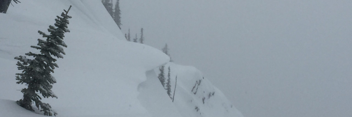
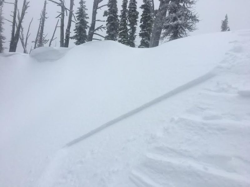
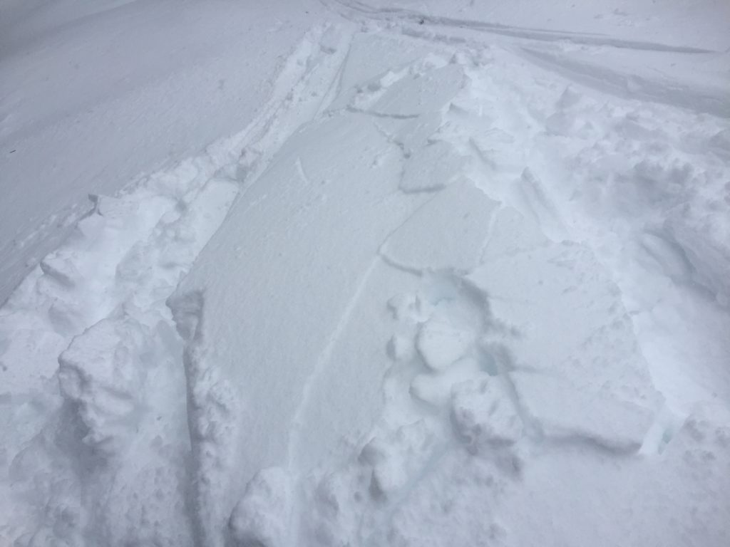
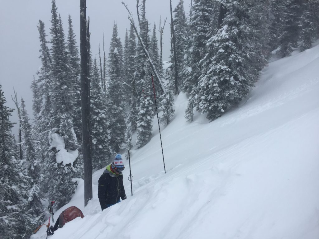
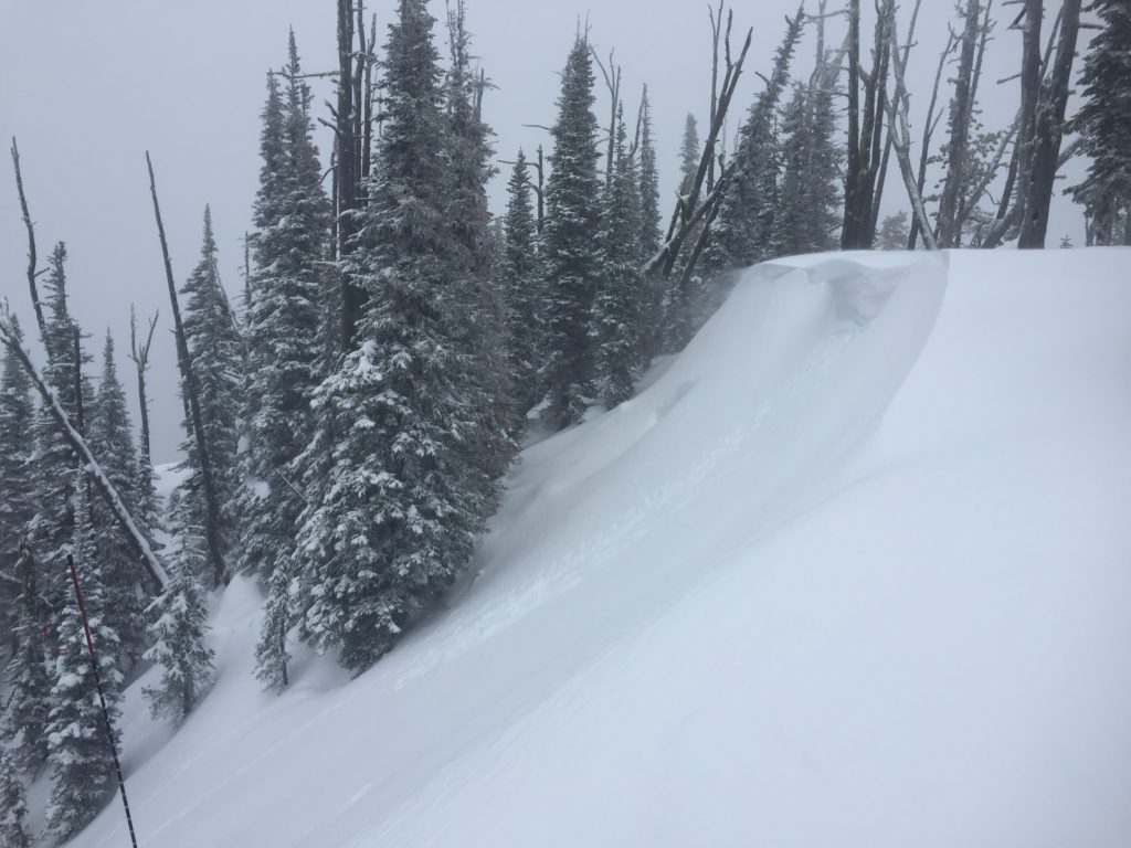
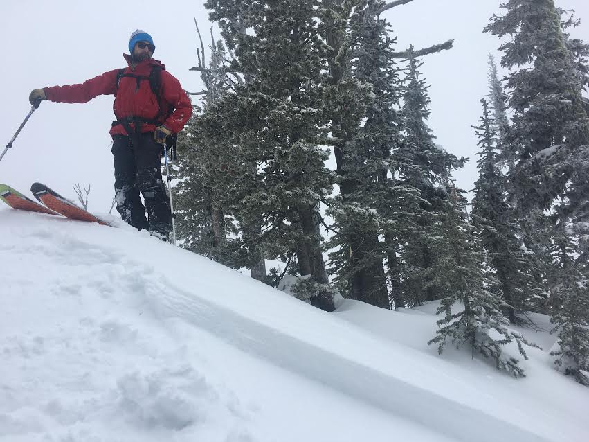
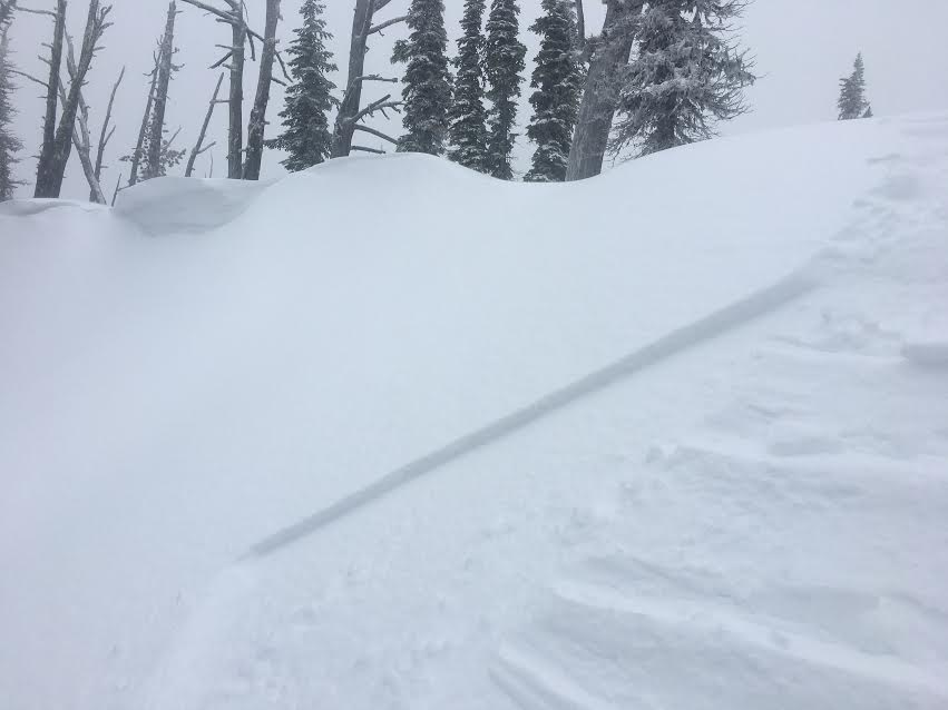
The primary avalanche concern today is wind slabs. Josh and I toured in the Rattlesnake yesterday and found small soft wind slabs forming early in the day that were already starting to have some shooting cracks and signs of instability in tests (Video). With significantly more snow becoming available for transport through the day and winds reaching gale force, wind slabs will have further developed and will be touchy today. Winds have shifted directions from easterly to westerly so wind slabs and cross-loading can potentially be found on any aspect. Wind slabs will be suspect today and traveling on wind loaded terrain is not advised.
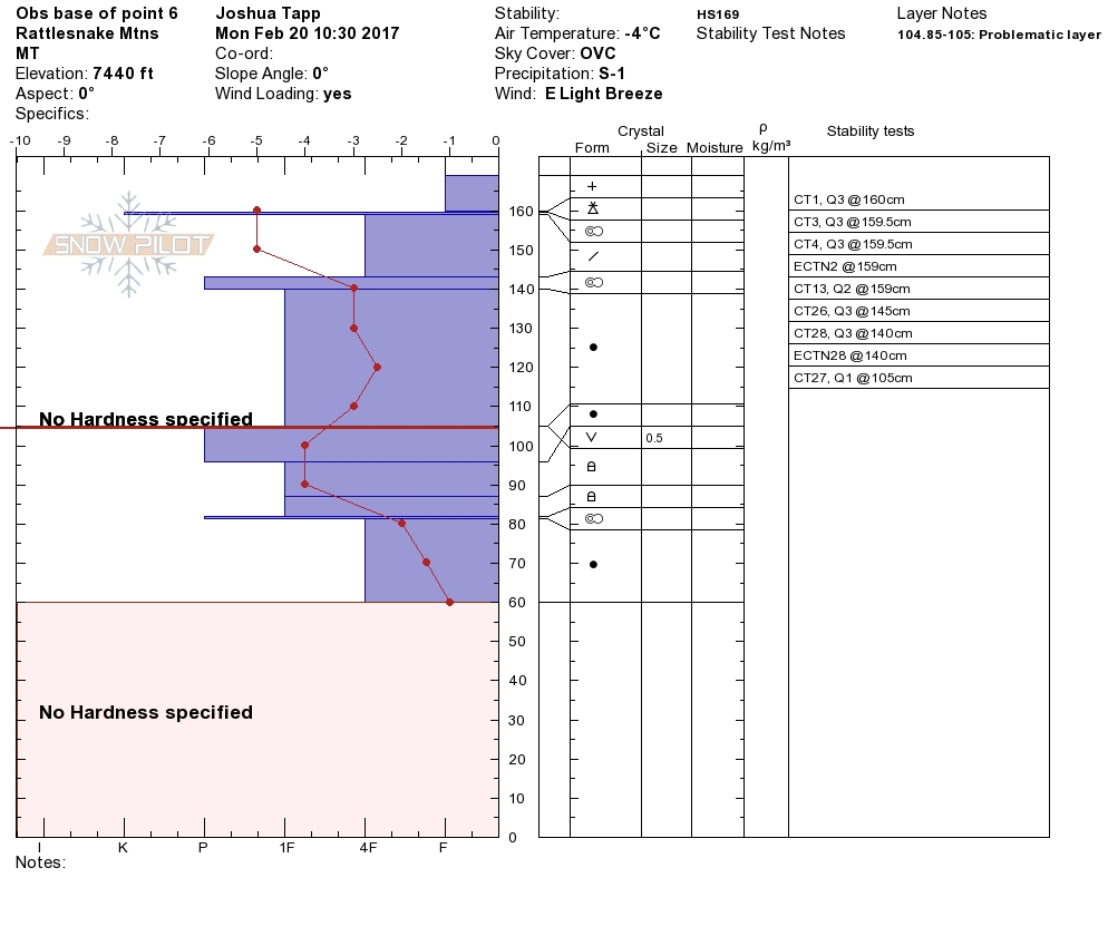
Persistent weak layers are the secondary concern today. Buried surface hoar and near surface facets continue to fail with clean shears but are not propagating as readily. The persistent weak layers still warrant attention so take the time to dig to see if these layers are present and propagating. The facets and buried surface hoar continue to break down and have become very small and are hard to identify until you perform stability tests.
The third concern today will depend on where you are in the advisory area. In the northern half of the advisory area small soft storm slabs will be possible. A good amount of new snow paired with wind effect will take some time for the new snow to bond to the old snow surface. In the southern portion of the advisory area where less snow has fallen loose avalanches will be more of a concern in steeper terrain.
Avalanche and Weather Outlook
Snow continues to fall in the mountains and an additional few inches are expected today. With more snow, the avalanche danger will slowly increasing throughout the day. Cooler temperatures and more snow are in the forecast for the next couple of days as winter looks to return.
If you are out in the backcountry, please send us your observations, these are very helpful in producing the advisory. The next regular advisory will be issued on Thursday, February 23, 2017.
Ski and ride safe.


