Posted:
Feb 25, 2017 @ 6:14 am

The current avalanche danger is MODERATE in the west central Montana backcountry above 6000 feet. Evaluate snow and terrain carefully; identify features of concern. Human triggered avalanches are possible. Below 6000 ft the avalanche danger is LOW.

Good morning, this is Travis Craft with the West Central Montana Avalanche Center’s avalanche advisory for February 25, 2017. This danger rating does not apply to operating ski areas, expires at midnight tonight and is the sole responsibility of the U.S. Forest Service.

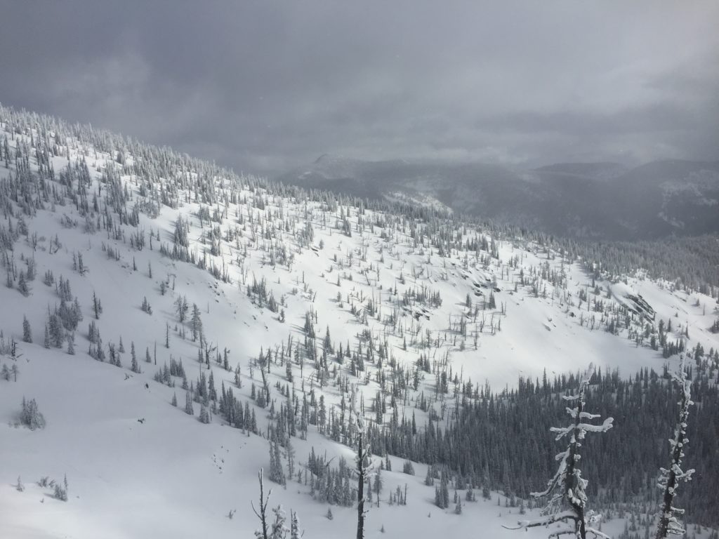
Weather and Snowpack

Mountain temperatures range from 5 F to 18 F in the region. Winds are 2 mph with gusts of 4 mph out of the W in the Bitterroot. Point Six, in the northern part of the advisory area, winds are reading calm. The forecast area received 1 to 2 inches of new snow in the last 24 hours. The new snow had SWE’s ranging from .1 to .2 inches of water.

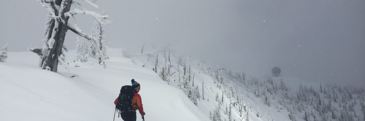
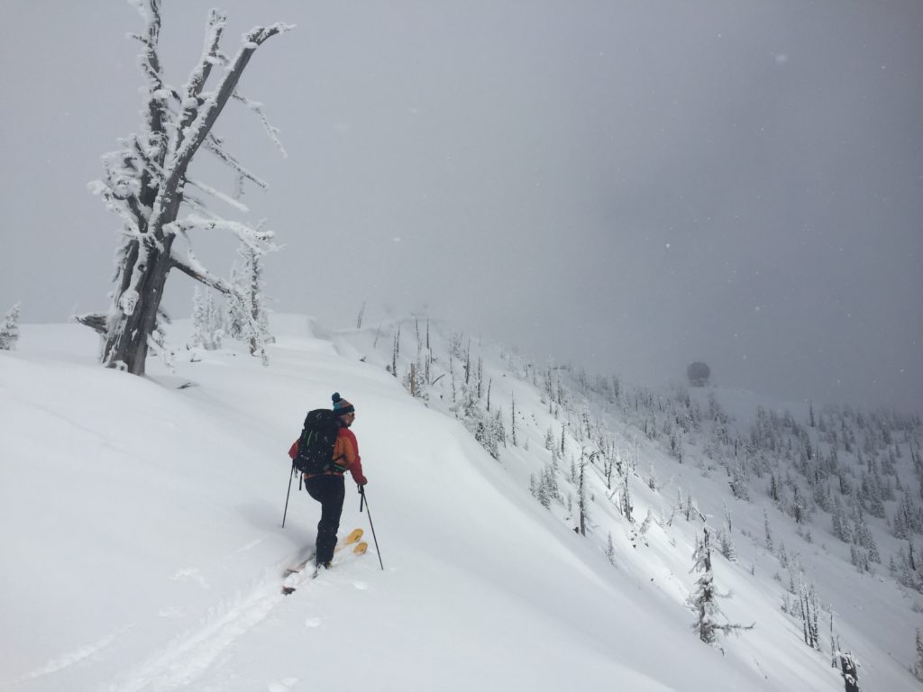
Logan and I toured in the Rattlesnake yesterday.  We were not able to get any of our persistent weak layers to propagate.  The storm snow is bonding to the old snow surfaces.  We did observe some loose dry sluffs. Tim was at Downing Mountain Lodge in the central Bitterroot and found the storm snow was settling out.

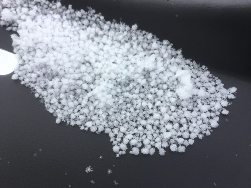
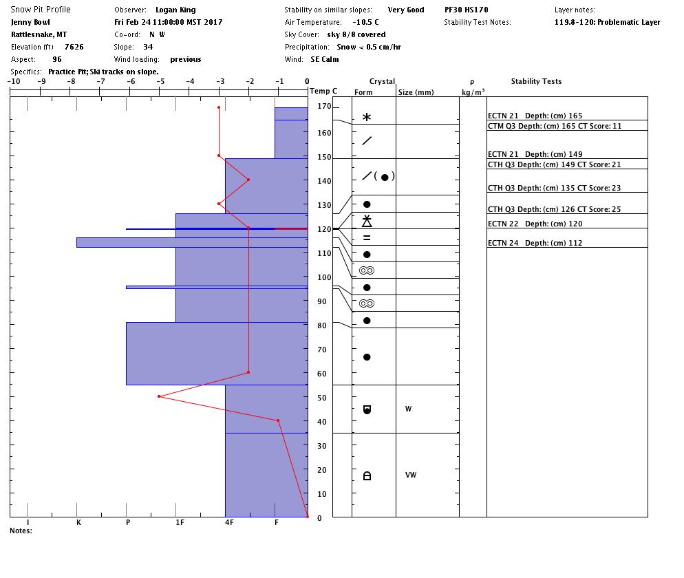
The primary avalanche concern is persistent slabs.  There are weak layers in our snowpack, these layers (graupel, near surface facets, and different crusts) have not propagated in our pit tests.  Dig a pit to see if these layers are reactive before committing to a steep slope.

The second avalanche concern is loose dry releases on steep terrain.  These should not be a problem to manage unless they knock you down and carry you into a terrain trap.

The final avalanche problem is wind slabs.  These slabs are very stubborn to trigger.  Wind slabs are in isolated areas in the region.  Identify these slopes and avoid them.

Avalanche and Weather Outlook 

Light mountain showers today until a cold front moves into the area on Sunday.  This cold front will bring 3 to 7 inches of new snow to the mid elevations and up to 12 inches to the higher elevations.  Wind is expected to accompany this front.  Temperatures will remain cooler and expect additional accumulations on Monday. The cooler temperatures will keep this snow low density.  With these conditions expect the avalanche danger to increase.

If you are out in the backcountry, please send us your observations, these are very helpful in producing the advisory. I will issue the next advisory on February 28, 2017.

Ski and ride safe.


READ FULL ADVISORY  

Problem 1 - Persistent Slabs

  • TYPE

    persistent-slabs

    Persistent Slabs

    Release of a cohesive layer of soft to hard snow (a slab) in the middle to upper snowpack, when the bond to an underlying persistent weak layer breaks.  Persistent layers include: surface hoar, depth hoar, near-surface facets, or faceted snow. Persistent weak layers can continue to produce avalanches for days, weeks or even months, making them especially dangerous and tricky. As additional snow and wind events build a thicker slab on top of the persistent weak layer, this avalanche problem may develop into a Persistent, Deep-Slab.

  • SIZE

    3-4

    1-2 (Small-Large)

    The potential size of avalanche resulting from this problem.

  • LIKELIHOOD

    Likelihood-2

    Unlikely/Possible

    The likelihood of an avalanche resulting from this problem.

  • IMAGE

There are weak layers in the snowpack.  Dig a pit to see if they are reactive.

Problem 2 - Loose Dry

  • TYPE

    loose-dry

    Loose Dry

    Release of wet unconsolidated snow or slush. These avalanches typically occur within layers of wet snow near the surface of the snowpack, but they may quickly gouge into lower snowpack layers. Like Loose-Dry Avalanches,they start at a point and entrain snow as they move downhill, forming a fan-shaped avalanche. They generally move slowly, but can contain enough mass to cause significant damage to trees, cars or buildings. Other names for loose-wet avalanches include point-release avalanches or sluffs. Loose-wet avalanches can trigger slab avalanches that break into deeper snow layers.

  • SIZE

    2-3

    1 (Small)

    The potential size of avalanche resulting from this problem.

  • LIKELIHOOD

    Likelihood-3

    Possible

    The likelihood of an avalanche resulting from this problem.

These should not be a problem to manage unless they knock you down and carry you into a terrain trap.

Problem 3 - Wind Slabs

  • TYPE

    wind-slabs

    Wind Slabs

    Release of a cohesive layer of snow (a slab) formed by the wind.  Wind typically erodes snow from the upwind sides of terrain features and deposits snow on the downwind side.  Wind slabs are often smooth and rounded and sometimes sound hollow, and can range from soft to hard. Wind slabs that form over a persistent weak layer (surface hoar, depth hoar, or near-surface facets) may be termed Persistent Slabs or may develop into Persistent Slabs.

  • SIZE

    3-4

    1-2 (Small-Large)

    The potential size of avalanche resulting from this problem.

  • LIKELIHOOD

    Likelihood-2

    Unlikely/Possible

    The likelihood of an avalanche resulting from this problem.

There are isolated wind slabs in the advisory area.  Identify these and avoid them.

VIDEO

Observations 02/24/2017

Observations 02/24/2017

FORECAST & OUTLOOK

New snow and wind on Sunday and Monday.

This information is the sole responsibility of the Forest Service and does not apply to operating ski areas. The avalanche danger rating expires at midnight tonight but the information can help you make a more informed decision regarding travel in avalanche terrain for the next few days.

Our advisory area includes National Forest System lands in the Bitterroot Mountains from Lost Trail Pass north to Granite Pass, the Rattlesnake Mountains north of Missoula and the Southern Swan and Mission Mountains near Seeley Lake, MT. Avalanche information for the Lookout Pass/St. Regis Basin area is available from the Idaho Panhandle Avalanche Center.