Posted:
Mar 2, 2017 @ 6:16 am

The current avalanche danger is CONSIDERABLE in the west central Montana backcountry. Careful snowpack evaluation, cautious route-finding, and conservative decision-making are essential today. Human triggered avalanches are likely.

Good morning, this is Travis Craft with the West Central Montana Avalanche Center’s avalanche advisory for March 02, 2017. This danger rating does not apply to operating ski areas, expires at midnight tonight and is the sole responsibility of the U.S. Forest Service.

Weather and Snowpack

Mountain temperatures range from 17 F to 25 F in the region. Winds are 11 mph with gusts of 16 mph out of the SSW in the Bitterroot. Point Six, in the northern part of the advisory area, winds are 26 mph with gusts of 31 mph out of the W.  Snotels went offline at 100 am and are not reporting this morning.  The northern part of the advisory area picked up between .4 and .6 inches of water in that time.  The southern region received .2 inches of water.

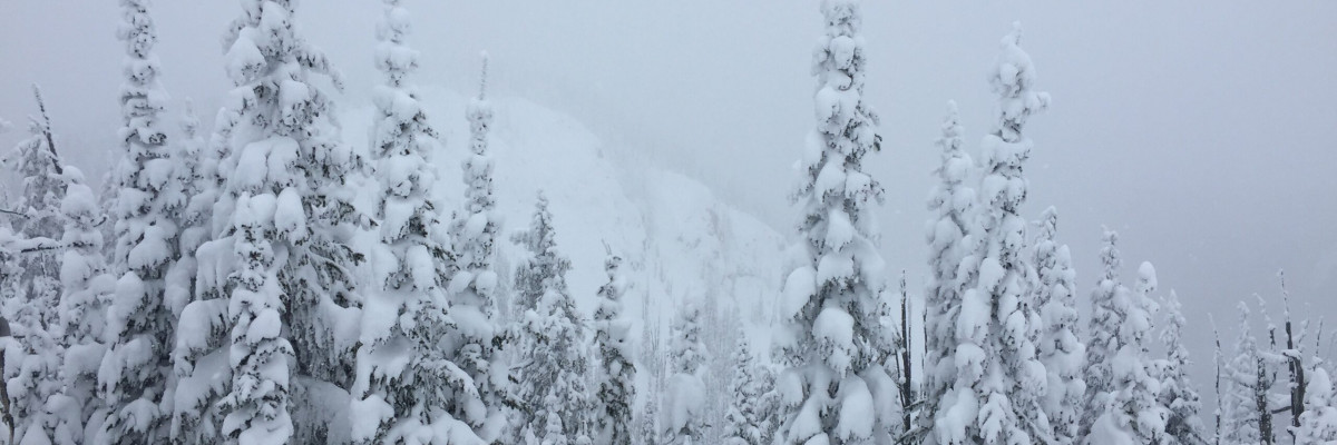
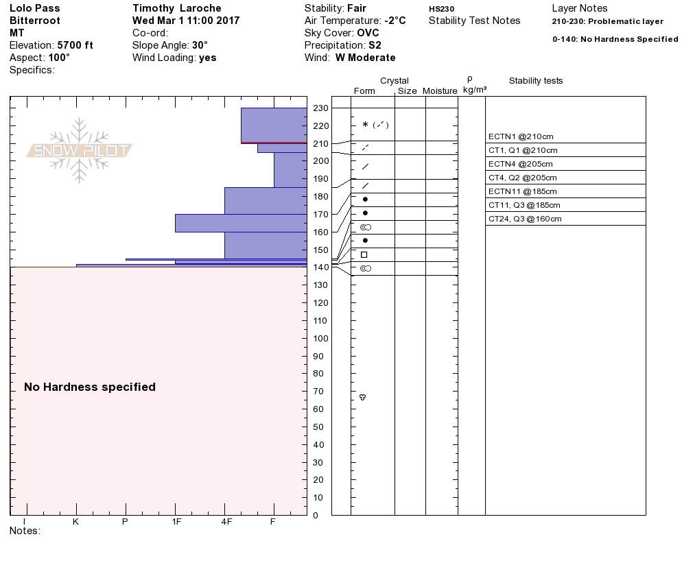
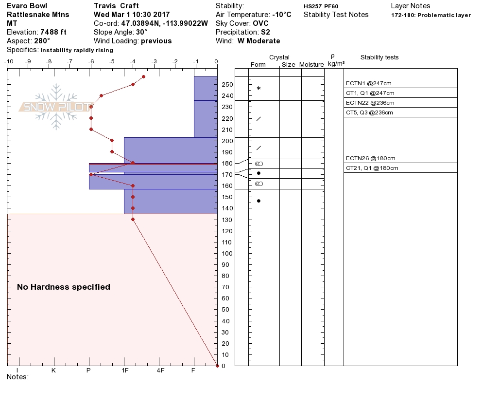
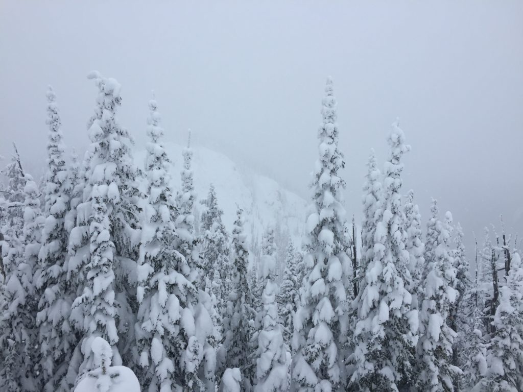
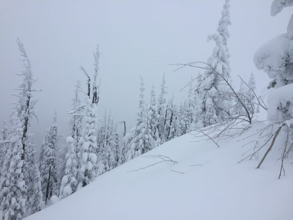
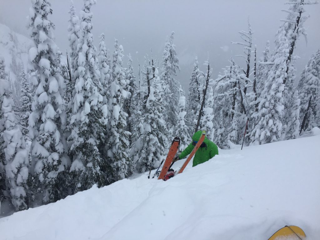
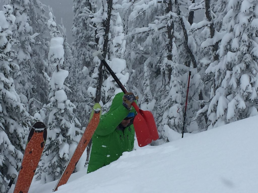
Logan and I toured in the Rattlesnake yesterday. Tim and Dave went to Lolo Pass. We all observed recent wind loading overnight. Logan and I got localized cracking on leeward slopes. We saw sensitive shallow wind slabs on South aspects. We also found thick, dense slabs on West slopes. All of us found significant amounts of snow available for transport. The storm has come in with wind averaging 30 mph and gusts in the 40 mph range. The stability in our snowpack has dramatically changed. With continued loading and wind expect the avalanche danger to rise steadily. Wind slabs will continue to increase in size and sensitivity. We had a week of good stability. Now is the time to pump the brakes and let snowpack adjust to the new load and wind.

The primary avalanche problem today is wind slabs. These slabs are on leeward aspects. They are very sensitive to triggers. Identify wind loaded terrain and avoid it.

The secondary avalanche concern is storm slabs. There has been significant new snow. The storm is getting warmer which means there is cold low-density snow below the heavier denser snow. We call this an upside down snowpack. It will take time for the new snow to bond with the old snow.

Avalanche and Weather Outlook

The next chance for precipitation will be this weekend. Warmer temperatures and then a cold front moves into the area Sunday. With this pattern expect the avalanche danger to stay the same.

If you are out in the backcountry, please send us your observations, these are very helpful in producing the advisory. Logan will issue the next advisory on March 04, 2017.

Ski and ride safe.


READ FULL ADVISORY  

Problem 1 - Wind Slabs

  • TYPE

    wind-slabs

    Wind Slabs

    Release of a cohesive layer of snow (a slab) formed by the wind.  Wind typically erodes snow from the upwind sides of terrain features and deposits snow on the downwind side.  Wind slabs are often smooth and rounded and sometimes sound hollow, and can range from soft to hard. Wind slabs that form over a persistent weak layer (surface hoar, depth hoar, or near-surface facets) may be termed Persistent Slabs or may develop into Persistent Slabs.

  • SIZE

    3-4

    1-2 (Small-Large)

    The potential size of avalanche resulting from this problem.

  • LIKELIHOOD

    Likelihood-5

    Likely

    The likelihood of an avalanche resulting from this problem.

There are sensitive wind slabs on leeward terrain.  There is significant snow available for transport. Expect these slabs to increase in size and sensitivity through the day.

Problem 2 - Storm Slabs

  • TYPE

    storm-slabs

    Storm Slabs

    Release of a soft cohesive layer (a slab) of new snow which breaks within the storm snow or on the old snow surface. Storm-slab problems typically last between a few hours and few days. Storm-slabs that form over a persistent weak layer (surface hoar, depth hoar, or near-surface facets) may be termed Persistent Slabs or may develop into Persistent Slabs.

  • SIZE

    3-4

    1-2 (Small-Large)

    The potential size of avalanche resulting from this problem.

  • LIKELIHOOD

    Likelihood-3

    Possible

    The likelihood of an avalanche resulting from this problem.

  • ADDED DANGER

    Increased Slope Danger

    Increased/Added Danger

    There is an increased risk of avalanches on these slopes:

    N - North
    NE - Northeast
    E - East
    SE - Southeast
    S - South
    SW - Southwest
    W - West
    NW - Northwest

There is significant snow from this storm.  The storm snow needs time to bond to the old snow.

VIDEO

Observations 03/01/2017

Observations 03/01/2017

FORECAST & OUTLOOK

The next chance for precipitation will be this weekend. Warmer temperatures and then a cold front moves into the area Sunday. With this pattern expect the avalanche danger to stay the same.

This information is the sole responsibility of the Forest Service and does not apply to operating ski areas. The avalanche danger rating expires at midnight tonight but the information can help you make a more informed decision regarding travel in avalanche terrain for the next few days.

Our advisory area includes National Forest System lands in the Bitterroot Mountains from Lost Trail Pass north to Granite Pass, the Rattlesnake Mountains north of Missoula and the Southern Swan and Mission Mountains near Seeley Lake, MT. Avalanche information for the Lookout Pass/St. Regis Basin area is available from the Idaho Panhandle Avalanche Center.