
The avalanche warning has expired this morning, and the current avalanche danger in the West Central Montana Backcountry is still HIGH on wind loaded terrain above 7,000 feet. The avalanche danger is CONSIDERABLE on all other terrain. Below 7,000 feet the avalanche danger is considerable but will move towards HIGH as the day warms up and the sun starts to affect the snow surface. Conditions are variable and careful evaluation is critical to recreate safely in the backcountry today.
Good morning, this is Logan King with the West Central Montana Avalanche Center’s avalanche advisory for March 11, 2017. This danger rating does not apply to operating ski areas, expires at midnight tonight and is the sole responsibility of the U.S. Forest Service.
Weather and Snowpack
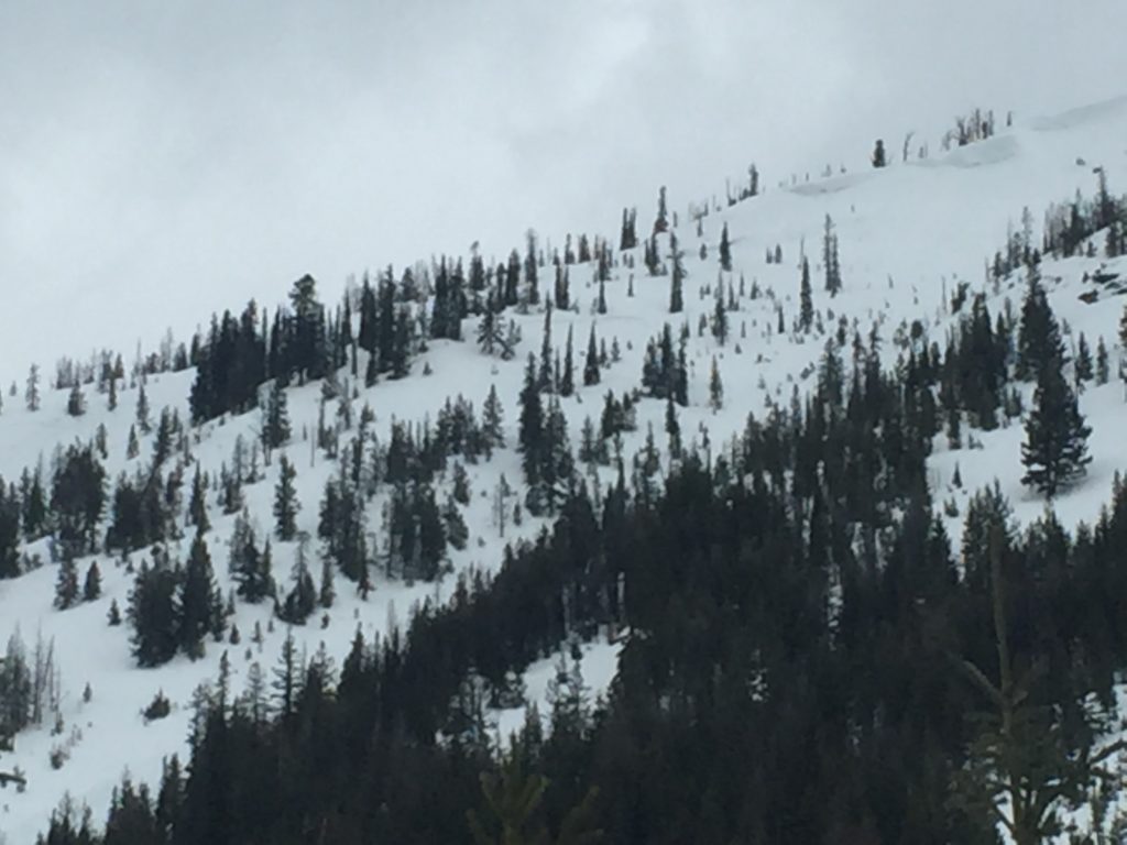
This morning mountain temperatures are just below freezing. Winds are currently 13 mph gusting to 18 mph from the WSW at Point 6, and are 7 mph gusting to 11 mph from the SSE at Deer Mountain. Most of the region did not accumulate snow overnight but a few isolated showers deposited a trace to 1 inch of snow at various locations.
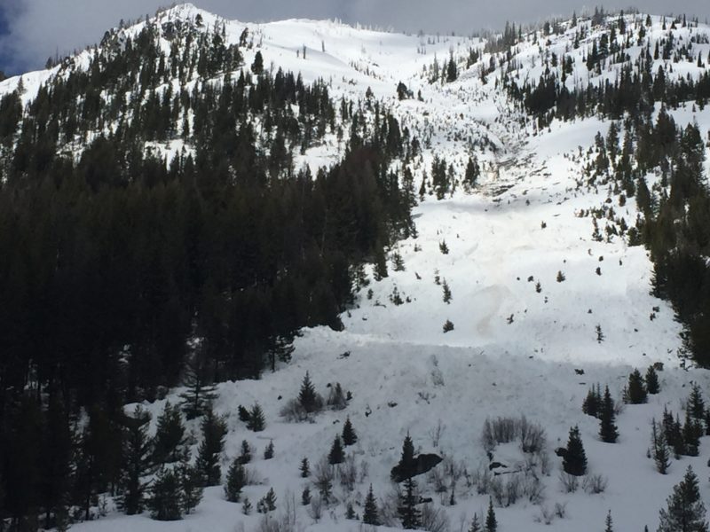
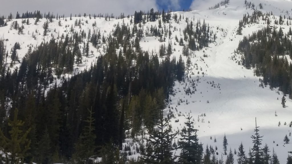
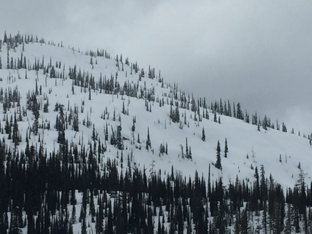
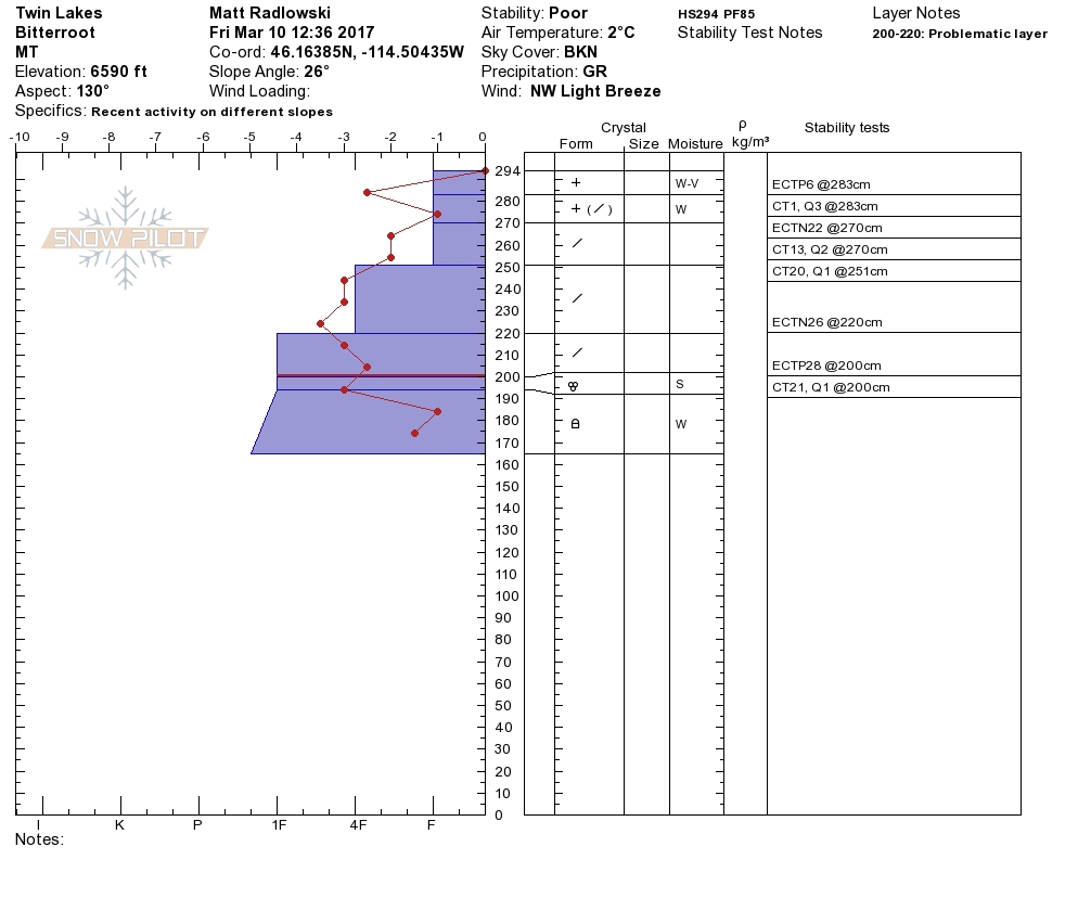
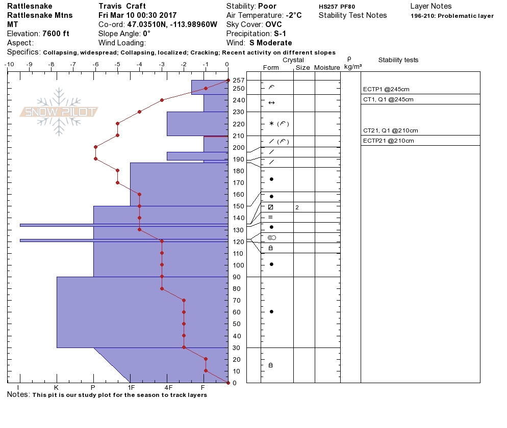
Travis was in the Rattlesnake yesterday and found wind slabs to be the greatest concern. Active transport was reported and wind slabs were touchy on leeward terrain. Matt and I were in the southern Bitterroot yesterday and we observed wind loading beginning later in the day with strong winds moving snow at upper elevations. Yesterday afternoon in the Bitterroot winds were sustained in the 20’s and gusting to 30 mph and were gusting up to the 40’s at Point 6. The primary avalanche concern today will be wind slabs above 7,000ft. With lots of new snow for transport and strong winds, wind slabs have gotten large and touchy. Recreating on or below wind loaded terrain will be dangerous as wind slabs continue to be reactive.
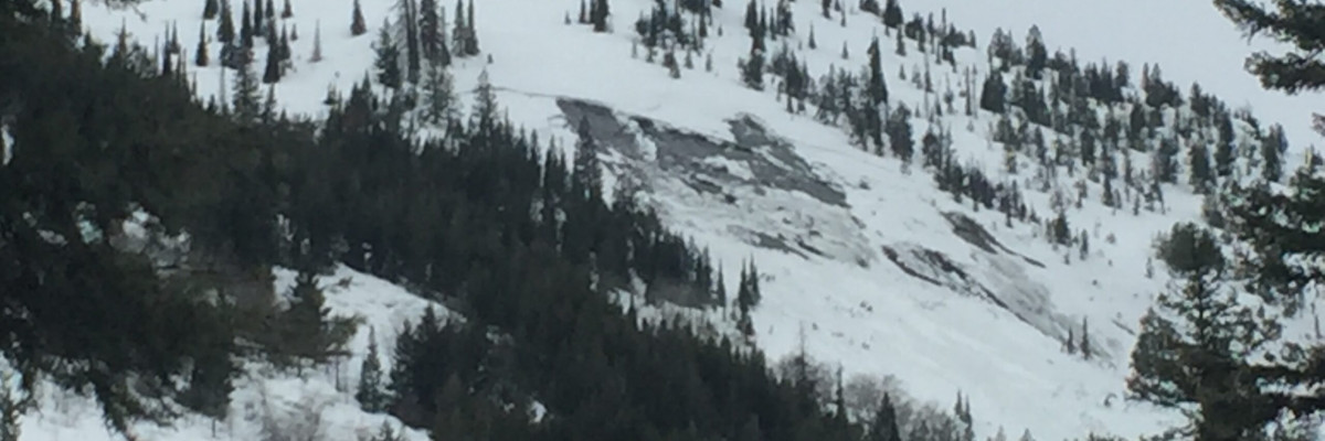
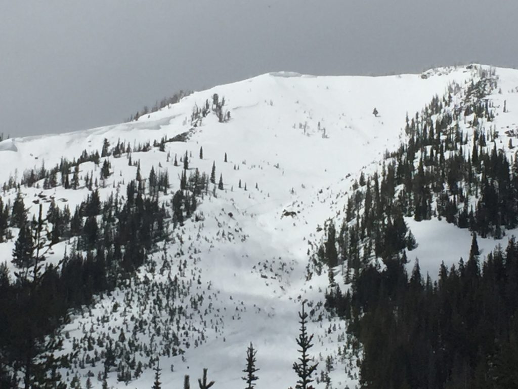
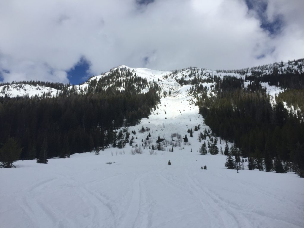
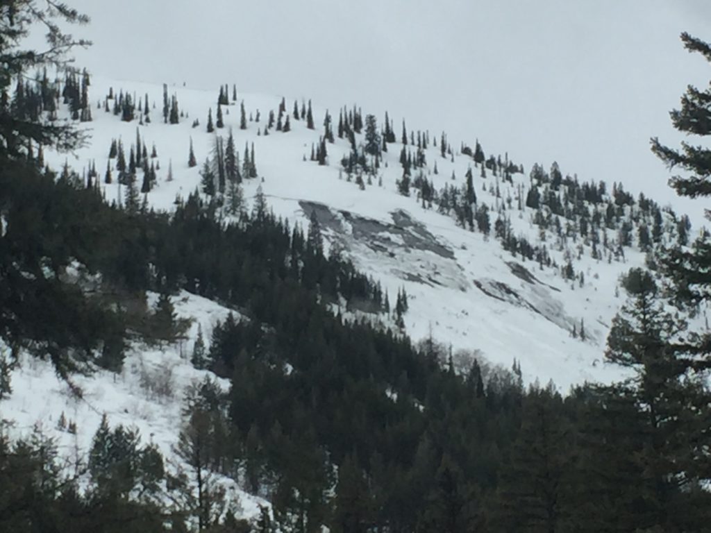
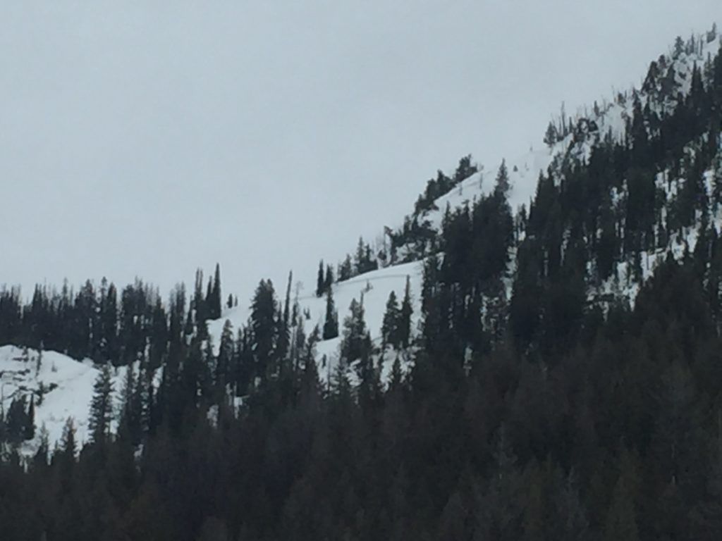
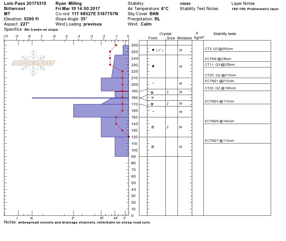
The next greatest concern is wet slab avalanches. Matt and I observed more than a dozen natural wet slabs and glide avalanches and a very saturated snowpack to about 7,000 ft in the Southern Bitterroot and Ryan found saturated snow near Lolo Pass. As the temperatures warm today, wet slabs will be likely below 7,000 feet, especially on aspects heavily affected by the sun. Be cautious of slopes on the southern half of the compass later in the day and at lower elevations.
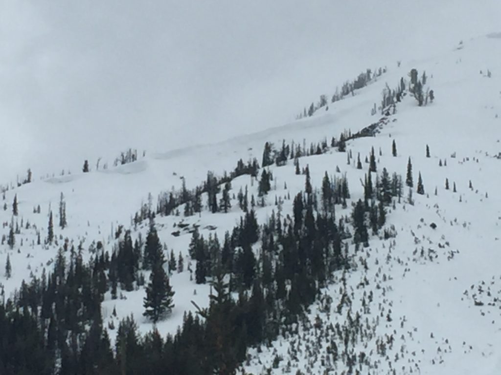
On all other terrain the greatest concern will be storm slabs. In the Rattlesnake and Southern Bitterroot we found the storm slab to propagate on two different layers of colder snow sandwiched in the storm slab. Freezing overnight and time will have helped to bond these layers but with multiple layers propagating in tests, conservative decision making will be critical today. Be sure to carefully assess the snow when choosing where to recreate to see if the weakness at the snow interface is still reactive.
Avalanche and Weather Outlook
Today looks to have a more settled weather pattern, and mountain temperatures will be warmer in the southern half of the advisory area. Snow is expected again tonight and the mountains could see an additional few inches of heavy dense snow by Sunday morning. The likelihood of wet avalanches will increase through the day today while the likelihood of triggering the storm slabs and wind slabs will stay the same today.
If you are out in the backcountry, please send us your observations, these are very helpful in producing the advisory. I will issue the next advisory on March 14, 2017.
Ski and ride safe.


