Posted:
Mar 16, 2017 @ 5:52 am

The current avalanche danger in the West Central Montana Backcountry is considerable. Human triggered avalanches are likely in specific terrain. Careful evaluation of the snowpack and cautious-route finding are essential to recreate in the backcountry today.

Good morning, this is Logan King with the West Central Montana Avalanche Center’s avalanche advisory for March 16, 2017. This danger rating does not apply to operating ski areas, expires at midnight tonight and is the sole responsibility of the U.S. Forest Service.

Weather and Snowpack

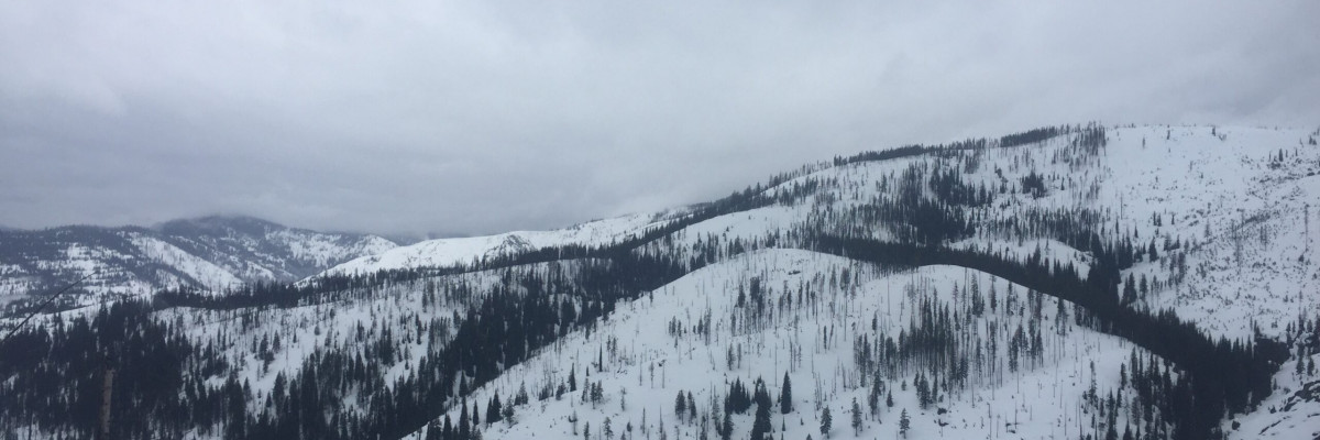
The weather across West Central Montana is shifting as a cold front moves into the region. Temperatures are dropping today and are in the low to mid 30’s this morning. Winds are increasing with the frontal passage and Point 6 is currently reporting winds from the W at 27mph gusting to 40mph. Deer Mountain in the southern Bitterroot is showing winds sustained at 20mph and gusting to 32mph from the WSW. Precipitation has tapered in the northern part of the area and even shifted back towards snow at some locations. The southern Bitterroot is currently receiving heavy rain. Twin Lakes has accumulated 1.2 inches of SWE in 24 hours with the bulk of the water coming in the last 4 hours as rain.

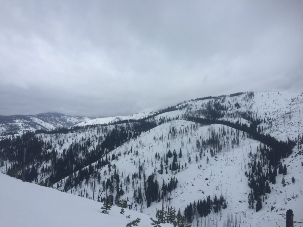
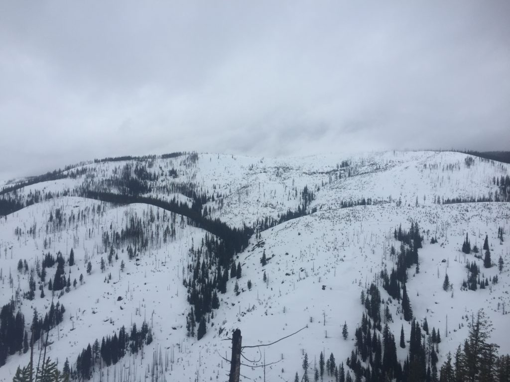
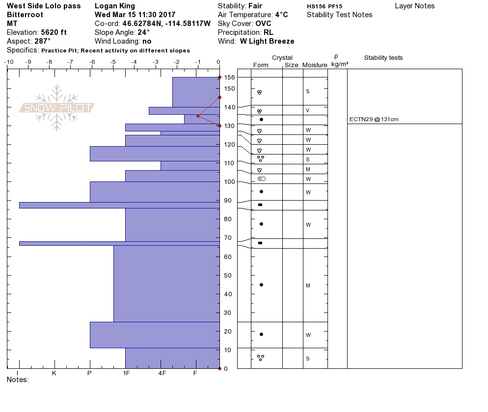
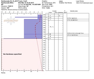
I was up at Lolo Pass yesterday, Josh is up at Yurtski, and Travis and Tim were in the Rattlesnake. At Lolo Pass the snowpack was wet to the ground. In the Rattlesnake the upper snowpack was wet but the water had not percolated as deep into the snowpack. Very large roller balls were observed in steep terrain at all locations.

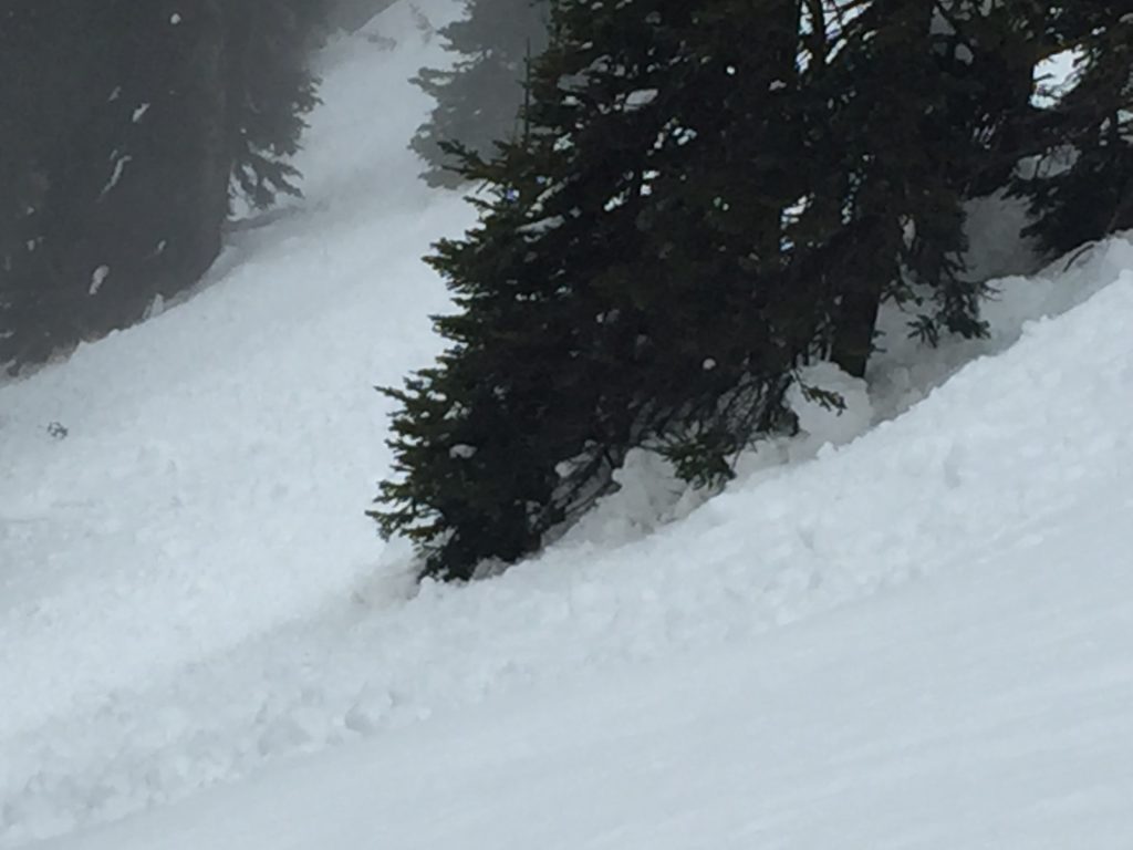
The primary concern today is wet loose avalanches below 7,500 feet. The combo of a wet snow surface and the snow not quite freezing overnight will result in heavy wet loose snow activity concentrated in the surface snow. Loose wet avalanches can be problematic in areas where the consequences of getting caught are amplified by terrain traps. Carefully evaluate the likelihood and consequences of getting caught in a loose wet avalanche.

Wet slab avalanches will be a concern today primarily in the southern Bitterroot. The southern Bitterroot only had a fraction of the moisture that was seen in the last few days but is now getting the lions share of the rain.  With a large amount of water added to the snowpack in a sort timeframe the snowpack will be sensitive for the next 24 hours as the load of free water settles into the snowpack. Freezing temperatures will help alleviate this problem, keep an eye on the thermometer as temperatures look to drop below freezing tonight.

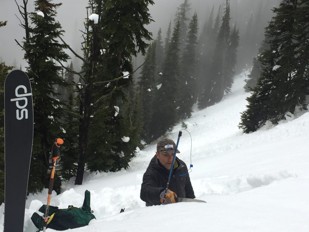
Travis and Tim reported a layer of near surface facets in the Rattlesnake that was not affected by the free water. These facets were about 1 meter deep and failed 50/100 (end) in a propagation saw test. This layer is only found in isolated areas and is not likely fail, but if it does the resulting avalanche will pack a punch. Take a minute to look for this layer and identify if it is reactive today.

Lastly cornices will warrant some attention today. With warm temperatures and rain for the last few days cornices will have significantly weakened. Give cornices an extra wide berth until freezing temperatures return as cornices failures have the potential to be large and are nearly impossible to predict.

Avalanche and Weather Outlook

Strong winds look to dominate the advisory area today as cooler temperatures return. The cold air will help to settle wet and cornices problems that were seen the last couple of days as the free water in the snowpack freezes. The avalanche danger will be on the decrease for the next day or two as cooler temperatures prevail.

If you are out in the backcountry, please send us your observations, these are very helpful in producing the advisory. I will issue the next advisory on March 18, 2017.

Ski and ride safe.


READ FULL ADVISORY  

Problem 1 - Loose Wet

  • TYPE

    loose-wet

    Loose Wet

    Release of wet unconsolidated snow or slush. These avalanches typically occur within layers of wet snow near the surface of the snowpack, but they may quickly gouge into lower snowpack layers. Like Loose-Dry Avalanches,they start at a point and entrain snow as they move downhill, forming a fan-shaped avalanche. They generally move slowly, but can contain enough mass to cause significant damage to trees, cars or buildings. Other names for loose-wet avalanches include point-release avalanches or sluffs. Loose-wet avalanches can trigger slab avalanches that break into deeper snow layers.

  • SIZE

    1-2

    < 1 (Small)

    The potential size of avalanche resulting from this problem.

  • LIKELIHOOD

    Likelihood-6

    Likely/Very Likely

    The likelihood of an avalanche resulting from this problem.

Wet surface snow will result in likely surface activity.

Problem 2 - Wet Slabs

  • TYPE

    wet-slabs

    Wet Slabs

    Release of a cohesive layer of snow (a slab) that is generally moist or wet when the flow of liquid water weakens the bond between the slab and the surface below (snow or ground). They often occur during prolonged warming events and/or rain-on-snow events. Wet slabs can be very destructive.

  • SIZE

    3-4

    1-2 (Small-Large)

    The potential size of avalanche resulting from this problem.

  • LIKELIHOOD

    Likelihood-4

    Possible/Likely

    The likelihood of an avalanche resulting from this problem.

Wet slabs are likely in areas with a saturated snow pack especially in the southern Bitterroot today.

Problem 3 - Persistent

  • TYPE

    persistent-slabs

    Persistent Slabs

    Release of a cohesive layer of soft to hard snow (a slab) in the middle to upper snowpack, when the bond to an underlying persistent weak layer breaks.  Persistent layers include: surface hoar, depth hoar, near-surface facets, or faceted snow. Persistent weak layers can continue to produce avalanches for days, weeks or even months, making them especially dangerous and tricky. As additional snow and wind events build a thicker slab on top of the persistent weak layer, this avalanche problem may develop into a Persistent, Deep-Slab.

  • SIZE

    6-7

    3 (Large-Very Large)

    The potential size of avalanche resulting from this problem.

  • LIKELIHOOD

    Likelihood-2

    Unlikely/Possible

    The likelihood of an avalanche resulting from this problem.

A layer of near surface facet buried about 1 meter deep is unlikely to be triggered but is failing in stability tests. If this layer fails it will result in a very large avalanche.

Problem 4 - Cornices

  • TYPE

    cornices

    Cornices / Cornice Fall

    Release of an overhanging mass of snow that forms as the wind moves snow over a sharp terrain feature, such as a ridge, and deposits snow on the down-wind side. They range from small wind lips of soft snow to large overhangs of hard snow that are 30 feet (~10 meters) or taller. They can break off the terrain suddenly and pull back onto the ridge top and catch people by surprise even on the flat ground above the slope. Even small cornices can have enough mass to be destructive and deadly. Cornice fall can entrain loose surface snow or trigger slab avalanches.

  • SIZE

    5-6

    2-3 (Large)

    The potential size of avalanche resulting from this problem.

  • LIKELIHOOD

    Likelihood-5

    Likely

    The likelihood of an avalanche resulting from this problem.

Cornices have lost strength over the last couple days and will be touchy.

FORECAST & OUTLOOK

As a cold front moves into the region temperatures will drop with snow lines and wind will increase.

This information is the sole responsibility of the Forest Service and does not apply to operating ski areas. The avalanche danger rating expires at midnight tonight but the information can help you make a more informed decision regarding travel in avalanche terrain for the next few days.

Our advisory area includes National Forest System lands in the Bitterroot Mountains from Lost Trail Pass north to Granite Pass, the Rattlesnake Mountains north of Missoula and the Southern Swan and Mission Mountains near Seeley Lake, MT. Avalanche information for the Lookout Pass/St. Regis Basin area is available from the Idaho Panhandle Avalanche Center.