Posted:
Mar 30, 2017 @ 5:50 am

The current avalanche danger is MODERATE for the West Central Montana backcountry. Human triggered avalanches are possible in specific terrain. Evaluate the snow and terrain carefully to to identify features of concern.

Good morning, this is Logan King with the West Central Montana Avalanche Center’s avalanche advisory for March 30, 2017. This danger rating does not apply to operating ski areas, expires at midnight tonight and is the sole responsibility of the U.S. Forest Service.

Weather and Snowpack

The next pulse of moisture has moved into the region and has been primarily rain but a few snotels are reporting up to 3 inches of snow in the advisory area. SWE’s have ranged from .3-.7 inches of water as the storm system is warm and wet with rain line at about 7,000 feet. Mountain temperatures this morning are in the mid 30‘s. Winds have been light; Point 6 is reporting winds of 13 mph gusting to 23 mph from the WNW. Deer Mountain has winds sustained at 6 mph and gusting to 11 mph from the WSW.

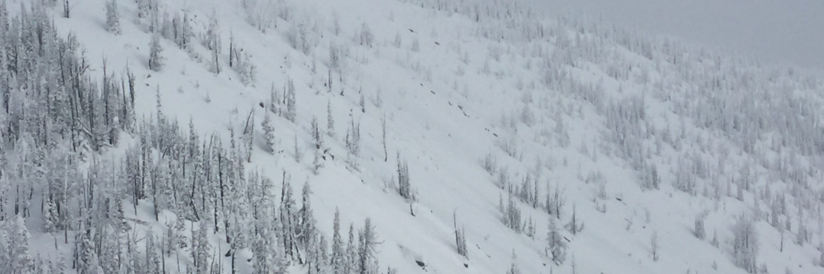
The primary avalanche concern today is storm slabs above 7,000 feet. Over the last few days about a foot of snow has accumulated at upper elevations and more snow is expected today as temperatures look to drop and snow levels will lower. Carefully evaluate how well the new snow is bonding to the old snow before committing to avalanche terrain.

The secondary concern is loose snow avalanches. The loose snow avalanches will be dry above 7,000 feet and will be wet at lower elevations. Appropriate terrain selection is important when dealing with loose snow avalanches. Identify features of concern and terrain traps that increase the consequences of getting caught in a slide.

Avalanche and Weather Outlook

Scattered and variable accumulations of snow will dominate the weather pattern for the region and should persist into the weekend. With moderate accumulations and no major changes in the weather the avalanche danger will remain the same through today and into tomorrow.

If you are out in the backcountry, please send us your observations, these are very helpful in producing the advisory. The next advisory will be issued April 1, 2017, and will be the last regular advisory of the season. Updates on avalanche conditions will be posted as necessary. 

Ski and ride safe.
READ FULL ADVISORY  

Problem 1 - Storm Slabs

  • TYPE

    storm-slabs

    Storm Slabs

    Release of a soft cohesive layer (a slab) of new snow which breaks within the storm snow or on the old snow surface. Storm-slab problems typically last between a few hours and few days. Storm-slabs that form over a persistent weak layer (surface hoar, depth hoar, or near-surface facets) may be termed Persistent Slabs or may develop into Persistent Slabs.

  • SIZE

    3-4

    1-2 (Small-Large)

    The potential size of avalanche resulting from this problem.

  • LIKELIHOOD

    Likelihood-3

    Possible

    The likelihood of an avalanche resulting from this problem.

Storm slabs are the primary concern above 7,000 feet.

Problem 2 - Loose Snow

  • TYPE

    loose-dry

    Loose Dry

    Release of wet unconsolidated snow or slush. These avalanches typically occur within layers of wet snow near the surface of the snowpack, but they may quickly gouge into lower snowpack layers. Like Loose-Dry Avalanches,they start at a point and entrain snow as they move downhill, forming a fan-shaped avalanche. They generally move slowly, but can contain enough mass to cause significant damage to trees, cars or buildings. Other names for loose-wet avalanches include point-release avalanches or sluffs. Loose-wet avalanches can trigger slab avalanches that break into deeper snow layers.

  • SIZE

    1-2

    < 1 (Small)

    The potential size of avalanche resulting from this problem.

  • LIKELIHOOD

    Likelihood-4

    Possible/Likely

    The likelihood of an avalanche resulting from this problem.

Loose snow avalanches will be dry at upper elevations and will be wet down low as rain and heavy wet snow are added to the snowpack.

FORECAST & OUTLOOK

Snow Accumulations of 6-12 inches are expected from scattered snow showers today and tomorrow in the southern portion of the advisory area.

This information is the sole responsibility of the Forest Service and does not apply to operating ski areas. The avalanche danger rating expires at midnight tonight but the information can help you make a more informed decision regarding travel in avalanche terrain for the next few days.

Our advisory area includes National Forest System lands in the Bitterroot Mountains from Lost Trail Pass north to Granite Pass, the Rattlesnake Mountains north of Missoula and the Southern Swan and Mission Mountains near Seeley Lake, MT. Avalanche information for the Lookout Pass/St. Regis Basin area is available from the Idaho Panhandle Avalanche Center.