
Good morning, this is Travis Craft with the West Central Montana Avalanche Center’s early season update for November 18, 2017.
Mountain temperatures range from 19 F to 26 F in the region. Winds are 9 mph with gusts of 12 mph out of the SSW in the Bitterroot. Point Six, in the northern part of the advisory area, winds are reading 28 mph with gusts of 34 mph out of the West. The region has picked up 2 to 6 new inches of snow in the last 48 hours.
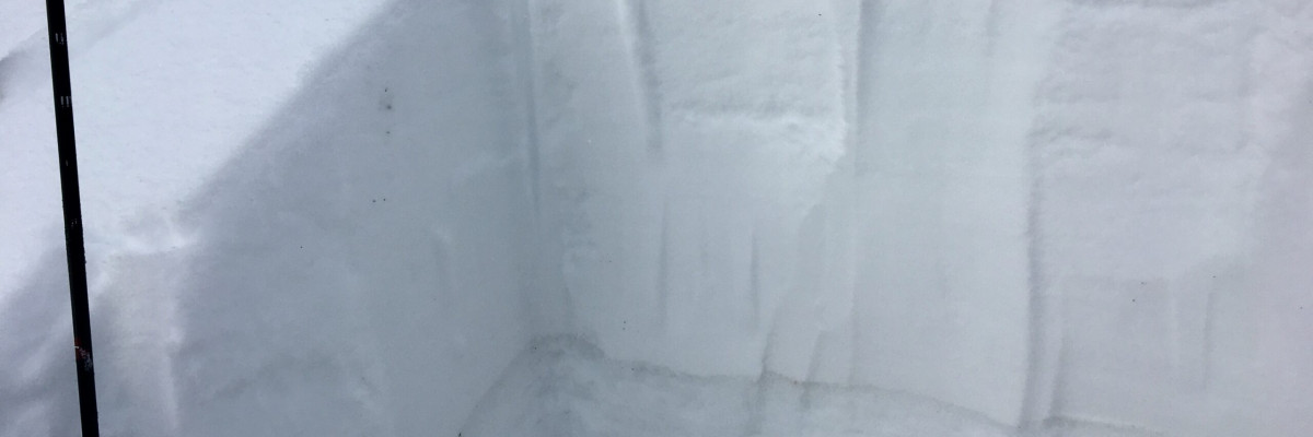
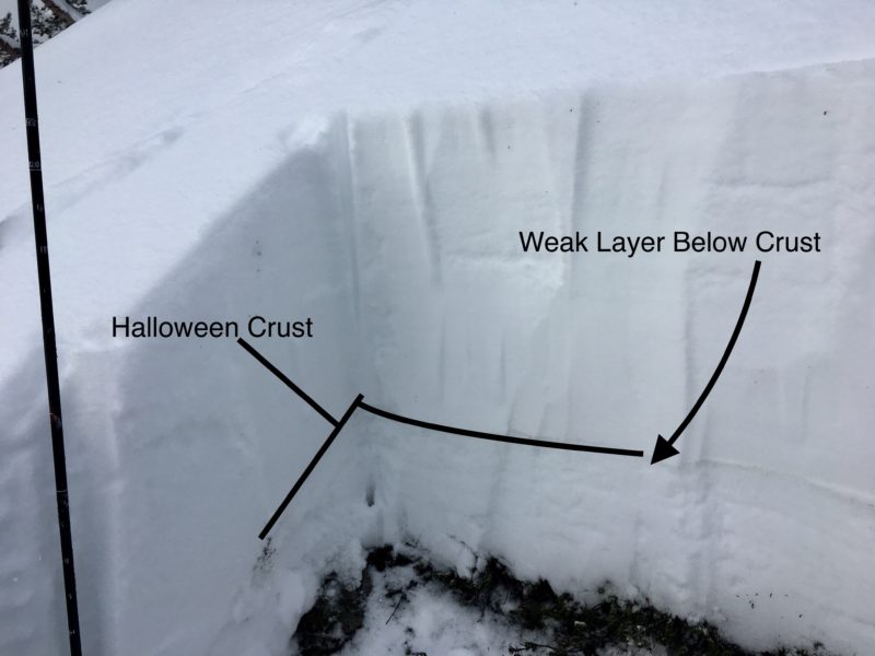
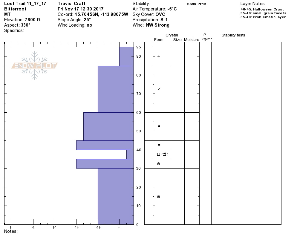
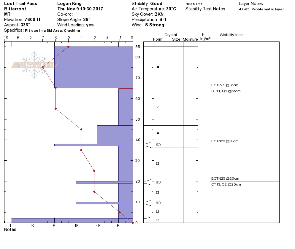
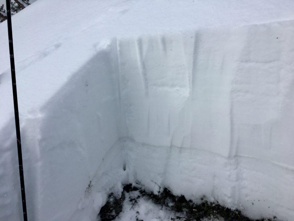
Tim and I toured near Lost Trail Pass yesterday in the southern Bitterroot. We saw active wind transport of snow loading leeward slopes with wind slabs. We also were able to get a layer of small-grained facets to propagate under the Halloween crust.
The primary avalanche problem is wind slabs. These slabs will be sensitive to human triggers and are located on leeward terrain. Winds have shifted in the last couple of days look for gullies to be cross-loaded and other unusual terrain to have wind slabs. The possibility also exists to trigger a wind slab and have it step down to a deeper weak layer in the snowpack causing a larger avalanche.
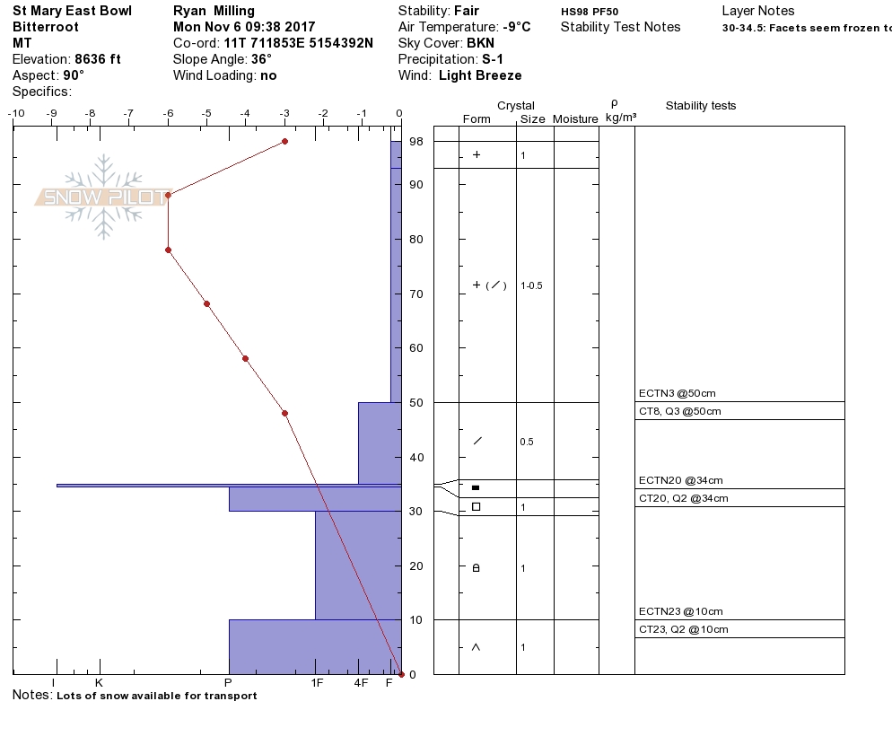
The second avalanche concern is persistent slabs. Tim and I were able to get a layer of small grain facets located below the Halloween crust to propagate in our stability tests. This layer is widespread in our snowpack and the only way to find it is to dig a pit and see how reactive it is in stability tests.
Across western Montana, there are backcountry locations that experienced wildfires during the 2017 season. Temporary emergency trail closures for the Lolo Peak (from the Mormon Ridge trailhead), Mill Creek and the Lantern Ridge trails. These burned areas, while sometimes opening up new skiable terrain, may also present hazards for backcountry skiers. Trees burned may have weakened or completely burned root systems. They could fall without warning – even in no wind conditions. Trees and other vegetation that may have anchored snow on steeper slopes in past years may now be completely burned. Downed trees from a fire can create unseen hazards on shallow snowpacks.
As always, be observant of conditions – not just the snowpack, but also what is above the snow when moving through a recently burned area, especially in strong and gusty winds.
If you see any of these obvious clues (listed below) signaling dangerous snow conditions, avoid being on or under open slopes steeper than 30 degrees.
Recent avalanche activity
Cracking or collapsing snowpack
Heavy snowfall
High winds
Rapid increase in temperature
If you spend any amount of time in the mountains in the winter, chances are good that you will encounter avalanche terrain. Having basic awareness of terrain, weather and snow factors goes a long way toward making good decisions in avalanche terrain. To assist you, we are offering several basic and advanced avalanche awareness classes this winter. We also have instructors available to provide your organization a range of programs from introductory lectures to classes with a field component.
Any information you can provide and send the WCMAC is appreciated and helps us inform the rest of the community about avalanche safety conditions. Please send a quick email to [email protected] or complete the form here public observation.
We will update the advisory as the weather dictates and plan to begin issuing regular avalanche advisories with a danger rating in mid-December.


