Posted:
Dec 17, 2017 @ 6:40 am

Good morning, this is Travis Craft with the West Central Montana Avalanche Center’s weather and avalanche update for December 17, 2017. This danger rating does not apply to operating ski areas, expires at midnight tonight and is the sole responsibility of the U.S. Forest Service.

Weather and Snowpack

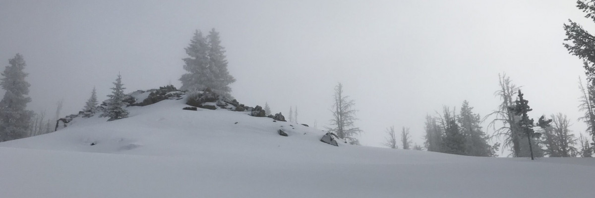
Mountain temperatures range from 8 F to 18 F in the region. Winds are 8 mph with gusts of 11 mph out of the SSW in the Bitterroot. Point Six, in the northern part of the advisory area, winds are 22 mph with gusts of 29 mph out of the WNW.  The advisory area received 0 to 1 inches of snow in the last 24 hours.

The primary avalanche problem is wind slabs. Leeward terrain has wind slabs. Look for rounded pillows of snow near ridgelines and recognize signs of instability such as cracking in the surface snow.  Look for cross-loaded terrain as well as ridge tops.

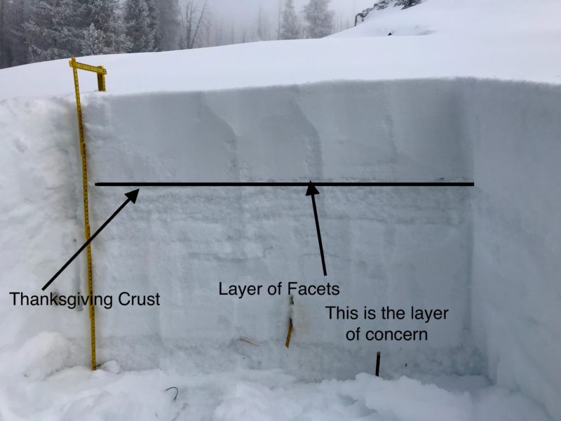
The secondary avalanche problem is persistent slabs.  The new snow will be stressing and burying layers of concern.  The two layers of concern are the buried surface hoar and the near surface facets on top of the Thanksgiving crust.  Dig a pit to assess how reactive these layers are before committing to any slope over 30 degrees.

Avalanche and Weather Outlook

A system is going to move into tonight with new snow and 50 mph ridge top winds.  Look for the avalanche danger to rise when this storm moves in with the addition of new snow and strong winds.


READ FULL ADVISORY  

Problem 1 - Wind Slabs

  • TYPE

    wind-slabs

    Wind Slabs

    Release of a cohesive layer of snow (a slab) formed by the wind.  Wind typically erodes snow from the upwind sides of terrain features and deposits snow on the downwind side.  Wind slabs are often smooth and rounded and sometimes sound hollow, and can range from soft to hard. Wind slabs that form over a persistent weak layer (surface hoar, depth hoar, or near-surface facets) may be termed Persistent Slabs or may develop into Persistent Slabs.

  • SIZE

    3-4

    1-2 (Small-Large)

    The potential size of avalanche resulting from this problem.

  • LIKELIHOOD

    Likelihood-3

    Possible

    The likelihood of an avalanche resulting from this problem.

Leeward terrain has wind slabs. Look for rounded pillows of snow near ridgelines and recognize signs of instability such as cracking in the surface snow.  Look for cross-loaded terrain as well as ridge tops.

Problem 2 - Persistent Slabs

  • TYPE

    persistent-slabs

    Persistent Slabs

    Release of a cohesive layer of soft to hard snow (a slab) in the middle to upper snowpack, when the bond to an underlying persistent weak layer breaks.  Persistent layers include: surface hoar, depth hoar, near-surface facets, or faceted snow. Persistent weak layers can continue to produce avalanches for days, weeks or even months, making them especially dangerous and tricky. As additional snow and wind events build a thicker slab on top of the persistent weak layer, this avalanche problem may develop into a Persistent, Deep-Slab.

  • SIZE

    3-4

    1-2 (Small-Large)

    The potential size of avalanche resulting from this problem.

  • LIKELIHOOD

    Likelihood-3

    Possible

    The likelihood of an avalanche resulting from this problem.

  • IMAGE

The two layers of concern are the buried surface hoar and the near surface facets on top of the Thanksgiving crust.  Dig a pit to assess how reactive these layers are before committing to any slope over 30 degrees.

FORECAST & OUTLOOK

A system will move into the area tonight and will bring high ridge top winds and snow by Monday morning.  See the whole forecast here.

This information is the sole responsibility of the Forest Service and does not apply to operating ski areas. The avalanche danger rating expires at midnight tonight but the information can help you make a more informed decision regarding travel in avalanche terrain for the next few days.

Our advisory area includes National Forest System lands in the Bitterroot Mountains from Lost Trail Pass north to Granite Pass, the Rattlesnake Mountains north of Missoula and the Southern Swan and Mission Mountains near Seeley Lake, MT. Avalanche information for the Lookout Pass/St. Regis Basin area is available from the Idaho Panhandle Avalanche Center.