Posted:
Dec 19, 2017 @ 6:56 am

The current avalanche danger is HIGH  on wind loaded slopes above 5500 feet in the West Central Montana backcountry.  On all other slopes in the advisory area, the avalanche danger is CONSIDERABLE.  Travel on wind loaded slopes is not recommended.  This means careful snowpack evaluation, cautious route-finding, and conservative decision-making are essential to recreate today.  With more snow and wind expect the avalanche danger to rise today.

Good morning, this is Travis Craft with the West Central Montana Avalanche Center’s avalanche advisory for December 19, 2017.  This danger rating does not apply to operating ski areas, expires at midnight tonight and is the sole responsibility of the U.S. Forest Service.

Weather and Snowpack

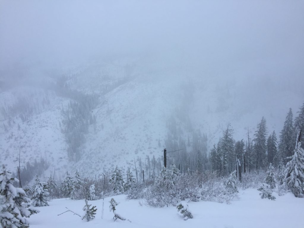
Mountain temperatures range from 24 F to 33 F in the region.  In the Bitterroot winds are 12 mph with gusts of 19 out of the S.  In the northern part of the advisory area, at Point Six, winds are reading 13 mph with gusts of 22 mph out of the SW.  The forecast area received 4 to 12 inches of new snow in the last 24 hours with the greater portion of snow falling in the northern half of the advisory area.  The new snow had SWE’s ranging from .2 to 2.2 inches of water.

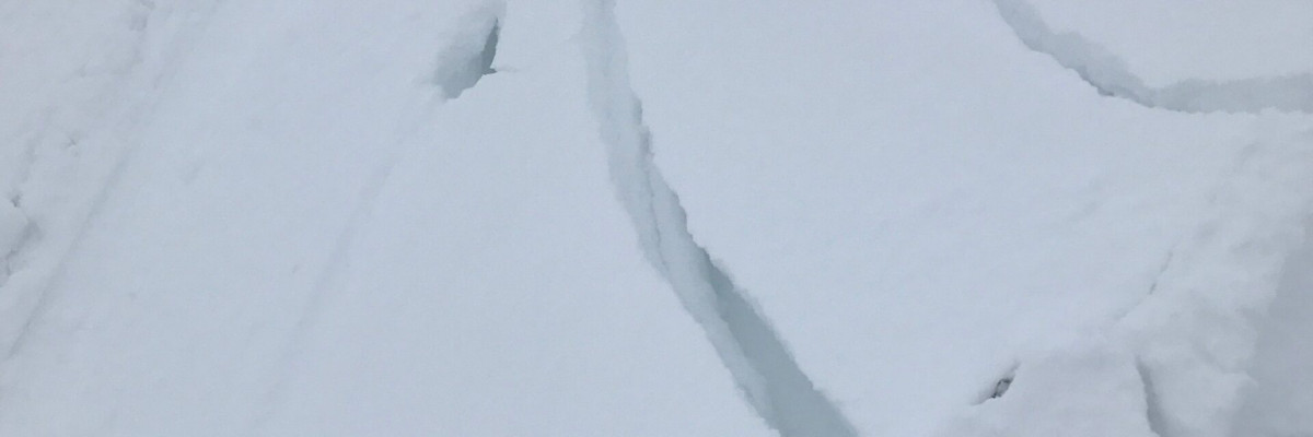
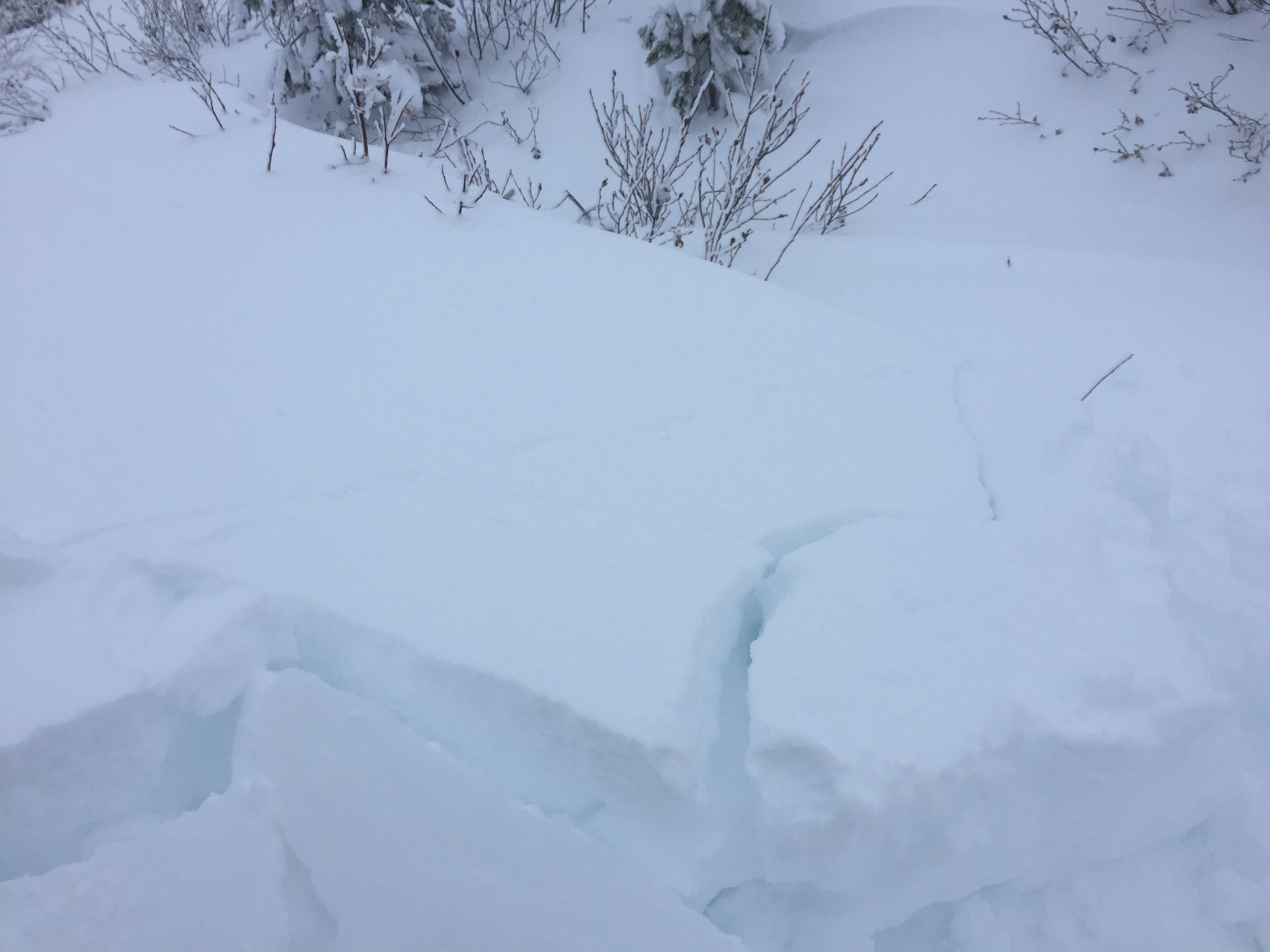
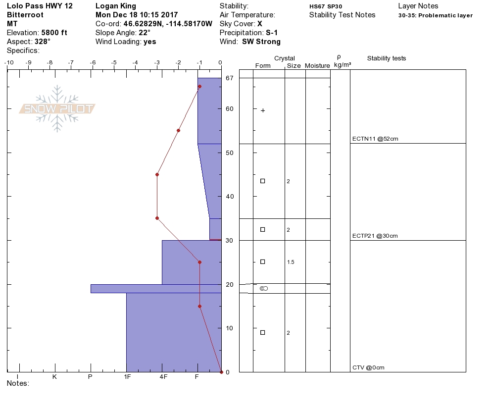
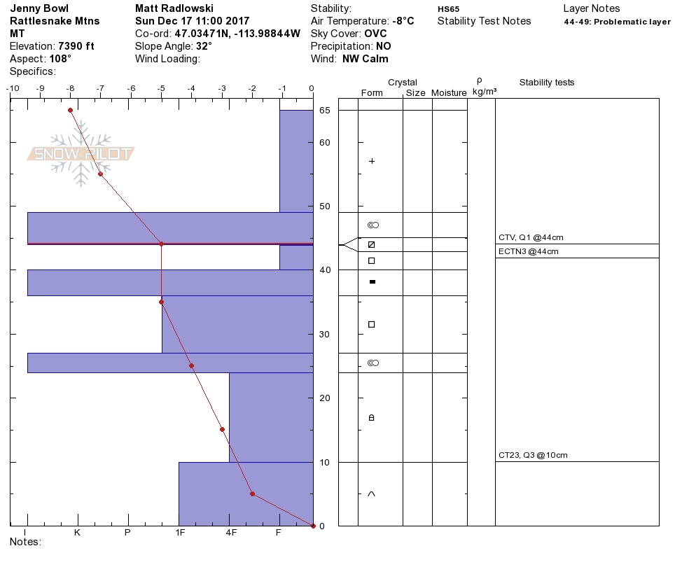
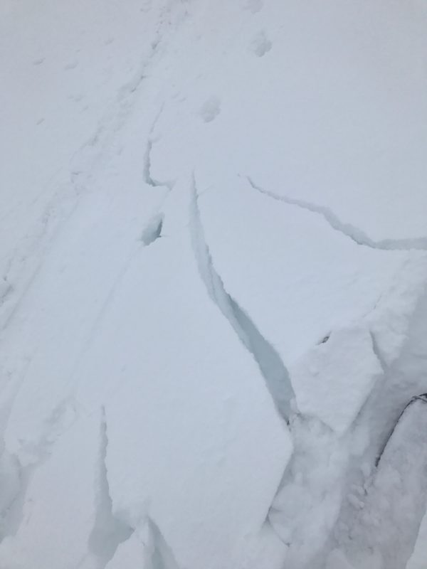
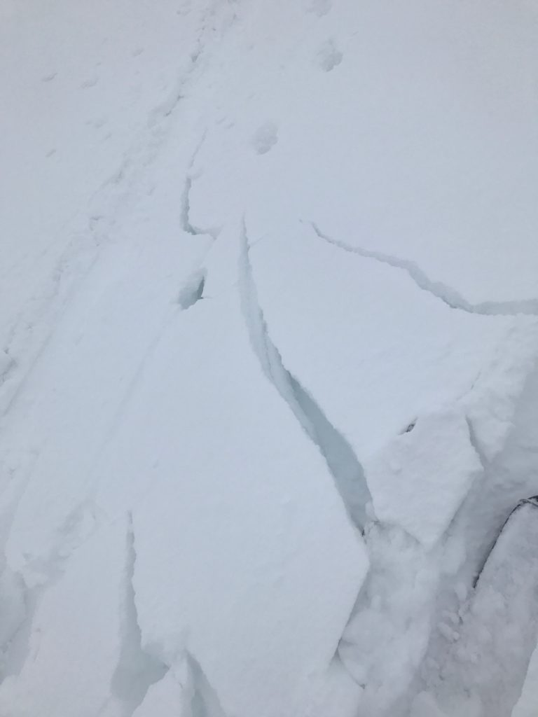
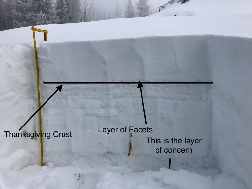
Logan and I toured near Lolo pass yesterday.  We saw active wind transport of snow and got shooting cracks from our skis.  We got facets in our snowpack to propagate in our pit tests.  Matt was in the Rattlesnake on Sunday, and found a poor snowpack structure.

The primary avalanche problem is wind slabs.  Leeward terrain will have large wind slabs.  Look for rounded pillows of snow near ridgelines and recognize signs of instability such as cracking in the surface snow.  These slabs will be very sensitive to human triggers.  Avoid traveling on or under wind loaded slopes.

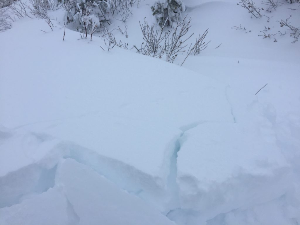
The second avalanche problem is storm slabs.  Storm slabs will be large with depths up to 11 inches.  Give the snowpack time to adjust to the new load.  Look for bullseye data such as localized collapsing and shooting cracks.

The final avalanche problem is persistent slabs. The new snow will stress our weak layers.  We have poor snowpack structure throughout our advisory area. This means careful snowpack evaluation, cautious route-finding, and conservative decision-making are essential to recreate today.  Look for clues from the snowpack shooting cracks and localized collapsing.  Dig a pit on low angle terrain in a safe spot out of runout zones to see how the layers are adjusting to the new load.

Avalanche and Weather Outlook

The northern portion of the advisory area is expected to get more snow and moderate winds.  With the addition of new snow and snow available for transport expect the avalanche danger to rise.

If you are out in the backcountry, please send us your observation, these are very helpful in producing the advisory. Logan will issue a weather update tomorrow  December 20, 2017.

Ski and ride safe.


READ FULL ADVISORY  

Problem 1 - Wind Slabs

  • TYPE

    wind-slabs

    Wind Slabs

    Release of a cohesive layer of snow (a slab) formed by the wind.  Wind typically erodes snow from the upwind sides of terrain features and deposits snow on the downwind side.  Wind slabs are often smooth and rounded and sometimes sound hollow, and can range from soft to hard. Wind slabs that form over a persistent weak layer (surface hoar, depth hoar, or near-surface facets) may be termed Persistent Slabs or may develop into Persistent Slabs.

  • SIZE

    6-7

    3 (Large-Very Large)

    The potential size of avalanche resulting from this problem.

  • LIKELIHOOD

    Likelihood-5

    Likely

    The likelihood of an avalanche resulting from this problem.

  • IMAGE

Leeward terrain will have large wind slabs.  Look for rounded pillows of snow near ridgelines and recognize signs of instability such as cracking in the surface snow.  These slabs will be  very sensitive to human triggers.  Avoid traveling on or under wind loaded slopes.

Problem 2 - Storm Slabs

  • TYPE

    storm-slabs

    Storm Slabs

    Release of a soft cohesive layer (a slab) of new snow which breaks within the storm snow or on the old snow surface. Storm-slab problems typically last between a few hours and few days. Storm-slabs that form over a persistent weak layer (surface hoar, depth hoar, or near-surface facets) may be termed Persistent Slabs or may develop into Persistent Slabs.

  • SIZE

    5-6

    2-3 (Large)

    The potential size of avalanche resulting from this problem.

  • LIKELIHOOD

    Likelihood-5

    Likely

    The likelihood of an avalanche resulting from this problem.

  • ADDED DANGER

    Increased Slope Danger

    Increased/Added Danger

    There is an increased risk of avalanches on these slopes:

    N - North
    NE - Northeast
    E - East
    SE - Southeast
    S - South
    SW - Southwest
    W - West
    NW - Northwest

Storm slabs will be large with depths up to 11 inches.  Give the snowpack time to adjust to the new load.  Look for bullseye data such as localized collapsing and shooting cracks.

Problem 3 - Persistent Slabs

  • TYPE

    persistent-slabs

    Persistent Slabs

    Release of a cohesive layer of soft to hard snow (a slab) in the middle to upper snowpack, when the bond to an underlying persistent weak layer breaks.  Persistent layers include: surface hoar, depth hoar, near-surface facets, or faceted snow. Persistent weak layers can continue to produce avalanches for days, weeks or even months, making them especially dangerous and tricky. As additional snow and wind events build a thicker slab on top of the persistent weak layer, this avalanche problem may develop into a Persistent, Deep-Slab.

  • SIZE

    5-6

    2-3 (Large)

    The potential size of avalanche resulting from this problem.

  • LIKELIHOOD

    Likelihood-5

    Likely

    The likelihood of an avalanche resulting from this problem.

  • ADDED DANGER

    Increased Slope Danger

    Increased/Added Danger

    There is an increased risk of avalanches on these slopes:

    N - North
    NE - Northeast
    E - East
    SE - Southeast
    S - South
    SW - Southwest
    W - West
    NW - Northwest

The new snow will stress our weak layers.  We have poor snowpack structure throughout our advisory area. This means careful snowpack evaluation, cautious route-finding and conservative decision-making are essential to recreate today.  Look for clues from the snowpack shooting cracks and localized collapsing.  Dig a pit on low angle terrain in safe spot out of runout zones to see how the layers are adjusting to the new load.

VIDEO

Lolo Pass 12/18/2017

Observations 12/19/2017

FORECAST & OUTLOOK

Snow levels will rise to between 4000 feet and 5000 feet then crash Wednesday to 2000 feet.  Expect more snow and moderate to strong winds with this system.  The avalanche danger will rise with the addition of more snow. See the forecast here.

This information is the sole responsibility of the Forest Service and does not apply to operating ski areas. The avalanche danger rating expires at midnight tonight but the information can help you make a more informed decision regarding travel in avalanche terrain for the next few days.

Our advisory area includes National Forest System lands in the Bitterroot Mountains from Lost Trail Pass north to Granite Pass, the Rattlesnake Mountains north of Missoula and the Southern Swan and Mission Mountains near Seeley Lake, MT. Avalanche information for the Lookout Pass/St. Regis Basin area is available from the Idaho Panhandle Avalanche Center.