Posted:
Dec 30, 2017 @ 6:59 am

An avalanche warning is in effect for the West central Montana backcountry.  The current avalanche danger is HIGH.  Very dangerous avalanche conditions are present.  Travel in avalanche terrain is not recommended today.  Avoid runout zones.  Human triggered avalanches are very likely, and natural avalanches are likely.

This is Travis Craft with an avalanche warning for Saturday, December 30th, 2017.  This avalanche warning will expire at 6:00 am December 31, 2017.  The warning will either be extended or terminated at that time.

This danger rating does not apply to operating ski areas and is the sole responsibility of the U.S. Forest Service.

 Weather and Snowpack

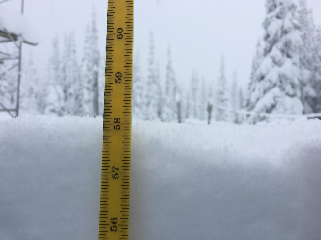
Mountain temperatures range from 27 F to 35 F in the region.  In the Bitterroot winds are calm.  In the northern part of the advisory area, at Point Six, winds are reading 36 mph with gusts of 55 mph out of the W.  The forecast area received 10 to 14 inches of new snow in the last 24 hours. The SWE totals range from 1 to 2.4 inches.

We are adding a significant new load to an already poor snowpack structure.  We have reports of natural activity and triggered avalanches in the advisory area. Travel in avalanche terrain is not recommended today.

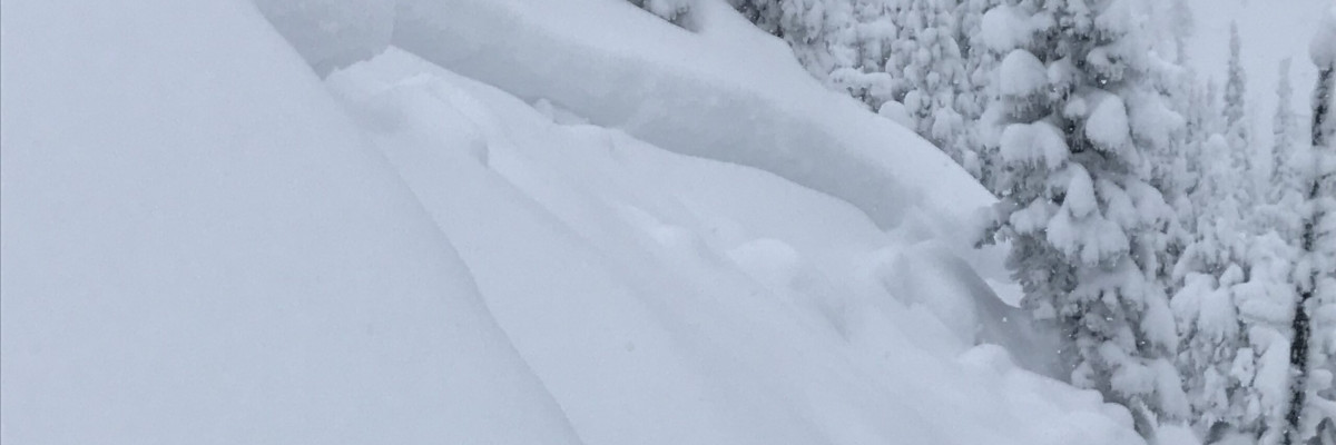
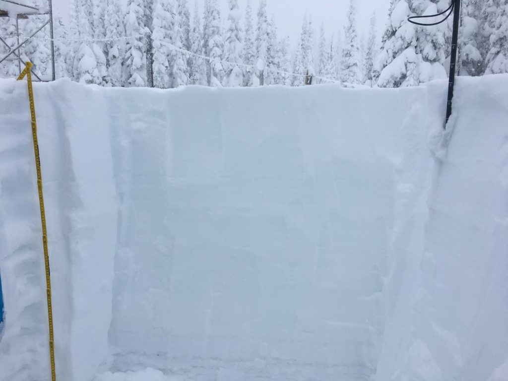
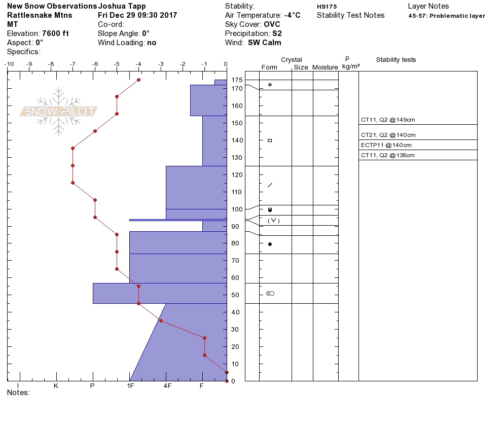
Josh and I went to the Rattlesnake yesterday and saw natural activity and had poor pit tests.  The addition of strong winds today and more snow will keep the avalanche danger High today. We are in a natural avalanche cycle.

The primary concern is storm slabs.  Heavy new snow is sitting on weak lighter snow.  These slabs will grow in size today.  These slabs are large and will be sensitive to triggers. There is potential for these slides to fail and step down to our deeper weak layers in the snowpack.

The second avalanche problem is wind slabs.  These slabs will be large and very sensitive to triggers.  There is potential for these slides to fail and step down to our deeper weak layers in the snowpack.

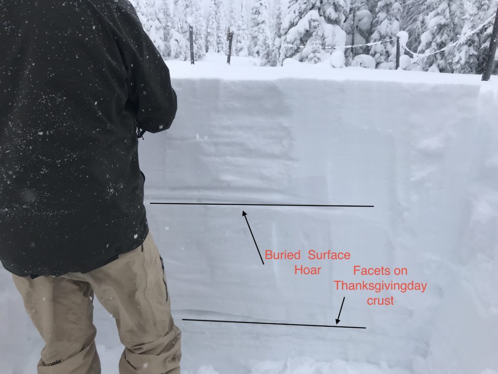
The final avalanche problem is persistent slabs.  We have a report of this layer being triggered in our advisory area.  These slabs are very large and are possible to trigger.

Travel in avalanche terrain is not recommended today.  Avoid runout zones.

Avalanche and Weather Outlook

The advisory area is in a natural avalanche cycle.  We will continue to see strong winds and more loading today.  The avalanche danger will be High. Avoid runout zones. Travel in avalanche terrain is not recommended today.

I will issue an update tomorrow.

Ski and ride safe.

READ FULL ADVISORY  

Problem 1 - Storm Slabs

  • TYPE

    storm-slabs

    Storm Slabs

    Release of a soft cohesive layer (a slab) of new snow which breaks within the storm snow or on the old snow surface. Storm-slab problems typically last between a few hours and few days. Storm-slabs that form over a persistent weak layer (surface hoar, depth hoar, or near-surface facets) may be termed Persistent Slabs or may develop into Persistent Slabs.

  • SIZE

    5-6

    2-3 (Large)

    The potential size of avalanche resulting from this problem.

  • LIKELIHOOD

    Likelihood-7

    Very Likely

    The likelihood of an avalanche resulting from this problem.

These slabs are large and very sensitive to triggers.  We have reports of this layer triggering naturally and stepping down to deeper layers in the snowpack.

Problem 2 - Wind Slabs

  • TYPE

    wind-slabs

    Wind Slabs

    Release of a cohesive layer of snow (a slab) formed by the wind.  Wind typically erodes snow from the upwind sides of terrain features and deposits snow on the downwind side.  Wind slabs are often smooth and rounded and sometimes sound hollow, and can range from soft to hard. Wind slabs that form over a persistent weak layer (surface hoar, depth hoar, or near-surface facets) may be termed Persistent Slabs or may develop into Persistent Slabs.

  • SIZE

    4-5

    2 (Large)

    The potential size of avalanche resulting from this problem.

  • LIKELIHOOD

    Likelihood-6

    Likely/Very Likely

    The likelihood of an avalanche resulting from this problem.

Strong winds have entered the Rattlesnake, Southern Missions, and Southern Swans.  Look for wind slabs to sensitive to triggers.

Problem 3 - Persistent Slabs

  • TYPE

    persistent-slabs

    Persistent Slabs

    Release of a cohesive layer of soft to hard snow (a slab) in the middle to upper snowpack, when the bond to an underlying persistent weak layer breaks.  Persistent layers include: surface hoar, depth hoar, near-surface facets, or faceted snow. Persistent weak layers can continue to produce avalanches for days, weeks or even months, making them especially dangerous and tricky. As additional snow and wind events build a thicker slab on top of the persistent weak layer, this avalanche problem may develop into a Persistent, Deep-Slab.

  • SIZE

    7-8

    3-4 (Very Large)

    The potential size of avalanche resulting from this problem.

  • LIKELIHOOD

    Likelihood-4

    Possible/Likely

    The likelihood of an avalanche resulting from this problem.

We have reports of this layer being active and releasing naturally.

VIDEO

ECTP

12/29/2017

FORECAST & OUTLOOK

We are in a natural avalanche cycle.  Travel in avalanche terrain is not recommended. Avoid runout zones.  The storm should leave our area later today.  Here is the link to the discussion.

This information is the sole responsibility of the Forest Service and does not apply to operating ski areas. The avalanche danger rating expires at midnight tonight but the information can help you make a more informed decision regarding travel in avalanche terrain for the next few days.

Our advisory area includes National Forest System lands in the Bitterroot Mountains from Lost Trail Pass north to Granite Pass, the Rattlesnake Mountains north of Missoula and the Southern Swan and Mission Mountains near Seeley Lake, MT. Avalanche information for the Lookout Pass/St. Regis Basin area is available from the Idaho Panhandle Avalanche Center.