Posted:
Jan 2, 2018 @ 6:43 am

The current avalanche danger is CONSIDERABLE on all slopes above 6000 feet in the West central Montana backcountry.  Careful snowpack evaluation, cautious route-finding, and conservative decision-making are essential to recreate today.  Natural avalanches are possible and human triggered avalanches are likely across the region.  All slopes below 6000 feet are moderate today.

Good morning, this is Travis Craft with the West Central Montana Avalanche Center’s avalanche advisory for January 02, 2018.  This danger rating does not apply to operating ski areas, expires at midnight tonight and is the sole responsibility of the U.S. Forest Service.

Weather and Snowpack

Mountain temperatures range from 4 F to 20 F in the region.  In the Bitterroot winds are 8 mph with gusts of 11 out of the S.  In the northern part of the advisory area, at Point Six, winds are reading 21 mph with gusts of 24 mph out of the WNW.  The forecast area received 0 to 1 inch of new snow in the last 24 hours.

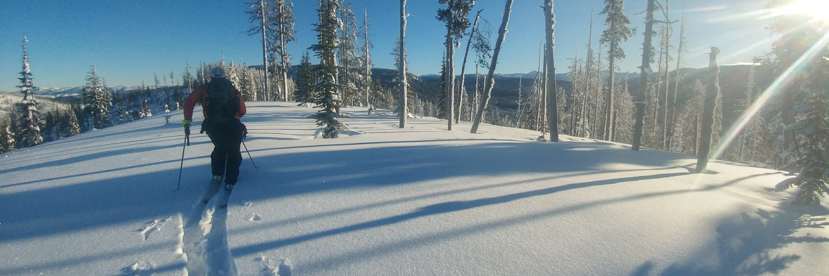
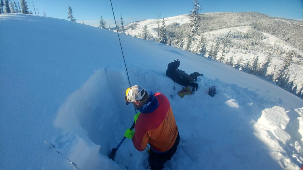
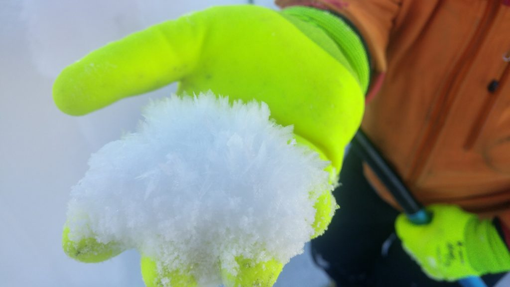
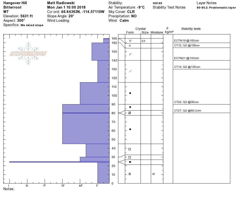
Matt and I toured near Lolo Pass yesterday.  We found the snowpack below 6000 feet to be relatively stable. We have public observations(PB01,  PB02) of the storm slab gaining strength. We got reports of natural activity on North aspects above 7000 feet in the southern Bitterroot on the Thanksgiving crust. We also found surface hoar growth; this will be a layer of concern when it gets buried with the next storm.

Wind slabs are the primary avalanche problem.  These slabs are gaining strength but still will be likely triggered by a human.  Leeward terrain will have large wind slabs.  Look for rounded pillows of snow near ridgelines and recognize signs of instability such as cracking in the surface snow.

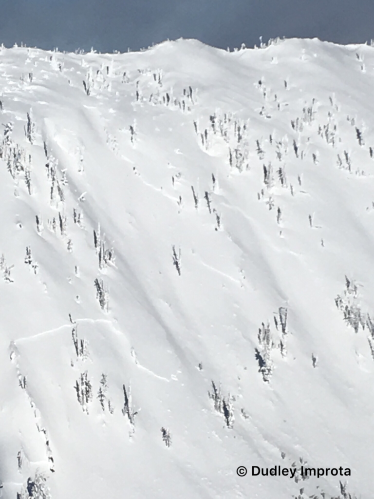
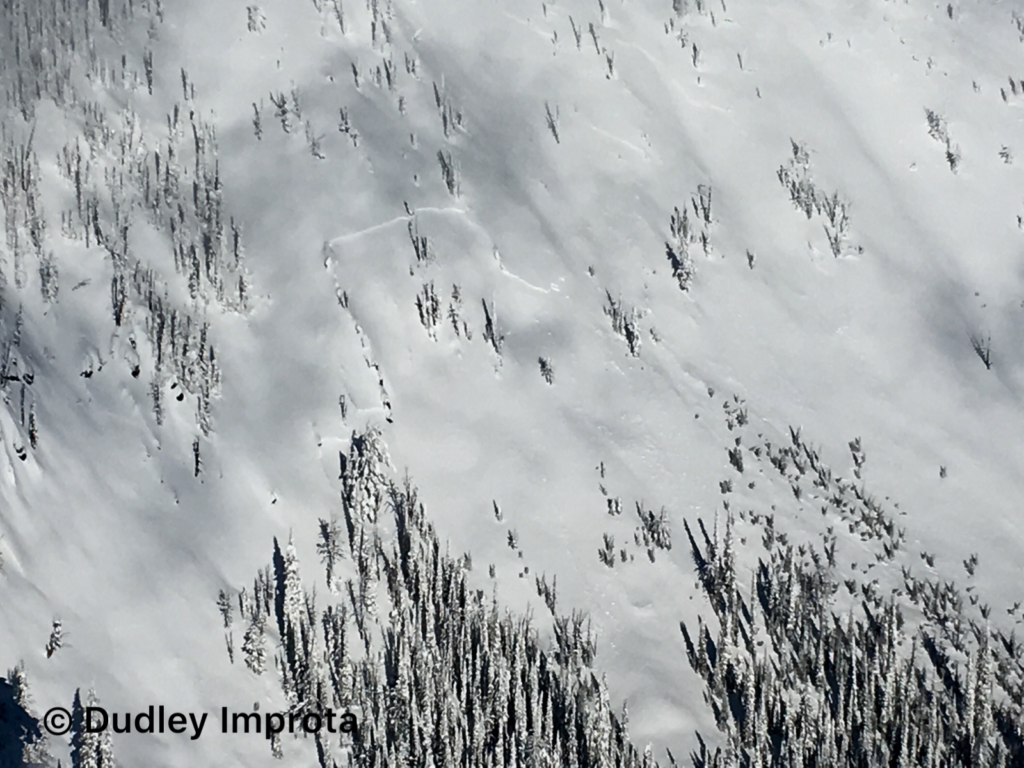
The second avalanche problem is persistent slabs.  The facets on the Thanksgiving crust are reactive on slopes above 6000 feet.  We got observations of this layer releasing naturally yesterday in the southern Bitterroot on a North facing aspect.  Natural activity is a bullseye clue to instability.  The other way to find this layer is to dig a pit in a safe spot out of runout zones and on low angle terrain.

Our next chance for snow will be in the middle of the week.  With the forecast look for the avalanche danger to slowly decrease as the snowpack strengthens.

If you are out in the backcountry, please send us your observation, these are very helpful in producing the advisory.Logan will issue a weather update tomorrow January 03, 2018.

Ski and ride safe.

READ FULL ADVISORY  

Problem 1 - Wind Slabs

  • TYPE

    wind-slabs

    Wind Slabs

    Release of a cohesive layer of snow (a slab) formed by the wind.  Wind typically erodes snow from the upwind sides of terrain features and deposits snow on the downwind side.  Wind slabs are often smooth and rounded and sometimes sound hollow, and can range from soft to hard. Wind slabs that form over a persistent weak layer (surface hoar, depth hoar, or near-surface facets) may be termed Persistent Slabs or may develop into Persistent Slabs.

  • SIZE

    4-5

    2 (Large)

    The potential size of avalanche resulting from this problem.

  • LIKELIHOOD

    Likelihood-5

    Likely

    The likelihood of an avalanche resulting from this problem.

These slabs are gaining strength but still will be likely triggered by a human.  Leeward terrain will have large wind slabs.  Look for rounded pillows of snow near ridgelines and recognize signs of instability such as cracking in the surface snow.

Problem 2 - Persistent Slabs

  • TYPE

    persistent-slabs

    Persistent Slabs

    Release of a cohesive layer of soft to hard snow (a slab) in the middle to upper snowpack, when the bond to an underlying persistent weak layer breaks.  Persistent layers include: surface hoar, depth hoar, near-surface facets, or faceted snow. Persistent weak layers can continue to produce avalanches for days, weeks or even months, making them especially dangerous and tricky. As additional snow and wind events build a thicker slab on top of the persistent weak layer, this avalanche problem may develop into a Persistent, Deep-Slab.

  • SIZE

    5-6

    2-3 (Large)

    The potential size of avalanche resulting from this problem.

  • LIKELIHOOD

    Likelihood-4

    Possible/Likely

    The likelihood of an avalanche resulting from this problem.

The facets on the Thanksgiving crust are reactive on slopes above 6000 feet.  We got observations of this layer releasing naturally yesterday in the southern Bitterroot on a North facing aspect.  Natural activity is a bullseye clue to instability.  The other way to find this layer is to dig a pit in a safe spot out of runout zones and on low angle terrain.

VIDEO

New Years Day Lolo

New Years Day Observations

FORECAST & OUTLOOK

Next chance for snow is mid week.  Here is a link to the discussion.

This information is the sole responsibility of the Forest Service and does not apply to operating ski areas. The avalanche danger rating expires at midnight tonight but the information can help you make a more informed decision regarding travel in avalanche terrain for the next few days.

Our advisory area includes National Forest System lands in the Bitterroot Mountains from Lost Trail Pass north to Granite Pass, the Rattlesnake Mountains north of Missoula and the Southern Swan and Mission Mountains near Seeley Lake, MT. Avalanche information for the Lookout Pass/St. Regis Basin area is available from the Idaho Panhandle Avalanche Center.