
The avalanche danger for the West Central Montana backcountry is Considerable on wind loaded terrain. On non-wind loaded terrain the avalanche danger is Moderate. Large avalanches are likely in areas that have been wind loaded. Cautious route finding, and conservative decision-making are required to navigate dangerous avalanche conditions.
Good morning, this is Logan King with the West Central Montana Avalanche Center’s avalanche advisory for January 27th, 2018. This danger rating does not apply to operating ski areas, expires at midnight tonight and is the sole responsibility of the U.S. Forest Service.
Weather and Snowpack
The Rattlesnake down through the central Bitterroot picked up 3-4 inches of snow last night with temperatures in teens to twenties. The southern Bitterroot received about and inch of snow last night with similar temperatures. The North Fork Jocko snotel picked up 1.2 inches of water for the past 24 hours and around a foot of snow. Winds this morning are from the SSE at Deer Mountain and are gusting to 16 mph. Winds at Mt. Sentinel are 12 mph gusting to 20 mph from the S.
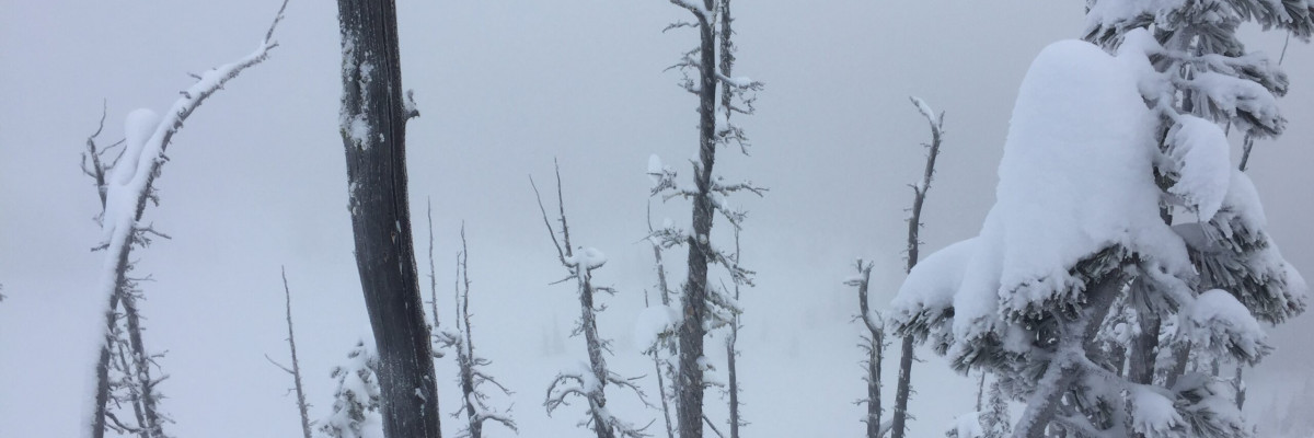
The latest round of snow has been exceptionally variable across the region. The northern portion of the advisory area got the bulk of the snow while the southern tip hardly received any. Conditions vary significantly from North to South, strong upper elevation winds are about the only thing that was uniform across the advisory area. I checked on the wind slab development at upper elevations in the rattlesnake yesterday. Above 7,000 feet we found continued strong winds from the west were producing large wind slabs and some high energy soft wind slabs.
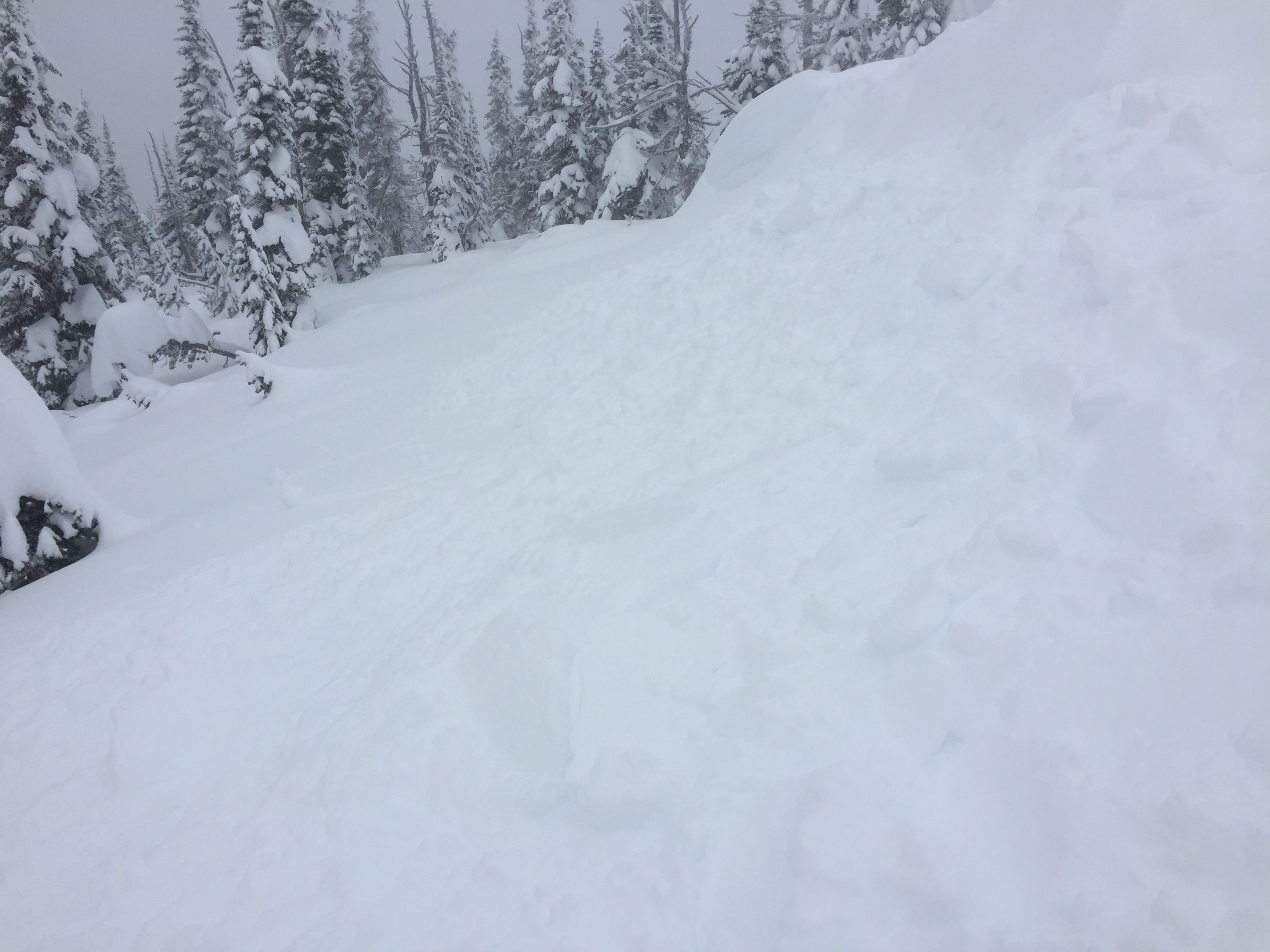
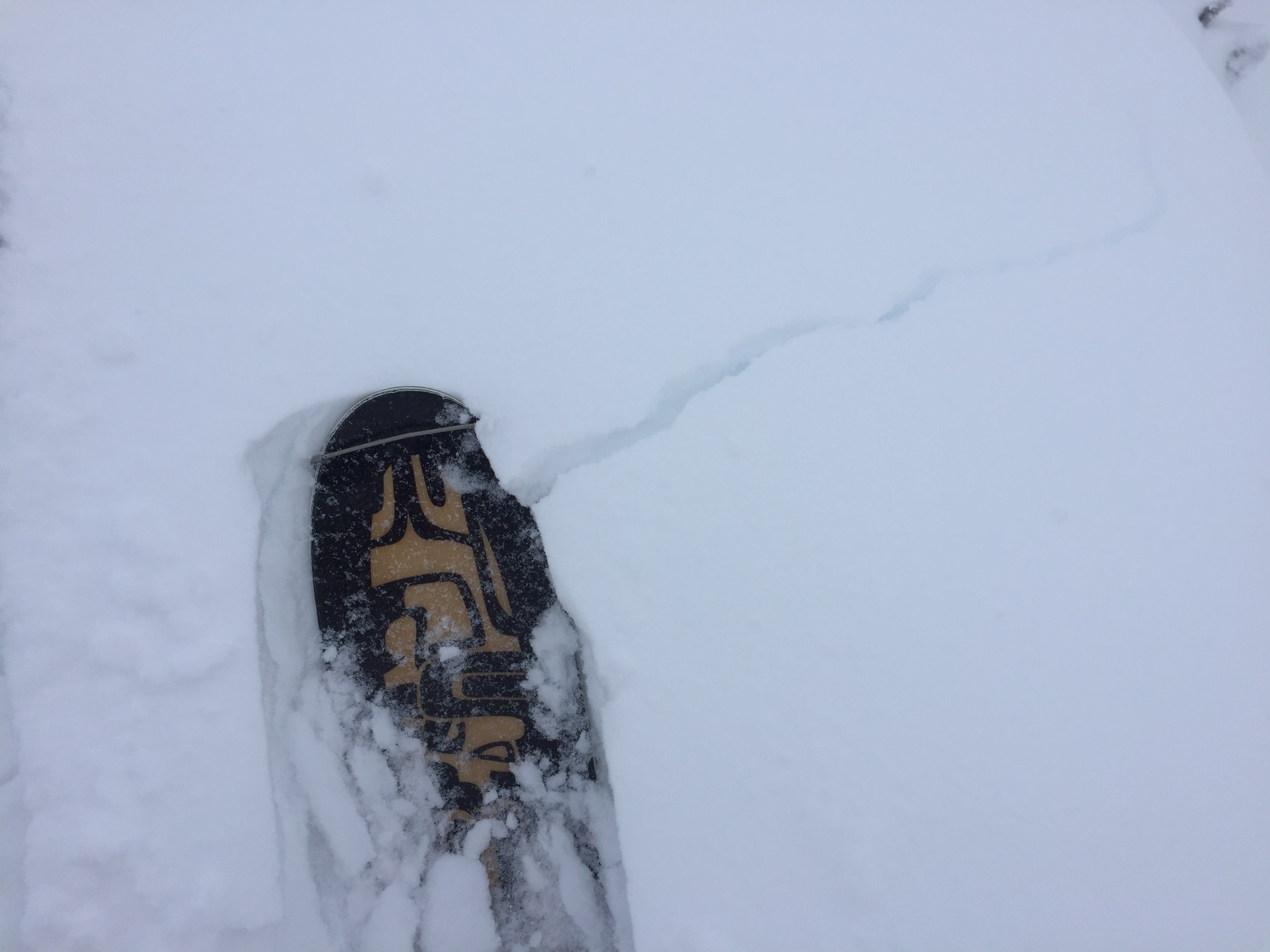
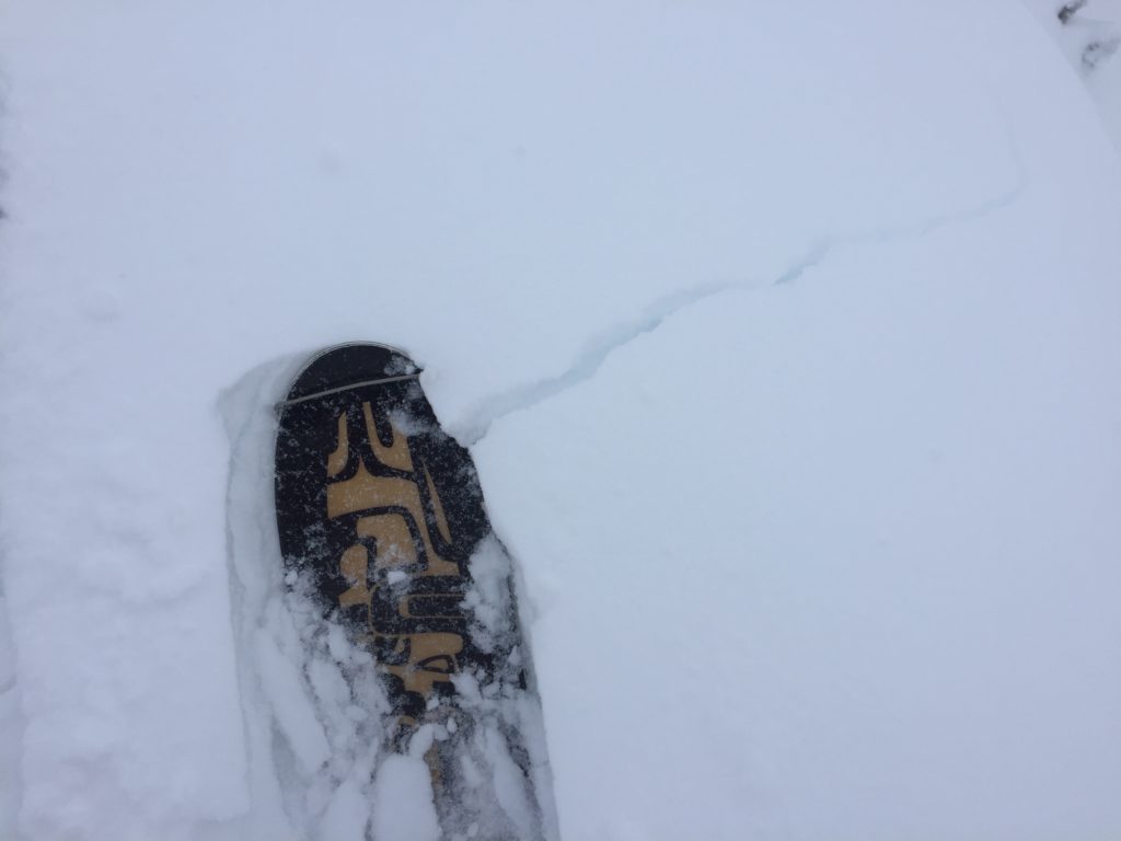
The primary avalanche concern today will be wind slabs. Strong winds and new snow for transport have been building wind slabs over the last few days. Yesterday, wind slabs were small with high energy and will be stiffer today and easily triggered above 7,000 feet on leeward terrain. Avoid terrain that has been wind loaded while traveling in the backcountry today and look for signs like wind pillows, cornices, and shooting cracks.
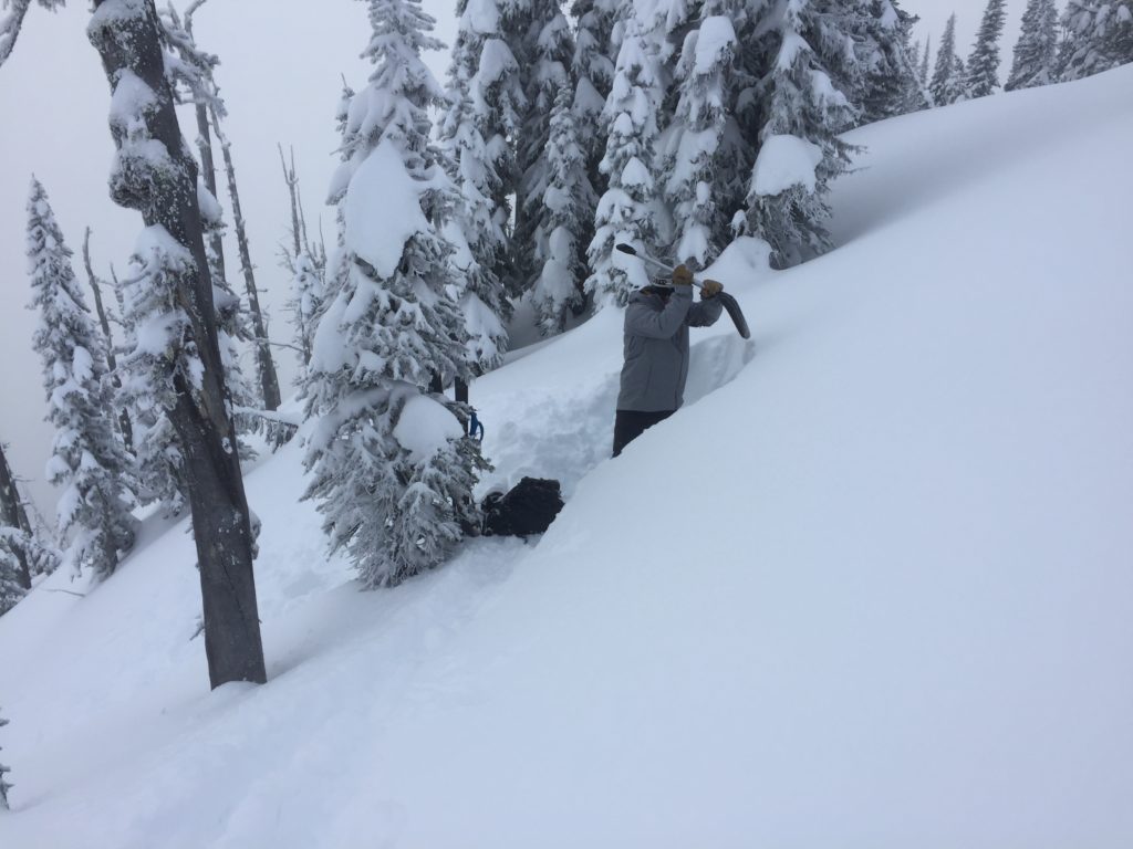
The buried surface hoar is now about 2 feet deep in the snowpack but is still reactive in stability tests. We found this layer to propagate readily with high energy on a shaded aspect with a soft wind slab on top. This layer may be slightly less reactive now but the consequences of a slide continue to increase. The only way to identify this layer is to dig and perform stability tests. Don’t just think about the likelihood of avalanches but consider the consequences of this layer failing before committing to avalanche terrain.
Storm slabs will also be a concern today for areas that received more snow, like the southern Missions and southern Swan ranges. With a foot of lighter snow and over an inch of water, soft storm slabs are possible today. Carefully assess the new snow to determine if it is bonding or if it has formed a suspect slab before traveling on or around avalanche terrain.
Avalanche and Weather Outlook
Light snow and strong winds are expected to continue across the region. The forecast suggests an accumulation of a couple inches each day through the weekend before the next significant system arrives early next week. The avalanche danger will be increasing today as more snow and active winds will further wind slab problems.
The next avalanche advisory will be issued on Monday, January 29th, 2018.
Ski and ride safe.


