Posted:
Jan 30, 2018 @ 6:35 am

The current avalanche danger is MODERATE in the west central Montana backcountry. Human triggered avalanches are possible.  Heightened avalanche conditions exist on specific terrain features.  Evaluate snow and terrain carefully and identify features of concern.

Good morning, this is Travis Craft with the West Central Montana Avalanche Center’s avalanche advisory for January 30, 2018.  This danger rating does not apply to operating ski areas, expires at midnight tonight and is the sole responsibility of the U.S. Forest Service.

Weather and Snowpack

Mountain temperatures range from 30 F to 38 F in the region.  In the Bitterroot winds are 16 mph with gusts of 39 mph out of the WSW.  In the northern part of the advisory area, winds are reading 34 mph with gusts of 46 mph out of the West.  The forecast area received 0 to 2 inches of new snow in the last 24 hours.

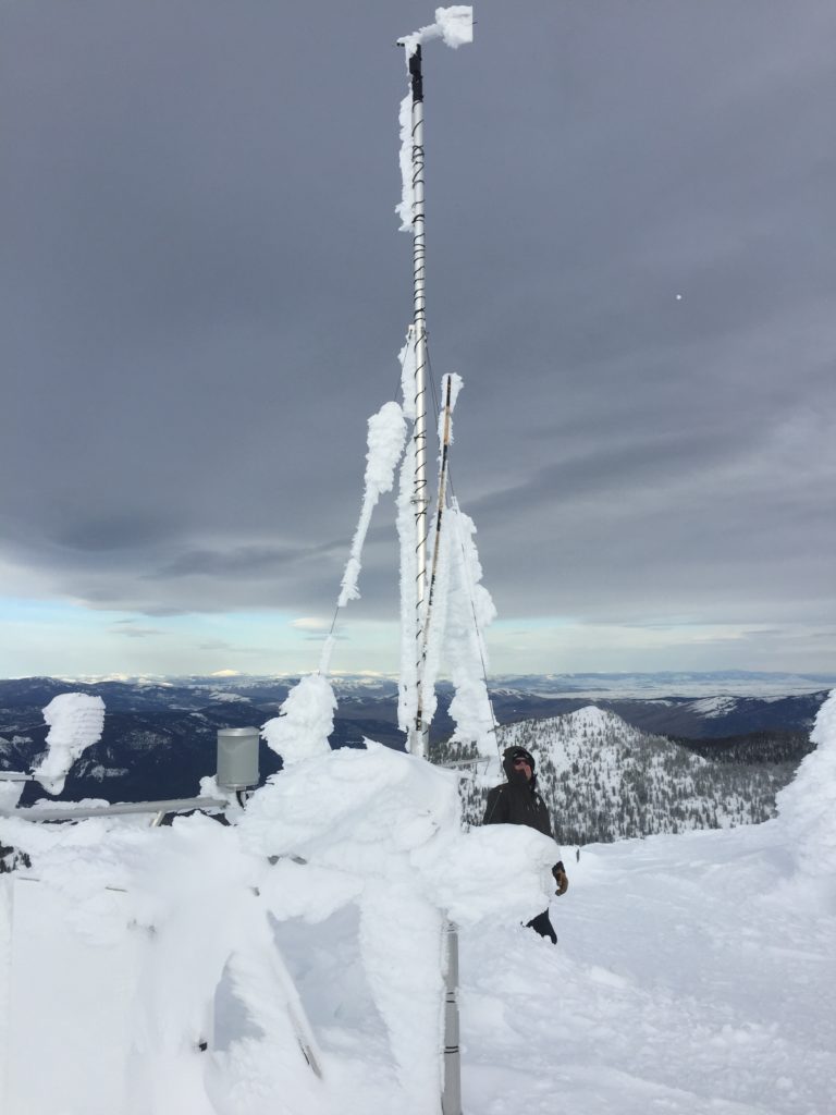
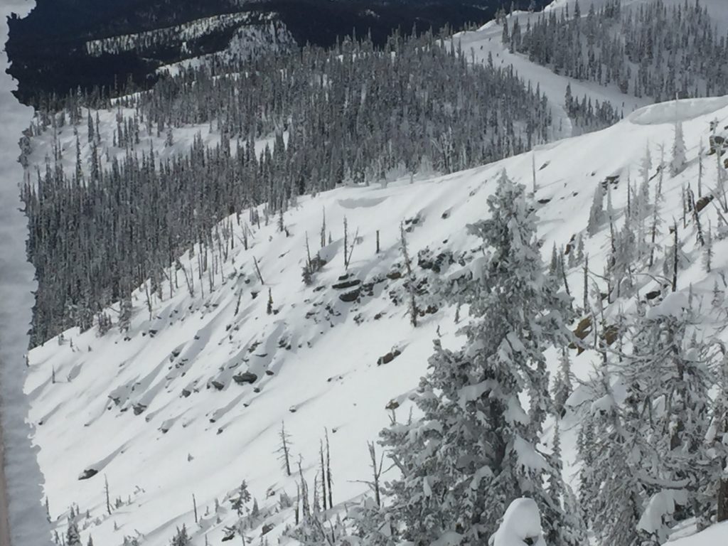
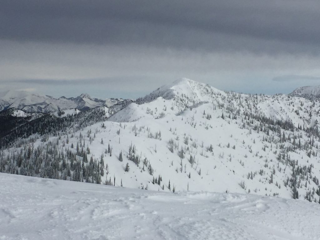
Logan, Steve and I went to the Rattlesnake yesterday to repair the anemometer on the Point Six RAWS station.  We saw many loose wet releases in the Rattlesnake.  The snowpack is strengthening.  There are large wind slabs at higher elevations on leeward aspects.  Overnight we had strong winds gusting to 60 mph. The snowpack did not refreeze till 600 am below 6000 feet.

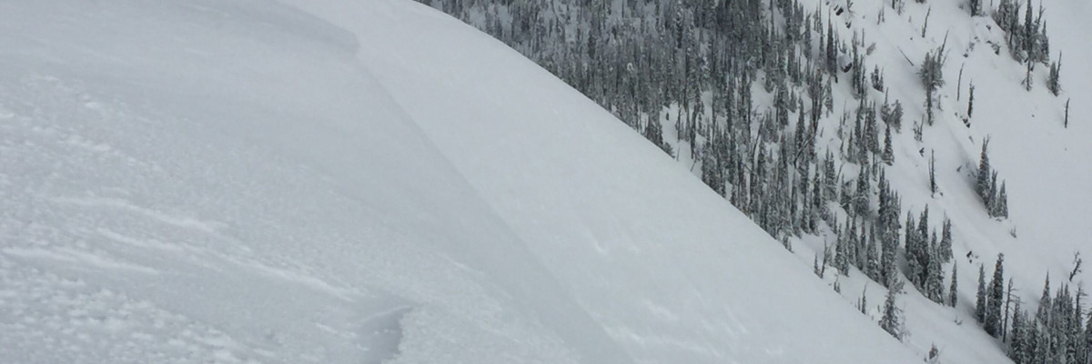
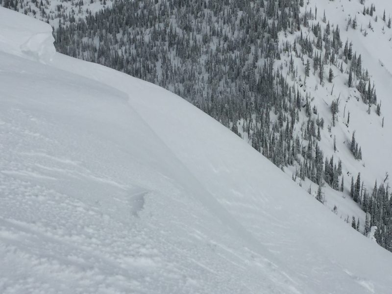
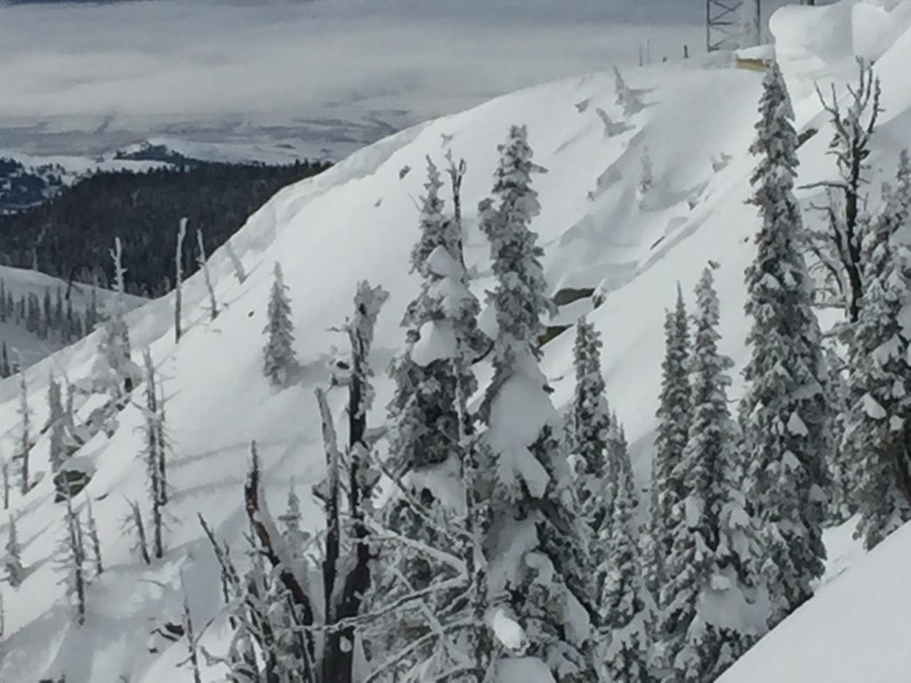
The primary avalanche problem is wind slabs.  Over the last 3 days, wind slabs have developed on leeward aspects. Look for rounded pillows of snow near ridgelines and on cross-loaded slopes. Recognize signs of instability such as cracking in the surface snow.  Avoid slopes that are wind loaded.

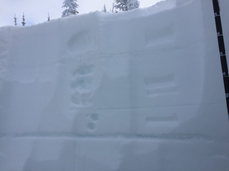
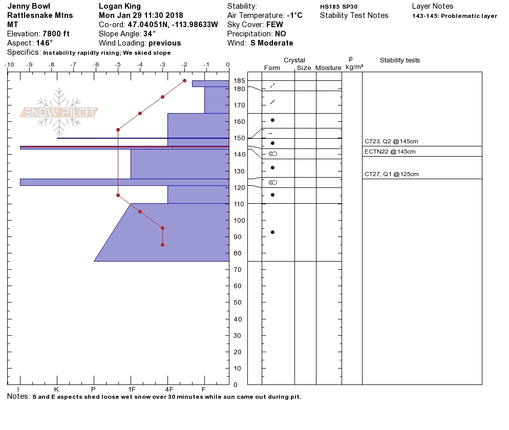
The second avalanche problem is persistent slabs.  There is buried surface hoar on shaded aspects and a melt-freeze crust on southern aspects.  Dig a pit three feet down and see if you find these layers.  Perform a stability test to assess these layers.

Avalanche and Weather Outlook

A cold front is pushing into the area now.  We are expected to pick up more snow and have strong winds. See the forecast here.   Expect the avalanche danger to increase with these conditions.  I will issue the next advisory on Thursday, February 01, 2018.

Ski and ride safe.


READ FULL ADVISORY  

Problem 1 - Wind Slabs

  • TYPE

    wind-slabs

    Wind Slabs

    Release of a cohesive layer of snow (a slab) formed by the wind.  Wind typically erodes snow from the upwind sides of terrain features and deposits snow on the downwind side.  Wind slabs are often smooth and rounded and sometimes sound hollow, and can range from soft to hard. Wind slabs that form over a persistent weak layer (surface hoar, depth hoar, or near-surface facets) may be termed Persistent Slabs or may develop into Persistent Slabs.

  • SIZE

    4-5

    2 (Large)

    The potential size of avalanche resulting from this problem.

  • LIKELIHOOD

    Likelihood-3

    Possible

    The likelihood of an avalanche resulting from this problem.

  • IMAGE

Over the last 3 days, wind slabs have developed on leeward aspects. Look for rounded pillows of snow near ridgelines and on cross-loaded slopes. Recognize signs of instability such as cracking in the surface snow. Avoid slopes that are wind loaded.

Problem 2 - Persistent Slabs

  • TYPE

    persistent-slabs

    Persistent Slabs

    Release of a cohesive layer of soft to hard snow (a slab) in the middle to upper snowpack, when the bond to an underlying persistent weak layer breaks.  Persistent layers include: surface hoar, depth hoar, near-surface facets, or faceted snow. Persistent weak layers can continue to produce avalanches for days, weeks or even months, making them especially dangerous and tricky. As additional snow and wind events build a thicker slab on top of the persistent weak layer, this avalanche problem may develop into a Persistent, Deep-Slab.

  • SIZE

    4-5

    2 (Large)

    The potential size of avalanche resulting from this problem.

  • LIKELIHOOD

    Likelihood-3

    Possible

    The likelihood of an avalanche resulting from this problem.

  • IMAGE

There is buried surface hoar on shaded aspects and a melt-freeze crust on southern aspects.  Dig a pit three feet down and see if you find these layers.  Perform a stability test to assess these layers.


VIDEO

Advisory 01/30/2018

Advisory 01/30/2018

FORECAST & OUTLOOK

A cold front is pushing into the area now.  We are expected to pick up more snow and have strong winds.  See the forecast here.  With this forecast expect the avalanche danger to increase.

This information is the sole responsibility of the Forest Service and does not apply to operating ski areas. The avalanche danger rating expires at midnight tonight but the information can help you make a more informed decision regarding travel in avalanche terrain for the next few days.

Our advisory area includes National Forest System lands in the Bitterroot Mountains from Lost Trail Pass north to Granite Pass, the Rattlesnake Mountains north of Missoula and the Southern Swan and Mission Mountains near Seeley Lake, MT. Avalanche information for the Lookout Pass/St. Regis Basin area is available from the Idaho Panhandle Avalanche Center.