Posted:
Feb 6, 2018 @ 6:06 am

The avalanche warning has expired and the current avalanche danger is CONSIDERABLE for the west central Montana backcountry.  Human triggered avalanches are likely in specific terrain. With dangerous avalanche conditions, cautious route-finding and conservative decisions are critical for backcountry travel today.

Good morning, this is Logan King with the West Central Montana Avalanche Center’s avalanche advisory for February 06, 2018.  This danger rating does not apply to operating ski areas, expires at midnight tonight and is the sole responsibility of the U.S. Forest Service.

Weather and Snowpack

The storm has subsided and conditions have settled down a bit. Winds are calm at 5 mph gusting to 8 mph from the WSW. Snowfall has diminished and the advisory area picked up 1-4 inches of snow last night adding an additional .1-.2 inches of SWE. Temperatures have dropped below freezing and are averaging in the upper-twenties this morning.

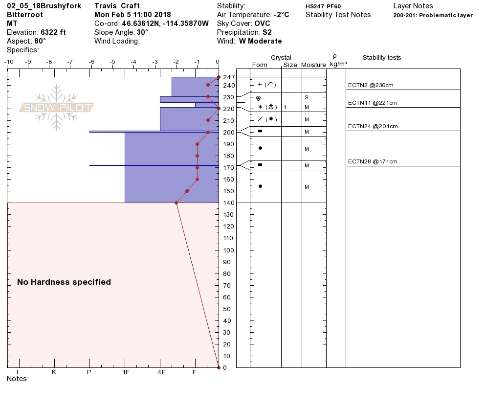
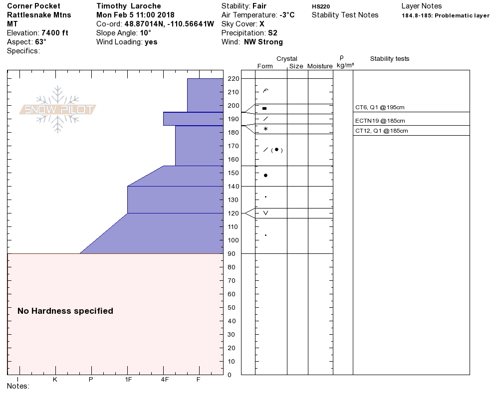
Travis and I rode in the Brushy Fork of the central Bitterroot yesterday while Tim toured in the Rattlesnake. Some cracking and whumphing was observed but conditions were rapidly improving yesterday. The cooler temps and dropping rain line helped the snowpack to settle and bond and conditions were noticeable more settled by mid-day.

The greatest concern today will be wind slabs. Sustained strong winds over the weekend paired with plenty of snow for transport have resulted in large windslabs above 6,000 feet. These wind slabs will easily be triggered by skiers or riders on leeward terrain and on features that have been cross loaded. Carefully evaluate the landscape to identify areas of wind loading before traveling near avalanche terrain.

The secondary concern today will be storm slabs. We found the storm slabs to be settling and bonding already yesterday and cool temps will further aid this process. Keep in mind that a large load of snow has been added over the last few days and even though it is starting to bond the new snow will be suspect for another day or so.

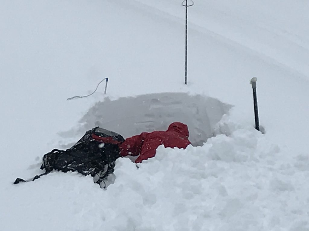
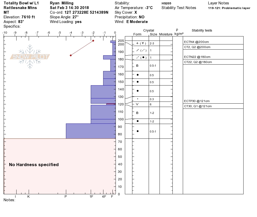
Persistent slabs are the final avalanche concern. The surface hoar that has been problematic is now buried pretty deep in most locations but when its found closer to the surface it continues to propagate readily in stability test. The only way to know if this layer is present is to dig pits and perform stability tests. The persistent weak layers are less likely to trigger now but if they do fail, it will result in very large avalanches. Be very mindful of the consequences of this layer failing.

Avalanche and Weather Outlook

The avalanche danger will continue to slowly decrease as the snow settles today and tomorrow before the next round of high water snow begins around Thursday. Minimal accumulations of snow will continue with light winds for the next day or two. The next storm looks to set up similarly to the last one with warm temperatures, high winds, and complex rain/snow boundaries.

Ski and ride safe.

READ FULL ADVISORY  

Problem 1 - Wind Slabs

  • TYPE

    wind-slabs

    Wind Slabs

    Release of a cohesive layer of snow (a slab) formed by the wind.  Wind typically erodes snow from the upwind sides of terrain features and deposits snow on the downwind side.  Wind slabs are often smooth and rounded and sometimes sound hollow, and can range from soft to hard. Wind slabs that form over a persistent weak layer (surface hoar, depth hoar, or near-surface facets) may be termed Persistent Slabs or may develop into Persistent Slabs.

  • SIZE

    5-6

    2-3 (Large)

    The potential size of avalanche resulting from this problem.

  • LIKELIHOOD

    Likelihood-5

    Likely

    The likelihood of an avalanche resulting from this problem.

Active winds and lots of snow for transport have created large wind slabs on lee terrain above 6,000 feet.

Problem 2 - Storm Slabs

  • TYPE

    storm-slabs

    Storm Slabs

    Release of a soft cohesive layer (a slab) of new snow which breaks within the storm snow or on the old snow surface. Storm-slab problems typically last between a few hours and few days. Storm-slabs that form over a persistent weak layer (surface hoar, depth hoar, or near-surface facets) may be termed Persistent Slabs or may develop into Persistent Slabs.

  • SIZE

    4-5

    2 (Large)

    The potential size of avalanche resulting from this problem.

  • LIKELIHOOD

    Likelihood-4

    Possible/Likely

    The likelihood of an avalanche resulting from this problem.

Heavy wet storm slabs have formed across the region. There are multiple density and temperature changes in the new snow. This new snow will be suspect until it has had time to heal.

Problem 3 - Persistent Slabs

  • TYPE

    persistent-slabs

    Persistent Slabs

    Release of a cohesive layer of soft to hard snow (a slab) in the middle to upper snowpack, when the bond to an underlying persistent weak layer breaks.  Persistent layers include: surface hoar, depth hoar, near-surface facets, or faceted snow. Persistent weak layers can continue to produce avalanches for days, weeks or even months, making them especially dangerous and tricky. As additional snow and wind events build a thicker slab on top of the persistent weak layer, this avalanche problem may develop into a Persistent, Deep-Slab.

  • SIZE

    7-8

    3-4 (Very Large)

    The potential size of avalanche resulting from this problem.

  • LIKELIHOOD

    Likelihood-3

    Possible

    The likelihood of an avalanche resulting from this problem.

  • ADDED DANGER

    Increased Slope Danger

    Increased/Added Danger

    There is an increased risk of avalanches on these slopes:

    N - North
    NE - Northeast
    E - East
    SE - Southeast
    NW - Northwest

Crusts and buried surface hoar are still problematic in the advisory area. These layers continue to get deeper in the snowpack but are only increasing in consequence.

VIDEO

FORECAST & OUTLOOK

The forecast suggest light snow showers off and on for the next two days. Accumulations will be minimal and winds will remain calm.

This information is the sole responsibility of the Forest Service and does not apply to operating ski areas. The avalanche danger rating expires at midnight tonight but the information can help you make a more informed decision regarding travel in avalanche terrain for the next few days.

Our advisory area includes National Forest System lands in the Bitterroot Mountains from Lost Trail Pass north to Granite Pass, the Rattlesnake Mountains north of Missoula and the Southern Swan and Mission Mountains near Seeley Lake, MT. Avalanche information for the Lookout Pass/St. Regis Basin area is available from the Idaho Panhandle Avalanche Center.