Posted:
Feb 8, 2018 @ 6:22 am

A considerable avalanche danger exists on wind loaded terrain across the West Central Montana backcountry. On all other terrain the avalanche danger is moderate but is trending towards instability by this afternoon. Conditions will be dynamic today, continually re-evaluate conditions and terrain if you are out in the backcountry.

Good morning, this is Logan King with the West Central Montana Avalanche Center’s avalanche advisory for Thursday,February 08, 2018.  This danger rating does not apply to operating ski areas, expires at midnight tonight and is the sole responsibility of the U.S. Forest Service.

Weather and Snowpack

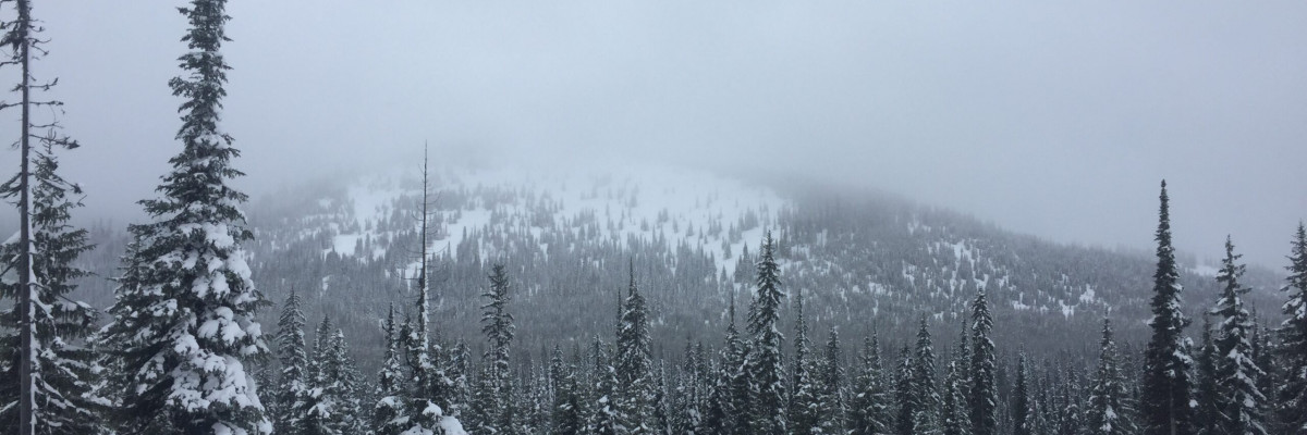
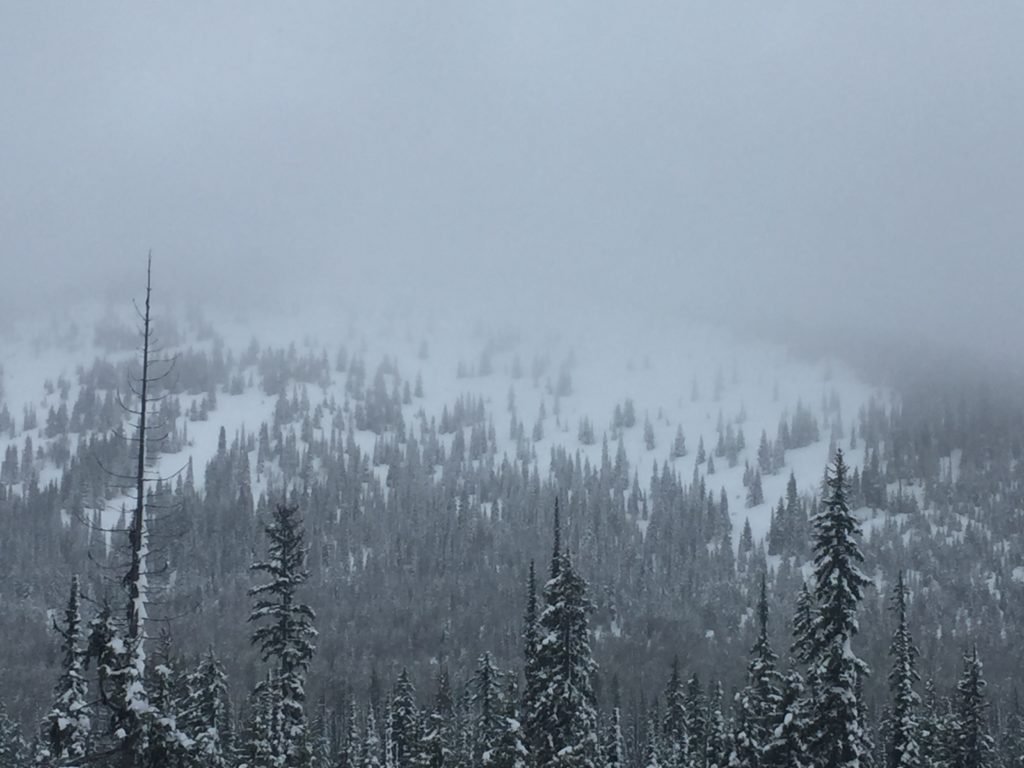
Snow showers and rain continue to impact the region this morning. Over the past 24 hours 1-4 inches of snow have accumulated. Temperatures did not drop below freezing last night and rain is falling to about 5,500 feet as of 5 a.m. Water totals this morning are .5-1.1 inches from the Central Bitterroot to the northern extent of the advisory area. The Southern Bitterroot has had significantly less precipitations thus far. Winds this morning are out of the SW-WSW in the teens gusting to the upper-twenties.

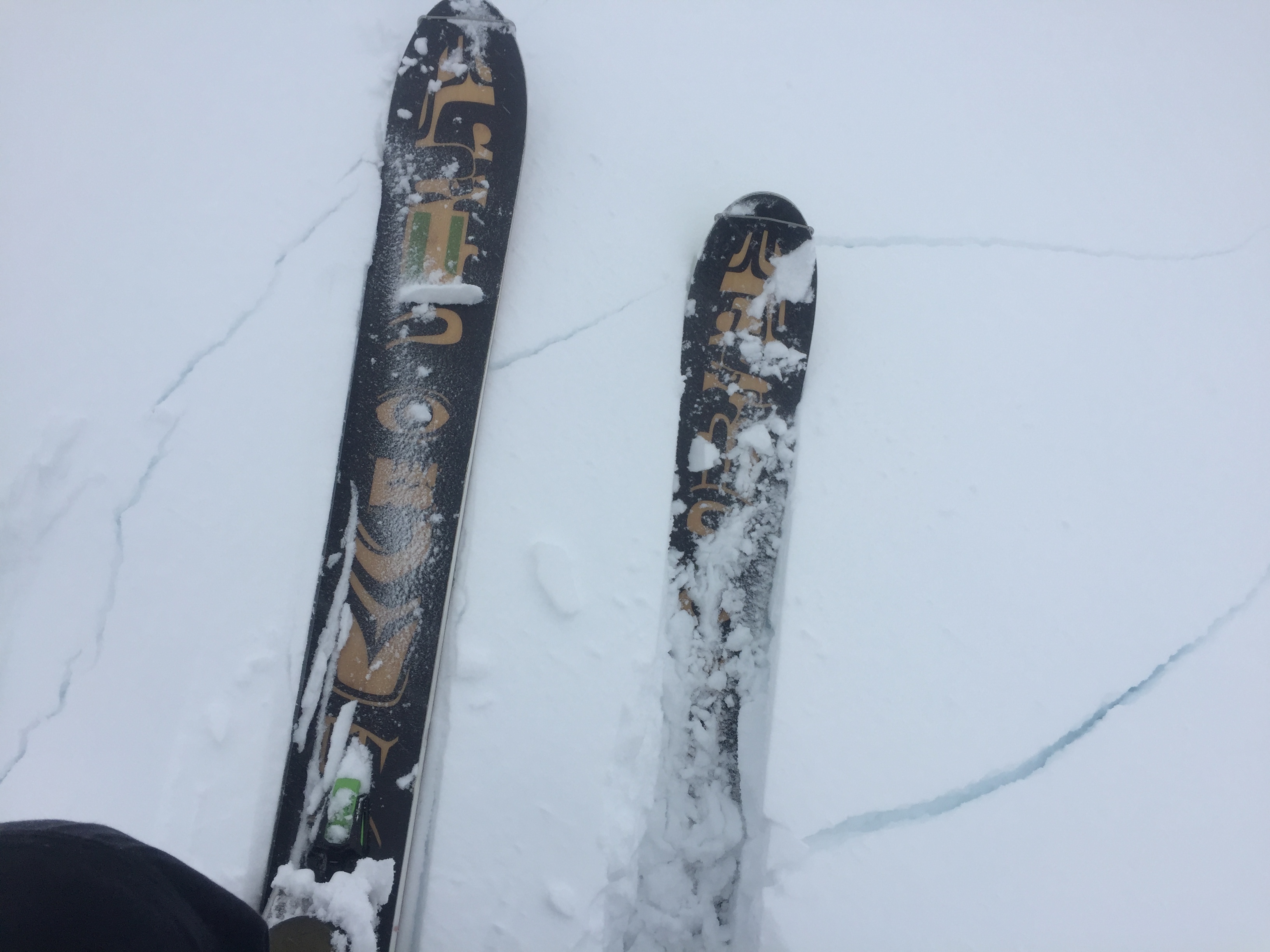
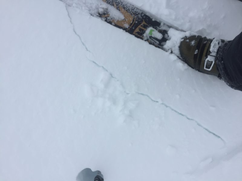
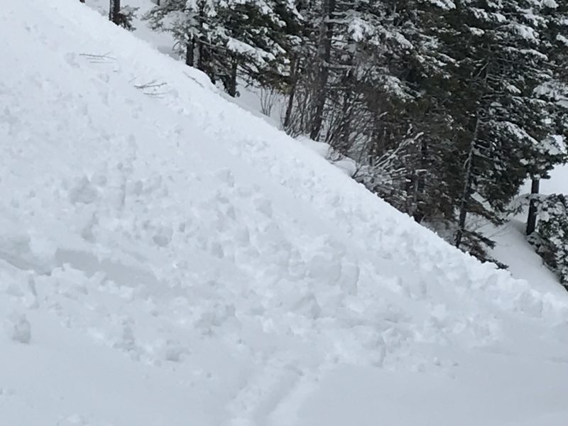
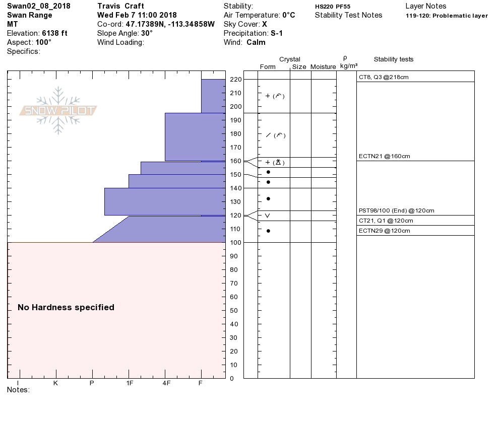
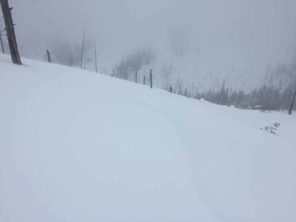
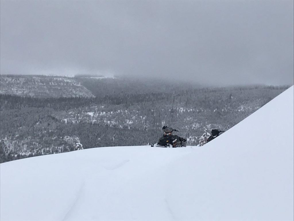
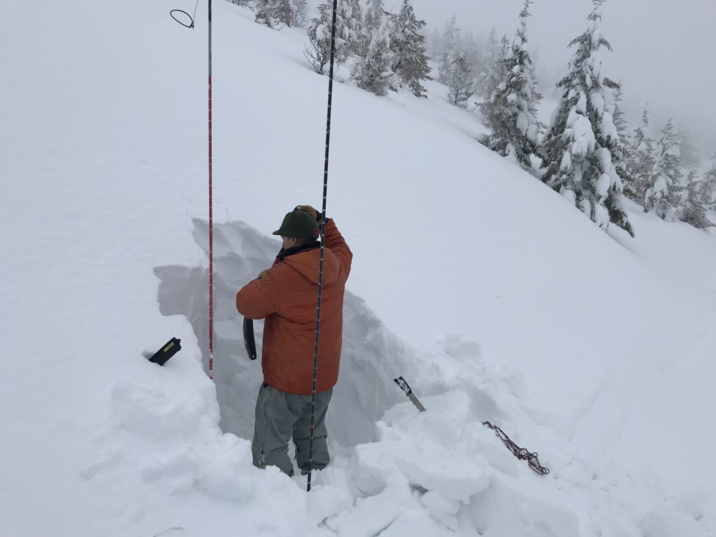
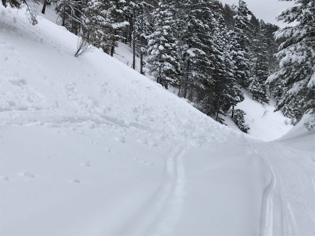
Variable conditions are prevalent today and will require keen observation and evaluation. I toured near Lolo pass yesterday and found strong winds that were cross loading slopes. The wind loaded areas were touchy and shooting cracks were easy to initiate while traveling on or near wind deposits. Travis and Tim were in the Southern Swans yesterday and also found wind slabs along with signs of loose wet activity.

Wind slabs are the number one concern today. Winds were strong yesterday and have continued through the night. Large wind slabs have formed near ridges and smaller ones can be found on cross loaded terrain. Carefully look for signs of wind loading and if you observe shooting cracks or other signs of wind slabs move to a different aspect.

Mild temperatures and mixed precipitation are expected today which will lead to continued loose wet avalanche activity. Look for indicators such as roller balls to identify the surface instability and avoid terrain traps that increase the consequences of a small slide. Rain line is going to climb this morning until the cold front begins to move into the region later today. With extended rain on snow, wet slab avalanches can become problematic as the day progresses. Avoid steep terrain where the snowpack is showing signs of saturation as wet slabs are notoriously hard to predict.

Persistent slabs are the final problem that should be on your radar today. Buried surface hoar and crust have become less sensitive since the last storm cycle. Although less reactive these layers are now deeply buried, creating the potential for very large avalanches. Persistent slabs are low probability and high consequence, so avoid likely trigger points like shallow and rocky areas.

Avalanche and Weather Outlook

The forecast suggest rain to 6,000 feet across the advisory area today and dropping this afternoon leading to heavy snow into friday. Strong winds are also expected and look to shift directions as the front approaches. Conditions have the potential to change rapidly today and are largely dependent on timing. Avalanche conditions will be on the rise as precipitaion and winds increase.

Ski and ride safe.

READ FULL ADVISORY  

Problem 1 - Wind Slabs

  • TYPE

    wind-slabs

    Wind Slabs

    Release of a cohesive layer of snow (a slab) formed by the wind.  Wind typically erodes snow from the upwind sides of terrain features and deposits snow on the downwind side.  Wind slabs are often smooth and rounded and sometimes sound hollow, and can range from soft to hard. Wind slabs that form over a persistent weak layer (surface hoar, depth hoar, or near-surface facets) may be termed Persistent Slabs or may develop into Persistent Slabs.

  • SIZE

    3-4

    1-2 (Small-Large)

    The potential size of avalanche resulting from this problem.

  • LIKELIHOOD

    Likelihood-4

    Possible/Likely

    The likelihood of an avalanche resulting from this problem.

  • IMAGE

Small to Large wind slabs have formed near ridges.

Problem 2 - Loose Wet

  • TYPE

    loose-wet

    Loose Wet

    Release of wet unconsolidated snow or slush. These avalanches typically occur within layers of wet snow near the surface of the snowpack, but they may quickly gouge into lower snowpack layers. Like Loose-Dry Avalanches,they start at a point and entrain snow as they move downhill, forming a fan-shaped avalanche. They generally move slowly, but can contain enough mass to cause significant damage to trees, cars or buildings. Other names for loose-wet avalanches include point-release avalanches or sluffs. Loose-wet avalanches can trigger slab avalanches that break into deeper snow layers.

  • SIZE

    1-2

    < 1 (Small)

    The potential size of avalanche resulting from this problem.

  • LIKELIHOOD

    Likelihood-4

    Possible/Likely

    The likelihood of an avalanche resulting from this problem.

  • IMAGE

Loose wet avalanches are possible in steep terrain.

Problem 3 - Wet Slabs

  • TYPE

    wet-slabs

    Wet Slabs

    Release of a cohesive layer of snow (a slab) that is generally moist or wet when the flow of liquid water weakens the bond between the slab and the surface below (snow or ground). They often occur during prolonged warming events and/or rain-on-snow events. Wet slabs can be very destructive.

  • SIZE

    3-4

    1-2 (Small-Large)

    The potential size of avalanche resulting from this problem.

  • LIKELIHOOD

    Likelihood-3

    Possible

    The likelihood of an avalanche resulting from this problem.

Wet slabs will be an increasing concern as water is added to the snowpack today.

Problem 4 - Persistent Slabs

  • TYPE

    persistent-slabs

    Persistent Slabs

    Release of a cohesive layer of soft to hard snow (a slab) in the middle to upper snowpack, when the bond to an underlying persistent weak layer breaks.  Persistent layers include: surface hoar, depth hoar, near-surface facets, or faceted snow. Persistent weak layers can continue to produce avalanches for days, weeks or even months, making them especially dangerous and tricky. As additional snow and wind events build a thicker slab on top of the persistent weak layer, this avalanche problem may develop into a Persistent, Deep-Slab.

  • SIZE

    7-8

    3-4 (Very Large)

    The potential size of avalanche resulting from this problem.

  • LIKELIHOOD

    Likelihood-2

    Unlikely/Possible

    The likelihood of an avalanche resulting from this problem.

Buried Surface hoar is still suspect in shallow areas.

FORECAST & OUTLOOK

The forecast suggest rain to 6,000 feet across the advisory area today and dropping this afternoon leading to heavy snow into friday. Strong winds are also expected and look to shift directions as the front approaches.

This information is the sole responsibility of the Forest Service and does not apply to operating ski areas. The avalanche danger rating expires at midnight tonight but the information can help you make a more informed decision regarding travel in avalanche terrain for the next few days.

Our advisory area includes National Forest System lands in the Bitterroot Mountains from Lost Trail Pass north to Granite Pass, the Rattlesnake Mountains north of Missoula and the Southern Swan and Mission Mountains near Seeley Lake, MT. Avalanche information for the Lookout Pass/St. Regis Basin area is available from the Idaho Panhandle Avalanche Center.