Posted:
Feb 13, 2018 @ 6:02 am

The current avalanche danger is MODERATE  on wind loaded slopes in the west central Montana backcountry; on all other slopes, the danger is Low.Human triggered avalanches are possible.  Heightened avalanche conditions exist on wind loaded terrain features.  Evaluate snow and terrain carefully and identify features of concern.

Good morning, this is Travis Craft with the West Central Montana Avalanche Center’s avalanche advisory for February 13, 2018.  This danger rating does not apply to operating ski areas, expires at midnight tonight and is the sole responsibility of the U.S. Forest Service.

Weather and Snowpack

Mountain temperatures range from 1 F to 10 F in the region.  In the Bitterroot winds are 10 mph with gusts of 17 mph out of the SW.  In the northern part of the advisory area, winds are reading 23 mph with gusts of 34 mph out of the West.  The forecast area received 0 to 1 inches of new snow in the last 24 hours.

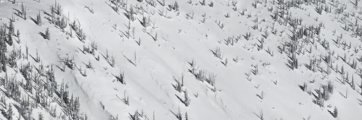
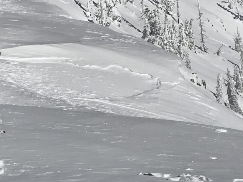
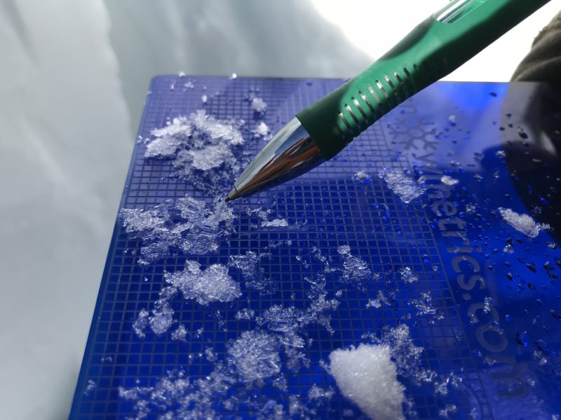
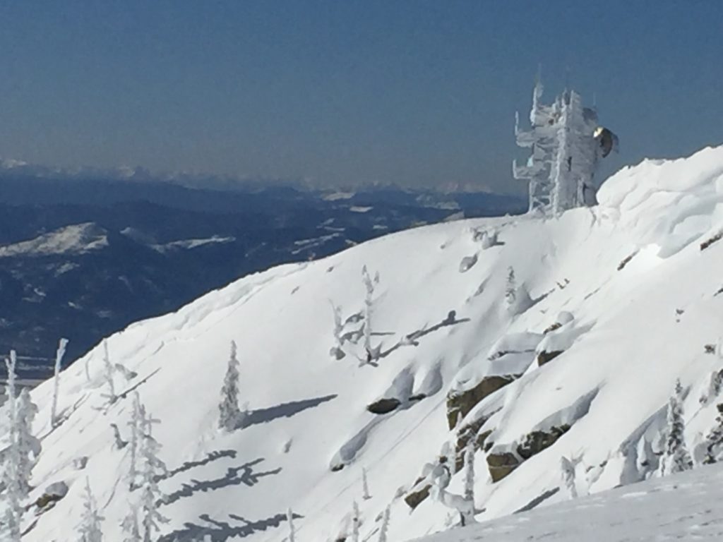
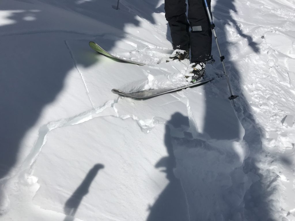
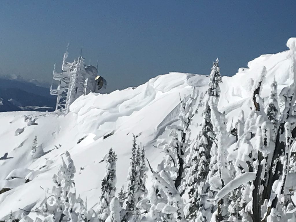
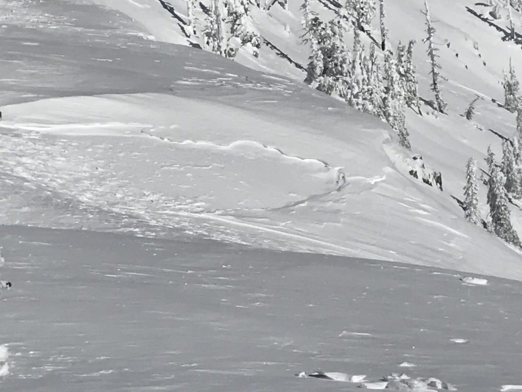
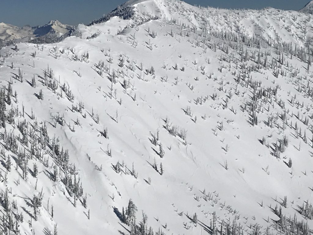
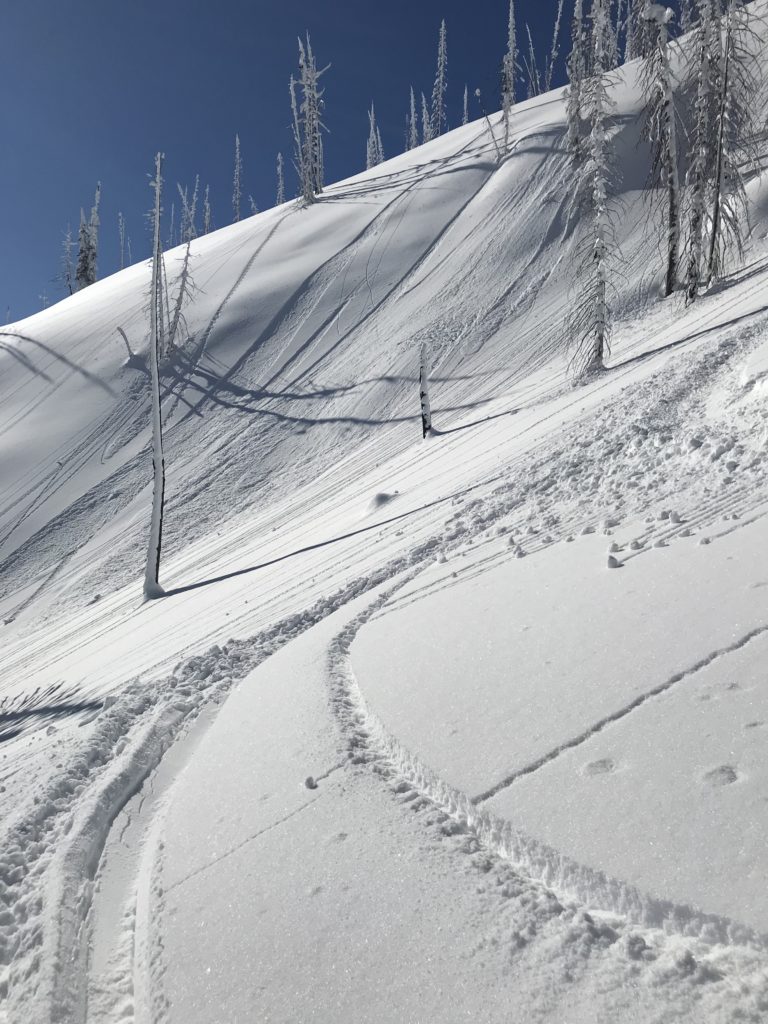
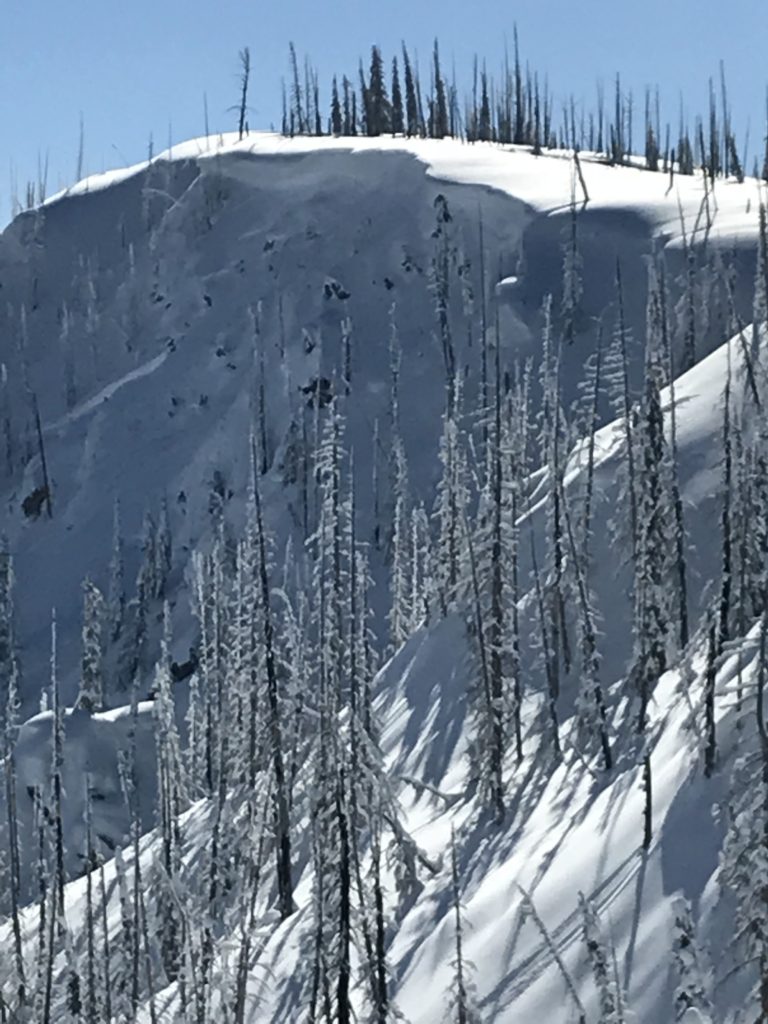
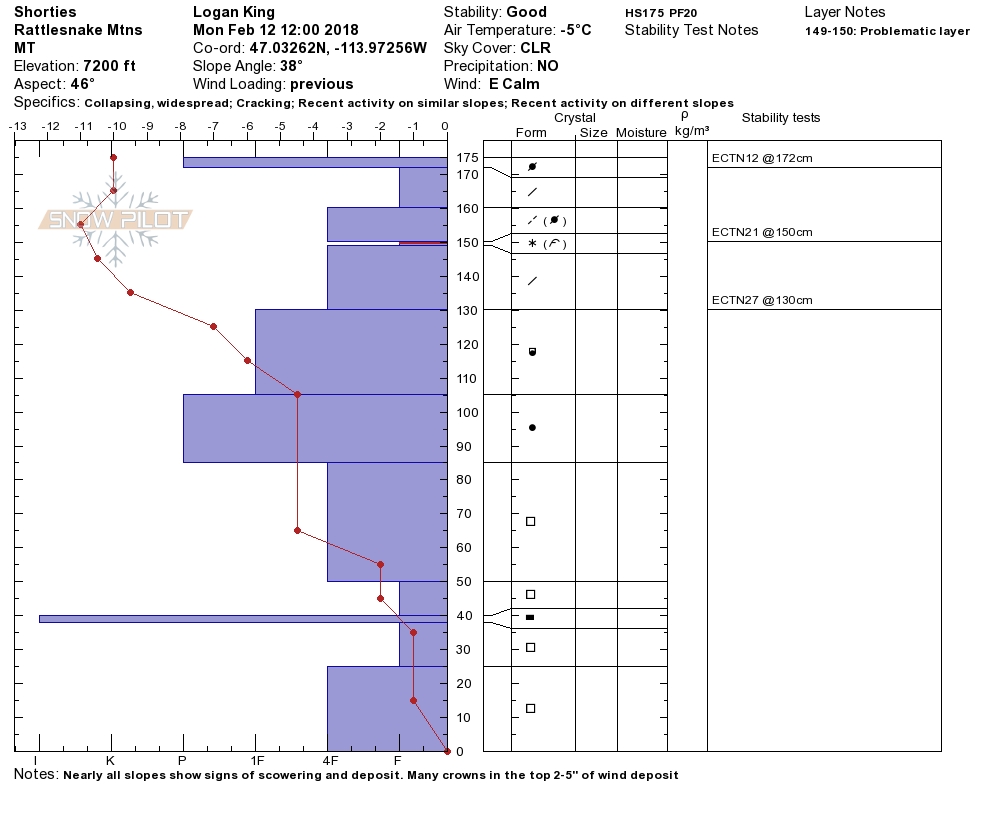
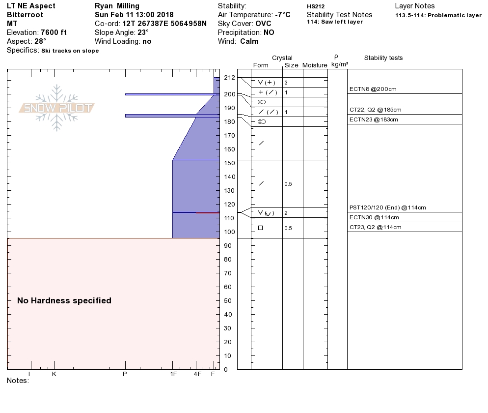
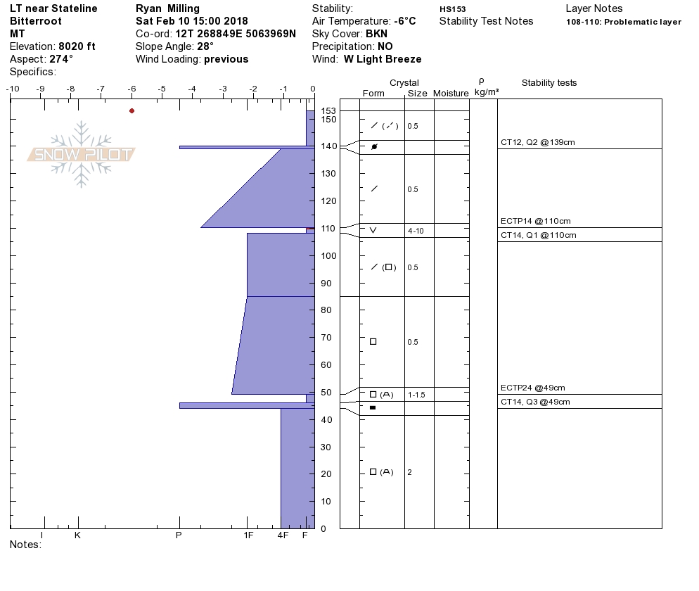
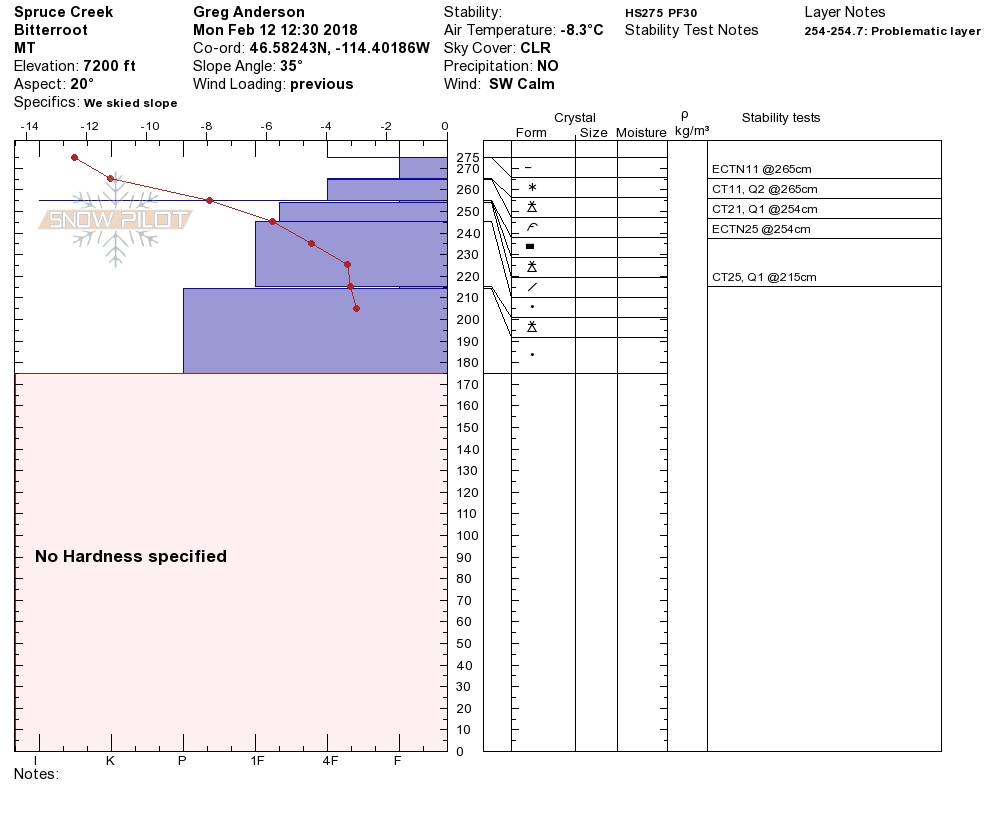
Logan and I went to the Rattlesnake yesterday. Tim and Greg went to Spruce Creek in the central Bitterroot.  We had a Level 1 avalanche class over the weekend at Lost Trail Pass.  All of us saw small cornice failures that happened in the last loading events over the weekend. We were not able to get any propagations in our pit tests except on the buried surface hoar in a shallow snowpack near Lost Trail.  Overall the snowpack is consolidating. We saw small 3 to 4-inch wind slabs that released naturally and got cracking on small wind slabs in the Rattlesnake.

The primary avalanche problem is wind slabs. The recent winds have scoured and created small to large wind slabs that are sensitive to human triggers on leeward slopes.  Look for rounded pillows of snow near ridgelines and on cross-loaded slopes. Recognize signs of instability such as cracking in the surface snow.

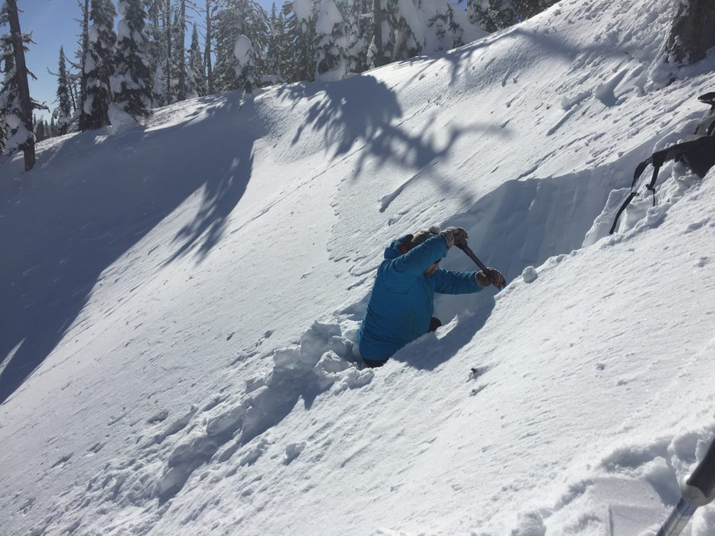
The second avalanche problem is persistent slabs. The buried surface hoar is not very reactive in pit tests.  Dig a pit to see if there are any layers of concern and how reactive they are in pit tests before committing to any steep slope.  Avoid shallow rocky terrain where it is more likely to trigger these weak layers.

Overall the shifting of winds over the weekend have scoured many slopes and created small sensitive wind slabs. The weak layers in our snowpack are strengthening. Cornices have grown with the strong winds give them a wide berth.  Identify wind loaded terrain and dig a pit to identify any weak layers before committing to steep slopes.

Avalanche and Weather Outlook

Expect the avalanche danger to stay the same until the storm system comes in on Wednesday. The avalanche danger will slowly increase with the storm. See the forecast here. I will issue the next advisory on Thursday, February 15th.

Ski and ride safe.


READ FULL ADVISORY  

Problem 1 - Wind Slabs

  • TYPE

    wind-slabs

    Wind Slabs

    Release of a cohesive layer of snow (a slab) formed by the wind.  Wind typically erodes snow from the upwind sides of terrain features and deposits snow on the downwind side.  Wind slabs are often smooth and rounded and sometimes sound hollow, and can range from soft to hard. Wind slabs that form over a persistent weak layer (surface hoar, depth hoar, or near-surface facets) may be termed Persistent Slabs or may develop into Persistent Slabs.

  • SIZE

    3-4

    1-2 (Small-Large)

    The potential size of avalanche resulting from this problem.

  • LIKELIHOOD

    Likelihood-3

    Possible

    The likelihood of an avalanche resulting from this problem.

  • IMAGE

The recent winds have scoured and created small to large wind slabs that are sensitive to human triggers on leeward slopes.  Look for rounded pillows of snow near ridgelines and on cross-loaded slopes. Recognize signs of instability such as cracking in the surface snow.


Problem 2 - Persistent Slabs

  • TYPE

    persistent-slabs

    Persistent Slabs

    Release of a cohesive layer of soft to hard snow (a slab) in the middle to upper snowpack, when the bond to an underlying persistent weak layer breaks.  Persistent layers include: surface hoar, depth hoar, near-surface facets, or faceted snow. Persistent weak layers can continue to produce avalanches for days, weeks or even months, making them especially dangerous and tricky. As additional snow and wind events build a thicker slab on top of the persistent weak layer, this avalanche problem may develop into a Persistent, Deep-Slab.

  • SIZE

    4-5

    2 (Large)

    The potential size of avalanche resulting from this problem.

  • LIKELIHOOD

    Likelihood-2

    Unlikely/Possible

    The likelihood of an avalanche resulting from this problem.

  • IMAGE

The buried surface hoar is not very reactive in pit tests.  Dig a pit to see if there are any layers of concern and how reactive they are in pit tests before committing to any steep slope.  Avoid shallow rocky terrain where it is more likely to trigger these weak layers.

VIDEO

Observations 02/12/2018

Observations 02/12/2018

FORECAST & OUTLOOK

  • Danger Trend

    same

    Same Danger

  • Area Forecast

    Wind

Expect the avalanche danger to stay the same until the storm system comes in on Wednesday. The avalanche danger will slowly increase with the storm. See the forecast here. I will issue the next advisory on Thursday, February 15th.


This information is the sole responsibility of the Forest Service and does not apply to operating ski areas. The avalanche danger rating expires at midnight tonight but the information can help you make a more informed decision regarding travel in avalanche terrain for the next few days.

Our advisory area includes National Forest System lands in the Bitterroot Mountains from Lost Trail Pass north to Granite Pass, the Rattlesnake Mountains north of Missoula and the Southern Swan and Mission Mountains near Seeley Lake, MT. Avalanche information for the Lookout Pass/St. Regis Basin area is available from the Idaho Panhandle Avalanche Center.