Posted:
Feb 15, 2018 @ 6:12 am

The current avalanche danger is CONSIDERABLE in the west central Montana backcountry on wind loaded slopes. All other slopes the danger is moderate. Natural avalanches are possible, and human-triggered avalanches remain likely on wind loaded slopes. Cautious route finding and conservative decision making are essential for backcountry travel today.

Good morning, this is Travis Craft with the West Central Montana Avalanche Center’s avalanche advisory for February 15, 2018.  This danger rating does not apply to operating ski areas, expires at midnight tonight and is the sole responsibility of the U.S. Forest Service.

Weather and Snowpack

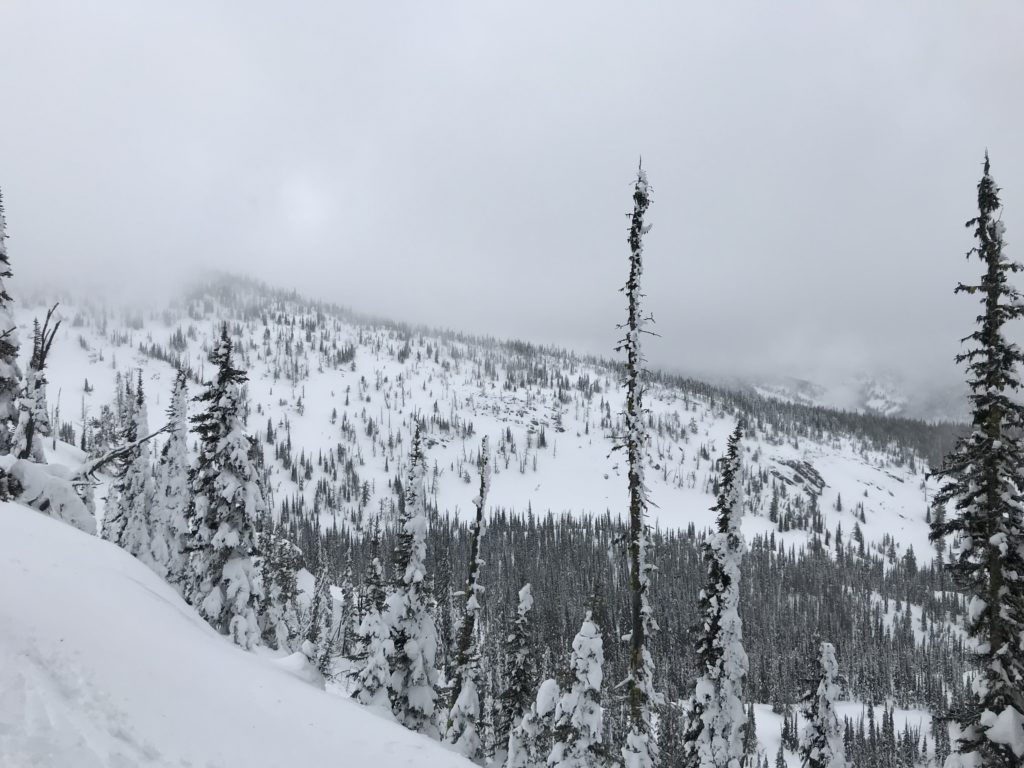
Mountain temperatures range from 12 F to 22 F in the region.  In the Bitterroot winds are 12 mph with gusts of 24 mph out of the W.  In the northern part of the advisory area, winds are reading 20 mph with gusts of 28 mph out of the West.  The forecast area received 4 to 9 inches of new snow in the last 24 hours.

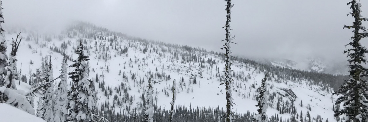
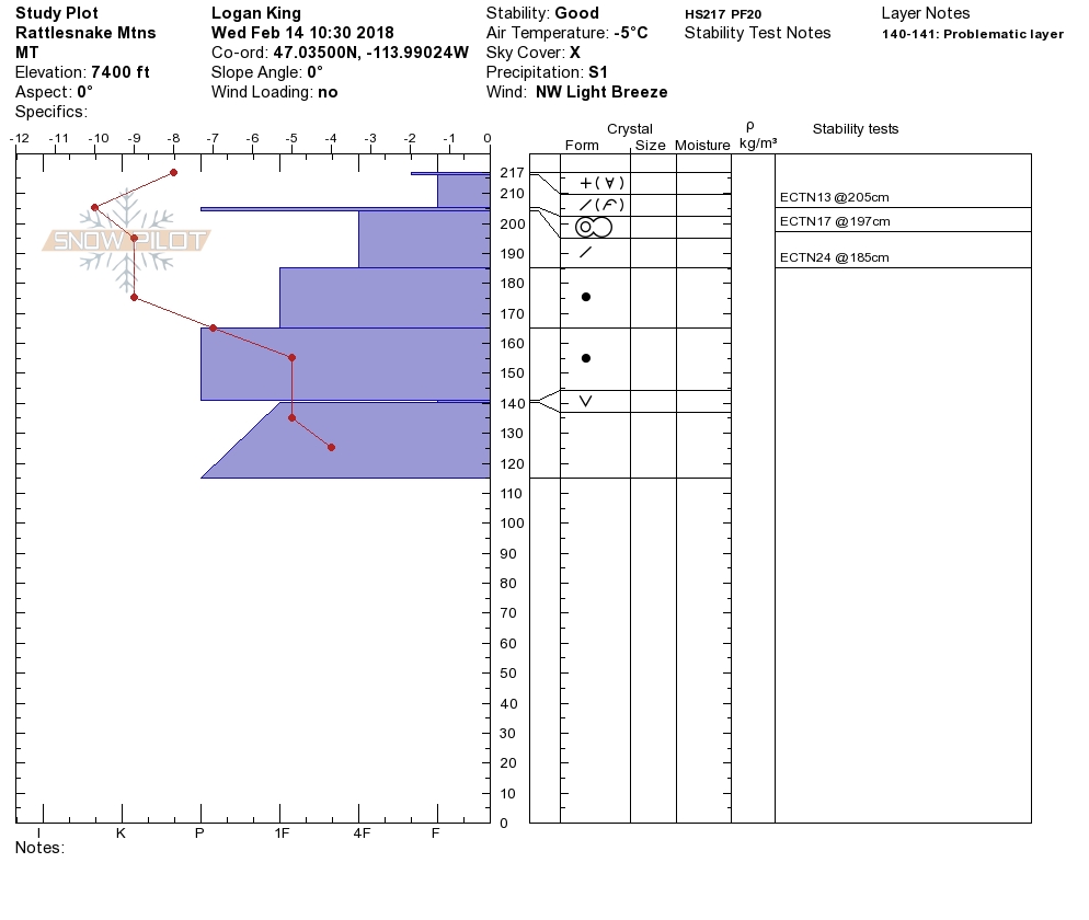
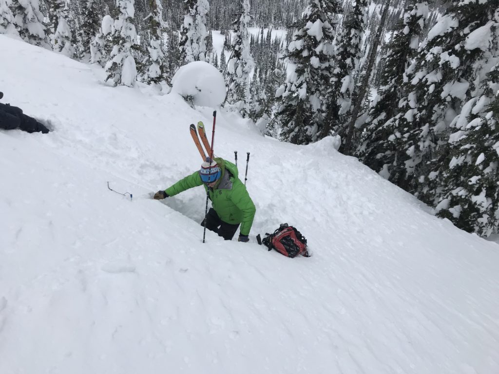
Logan and I went to the Rattlesnake yesterday. Tim and Greg went to Lolo Pass. Logan and I saw active wind transport and found many wind scoured slopes that the new snow will have a hard time bonding with. Greg and Tim found the new snow was bonding to the old snow surfaces. We were able to get a layer of facets 3 feet deep to propagate in a pit test.

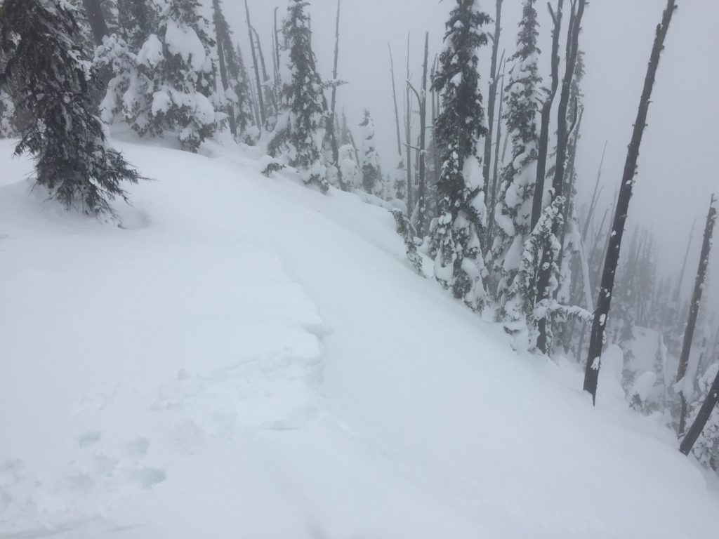
The primary avalanche problem is wind slabs. Look for rounded pillows of snow near ridgelines and on cross-loaded slopes. Recognize signs of instability such as cracking in the surface snow. New snow has been loaded onto previously loaded slopes or  scoured slopes. These freshly deposited slabs will be very sensitive to human triggers. Identify wind loaded slopes and avoid travel on or below them.

The second avalanche problem is persistent slabs. Dig a pit to see if there are any layers of concern and how reactive they are in pit tests before committing to any steep slope. Avoid shallow rocky terrain where it is more likely to trigger these weak layers. With the new load of snow the many layers in our snowpack may become reactive to human triggers. Look for bullseye data such as collapsing, shooting cracks and whumphing to help with identifying instabilities in the snowpack.

Wind slabs will be sensitive to human triggers today. Identify wind loaded slopes and avoid them. Use small test slopes with low consequences to see how the new snow is bonding to old snow surfaces. Look for bullseye data: shooting cracks, collapsing, and whumphing to help determine snow instabilities. Dig a pit 3 feet down to identify layers of concern and how reactive these layers are to the new load of snow.

Avalanche and Weather Outlook

The danger will stay the same until Friday when the next system moves in. See the forecast here. Logan will issue the advisory on Saturday.

Ski and ride safe.

READ FULL ADVISORY  

Problem 1 - Wind Slabs

  • TYPE

    wind-slabs

    Wind Slabs

    Release of a cohesive layer of snow (a slab) formed by the wind.  Wind typically erodes snow from the upwind sides of terrain features and deposits snow on the downwind side.  Wind slabs are often smooth and rounded and sometimes sound hollow, and can range from soft to hard. Wind slabs that form over a persistent weak layer (surface hoar, depth hoar, or near-surface facets) may be termed Persistent Slabs or may develop into Persistent Slabs.

  • SIZE

    3-4

    1-2 (Small-Large)

    The potential size of avalanche resulting from this problem.

  • LIKELIHOOD

    Likelihood-5

    Likely

    The likelihood of an avalanche resulting from this problem.

Look for rounded pillows of snow near ridgelines and on cross-loaded slopes. Recognize signs of instability such as cracking in the surface snow. New snow has been loaded onto previously loaded slopes or  scoured slopes. These freshly deposited slabs will be very sensitive to human triggers. Identify wind loaded slopes and avoid travel on or below them.

Problem 2 - Persistent Slabs

  • TYPE

    persistent-slabs

    Persistent Slabs

    Release of a cohesive layer of soft to hard snow (a slab) in the middle to upper snowpack, when the bond to an underlying persistent weak layer breaks.  Persistent layers include: surface hoar, depth hoar, near-surface facets, or faceted snow. Persistent weak layers can continue to produce avalanches for days, weeks or even months, making them especially dangerous and tricky. As additional snow and wind events build a thicker slab on top of the persistent weak layer, this avalanche problem may develop into a Persistent, Deep-Slab.

  • SIZE

    5-6

    2-3 (Large)

    The potential size of avalanche resulting from this problem.

  • LIKELIHOOD

    Likelihood-3

    Possible

    The likelihood of an avalanche resulting from this problem.

Dig a pit to see if there are any layers of concern and how reactive they are in pit tests before committing to any steep slope.  Avoid shallow rocky terrain where it is more likely to trigger these weak layers. With the new load of snow the many layers in our snowpack may become reactive to human triggers. Look for bullseye data such as collapsing, shooting cracks and whumphing to help with identifying instabilities in the snowpack.


VIDEO

Observations 02/14/2018

Observations 02/14/2018

FORECAST & OUTLOOK

The danger will stay the same until Friday when the next system moves in. See the forecast here. Logan will issue the advisory on Saturday.


This information is the sole responsibility of the Forest Service and does not apply to operating ski areas. The avalanche danger rating expires at midnight tonight but the information can help you make a more informed decision regarding travel in avalanche terrain for the next few days.

Our advisory area includes National Forest System lands in the Bitterroot Mountains from Lost Trail Pass north to Granite Pass, the Rattlesnake Mountains north of Missoula and the Southern Swan and Mission Mountains near Seeley Lake, MT. Avalanche information for the Lookout Pass/St. Regis Basin area is available from the Idaho Panhandle Avalanche Center.