
The avalanche danger is Considerable for the West Central Montana backcountry. Strong winds and significant snow are creating dangerous avalanche conditions, making human-triggered avalanches likely. Careful snowpack evaluation, cautious route-finding, and conservative decision-making are essential for travel in the backcountry today.
Good morning, this is Logan King with the West Central Montana Avalanche Center’s avalanche advisory for Saturday, February 17th, 2018. This danger rating does not apply to operating ski areas, expires at midnight tonight and is the sole responsibility of the U.S. Forest Service.
Weather and Snowpack
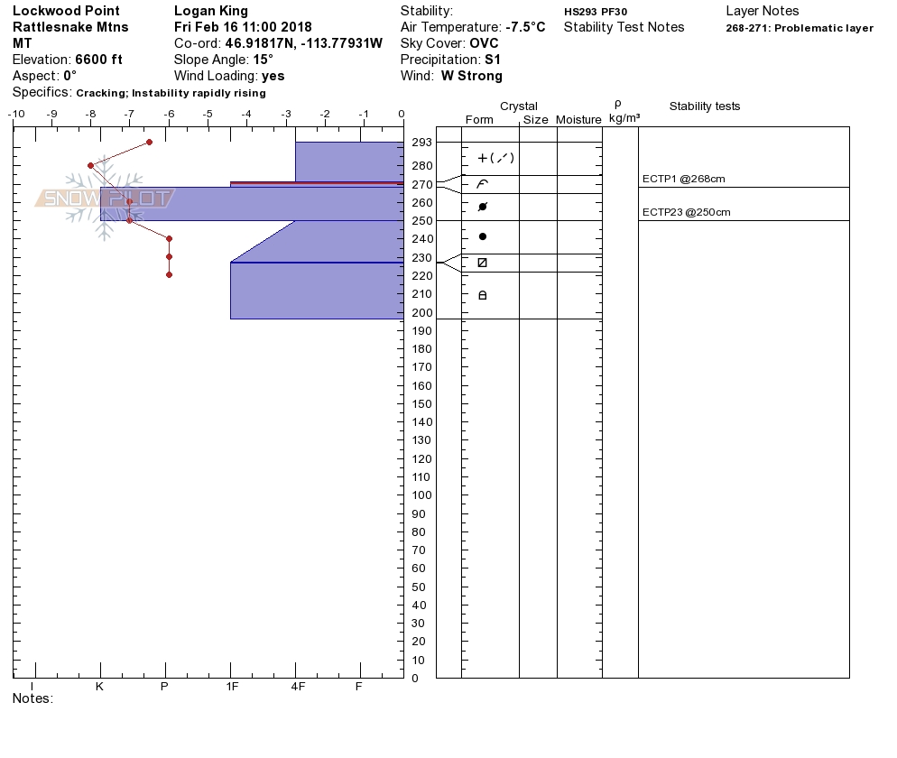
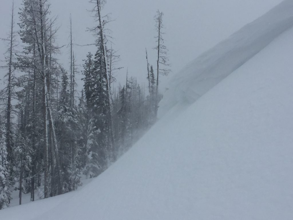
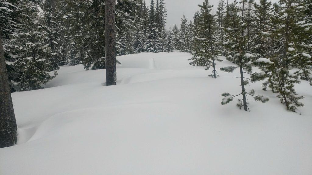
A storm system has begun to impact the area. Early this morning 3-6 inches of snow has accumulated since yesterday in the northern portion of the advisory area. The southern half of the region has picked up 8-16 inches of snow this morning and up to 1.2 inches of SWE. Temperatures are in the teens to mid-twenties. The strong winds from the past couple of days have settled a bit and are currently 14 mph gusting to 26 mph from the WNW at Point 6. In the southern Bitterroot at Deer Mountain winds are 8 mph gusting to 12 mph from the S.
Yesterday Matt was up at Lolo Pass, and he found storm slabs to be a growing concern with intensifying snowfall. On Thursday observers were at Lost Trail Pass and found that wind slabs were the most significant concern. I was up on Wisherd Ridge Yesterday and encountered strong winds that were creating very touchy wind slabs.
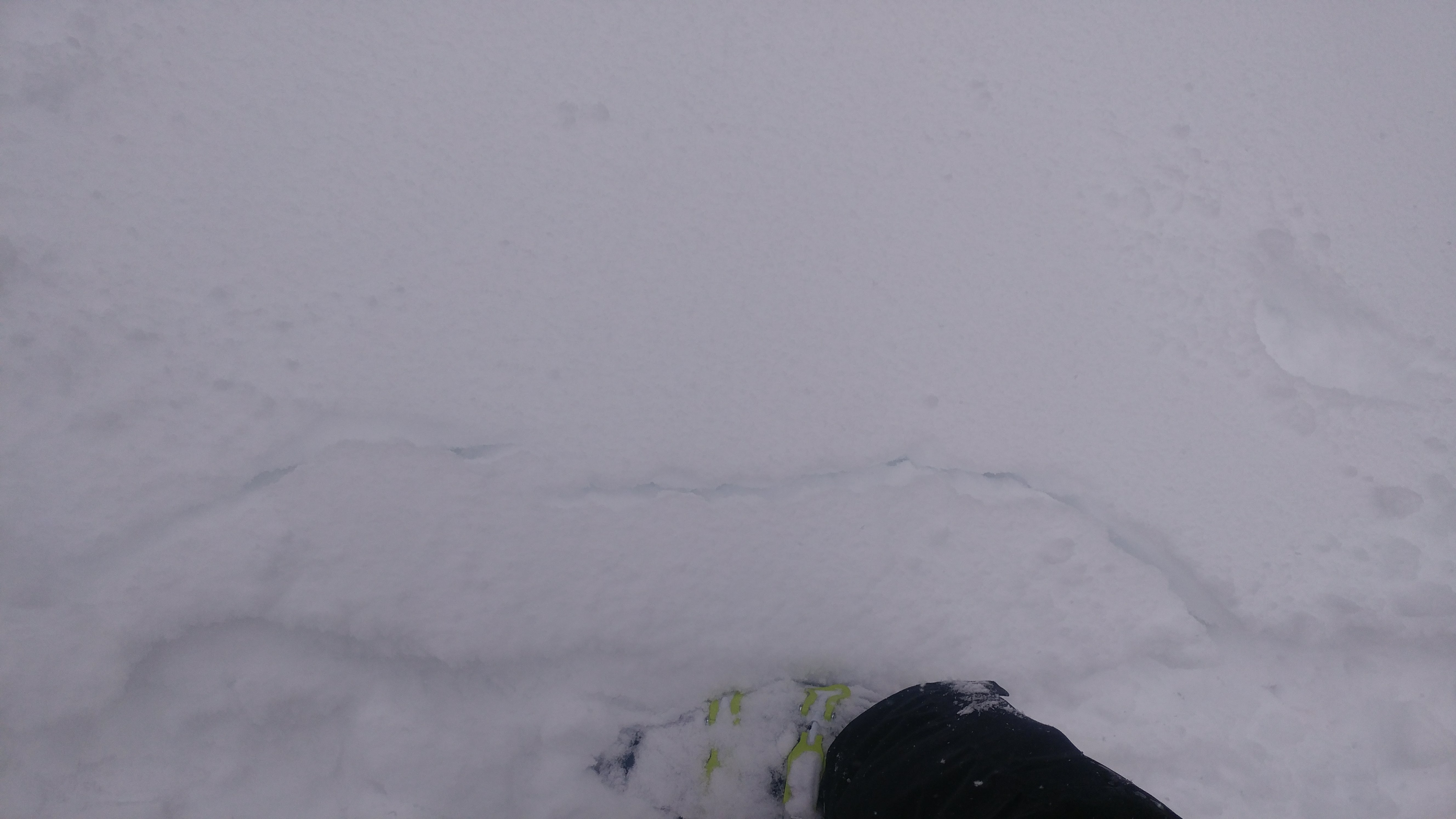
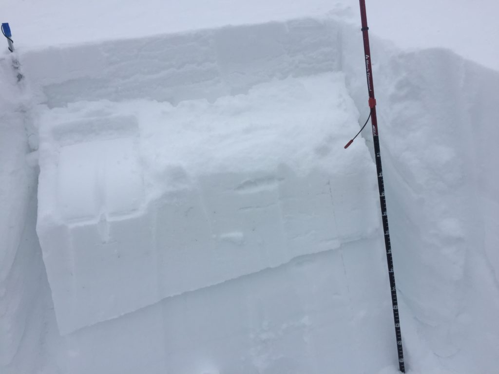
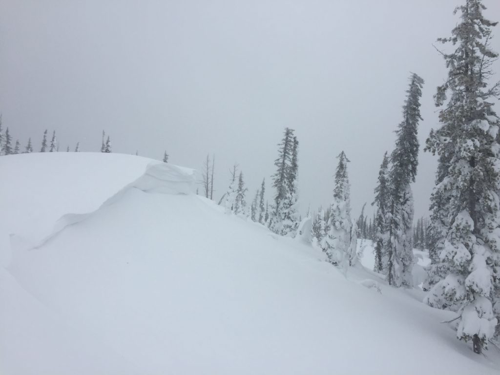
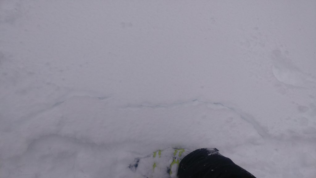
With plenty of snow for transport and the sensitive wind slabs observed yesterday, wind slabs will be a significant avalanche concern today. During stability tests we found the wind slabs to be extremely reactive with minimal force. Small to Large wind slab avalanches will be likely on leeward terrain. Look for rounded pillows of snow near ridges and mountain tops and avoid terrain below cornices.
Storm Slabs are the other significant concern today. With over an inch of water at some mountain locations and more snow in the forecast, the potential for storm slab avalanches will be increasing through the weekend. Look for signs like shooting cracks and whumphing to indicate that the storm snow is forming a slab and stressing the snowpack. Storm slabs problems usually settle within a day or two after the storm cycle is complete, so practice some patience and err on the side of caution as the storm slab problem will be dynamic and changing throughout the extended weekend.
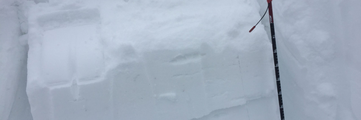
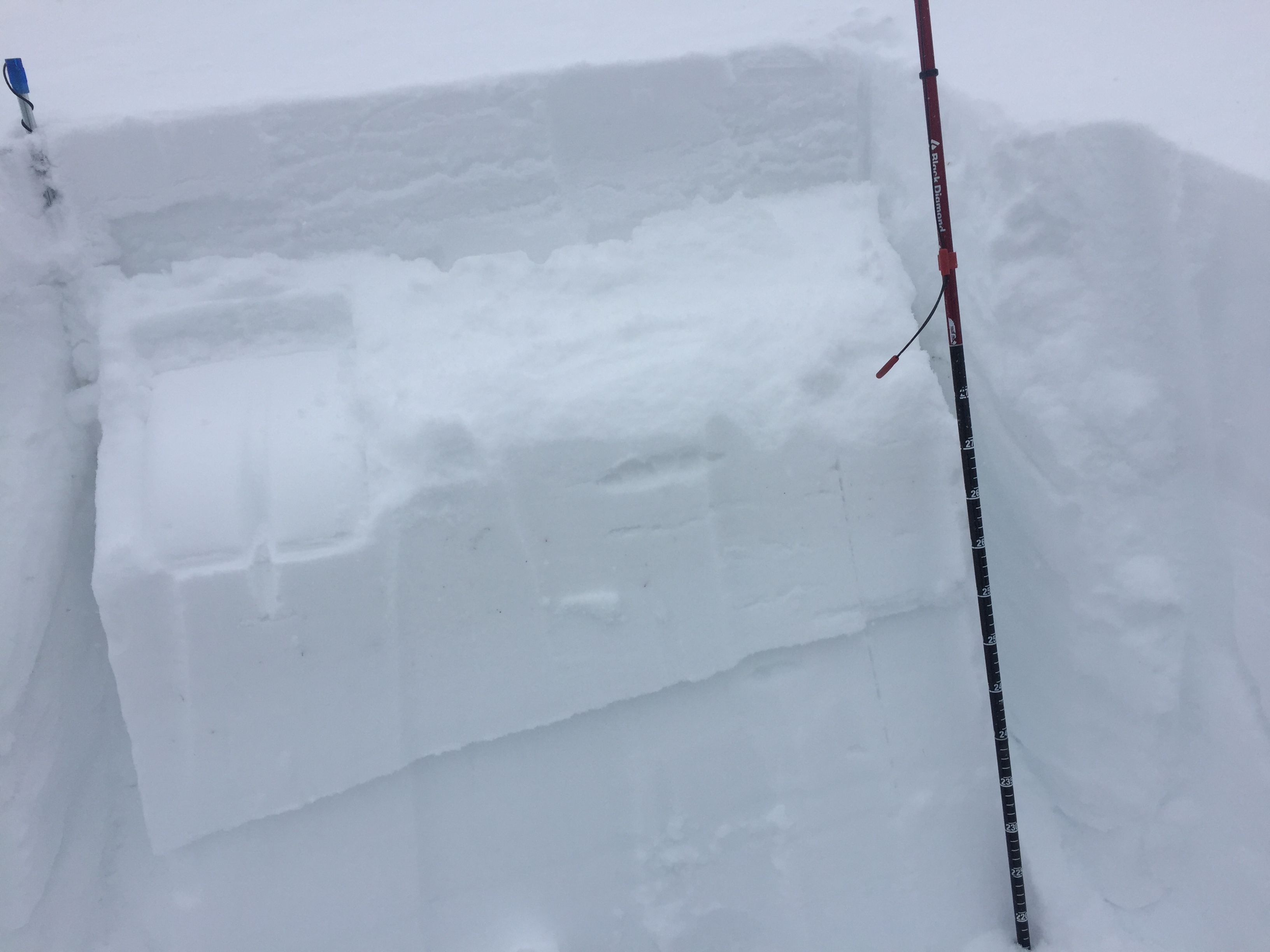
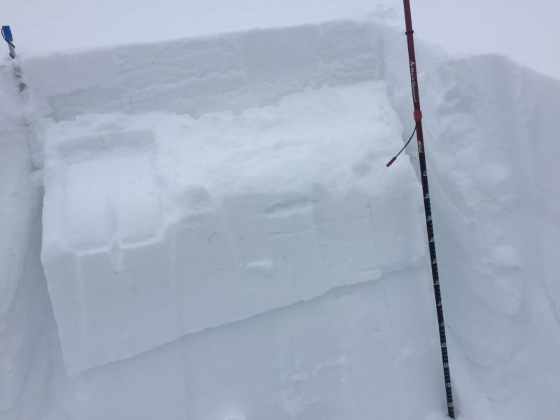
Persistent week layers are the third avalanche concern today. Buried surface hoar, near surface facets, and some stout crust continued to gain strength this week but should be approached with suspicion, considering the new load. The persistent weak layers are getting buried pretty deep and if they fail will produce very large avalanches in isolated areas. Take the time to dig a quick pit and perform stability tests because it is the only way to know if these layers are present and reactive.
Avalanche and Weather Outlook
The avalanche danger will be on the rise as snowfall will increase today. The weather forecast suggests intensifying snow throughout the day today with warming temperatures before an arctic airmass moves into the region late today and into tonight. As the cold air moves in, winds will shift directions and intensify further complicating avalanche conditions.
The next advisory will be issued on Tuesday, but an update will be posted if necessary as the storm continues to develop.
Ski and ride safe.


