Posted:
Feb 19, 2018 @ 5:58 am

The avalanche warning has expired, but a High avalanche danger remains on wind loaded terrain. On all other terrain across the West Central Montana backcountry, the avalanche danger is Considerable. Strong winds and significant snow have created sensitive wind slabs that will make avalanches likely on all wind loaded terrain. Careful snowpack evaluation, cautious route-finding, and conservative decision-making are essential for travel in the backcountry today.

Good morning, this is Logan King with the West Central Montana Avalanche Center’s avalanche advisory for Monday, February 19th, 2018. This danger rating does not apply to operating ski areas, expires at midnight tonight and is the sole responsibility of the U.S. Forest Service.

Weather and Snowpack

Snowfall has slowed across the advisory area. Overnight an additional inch or two of snow has accumulated. Temperatures this morning are below zero degrees fahrenheit. Winds are out of the E in the twenties  and are gusting to the thirties.

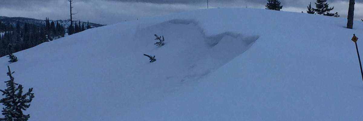
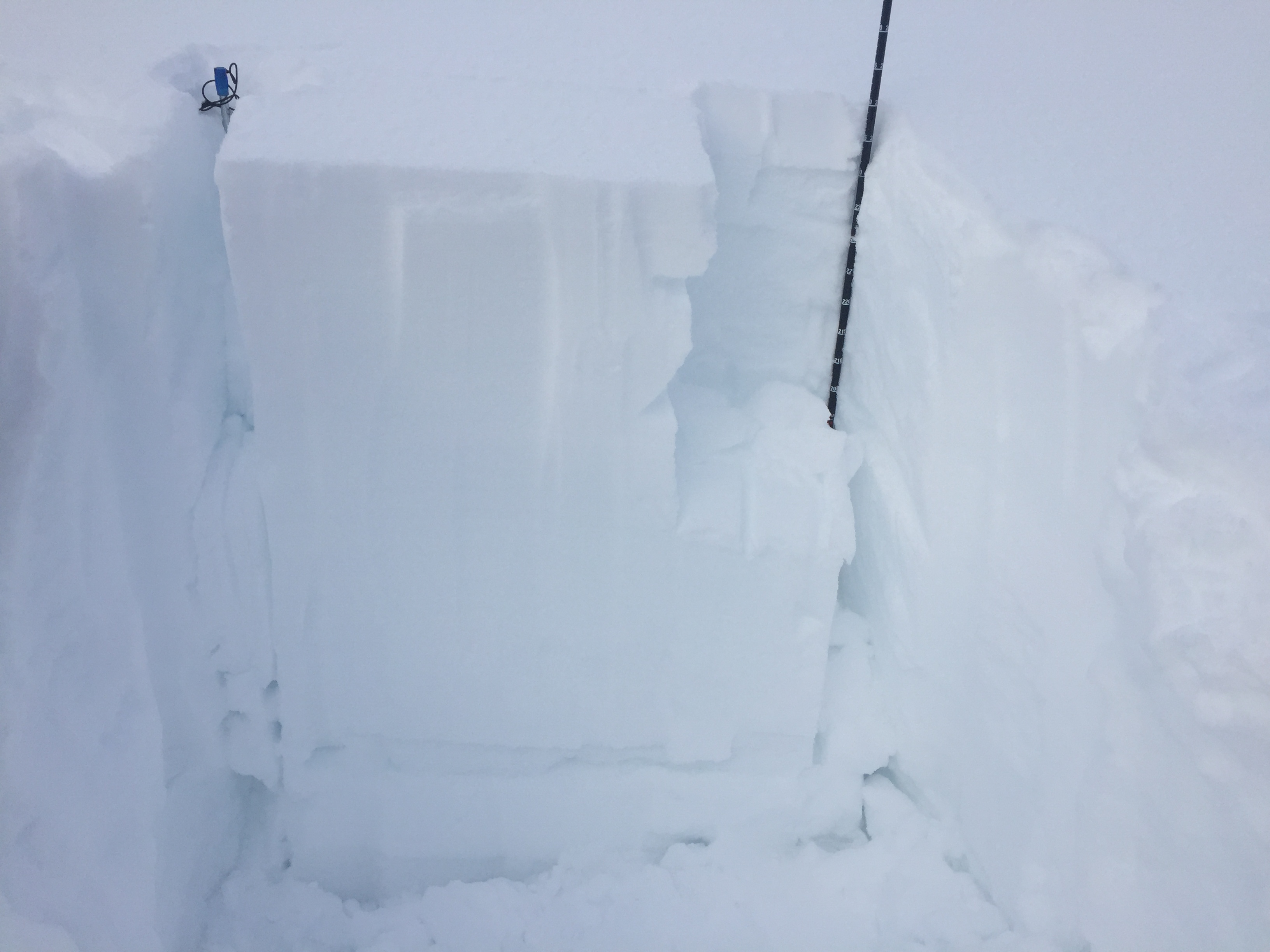
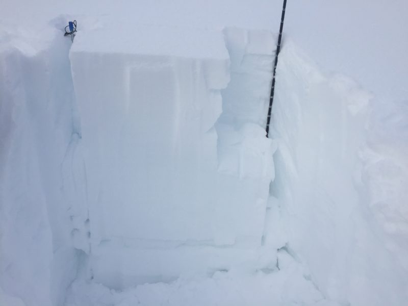
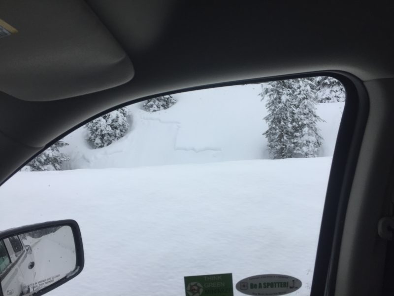
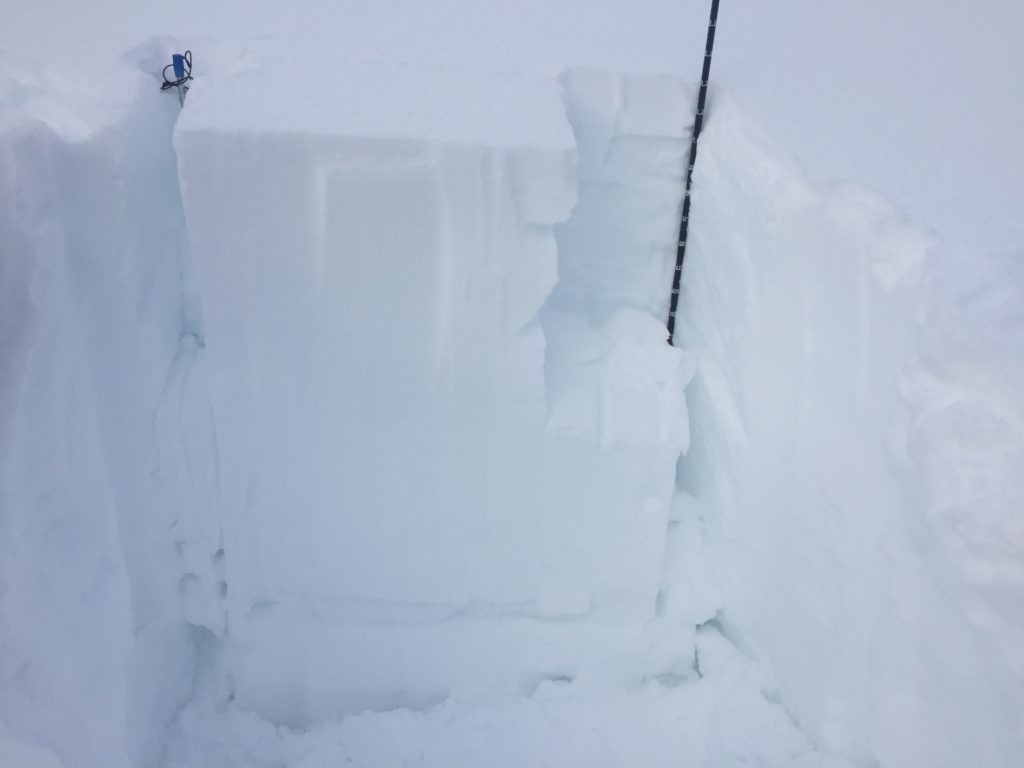
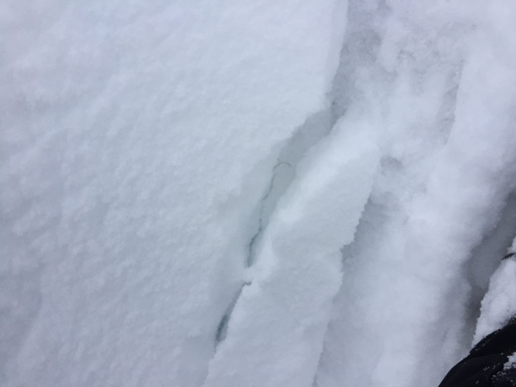
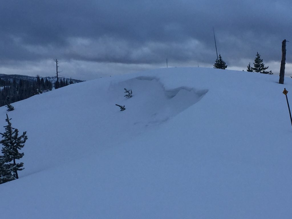
I was up at Lolo pass yesterday and found an unsettled snowpack. The storm slab had not yet bonded to the old snow surface. Numerous natural release small storm slabs were observed on all terrain. Widespread whumphing was found on terrain where the wind had affected the storm snow and wind slabs easily propagated in stability tests.

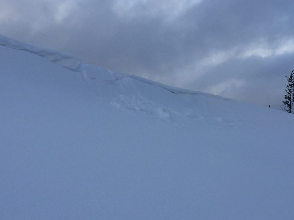
Wind slabs are the primary concern and will be easily triggered today. Travel in terrain where wind slabs have formed is not recommended. Strong easterly winds returned to the region behind the cold front that worked its way across Western Montana yesterday. This means that wind slabs can be found on any aspect so carefully evaluate slopes before moving into avalanche terrain.

The secondary concern today will be the storm slabs. As the storm intensity drops off the storm slab problem is beginning to settle out. Storm slab avalanches are still likely, but the snow continues to gain strength. The snow will need another day or so to fully bond before the storm slab problem can be put to rest.

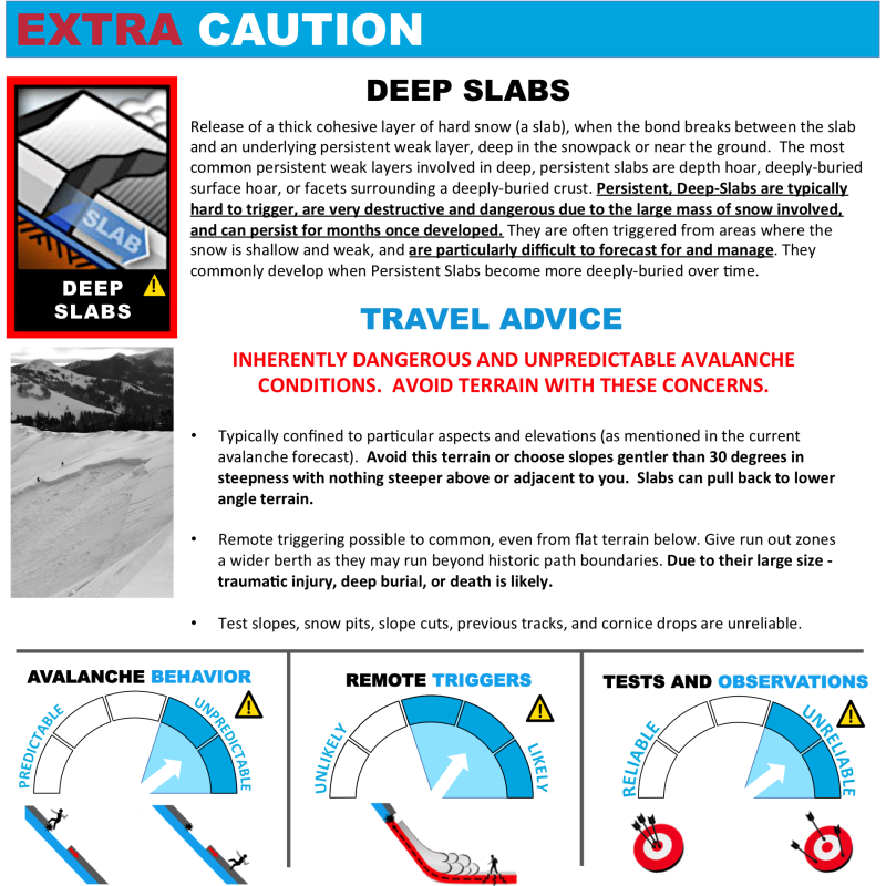
Deep persistent weak layers are the third avalanche concern today. The new load may have provided the additional stress needed to activate the now deeply buried layers. Given how touchy the snow has been this layer is now also susceptible to step down avalanches. If the deep persistent layers fail, the resulting avalanches will be very large so take the time to dig and see if these layers are present in the snowpack.

Avalanche and Weather Outlook

Overall the avalanche danger will remain the same through the day today. Strong easterly winds look to continue. The forecast now points towards cold temperatures and light snow showers before the storm breaks late today. The next advisory will be issued on Tuesday.

Ski and ride safe.

READ FULL ADVISORY  

Problem 1 - Wind Slabs

  • TYPE

    wind-slabs

    Wind Slabs

    Release of a cohesive layer of snow (a slab) formed by the wind.  Wind typically erodes snow from the upwind sides of terrain features and deposits snow on the downwind side.  Wind slabs are often smooth and rounded and sometimes sound hollow, and can range from soft to hard. Wind slabs that form over a persistent weak layer (surface hoar, depth hoar, or near-surface facets) may be termed Persistent Slabs or may develop into Persistent Slabs.

  • SIZE

    5-6

    2-3 (Large)

    The potential size of avalanche resulting from this problem.

  • LIKELIHOOD

    Likelihood-6

    Likely/Very Likely

    The likelihood of an avalanche resulting from this problem.

  • IMAGE

Sensitive wind slabs will be found on leeward terrain.

Problem 2 - Storm Slabs

  • TYPE

    storm-slabs

    Storm Slabs

    Release of a soft cohesive layer (a slab) of new snow which breaks within the storm snow or on the old snow surface. Storm-slab problems typically last between a few hours and few days. Storm-slabs that form over a persistent weak layer (surface hoar, depth hoar, or near-surface facets) may be termed Persistent Slabs or may develop into Persistent Slabs.

  • SIZE

    3-4

    1-2 (Small-Large)

    The potential size of avalanche resulting from this problem.

  • LIKELIHOOD

    Likelihood-4

    Possible/Likely

    The likelihood of an avalanche resulting from this problem.

  • IMAGE

Storm slabs have begun to settle but are still susceptible to triggers.

Problem 3 - Deep Persistent

  • TYPE

    deep-persistent-slabs

    Deep Persistent Slabs

    Release of a thick cohesive layer of hard snow (a slab), when the bond breaks between the slab and an underlying persistent weak layer, deep in the snowpack or near the ground.  The most common persistent weak layers involved in deep, persistent slabs are depth hoar, deeply-buried surface hoar, or facets surrounding a deeply-buried crust. Persistent, Deep-Slabs are typically hard to trigger, are very destructive and dangerous due to the large mass of snow involved, and can persist for months once developed. They are often triggered from areas where the snow is shallow and weak, and are particularly difficult to forecast for and manage. They commonly develop when Persistent Slabs become more deeply-buried over time.

  • SIZE

    7-8

    3-4 (Very Large)

    The potential size of avalanche resulting from this problem.

  • LIKELIHOOD

    Likelihood-2

    Unlikely/Possible

    The likelihood of an avalanche resulting from this problem.

This layer is suspect under the new load.

VIDEO

FORECAST & OUTLOOK

Cold temperatures and light snow showers are possible today. Strong Easterly winds are predicted to continue.

This information is the sole responsibility of the Forest Service and does not apply to operating ski areas. The avalanche danger rating expires at midnight tonight but the information can help you make a more informed decision regarding travel in avalanche terrain for the next few days.

Our advisory area includes National Forest System lands in the Bitterroot Mountains from Lost Trail Pass north to Granite Pass, the Rattlesnake Mountains north of Missoula and the Southern Swan and Mission Mountains near Seeley Lake, MT. Avalanche information for the Lookout Pass/St. Regis Basin area is available from the Idaho Panhandle Avalanche Center.